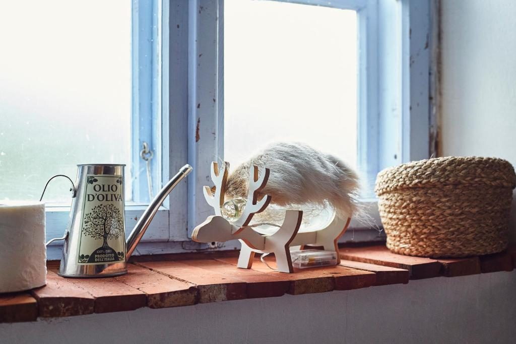
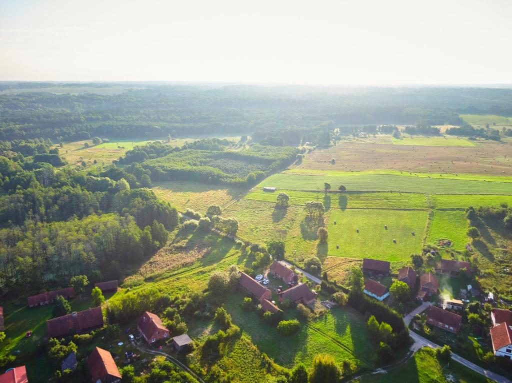
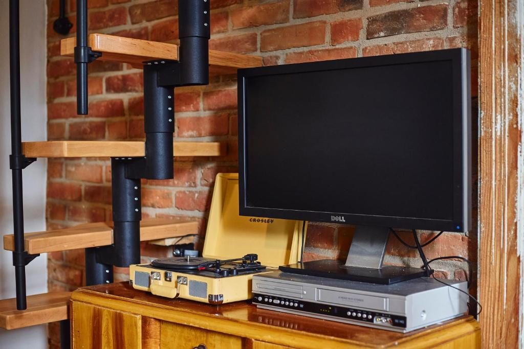
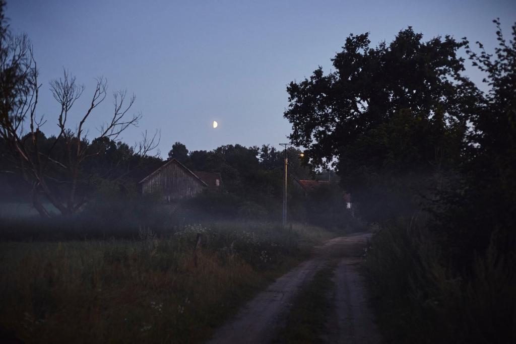
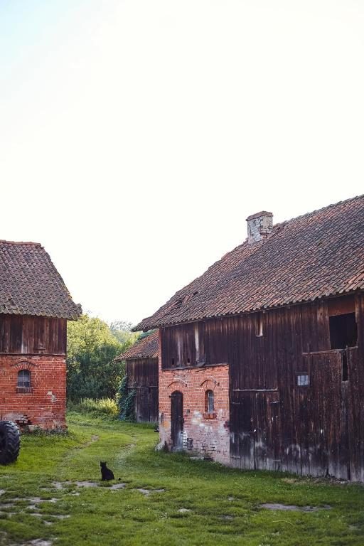
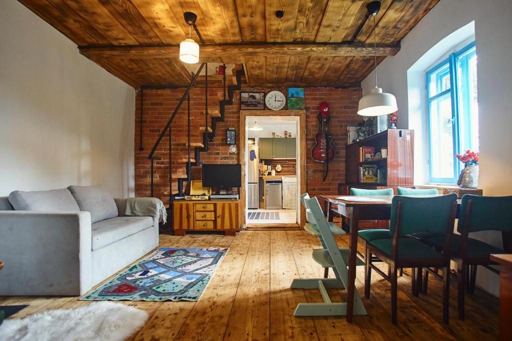
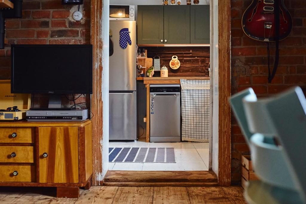
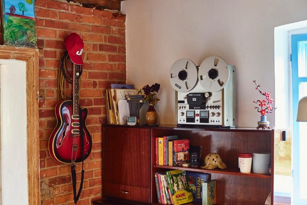
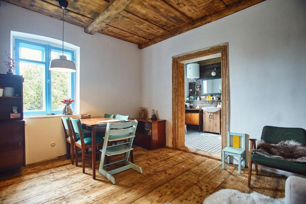
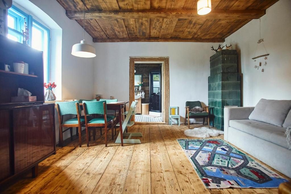
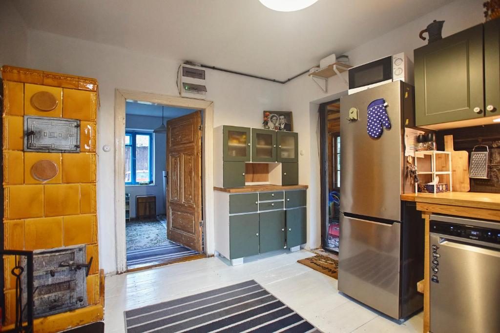
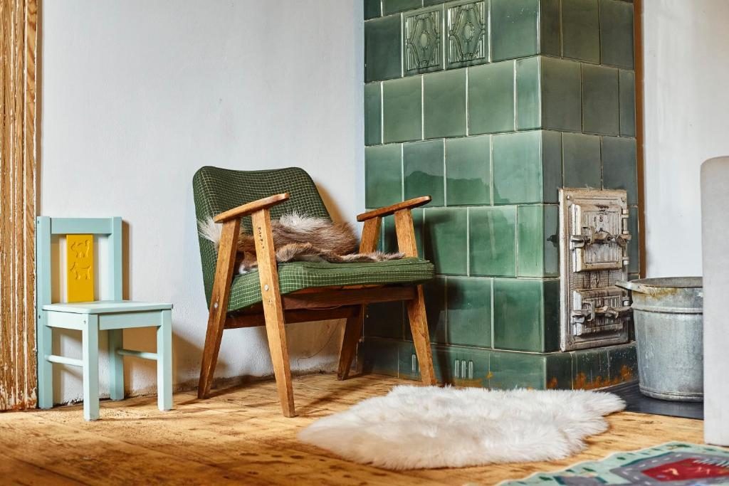
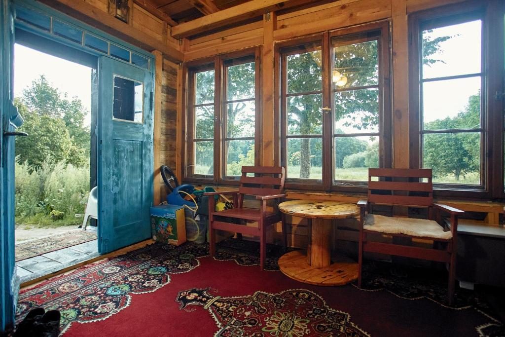
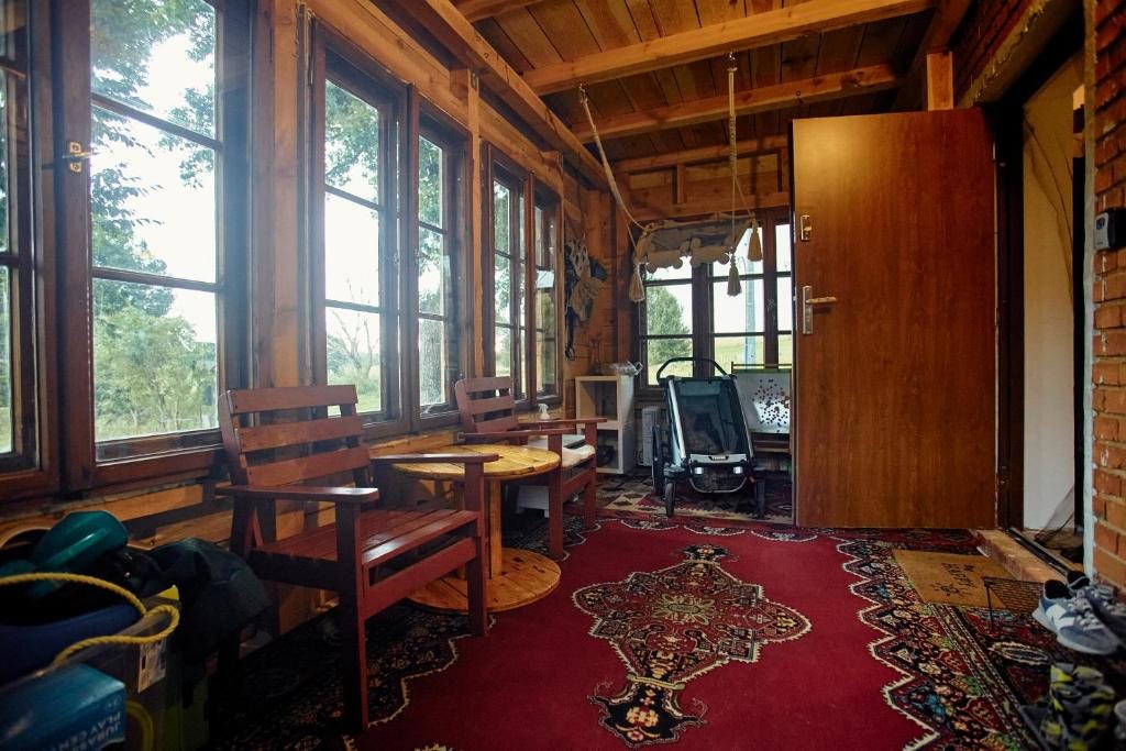
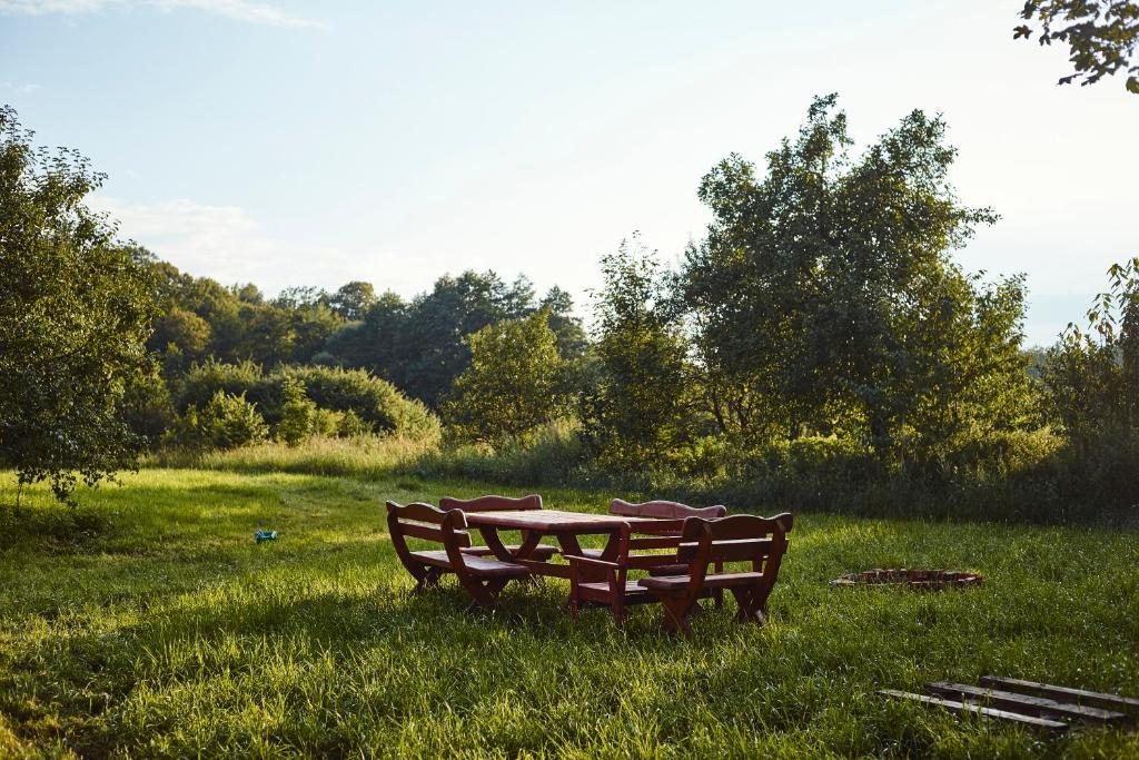
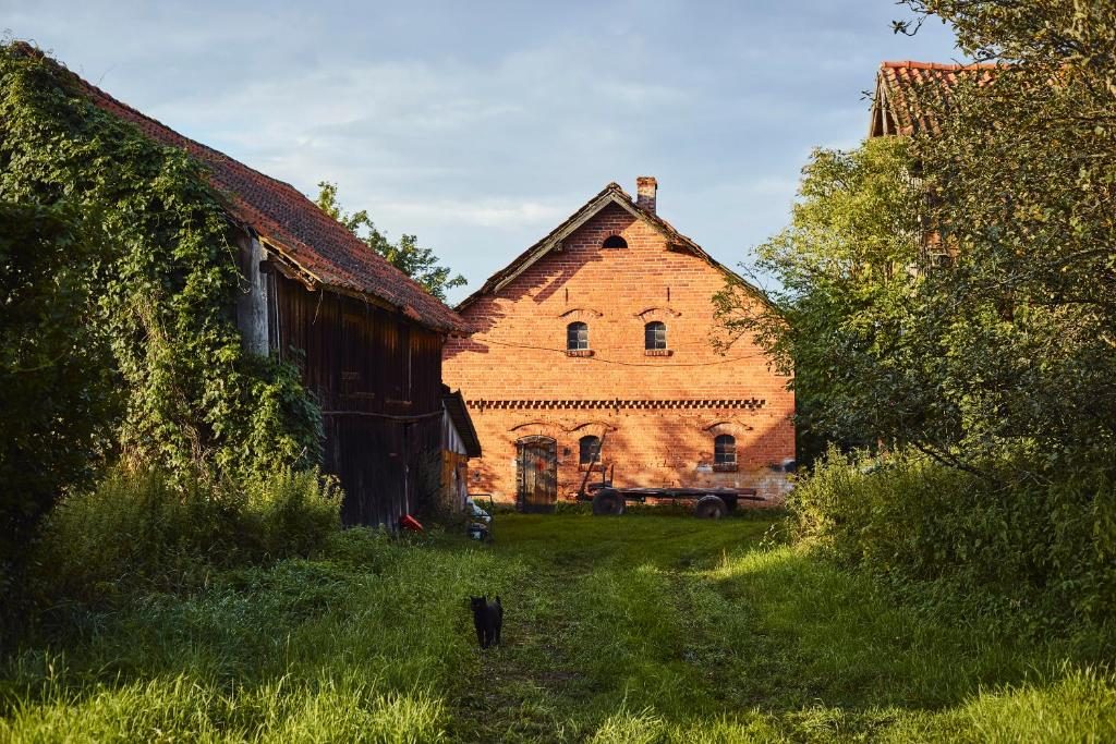
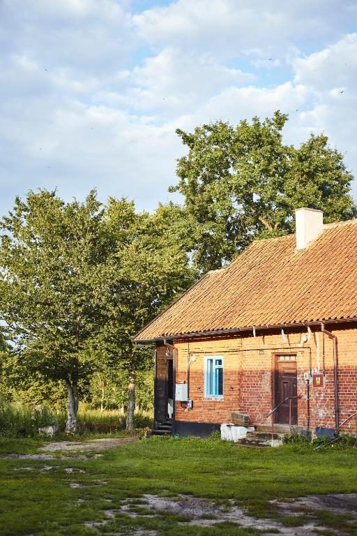
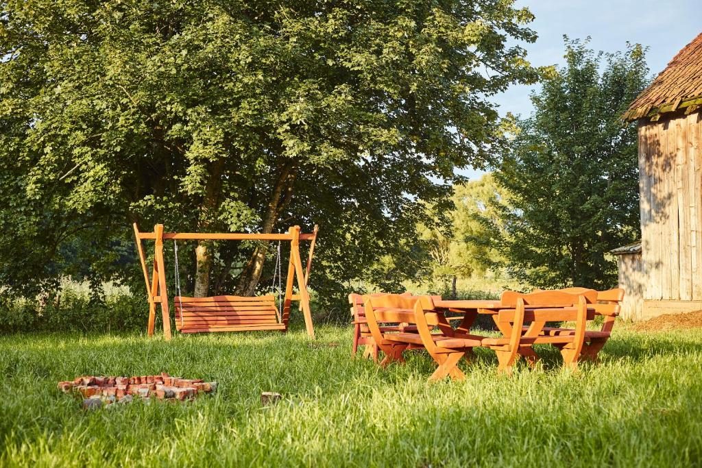
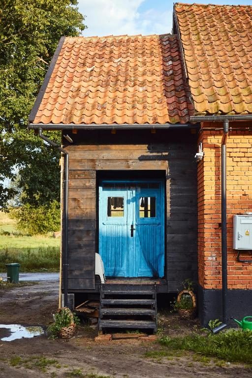
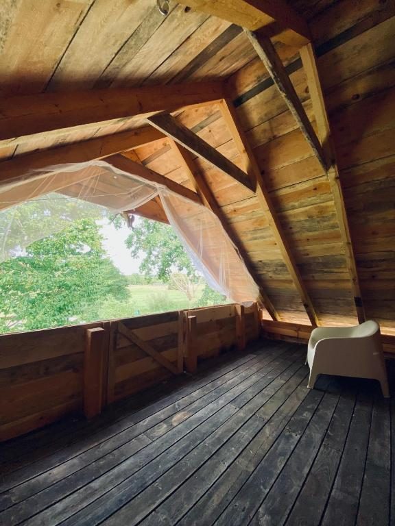
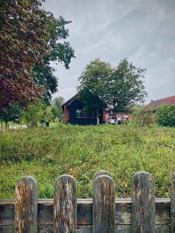
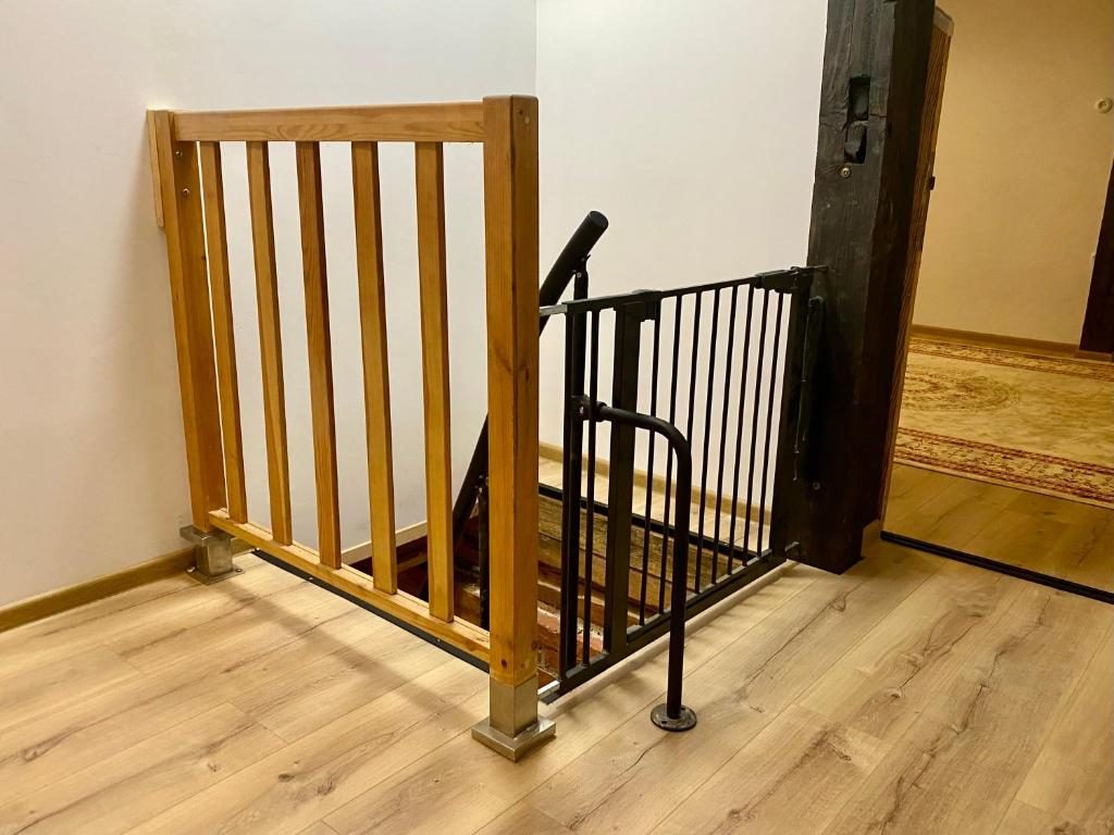
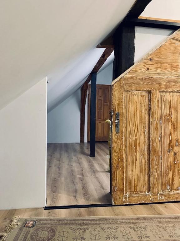
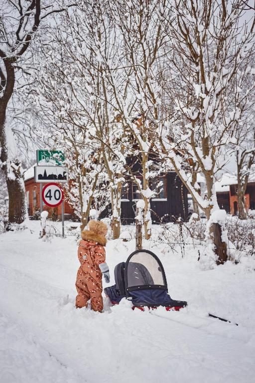
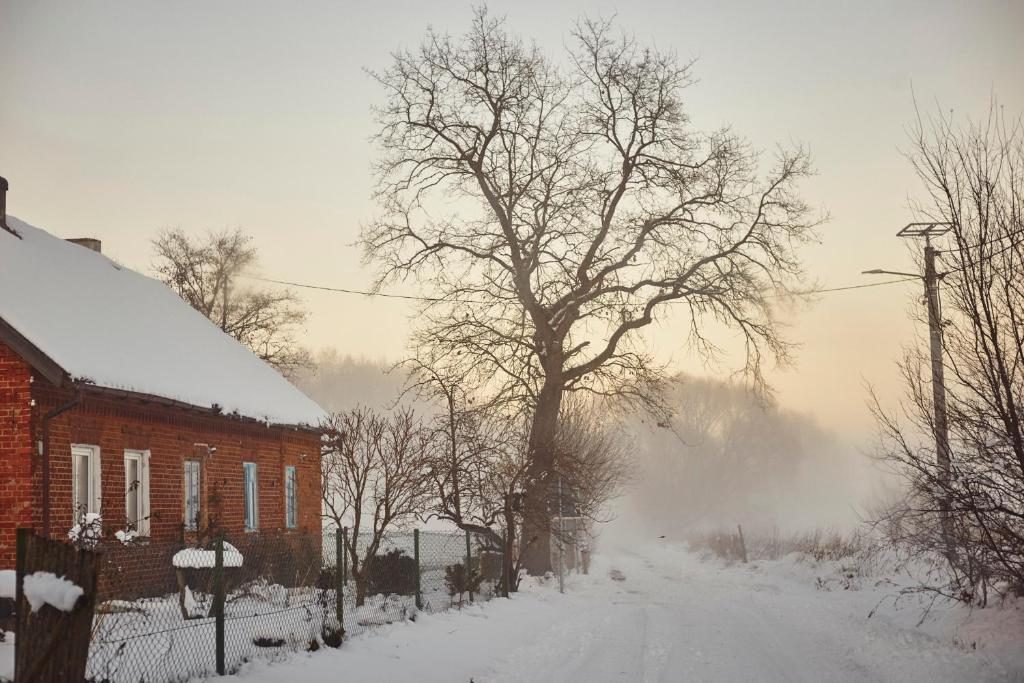
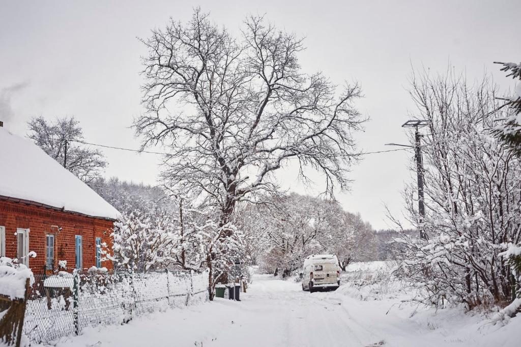
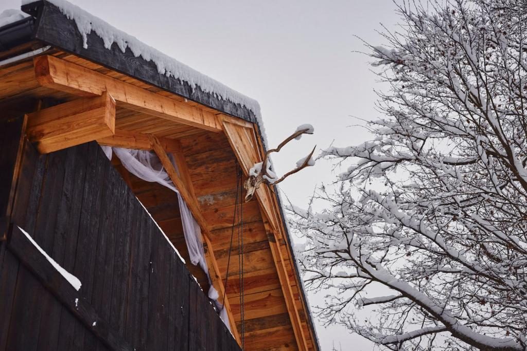
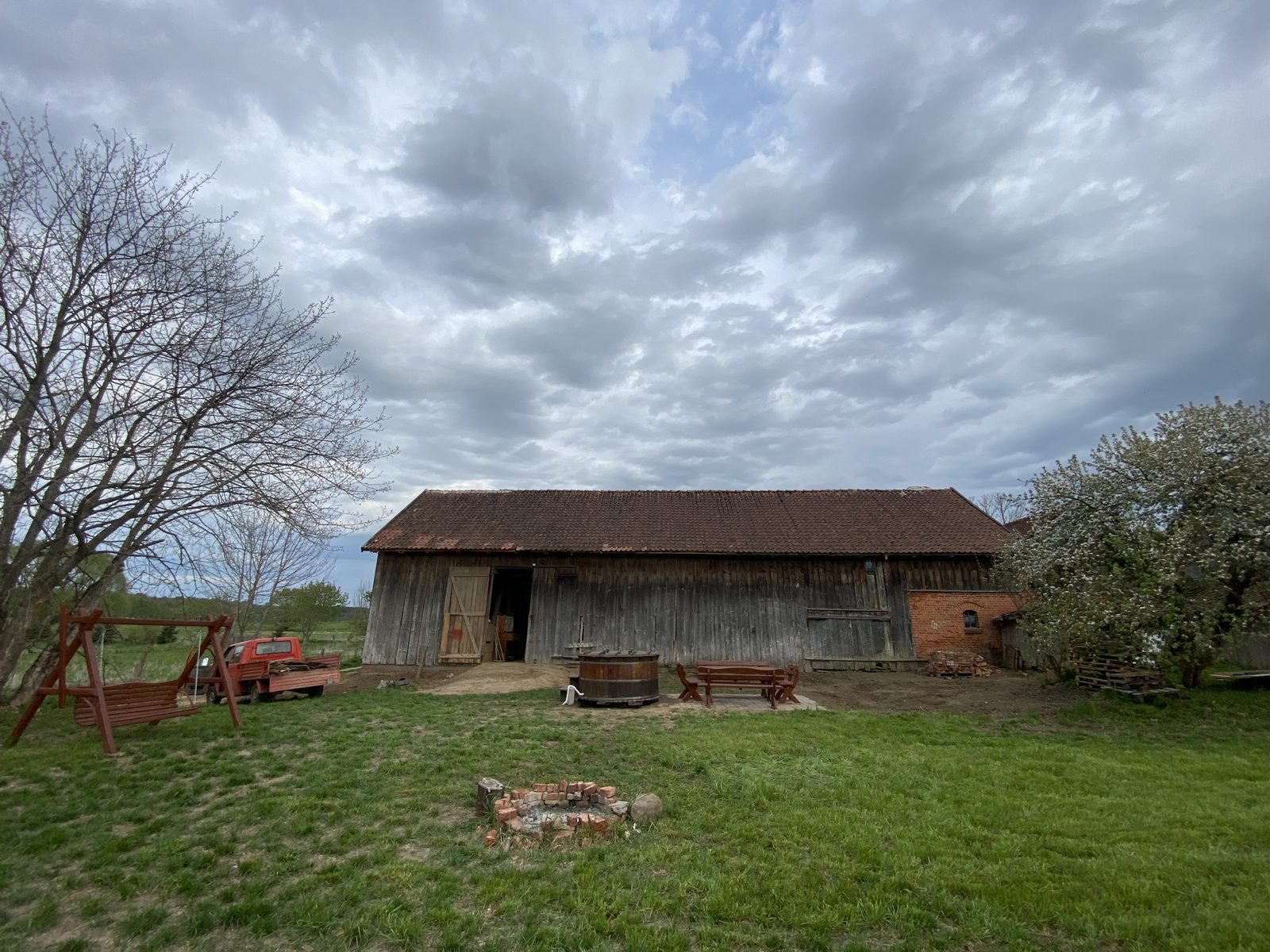
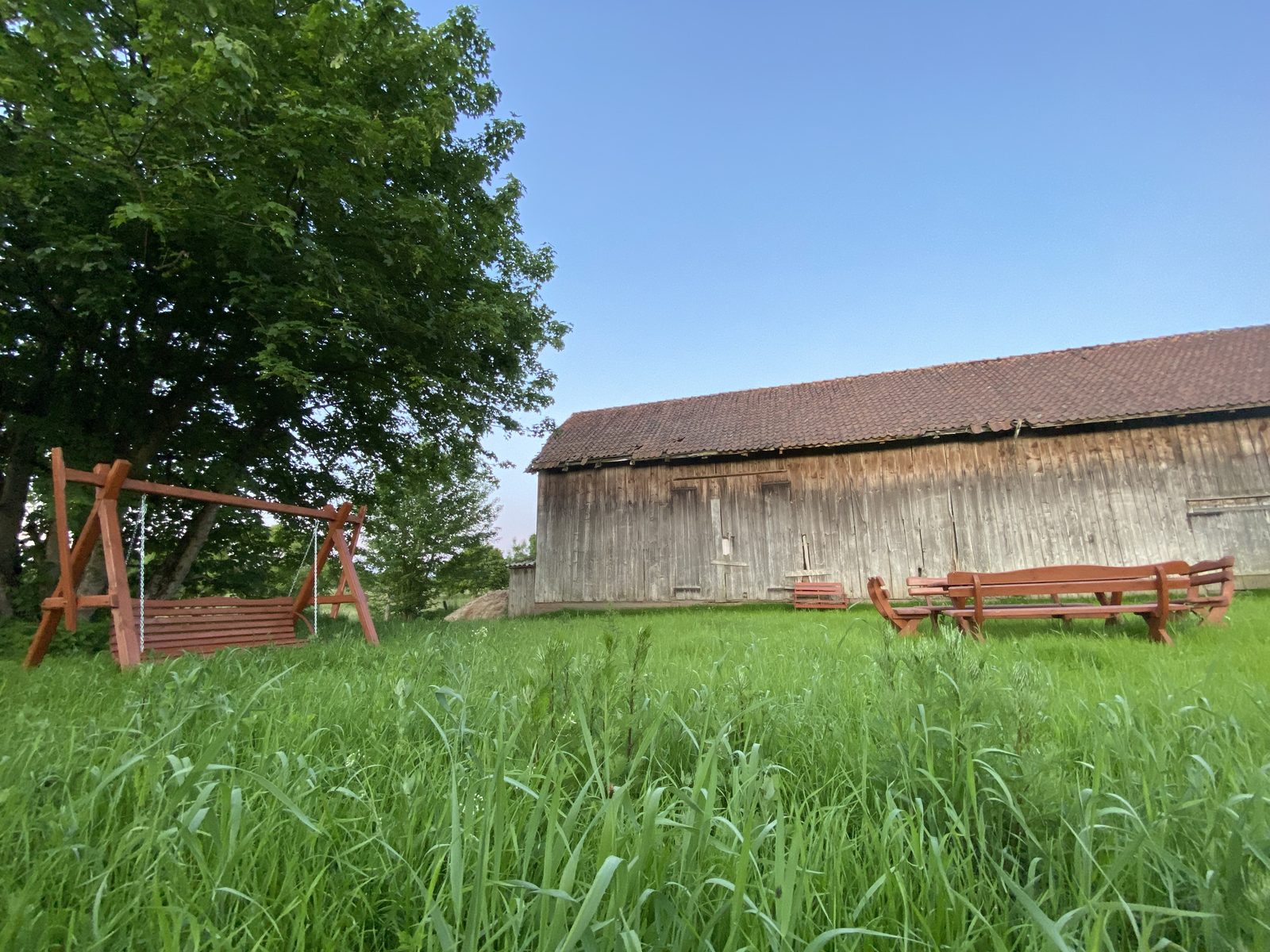
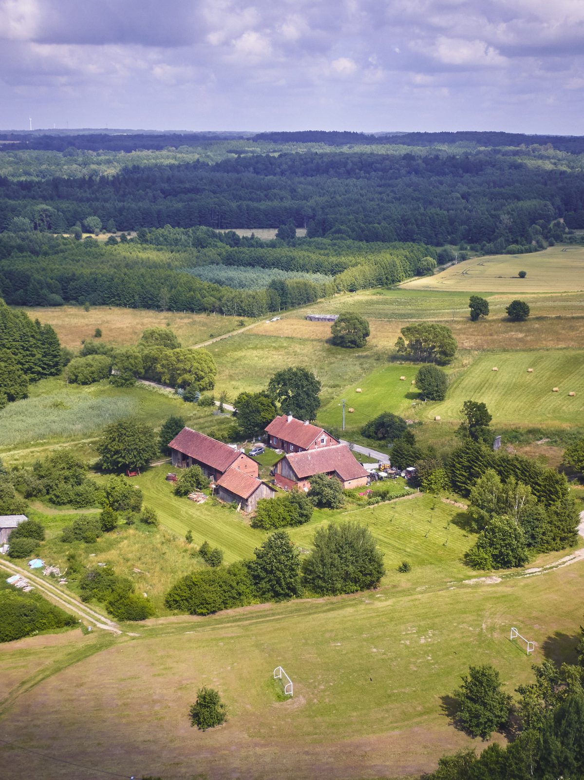
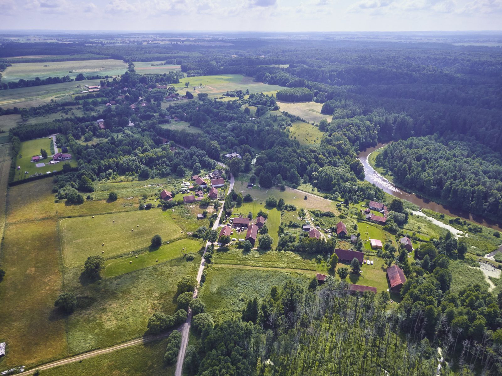
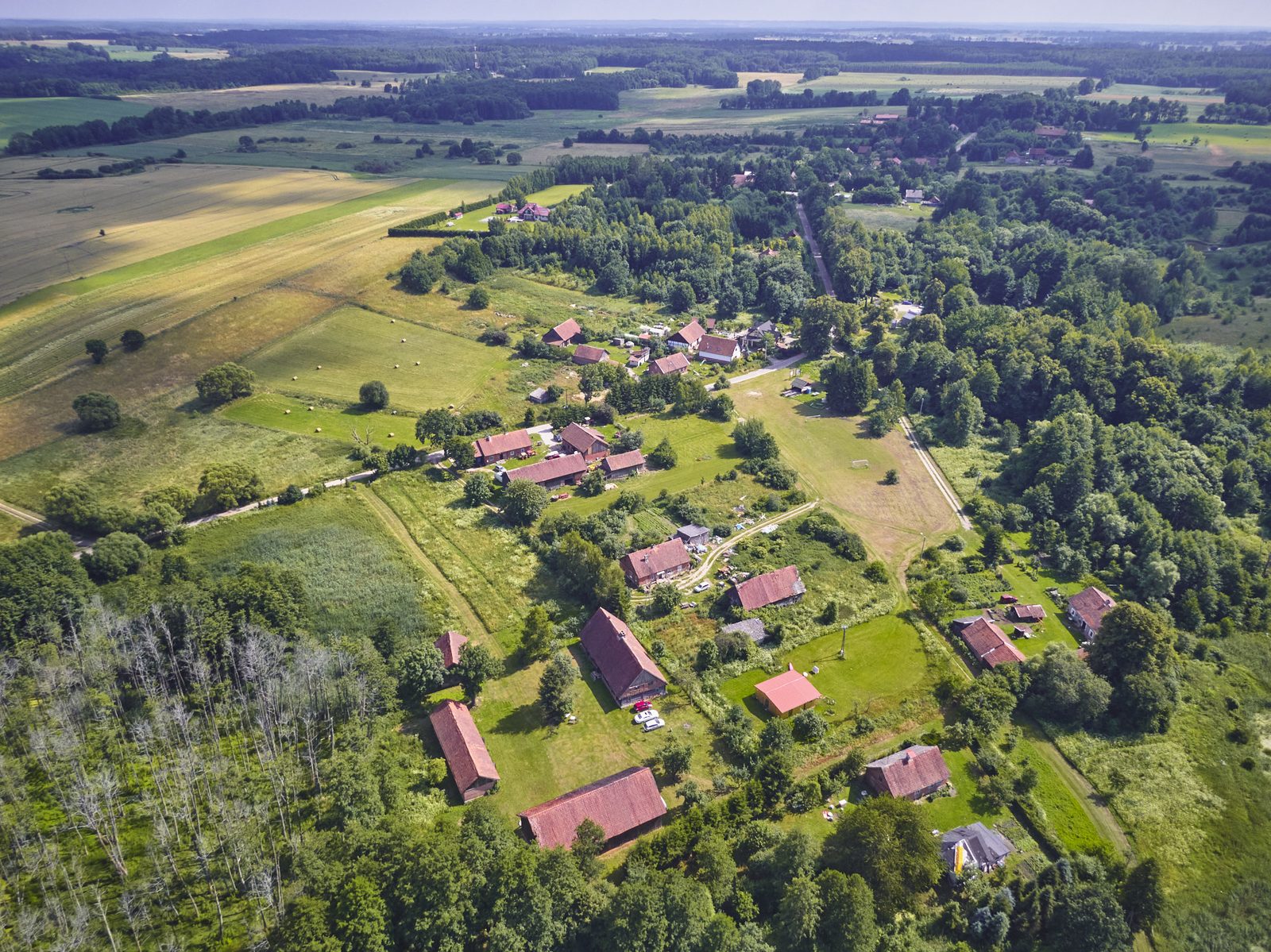
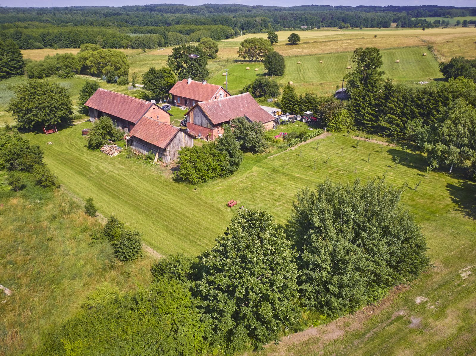
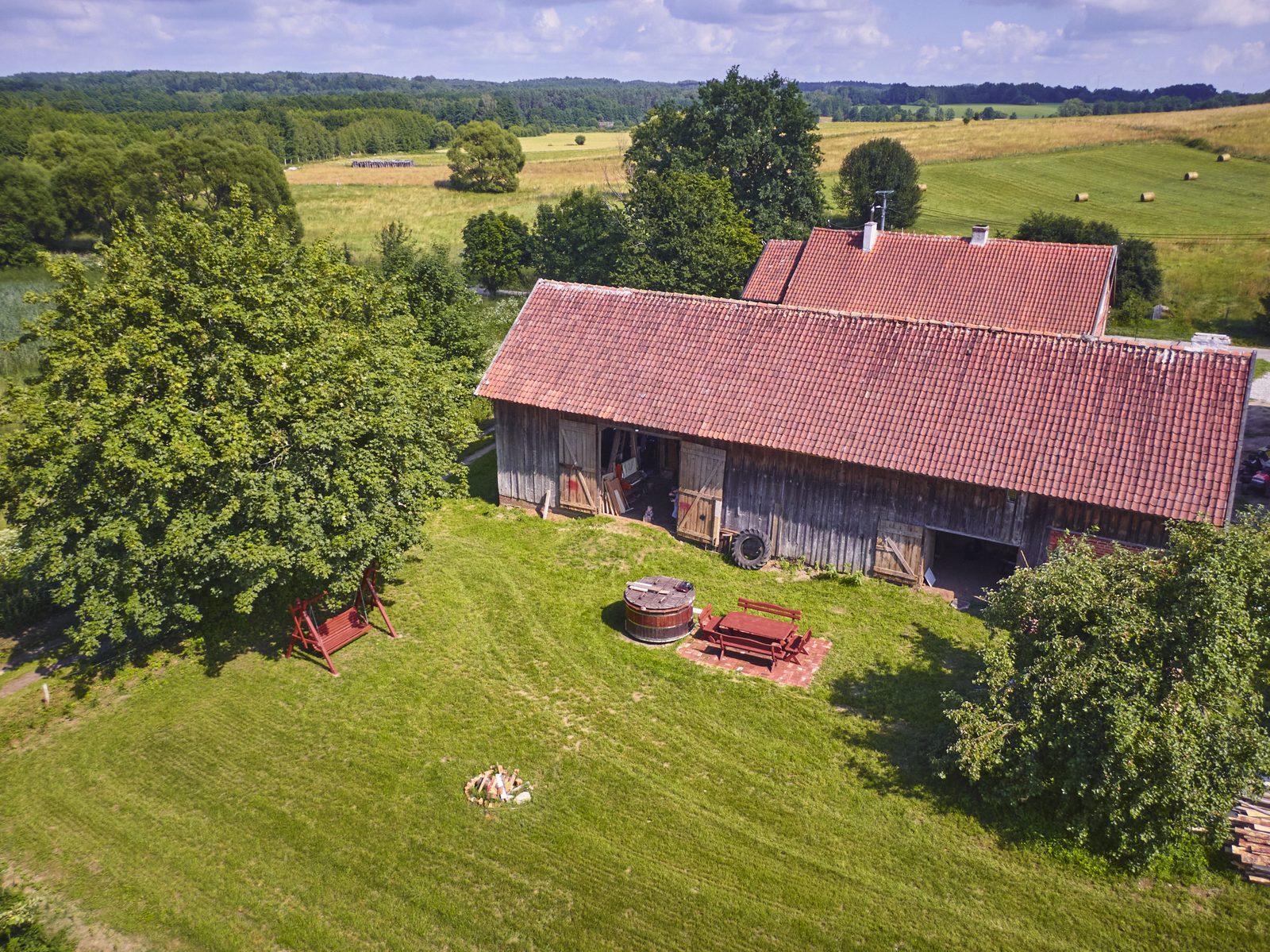
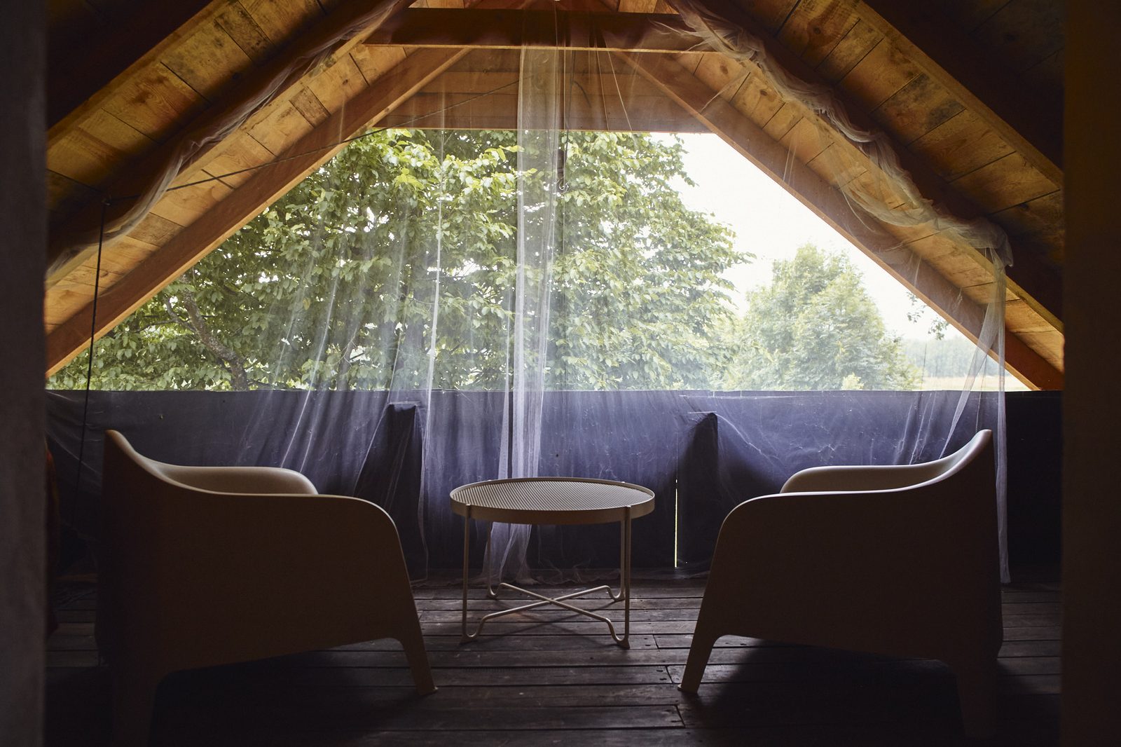
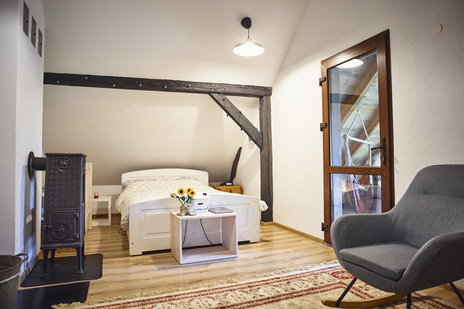
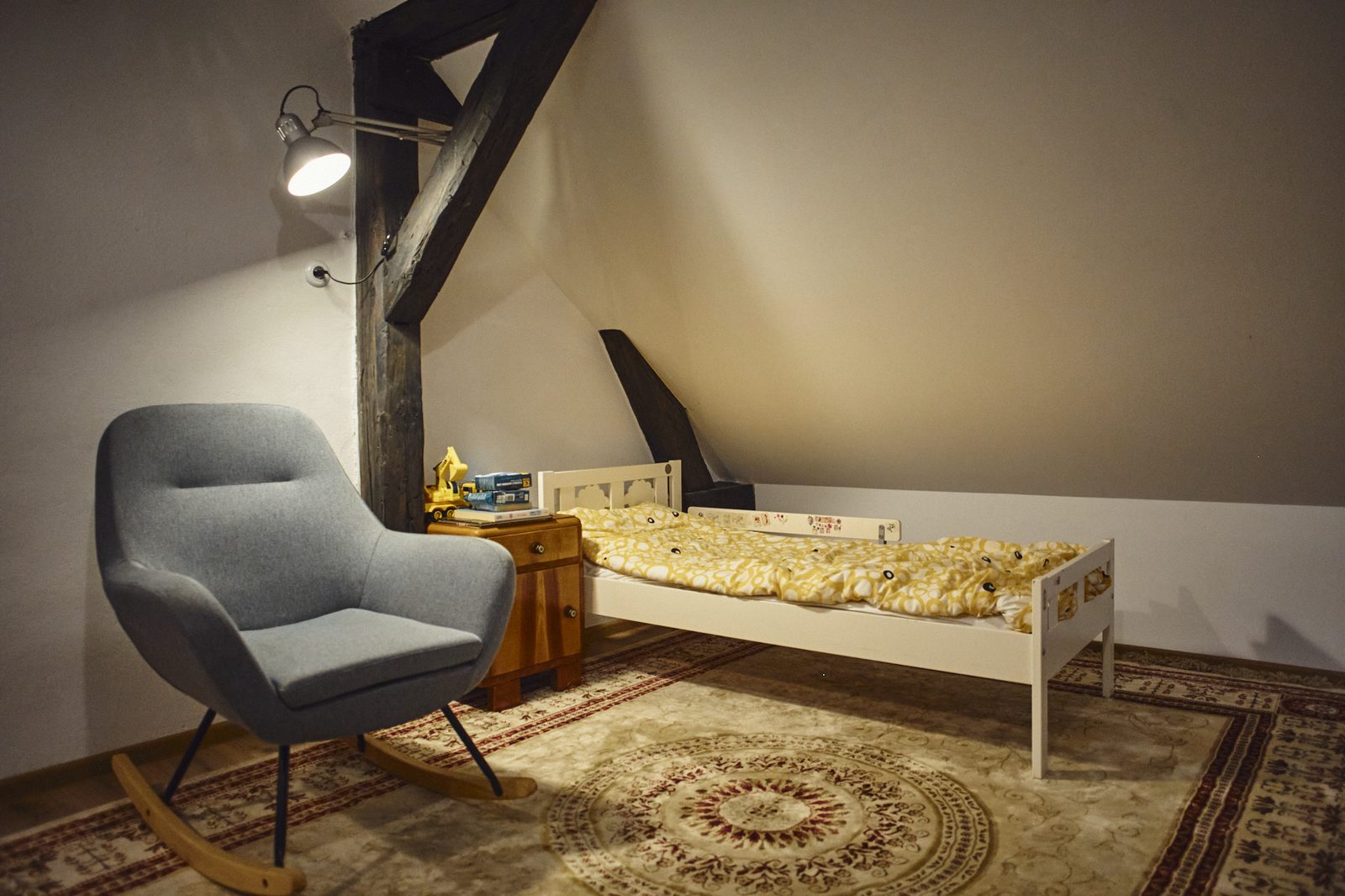
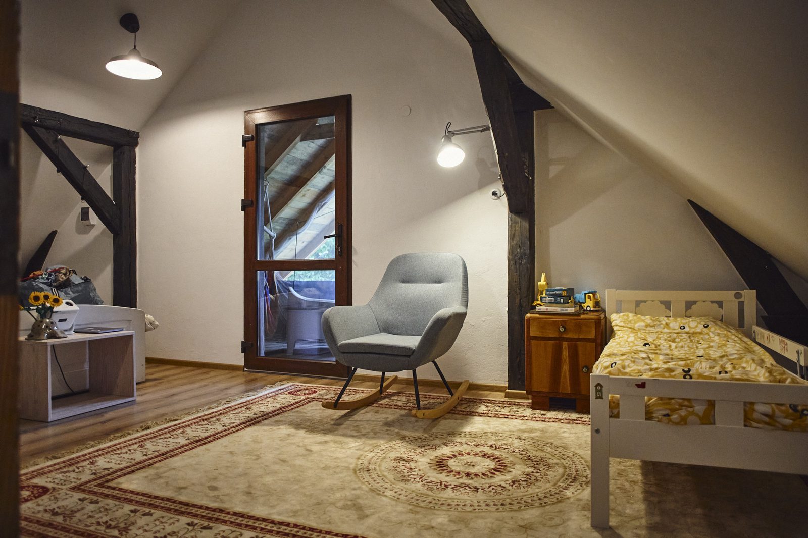
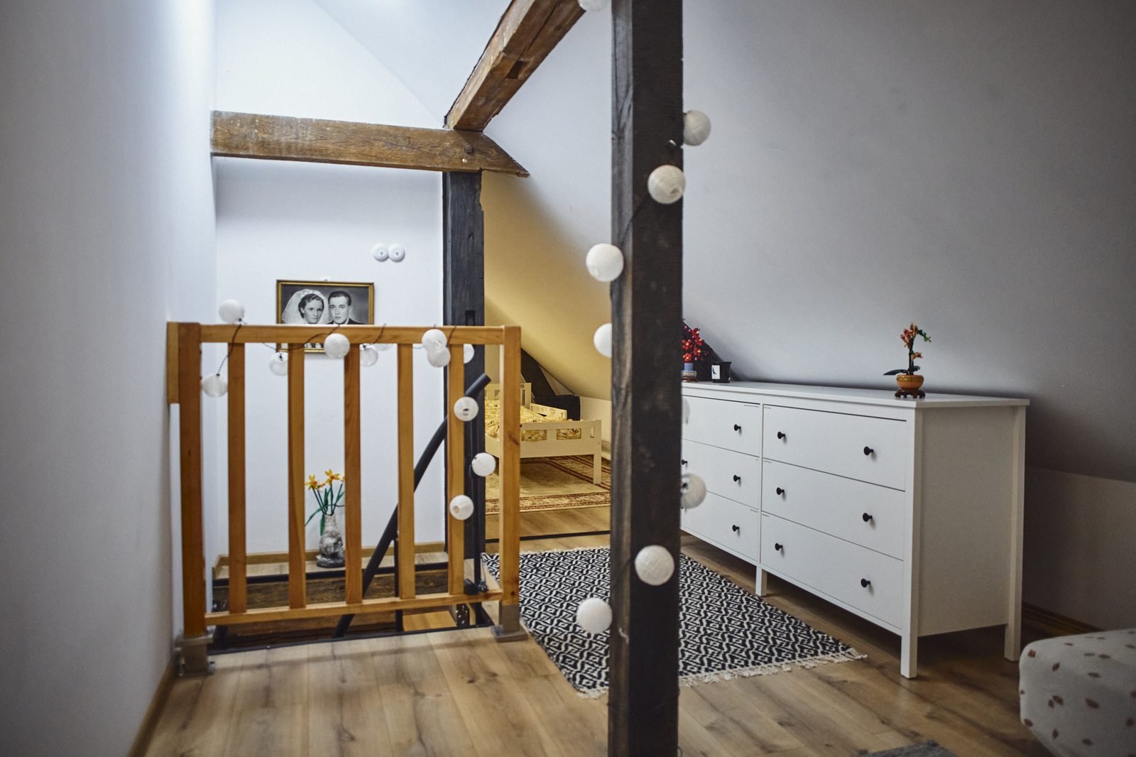
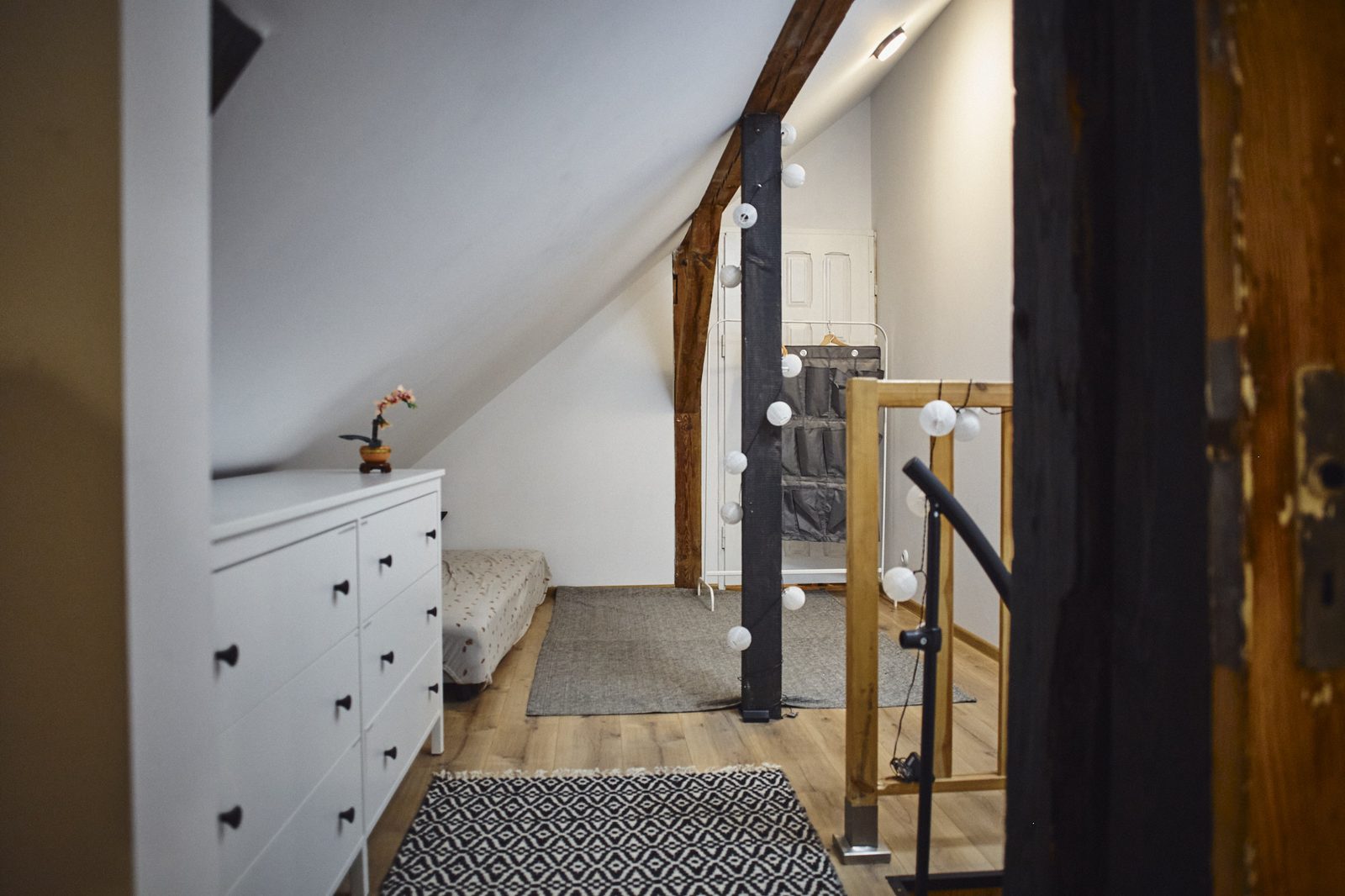
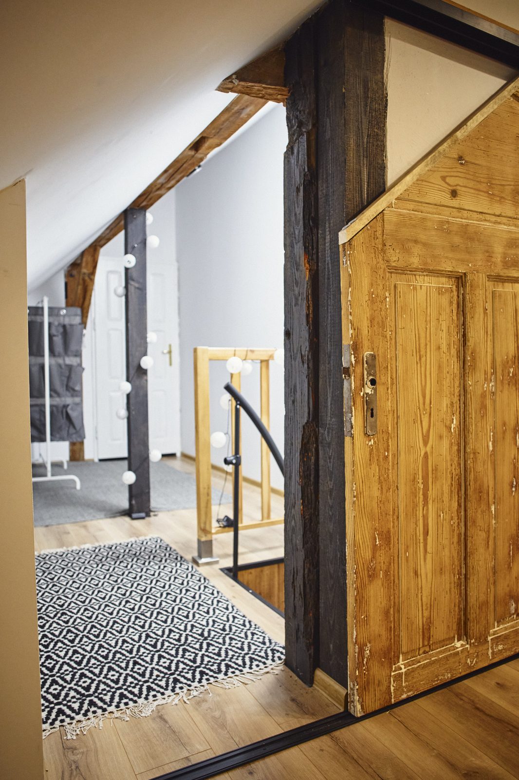
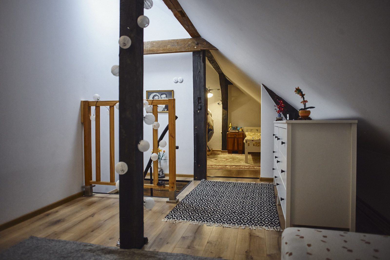
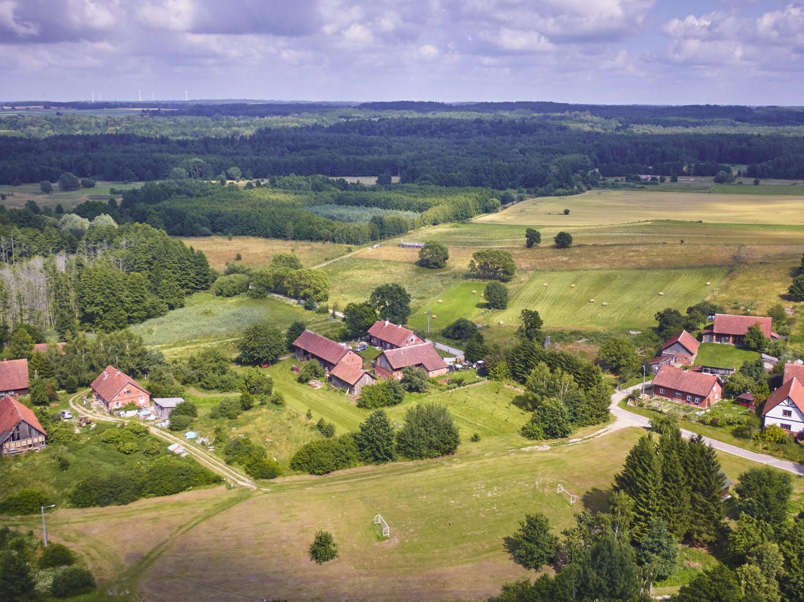
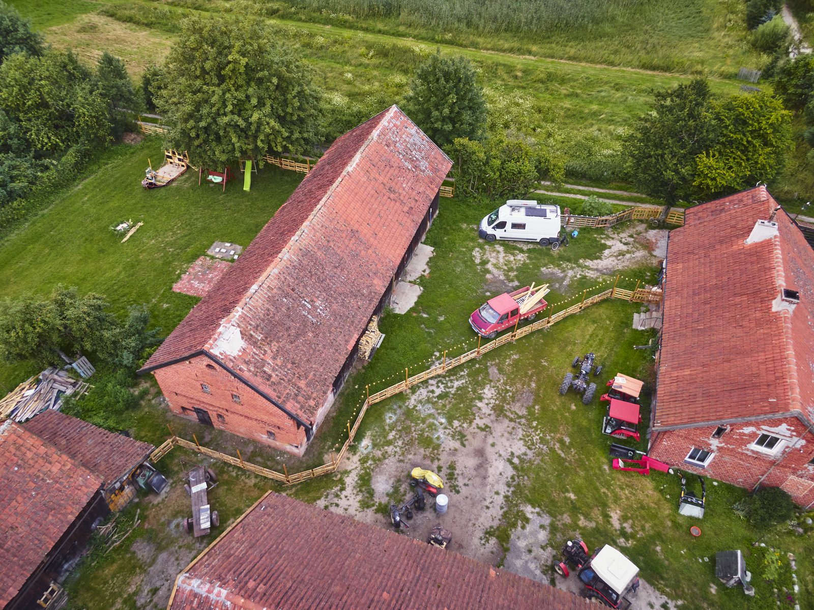
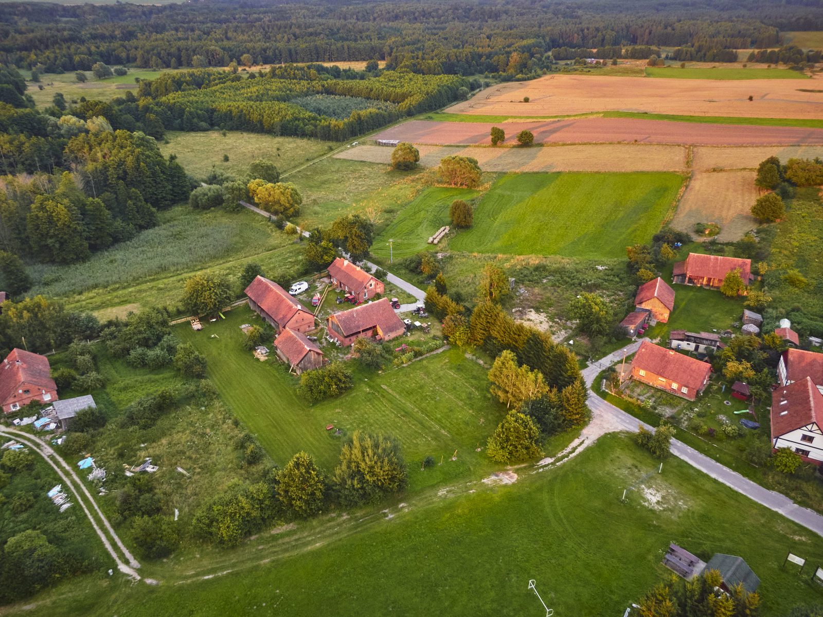
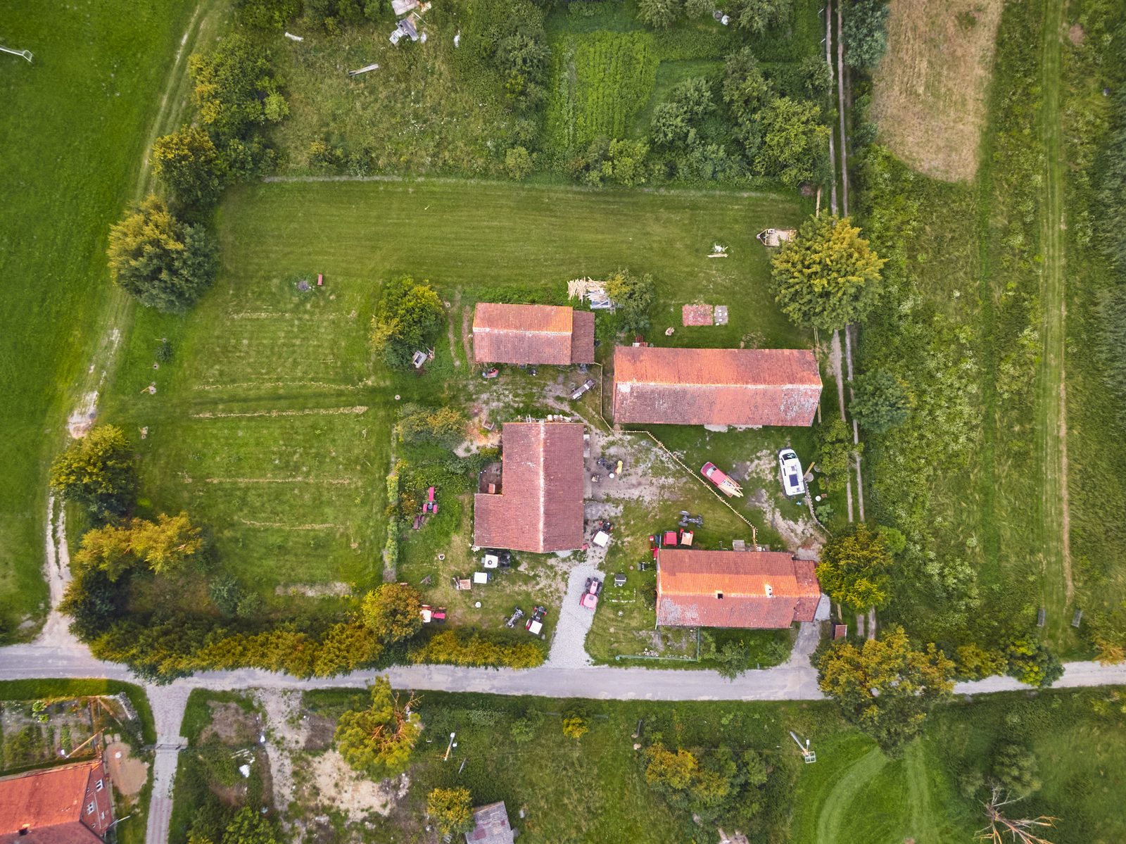
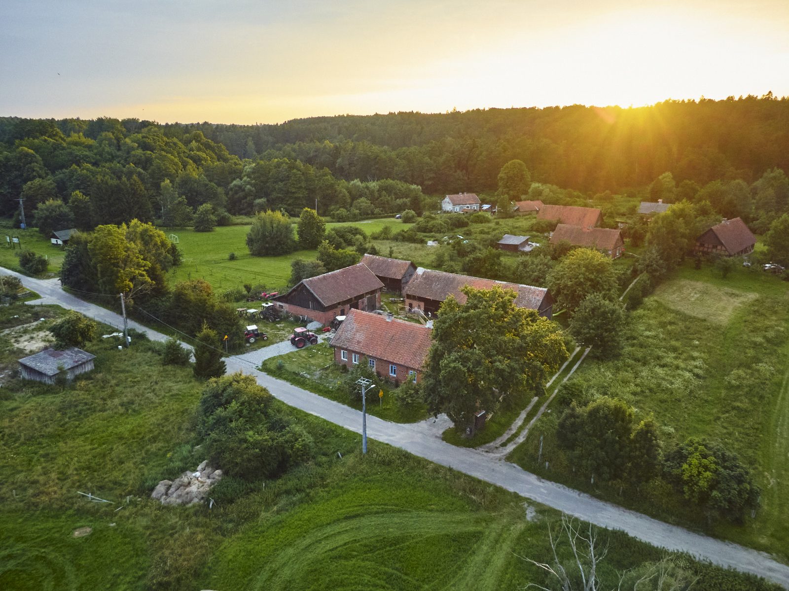
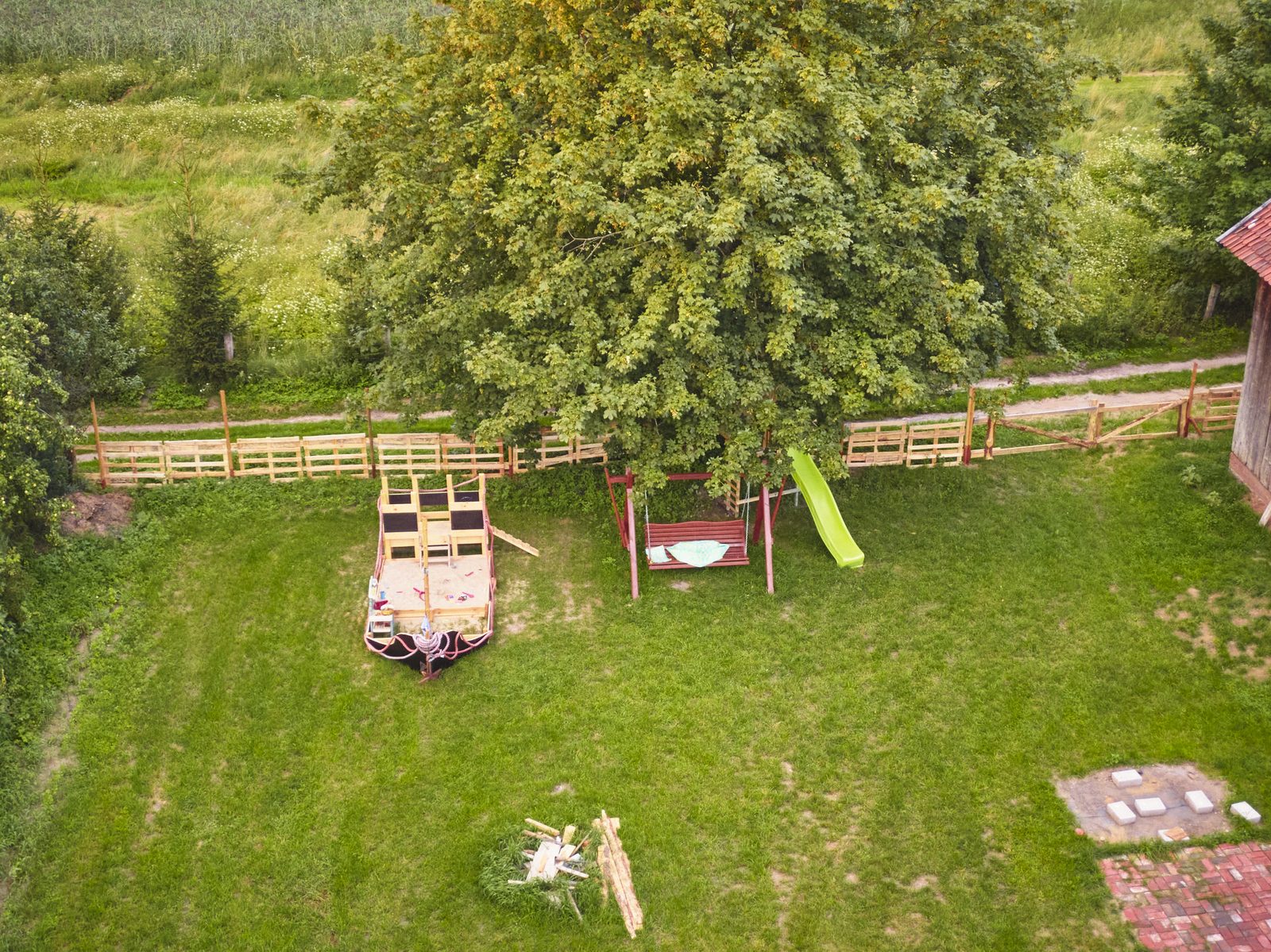
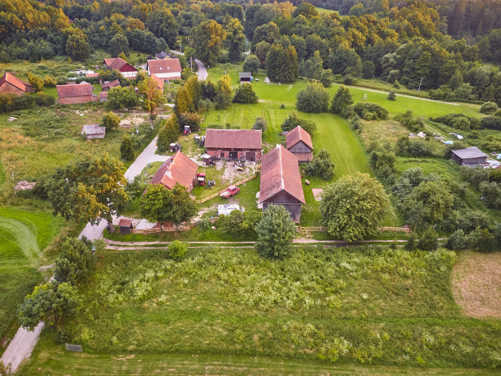
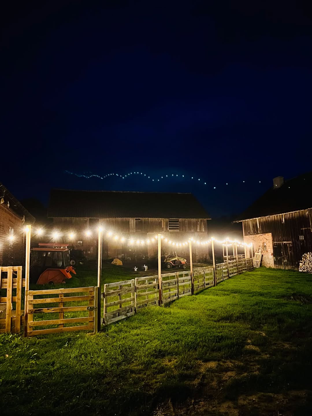
Dębinówka to przedwojenny dom w Dębinach, otoczony łąkami i lasem nad rzeką Pasłęką. Do Waszej wyłącznej dyspozycji oddajemy przytulne wnętrze, prywatny taras i ogromny ganek. Za stodołą czeka na Was wielka łąka — tylko dla Was — z huśtawką i stołem piknikowym dla 10 osób. Znajduje się tam również domek na drzewie oraz piaskownica w kształcie pirackiego statku, z prawdziwymi cumami i kotwicą.
Idealne miejsce dla rodzin z dziećmi, par i wszystkich, którzy chcą odetchnąć z dala od turystycznego zgiełku. Pieski mile widziane po wcześniejszym uzgodnieniu.
Dębinówka is a pre-war house in Dębiny, surrounded by meadows and forest along the Pasłęka River. We offer you exclusive use of a cozy interior, a private terrace, and a spacious porch. Behind the barn awaits a huge meadow — just for you — with a swing and a picnic table for 10 people. There's also a treehouse and a pirate-ship-shaped sandbox complete with real mooring ropes and an anchor.
The perfect place for families with children, couples, and anyone looking to get away from the tourist bustle. Dogs are welcome by prior arrangement.
Dębinówka ist ein Vorkriegshaus in Dębiny, umgeben von Wiesen und Wald an der Pasłęka (Passarge). Zu Ihrer ausschließlichen Verfügung stehen ein gemütlicher Innenraum, eine private Terrasse und eine große Veranda. Hinter der Scheune wartet eine riesige Wiese – nur für Sie – mit Schaukel und einem Picknicktisch für 10 Personen. Dort gibt es außerdem ein Baumhaus und einen Sandkasten in Form eines Piratenschiffs, mit echten Tauen und einem Anker.
Der ideale Ort für Familien mit Kindern, Paare und alle, die fernab des Touristentrubels durchatmen möchten. Hunde sind nach vorheriger Absprache willkommen.
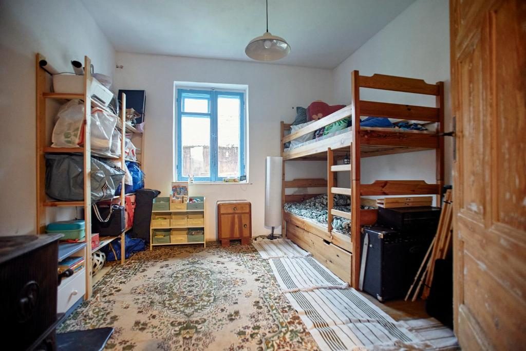
2 sypialnie
2 bedrooms
2 Schlafzimmer
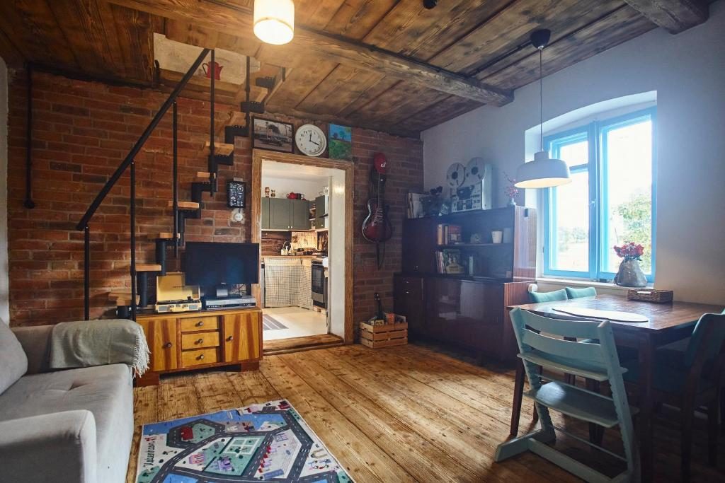
Salon
Living room
Wohnzimmer
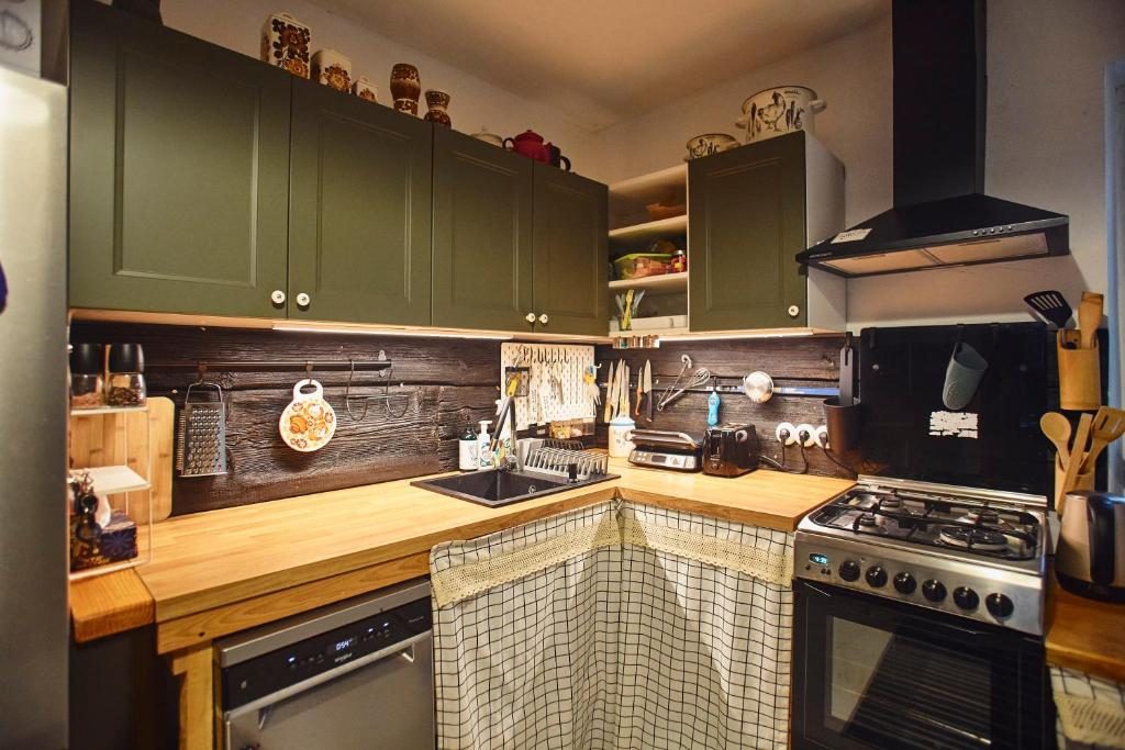
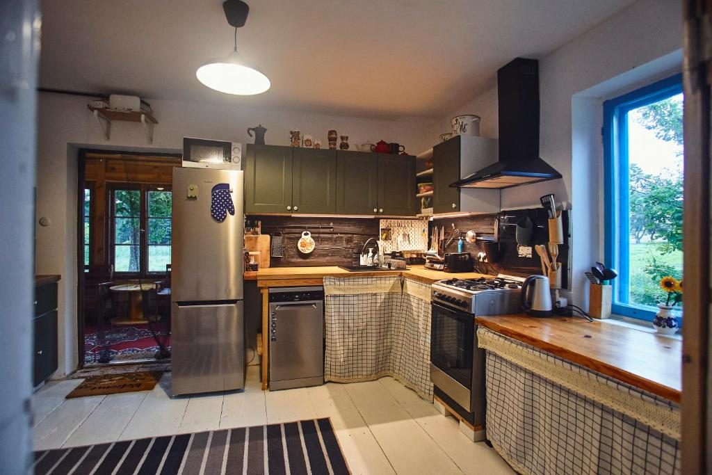
W pełni wyposażona kuchnia
Fully equipped kitchen
Voll ausgestattete Küche
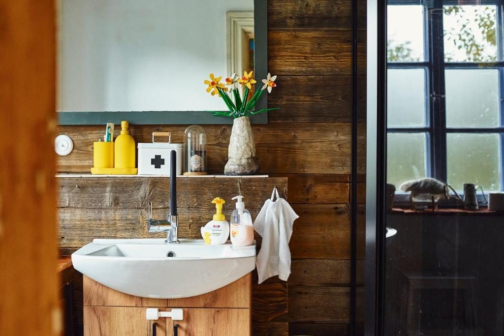
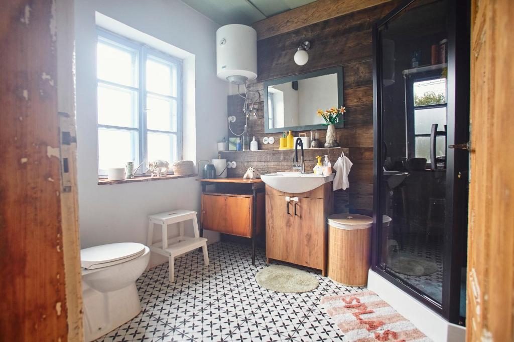
Łazienka z prysznicem
Bathroom with shower
Badezimmer mit Dusche
Prywatny taras i ganek
Private terrace & porch
Private Terrasse und Veranda
Łąka z huśtawką
Meadow with a swing
Wiese mit Schaukel
Bezpłatne Wi-Fi
Free Wi-Fi
Kostenloses WLAN
Parking na podwórku
On-site parking
Parkplatz auf dem Hof
Pościel i ręczniki w cenie
Linens & towels included
Bettwäsche und Handtücher inklusive
Plac zabaw dla dzieci
Playground for kids
Spielplatz für Kinder
ZdjęciaPhotosFotos
Boisko i wiata grillowaSports field & grill shelterSportplatz und Grillhütte
Nasza łąka graniczy bezpośrednio z gminnym boiskiem do piłki nożnej i siatkówki — możecie z niego swobodnie korzystać.
Przy boisku stoi też wiata z piecem do pizzy, grillem i wędzarnią, z których możecie skorzystać w ramach pobytu.
Our meadow borders directly on the village's football and volleyball pitch — you're welcome to use it freely.
Next to the pitch there's also a shelter with a pizza oven, a grill and a smokehouse, all available to you during your stay.
Unsere Wiese grenzt direkt an den Gemeindesportplatz für Fußball und Volleyball – Sie können ihn jederzeit frei nutzen.
Neben dem Platz steht außerdem eine Hütte mit Pizzaofen, Grill und Räucherkammer, die Sie während Ihres Aufenthalts nutzen können.
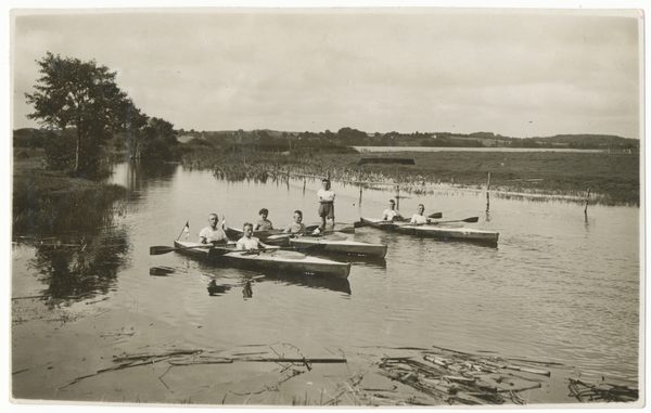
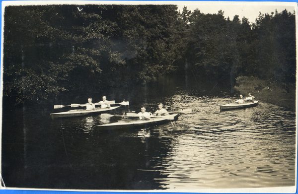
Tuż obok mamy rzekę Pasłękę, gdzie można łowić ryby po wykupieniu karty wędkarskiej i uzyskaniu zgody na połów. Można też się kąpać oraz pływać kajakiem z zachowaniem szacunku dla natury. Jest to rezerwat przyrody ostoja bobrów.
Right next to us is the Pasłęka River, where you can fish after purchasing a fishing license and obtaining permission to fish. You can also swim and kayak there while respecting nature. It is a nature reserve — a beaver sanctuary.
Gleich nebenan fließt die Pasłęka, wo man nach Erwerb eines Angelscheins und mit Angelerlaubnis fischen kann. Man kann dort auch baden und Kajak fahren – unter Wahrung des Respekts vor der Natur. Das Gebiet ist ein Naturschutzgebiet und ein Rückzugsort der Biber.
Jak do nas trafićGetting hereAnfahrt
Dębiny 33/2, 14-405 Wilczęta
Z Gdańska – najlepiej trasą przez Chruściel (S22 – „Berlinka”). Z Warszawy – przez Pasłęk i Młynary, gdzie znajdziecie sklepy, stację benzynową i pizzerię.
From Gdańsk, the best route runs through Chruściel (S22 – the "Berlinka" road). From Warsaw, via Pasłęk and Młynary, where you'll find shops, a petrol station and a pizzeria.
Aus Danzig – am besten über Chruściel (S22 – die „Berlinka“). Aus Warschau – über Pasłęk (Preußisch Holland) und Młynary (Mühlhausen), wo Sie Geschäfte, eine Tankstelle und eine Pizzeria finden.
Dookoła same łąki, las i malownicze zakola rzeki Pasłęki w zasięgu spaceru. To też świetna baza wypadowa do Fromborka, Kadyn, Słobit i nad Zalew Wiślany.
All around: meadows, forest and the scenic bends of the Pasłęka river within walking distance. Also a great base for exploring Frombork, Kadyny, Słobity and the Vistula Lagoon.
Ringsum nur Wiesen, Wald und die malerischen Schleifen der Pasłęka in Spazierdistanz. Zugleich ein hervorragender Ausgangspunkt für Ausflüge nach Frombork (Frauenburg), Kadyny (Cadinen), Słobity (Schlobitten) und an das Frische Haff.
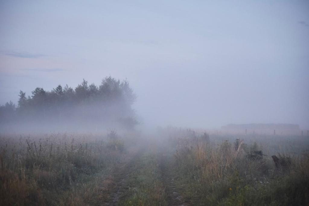
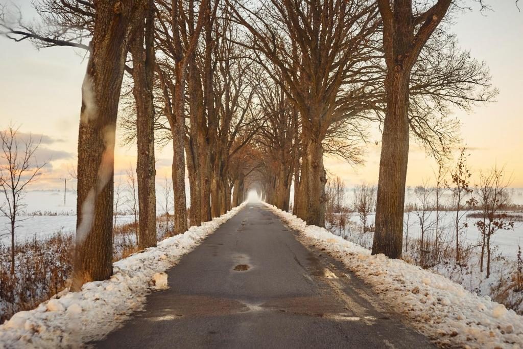
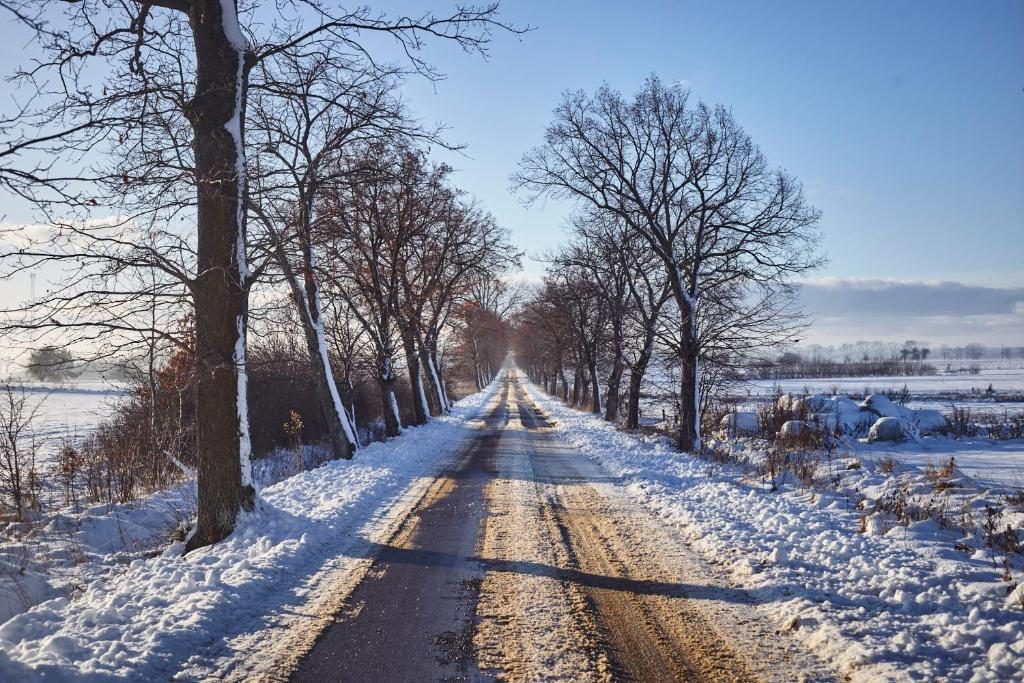
Dębiny nie leżą na żadnej przelotowej drodze — to ostatnia wieś przy tej drodze, więc nie ma tu przejeżdżającego tranzytem ruchu.
Asfalt drogi powiatowej kończy się przy naszym domu, bo to ostatni dom we wsi. Dalej prowadzi już tylko szutrowa droga — do lasu i nad rzekę.
Dębiny isn't on any through route — it's the last village along this road, so there's no passing traffic here.
The paved county road ends right at our house, since ours is the last house in the village. Beyond it there is only a gravel track — leading into the forest and down to the river.
Dębiny liegt an keiner Durchgangsstraße – es ist das letzte Dorf an dieser Straße, daher gibt es hier keinen Durchgangsverkehr.
Der Asphalt der Kreisstraße endet direkt an unserem Haus, denn es ist das letzte Haus im Dorf. Dahinter führt nur noch ein Schotterweg weiter – in den Wald und hinunter zum Fluss.
Dookoła Dębinówki same łąki, las i malownicze zakola rzeki Pasłęki. To też świetna baza wypadowa na kilkugodzinne wycieczki — oto miejsca, które podpowiadamy naszym gościom.
Around Dębinówka you'll find meadows, forest, and the scenic bends of the Pasłęka river. It's also a great base for a few hours' worth of day trips — here are the places we recommend to our guests.
Ringsum nur Wiesen, Wald und die malerischen Schleifen der Pasłęka. Zugleich ein hervorragender Ausgangspunkt für mehrstündige Ausflüge – hier die Orte, die wir unseren Gästen empfehlen.
Słobity — cień największej rezydencji Prus Wschodnich
Niem. Schlobitten, gmina Wilczęta, powiat braniewski, ok. 8 km na południowy zachód od Wilcząt, nad rzeką Gardyną.
Wieś, która była stolicą rodu
Nazwa Słobit jest pruskiego pochodzenia — od rodziny pruskich możnych Slobita (zapisywanych też jako Slobithe, Slobuthe), o których poza samym imieniem nie wiadomo praktycznie nic. Ich ziemie zakon krzyżacki przekazał najpierw rodzinie Landgreff, potem Haubitz.
W 1525 roku wieś trafiła w ręce Piotra zu Dohny (1483–1553), nadana mu przez ostatniego wielkiego mistrza Albrechta Hohenzollerna za zasługi dla zakonu. To data, od której zaczyna się właściwa historia tego miejsca: przez kolejne 420 lat, aż do 1945 roku, Słobity należały do Dohnów, a od 1589 roku były główną siedzibą linii zu Dohna-Schlobitten — jednego z najważniejszych rodów arystokratycznych w Prusach.
Pierwsi Dohnowie mieszkali w tzw. Nowym Domu, wzniesionym przez Achacego zu Dohnę (1533–1601), który przeniósł tu siedzibę rodu z Morąga. Fragmenty sklepionych piwnic z XVI wieku wmurowano później w nowszą budowlę.
Pałac: od niderlandzkiego renesansu do baroku królewskiego
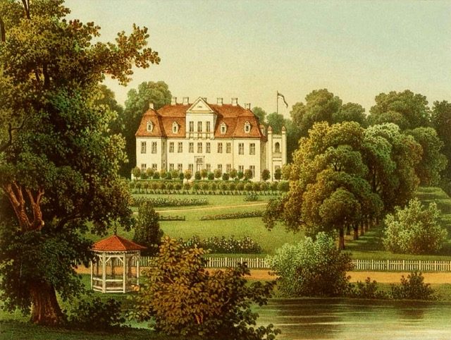
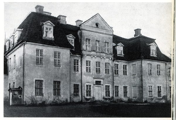
Pierwszy właściwy pałac postawił w latach 1621–1624 wnuk Piotra, Abraham zu Dohna (1579–1631) — człowiek o starannym wykształceniu humanistycznym, a przy tym inżynier fortyfikacji, więc zdolny sam zaprojektować własny dom. Budowla nawiązywała do architektury niderlandzkiej początku XVII wieku (Dohnowie byli skoligaceni z domem orańskim), założona na planie spłaszczonej litery H, z renesansowymi szczytami. Już w 1627 roku Abraham dobudował osobną, jednokondygnacyjną salę na swoją bibliotekę.
Drobna rozbieżność w źródłach: polska Wikipedia i portal ostpreussen.net podają lata 1621–1624, Leksykon Kultury Warmii i Mazur — 1622–1628. Różnica wynika zapewne z tego, czy liczy się rozpoczęcie prac, czy ich zakończenie wraz z aneksem bibliotecznym.
Dom szybko zniszczyli Szwedzi; odbudowano go prowizorycznie i to on stał się później środkową częścią barokowego założenia.
Prawdziwy rozmach przyszedł z Aleksandrem zu Dohną (1661–1728) — późniejszym feldmarszałkiem, szefem rządu prowincji pruskiej, gubernatorem Piławy i wychowawcą następcy tronu. Budowę prowadzono w latach 1696–1736, w zasadniczej części ukończono ją w 1713. Za generalny plan i wschodnie skrzydło (1695–1698) odpowiadał Jean Baptist Broebes (1660 – po 1720), wówczas budowniczy fortyfikacji w Piławie. Od 1704 roku kierownictwo przejął Johann Caspar Hindersin (1677–1738), wspierany jako rzeczoznawca przez królewieckiego budowniczego Joachima Ludwiga Schultheißa von Unfrieda (1678–1753) — to jego werdykt sprawił, że korpus środkowy podwyższono o niską kondygnację pod dachem mansardowym.
Architektoniczną osobliwością pałacu był brak reprezentacyjnego wejścia głównego na osi fasady — zastąpiono je dwoma symetrycznymi wejściami przy galeriach. Na piętrze mieściła się dwukondygnacyjna sala balowa z polichromiami i sztukateriami; według popularnych opracowań był to jedyny taki salon w Prusach.
Efektem był jeden z pruskich pałaców królewskich (Königsschlösser) — rezydencji, które miały obowiązek goszczenia króla w czasie jego podróży po prowincji. I rzeczywiście gościły: Fryderyk II zatrzymywał się tu wielokrotnie, marszałek Bernadotte urządził tu w 1807 roku swoją kwaterę główną podczas kampanii wschodniopruskiej, a cesarz Wilhelm II bywał regularnie jako gość Ryszarda zu Dohny, swojego łowczego dworu.
Jest jeszcze jeden słobicki wątek, o którym warto wspomnieć: w młodości, w latach 1790–1793, guwernerem dzieci na dworze w Słobitach był Friedrich Schleiermacher (1768–1834) — późniejszy filozof i teolog, jedna z kluczowych postaci niemieckiego protestantyzmu. Spacerował pod lipami zasadzonymi w 1625 roku, z których kilka przetrwało do dziś.
Zbiory, których już nie ma
Przez trzy stulecia pałac gromadził kolekcje. W 1893 roku biblioteka liczyła 23 tysiące woluminów; w 1944 — 55 tysięcy. Do tego zbiór obrazów, kolekcja monet, rzadkie fajanse, srebra. Majątek obejmował ok. 1500 hektarów uprawianych przez 160 rodzin; po 1918 roku działał tu również dom dla samotnych osób starszych.
To, że zbiory przetrwały w całości do XX wieku, zawdzięczamy Wiecznemu Testamentowi z 1621 roku, którym linia słobicka uczyniła swój majątek niepodzielnym fideikomisem rodowym.
Styczeń 1945
W styczniu 1945 roku mieszkańcy pałacu wraz ze służbą ruszyli na zachód pod wodzą księcia Aleksandra zu Dohny (1899–1997). Kolumna liczyła 330 osób, 140 koni i 38 wozów i pokonała okrężnymi drogami około 1500 kilometrów do północnych Niemiec. Wcześniej, potajemnie od 1943 roku, wywożono pociągami i wozami część wyposażenia — dzięki temu znaczna część inwentarza Schlobitten ocalała i tworzy dziś Sammlung Dohna-Schlobitten, kolekcję pod opieką Fundacji Pruskich Zamków i Ogrodów Berlin-Brandenburgia. Z 55 tysięcy tomów biblioteki do zbioru należy dziś jedenaście.
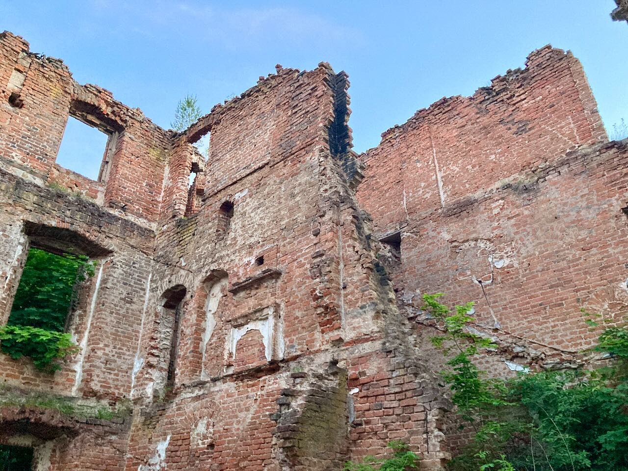
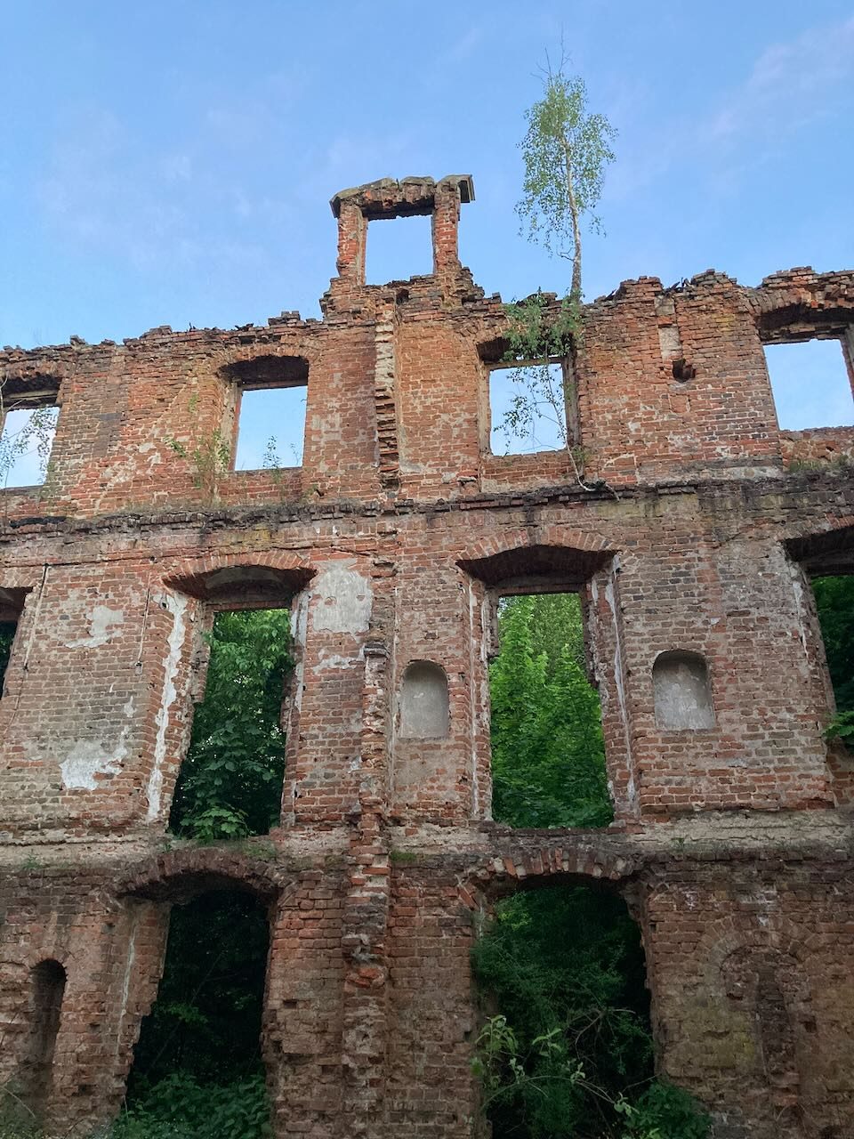
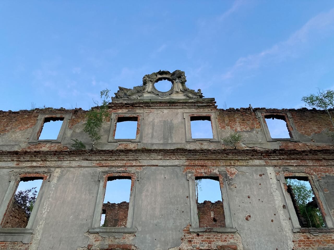
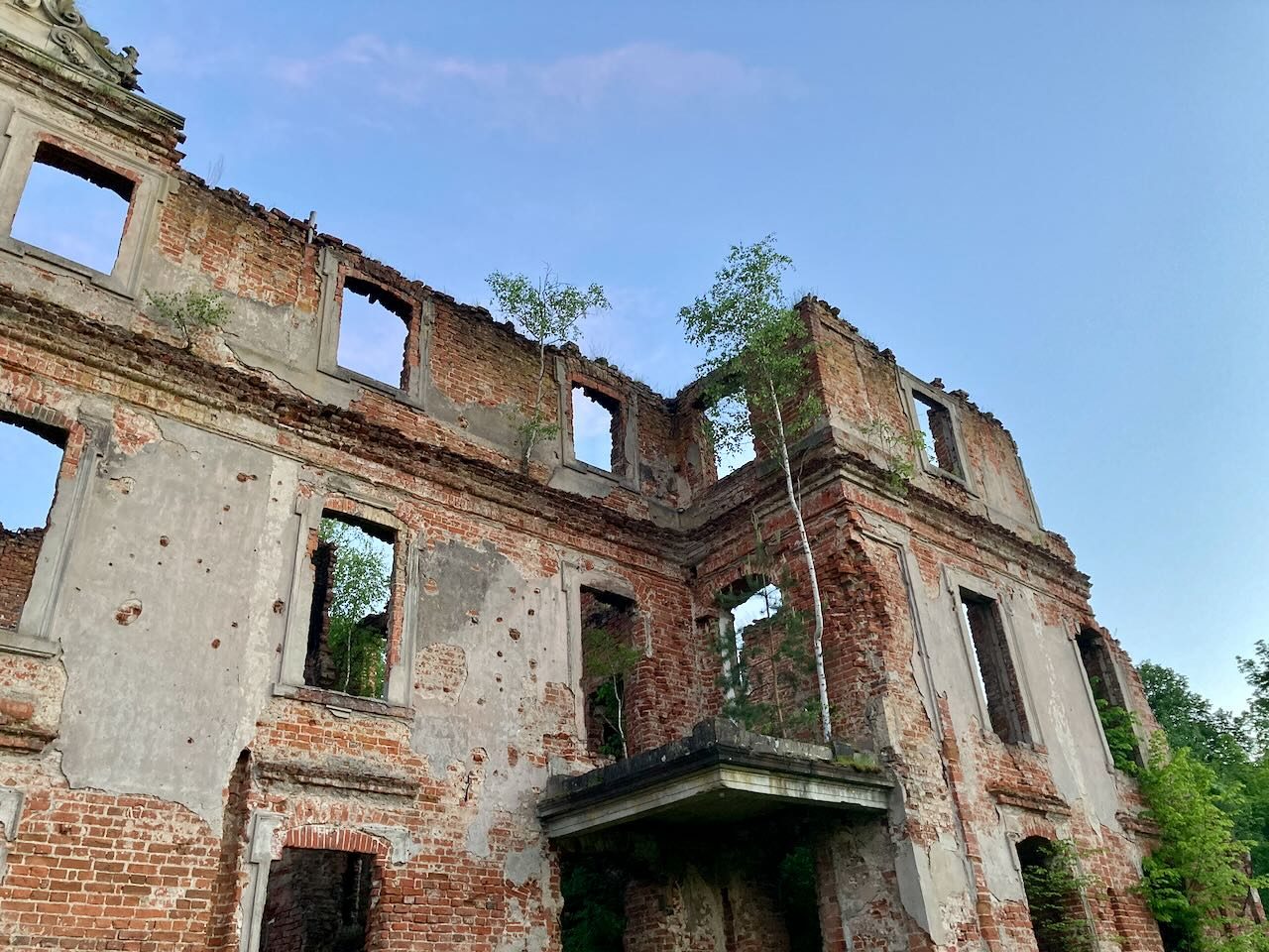
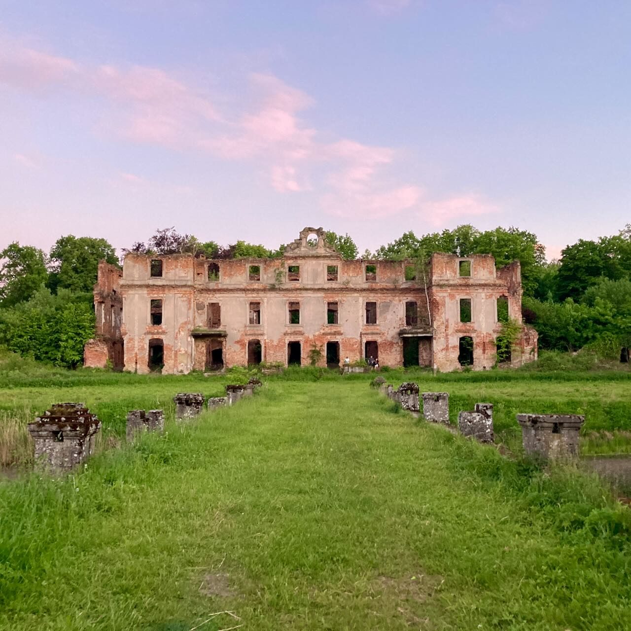
Armia Czerwona wkroczyła do Słobit 23 stycznia 1945 roku. Pałac splądrowano i podpalono. Ruiny skrzydeł bocznych rozebrano; stoją jeszcze mury zewnętrzne korpusu głównego. Stajnię z barokową wieżą i zegarem oraz browar trafiły wiosną 1945 bomby lotnicze, a ich pozostałości uprzątnięto po wojnie. Po wojnie na terenie majątku założono PGR.
Aleksander zu Dohna wracał tu po wojnie wielokrotnie — początkowo związany ze środowiskami rewizjonistycznymi, po memorandum Kościoła Ewangelickiego Niemiec z 1965 roku zmienił stanowisko, uznając, że Niemcy nie mają prawa do roszczeń wobec dawnych ziem wschodnich. Zaprzyjaźnił się m.in. z prof. Stanisławem Lorentzem, dyrektorem Muzeum Narodowego w Warszawie, i nawiązał kontakty z muzeami w Elblągu i Olsztynie. Próbował zainteresować polskie władze odbudową pałacu — bez rezultatu. Kilka uratowanych obrazów ze Słobit znajduje się w Muzeum Warmii i Mazur w Olsztynie.
Obiekt wpisano do polskiego rejestru zabytków 19 marca 1968 roku pod numerem 587/69.
Legenda Bursztynowej Komnaty
Słobity regularnie pojawiają się na listach domniemanych kryjówek Bursztynowej Komnaty. Podstawa jest jedna: jesienią 1944 roku dyrektor muzeum w Królewcu, dr Alfred Rohde, miał zaproponować księciu zu Dohnie przechowanie zdemontowanego skarbu w pałacowych piwnicach. Książę odmówił, tłumacząc, że piwnice są zbyt zawilgocone.
To wszystko. Nigdy nie potwierdzono, by do przekazania doszło. Reszta — dwupoziomowe piwnice, zalane wodą korytarze, tunel pod mostem — to poszlaki i domysły, które rozpalają wyobraźnię, ale nie mają statusu ustaleń. Legenda jest częścią historii tego miejsca, ale nie jest jego historią.
Folwark i gorzelnia
Naprzeciw pałacu, oddzielone dwoma stawami — dawnymi fosami — przez które przerzucono kamienny most, stały budynki gospodarcze utrzymane w stylu rezydencji: gorzelnia i browar. Stajnia z barokową wieżą zegarową zamykała wschodnią stronę dziedzińca.
Rozległe zabudowania folwarczne wzniesiono w latach 1718–1725. Folwark położony około kilometra od pałacu przetrwał wojnę — w odróżnieniu od samej rezydencji. Zachował się też dawny budynek gorzelni (Branntweinhaus) z lat 1704/05, choć nieużytkowany i niszczejący.
W rejestrze zabytków figuruje cały zespół: pałac z oficynami, park, zespół folwarczny, rządcówka, stajnia, pawilon, brama, obory i owczarnia.
Dworzec — kolej, która przyszła tu przez upór hrabiego
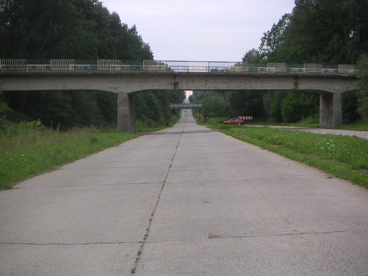
To jedna z ciekawszych historii w okolicy. Kiedy w latach 40. XIX wieku wytyczano przebieg Kolei Wschodniej (Ostbahn) z Berlina do Królewca, trasę poprowadzono przez Malbork, Elbląg, Młynary i Braniewo. Pasłęk odmówił udostępnienia ziemi pod budowę — decyzja, którą lokalni historycy nazywają krótkowzroczną. Dzięki zabiegom hrabiego Dohna-Schlobitten linia poszła przez Słobity.
Odcinek Malbork–Braniewo, długości dokładnie 83,8 km, otwarto uroczyście 19 października 1852 roku. Ostatni odcinek, Braniewo–Królewiec, uruchomiono 1 sierpnia 1853 roku.
Stacja dała początek osobnej miejscowości — Słobity-Stacja Kolejowa, do dziś funkcjonującej jako odrębna wieś i sołectwo.
Koniec był powolny. Ruch pasażerski na odcinku Bogaczewo–Braniewo zawieszono z dniem 1 kwietnia 2004 roku — mieszkańcy Słobit protestowali, sprawa trafiła nawet do mediów ogólnopolskich. Połączenia wracały jeszcze na kilka lat (reaktywacja jesienią 2010 roku), ale regionalne pociągi z Elbląga przez Młynary do Braniewa przestały kursować ostatecznie w 2012 roku; urząd marszałkowski tłumaczył likwidację niską frekwencją. Według stanu na 2026 rok województwo warmińsko-mazurskie, planując szeroką reaktywację nieczynnych linii, nie przewiduje przywrócenia przewozów na trasie Elbląg – Młynary – Braniewo.
Kościół i cmentarz rodowy
Pierwszy kościół w Słobitach wybudował Achacy zu Dohna — pochowano w nim dwoje jego dzieci, Barbarę i Fabiana. Była to prawdopodobnie budowla drewniana, którą strawił pożar; bliższych okoliczności nie znamy. W latach 1656–1657 Ryszard Fryderyk zu Dohna wzniósł świątynię murowaną.
Obecny, neogotycki kościół powstał w latach 1863–1865, a konsekrowano go w 1872 roku. Patronem był burgrabia i hrabia Ryszard Fryderyk zu Dohna. Pierwotnie ewangelicki, po 1945 roku przeszedł na własność Kościoła katolickiego pod wezwaniem Zmartwychwstania Pańskiego i stał się filią parafii w Młynarach. Wojnę przetrwał bez większych zniszczeń, ale przez dekady był zaniedbany; prace nad poprawą stanu technicznego ruszyły stosunkowo niedawno.
Przy kościele znajduje się cmentarz rodowy Dohnów. Od 1814 roku chowano tu członków rodziny; najstarsze zachowane nagrobki pochodzą z XIX wieku. To miejsce, obok ruin, jest chyba najbardziej poruszającym punktem w Słobitach — kilkaset lat jednej rodziny na kilkudziesięciu metrach kwadratowych.
Literatura uzupełniająca, niewykorzystana bezpośrednio: C. Grommelt, C. von Mertens, Das Dohnasche Schloß Schlobitten in Ostpreußen, Kohlhammer, Stuttgart 1962; Alexander Fürst zu Dohna-Schlobitten, Erinnerungen eines alten Ostpreußen; M. Jackiewicz-Garniec, M. Garniec, Pałace i dwory dawnych Prus Wschodnich, Olsztyn 2001.
Słobity — the shadow of the greatest residence in East Prussia
German: Schlobitten, Wilczęta municipality, Braniewo county, about 8 km south-west of Wilczęta, on the river Gardyna.
A village that was the seat of a dynasty
The name Słobity is of Old Prussian origin — from the family of Prussian noblemen Slobita (also recorded as Slobithe, Slobuthe), about whom practically nothing is known beyond the name itself. The Teutonic Order gave their lands first to the Landgreff family, then to the Haubitz family.
In 1525 the village passed into the hands of Peter zu Dohna (1483–1553), granted to him by the last Grand Master, Albrecht of Hohenzollern, for his services to the Order. This is the date from which the real history of the place begins: for the next 420 years, until 1945, Słobity belonged to the Dohnas, and from 1589 it was the main seat of the Dohna-Schlobitten line — one of the most important aristocratic families in Prussia.
The first Dohnas lived in the so-called New House, built by Achatius zu Dohna (1533–1601), who moved the family seat here from Morąg. Fragments of the vaulted 16th-century cellars were later built into the newer structure.
The palace: from Dutch Renaissance to royal Baroque
The first proper palace was built in 1621–1624 by Peter's grandson, Abraham zu Dohna (1579–1631) — a man with a thorough humanist education who was also a fortification engineer, and therefore capable of designing his own house. The building drew on early 17th-century Dutch architecture (the Dohnas were related to the House of Orange) and was laid out on the plan of a flattened letter H, with Renaissance gables. As early as 1627 Abraham added a separate single-storey hall for his library.
A minor discrepancy in the sources: Polish Wikipedia and the ostpreussen.net portal give the years 1621–1624, the Lexicon of the Culture of Warmia and Masuria 1622–1628. The difference probably comes from whether one counts the start of the works, or their end together with the library annex.
The house was soon damaged by the Swedes; it was rebuilt provisionally and later became the central part of the Baroque complex.
The real grandeur came with Alexander zu Dohna (1661–1728) — later a field marshal, head of the government of the Prussian province, governor of Pillau and tutor of the crown prince. Construction ran from 1696 to 1736 and was essentially completed in 1713. The general plan and the east wing (1695–1698) were the work of Jean Baptist Broebes (1660 – after 1720), then a builder of fortifications in Pillau. From 1704 the work was directed by Johann Caspar Hindersin (1677–1738), supported as an expert consultant by the Königsberg architect Joachim Ludwig Schultheiß von Unfried (1678–1753) — it was his verdict that led to the central block being raised by a low storey under a mansard roof.
An architectural peculiarity of the palace was the absence of a grand main entrance on the axis of the façade — it was replaced by two symmetrical entrances beside the galleries. On the upper floor was a two-storey ballroom with polychrome decoration and stuccowork; according to popular accounts it was the only such salon in Prussia.
The result was one of the Prussian royal palaces (Königsschlösser) — residences that were obliged to host the king during his travels around the province. And they did host him: Frederick II stayed here many times, Marshal Bernadotte set up his headquarters here in 1807 during the East Prussian campaign, and Emperor Wilhelm II came regularly as a guest of Richard zu Dohna, his Master of the Hunt.
There is one more Słobity thread worth mentioning: in his youth, from 1790 to 1793, Friedrich Schleiermacher (1768–1834) — later a philosopher and theologian, one of the key figures of German Protestantism — was tutor to the children at the Słobity court. He walked beneath the lime trees planted in 1625, a few of which survive to this day.
Collections that are no more
For three centuries the palace accumulated collections. In 1893 the library numbered 23,000 volumes; in 1944, 55,000. Added to that were a collection of paintings, a coin collection, rare faience and silverware. The estate covered about 1,500 hectares farmed by 160 families; after 1918 there was also a home for elderly people living alone.
That the collections survived intact into the 20th century is thanks to the Eternal Testament of 1621, by which the Schlobitten line made its estate an indivisible family entail.
January 1945
In January 1945 the palace residents and their servants set off westward under the leadership of Prince Alexander zu Dohna (1899–1997). The column numbered 330 people, 140 horses and 38 wagons, and covered around 1,500 kilometres by roundabout routes to northern Germany. Earlier, in secret since 1943, part of the furnishings had been removed by train and wagon — thanks to this, a considerable part of the Schlobitten inventory survived and today forms the Sammlung Dohna-Schlobitten, a collection under the care of the Prussian Palaces and Gardens Foundation Berlin-Brandenburg. Of the library's 55,000 volumes, eleven belong to the collection today.
The Red Army entered Słobity on 23 January 1945. The palace was looted and set on fire. The ruins of the side wings were demolished; the outer walls of the main block still stand. The stables with the Baroque tower and clock, and the brewery, were hit by aerial bombs in spring 1945, and their remains were cleared after the war. After the war a state farm (PGR) was established on the estate grounds.
Alexander zu Dohna returned here many times after the war — initially associated with revisionist circles, he changed his position after the 1965 memorandum of the Evangelical Church in Germany, recognising that Germany had no right to claims over the former eastern lands. He made friends with, among others, Prof. Stanisław Lorentz, director of the National Museum in Warsaw, and established contacts with the museums in Elbląg and Olsztyn. He tried to interest the Polish authorities in rebuilding the palace — without result. A few paintings rescued from Słobity are held in the Museum of Warmia and Masuria in Olsztyn.
The site was entered in the Polish register of monuments on 19 March 1968 under number 587/69.
The legend of the Amber Room
Słobity regularly appears on lists of supposed hiding places of the Amber Room. There is one basis: in autumn 1944 the director of the Königsberg museum, Dr Alfred Rohde, is said to have proposed to Prince zu Dohna that the dismantled treasure be stored in the palace cellars. The prince declined, explaining that the cellars were too damp.
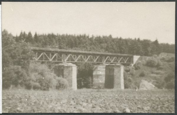
That is all. It has never been confirmed that any handover took place. The rest — two-level cellars, corridors flooded with water, a tunnel under the bridge — is circumstantial evidence and conjecture, which fires the imagination but has no status as established fact. The legend is part of the history of this place, but it is not its history.
The manor farm and distillery
Opposite the palace, separated by two ponds — former moats — across which a stone bridge was thrown, stood farm buildings kept in the style of the residence: a distillery and a brewery. The stables with the Baroque clock tower closed off the eastern side of the courtyard.
The extensive farm buildings were erected in 1718–1725. The manor farm, located about a kilometre from the palace, survived the war — unlike the residence itself. The former distillery building (Branntweinhaus) from 1704/05 has also survived, though disused and decaying.
The entire complex is listed in the register of monuments: the palace with its outbuildings, the park, the manor farm complex, the steward's house, the stables, a pavilion, the gate, cowsheds and the sheepfold.
The station — a railway that came here through a count's stubbornness
This is one of the more interesting stories in the area. When the route of the Eastern Railway (Ostbahn) from Berlin to Königsberg was being laid out in the 1840s, the line was routed through Malbork, Elbląg, Młynary and Braniewo. Pasłęk refused to make land available for construction — a decision local historians call short-sighted. Thanks to the efforts of Count Dohna-Schlobitten, the line went through Słobity.
The Malbork–Braniewo section, exactly 83.8 km long, was opened with ceremony on 19 October 1852. The last section, Braniewo–Königsberg, was put into service on 1 August 1853.
The station gave rise to a separate settlement — Słobity-Stacja Kolejowa, which still exists as a separate village and administrative unit (sołectwo).
The end was slow. Passenger traffic on the Bogaczewo–Braniewo section was suspended from 1 April 2004 — the residents of Słobity protested, and the matter even reached the national media. Services returned for a few more years (reactivation in autumn 2010), but regional trains from Elbląg through Młynary to Braniewo finally stopped running in 2012; the marshal's office explained the closure by low ridership. As of 2026, the Warmian-Masurian Voivodeship, while planning a broad reactivation of disused lines, does not foresee restoring services on the Elbląg – Młynary – Braniewo route.
The church and the family cemetery
The first church in Słobity was built by Achatius zu Dohna — two of his children, Barbara and Fabian, were buried in it. It was probably a wooden building that was destroyed by fire; we do not know the exact circumstances. In 1656–1657 Richard Frederick zu Dohna built a masonry church.
The present neo-Gothic church was built in 1863–1865 and consecrated in 1872. Its patron was Burgrave and Count Richard Frederick zu Dohna. Originally Evangelical, after 1945 it passed into the ownership of the Catholic Church under the dedication of the Resurrection of the Lord and became a branch of the parish in Młynary. It survived the war without major damage, but was neglected for decades; work to improve its technical condition began relatively recently.
Next to the church is the Dohna family cemetery. Members of the family have been buried here since 1814; the oldest surviving gravestones date from the 19th century. This place, alongside the ruins, is perhaps the most moving spot in Słobity — several hundred years of one family on a few dozen square metres.
Further reading, not used directly: C. Grommelt, C. von Mertens, Das Dohnasche Schloß Schlobitten in Ostpreußen, Kohlhammer, Stuttgart 1962; Alexander Fürst zu Dohna-Schlobitten, Erinnerungen eines alten Ostpreußen; M. Jackiewicz-Garniec, M. Garniec, Pałace i dwory dawnych Prus Wschodnich, Olsztyn 2001.
Słobity (Schlobitten) — der Schatten der größten Residenz Ostpreußens
Polnisch: Słobity, Gemeinde Wilczęta, Kreis Braniewo (Braunsberg), etwa 8 km südwestlich von Wilczęta (Wilknitt), am Flüsschen Gardyna.
Ein Dorf als Stammsitz einer Dynastie
Der Name Słobity ist altpreußischen Ursprungs — er geht auf die preußische Adelsfamilie Slobita zurück (auch Slobithe, Slobuthe geschrieben), von der über den Namen hinaus praktisch nichts bekannt ist. Ihre Ländereien übergab der Deutsche Orden zunächst der Familie Landgreff, dann den Haubitz.
Im Jahr 1525 kam das Dorf in die Hände von Peter zu Dohna (1483–1553), dem es vom letzten Hochmeister, Albrecht von Hohenzollern, für seine Verdienste um den Orden verliehen wurde. Von diesem Datum an beginnt die eigentliche Geschichte des Ortes: Die folgenden 420 Jahre, bis 1945, gehörte Schlobitten den Dohnas, und ab 1589 war es der Hauptsitz der Linie Dohna-Schlobitten — einer der bedeutendsten Adelsfamilien Preußens.
Die ersten Dohnas wohnten im sogenannten Neuen Haus, das Achatius zu Dohna (1533–1601) errichten ließ, der den Familiensitz von Mohrungen hierher verlegte. Reste der gewölbten Keller aus dem 16. Jahrhundert wurden später in den jüngeren Bau einbezogen.
Das Schloss: von der niederländischen Renaissance zum königlichen Barock
Das erste eigentliche Schloss ließ 1621–1624 Peters Enkel Abraham zu Dohna (1579–1631) errichten — ein Mann mit gründlicher humanistischer Bildung und zugleich Festungsbauingenieur, der sein Haus also selbst entwerfen konnte. Der Bau knüpfte an die niederländische Architektur des frühen 17. Jahrhunderts an (die Dohnas waren mit dem Haus Oranien verwandt) und war auf dem Grundriss eines gedrungenen H angelegt, mit Renaissance-Giebeln. Schon 1627 fügte Abraham einen separaten, eingeschossigen Saal für seine Bibliothek hinzu.
Eine kleine Abweichung in den Quellen: Die polnische Wikipedia und das Portal ostpreussen.net nennen die Jahre 1621–1624, das Leksykon Kultury Warmii i Mazur 1622–1628. Der Unterschied rührt wohl daher, ob man den Beginn der Arbeiten oder ihr Ende samt Bibliotheksanbau zählt.
Das Haus wurde bald von den Schweden zerstört; es wurde provisorisch wiederaufgebaut und wurde später zum Mittelteil der barocken Anlage.
Den wahren Aufschwung brachte Alexander zu Dohna (1661–1728) — später Feldmarschall, Chef der Regierung der preußischen Provinz, Gouverneur von Pillau und Erzieher des Kronprinzen. Gebaut wurde von 1696 bis 1736; im Wesentlichen war das Schloss 1713 fertiggestellt. Für den Gesamtplan und den Ostflügel (1695–1698) war Jean Baptiste Broebes (1660 – nach 1720) verantwortlich, damals Festungsbaumeister in Pillau. Ab 1704 übernahm Johann Caspar Hindersin (1677–1738) die Leitung, unterstützt als Gutachter vom Königsberger Baumeister Joachim Ludwig Schultheiß von Unfried (1678–1753) — sein Urteil führte dazu, dass der Mittelbau um ein niedriges Geschoss unter einem Mansarddach aufgestockt wurde.
Eine architektonische Besonderheit des Schlosses war das Fehlen eines repräsentativen Haupteingangs auf der Fassadenachse — an seine Stelle traten zwei symmetrische Eingänge bei den Galerien. Im Obergeschoss befand sich ein zweigeschossiger Ballsaal mit Polychromie und Stuckarbeiten; nach gängigen Darstellungen war es der einzige derartige Saal in Preußen.
Das Ergebnis war eines der preußischen Königsschlösser — Residenzen, die verpflichtet waren, den König auf seinen Reisen durch die Provinz zu beherbergen. Und sie beherbergten ihn tatsächlich: Friedrich II. hielt sich hier mehrfach auf, Marschall Bernadotte richtete hier 1807 während des ostpreußischen Feldzugs sein Hauptquartier ein, und Kaiser Wilhelm II. kam regelmäßig als Gast von Richard zu Dohna, seinem Hofjägermeister.
Es gibt noch einen weiteren Schlobitter Strang, der erwähnenswert ist: In seiner Jugend, von 1790 bis 1793, war Friedrich Schleiermacher (1768–1834) — später Philosoph und Theologe, eine der Schlüsselfiguren des deutschen Protestantismus — Hauslehrer der Kinder am Hof von Schlobitten. Er spazierte unter den 1625 gepflanzten Linden, von denen einige bis heute erhalten sind.
Sammlungen, die es nicht mehr gibt
Drei Jahrhunderte lang sammelte das Schloss Kunst- und Büchersammlungen. 1893 zählte die Bibliothek 23.000 Bände; 1944 waren es 55.000. Hinzu kamen eine Gemäldesammlung, eine Münzsammlung, seltene Fayencen und Silber. Das Gut umfasste rund 1.500 Hektar, bewirtschaftet von 160 Familien; nach 1918 gab es hier außerdem ein Heim für alleinstehende ältere Menschen.
Dass die Sammlungen bis ins 20. Jahrhundert vollständig erhalten blieben, verdanken wir dem Ewigen Testament von 1621, mit dem die Schlobitter Linie ihren Besitz zu einem unteilbaren Familienfideikommiss machte.
Januar 1945
Im Januar 1945 brachen die Schlossbewohner mit ihrem Gesinde unter der Führung von Fürst Alexander zu Dohna (1899–1997) nach Westen auf. Der Treck umfasste 330 Personen, 140 Pferde und 38 Wagen und legte auf Umwegen rund 1.500 Kilometer bis nach Norddeutschland zurück. Zuvor, seit 1943 heimlich, war ein Teil der Ausstattung per Bahn und Wagen abtransportiert worden — dadurch blieb ein beträchtlicher Teil des Schlobitter Inventars erhalten und bildet heute die Sammlung Dohna-Schlobitten, eine Sammlung in der Obhut der Stiftung Preußische Schlösser und Gärten Berlin-Brandenburg. Von den 55.000 Bänden der Bibliothek gehören heute elf zu dieser Sammlung.
Die Rote Armee rückte am 23. Januar 1945 in Schlobitten ein. Das Schloss wurde geplündert und in Brand gesetzt. Die Ruinen der Seitenflügel wurden abgetragen; die Außenmauern des Hauptkörpers stehen noch. Den Marstall mit dem barocken Turm und der Uhr sowie die Brauerei trafen im Frühjahr 1945 Fliegerbomben; ihre Überreste wurden nach dem Krieg beseitigt. Nach dem Krieg wurde auf dem Gutsgelände eine LPG (polnisch: PGR) eingerichtet.
Alexander zu Dohna kehrte nach dem Krieg mehrfach hierher zurück — anfangs den revisionistischen Kreisen verbunden, änderte er nach der Denkschrift der Evangelischen Kirche in Deutschland von 1965 seine Haltung und erkannte an, dass Deutschland kein Recht auf Ansprüche gegenüber den ehemaligen Ostgebieten habe. Er freundete sich unter anderem mit Prof. Stanisław Lorentz an, dem Direktor des Nationalmuseums in Warschau, und knüpfte Kontakte zu den Museen in Elbląg (Elbing) und Olsztyn (Allenstein). Er versuchte, die polnischen Behörden für einen Wiederaufbau des Schlosses zu interessieren — ohne Ergebnis. Einige gerettete Gemälde aus Schlobitten befinden sich im Museum für Ermland und Masuren in Olsztyn.
Das Objekt wurde am 19. März 1968 unter der Nummer 587/69 in das polnische Denkmalregister eingetragen.
Die Legende vom Bernsteinzimmer
Schlobitten taucht regelmäßig auf Listen vermuteter Verstecke des Bernsteinzimmers auf. Die Grundlage ist eine einzige: Im Herbst 1944 soll der Direktor des Königsberger Museums, Dr. Alfred Rohde, dem Fürsten zu Dohna vorgeschlagen haben, den demontierten Schatz in den Schlosskellern zu verwahren. Der Fürst lehnte ab mit der Begründung, die Keller seien zu feucht.
Das ist alles. Dass es zu einer Übergabe kam, wurde nie bestätigt. Der Rest — zweistöckige Keller, überflutete Gänge, ein Tunnel unter der Brücke — sind Indizien und Mutmaßungen, die die Fantasie beflügeln, aber nicht den Status gesicherter Erkenntnisse haben. Die Legende ist Teil der Geschichte dieses Ortes, aber sie ist nicht seine Geschichte.
Vorwerk und Brennerei
Dem Schloss gegenüber, getrennt durch zwei Teiche — die ehemaligen Gräben —, über die eine steinerne Brücke geschlagen wurde, standen im Stil der Residenz gehaltene Wirtschaftsgebäude: Brennerei und Brauerei. Der Marstall mit dem barocken Uhrturm schloss die Ostseite des Hofes ab.
Die weitläufigen Wirtschaftsgebäude wurden in den Jahren 1718–1725 errichtet. Das etwa einen Kilometer vom Schloss entfernte Vorwerk überstand den Krieg — im Gegensatz zur Residenz selbst. Erhalten ist auch das alte Brennereigebäude (Branntweinhaus) von 1704/05, wenn auch ungenutzt und verfallend.
Im Denkmalregister ist die gesamte Anlage verzeichnet: das Schloss mit Nebengebäuden, der Park, die Vorwerksanlage, das Verwalterhaus, der Marstall, ein Pavillon, das Tor, Viehställe und der Schafstall.
Der Bahnhof — eine Eisenbahn, die durch den Eigensinn eines Grafen hierher kam
Das ist eine der interessanteren Geschichten der Umgebung. Als in den 1840er Jahren die Trasse der Ostbahn von Berlin nach Königsberg festgelegt wurde, führte man die Strecke über Marienburg, Elbing, Mühlhausen und Braunsberg. Preußisch Holland (Pasłęk) verweigerte die Herausgabe von Land für den Bau — eine Entscheidung, die lokale Historiker als kurzsichtig bezeichnen. Dank der Bemühungen des Grafen Dohna-Schlobitten führte die Linie über Schlobitten.
Der Abschnitt Marienburg–Braunsberg, genau 83,8 km lang, wurde am 19. Oktober 1852 feierlich eröffnet. Der letzte Abschnitt, Braunsberg–Königsberg, wurde am 1. August 1853 in Betrieb genommen.
Der Bahnhof gab Anlass zu einer eigenen Ortschaft — Słobity-Stacja Kolejowa, die bis heute als eigenständiges Dorf und Schulzenamt (sołectwo) besteht.
Das Ende kam langsam. Der Personenverkehr auf dem Abschnitt Bogaczewo–Braniewo wurde zum 1. April 2004 eingestellt — die Einwohner von Słobity protestierten, die Sache schaffte es sogar in die landesweiten Medien. Die Verbindungen kehrten noch für einige Jahre zurück (Wiederaufnahme im Herbst 2010), aber die Regionalzüge von Elbląg über Młynary nach Braniewo stellten ihren Betrieb endgültig 2012 ein; das Marschallamt begründete die Stilllegung mit geringer Auslastung. Nach Stand von 2026 sieht die Woiwodschaft Ermland-Masuren, die eine breite Reaktivierung stillgelegter Strecken plant, keine Wiederaufnahme des Verkehrs auf der Strecke Elbląg – Młynary – Braniewo vor.
Kirche und Familienfriedhof
Die erste Kirche in Schlobitten ließ Achatius zu Dohna bauen — in ihr wurden zwei seiner Kinder, Barbara und Fabian, beigesetzt. Es war wahrscheinlich ein Holzbau, der einem Brand zum Opfer fiel; die näheren Umstände kennen wir nicht. In den Jahren 1656–1657 errichtete Richard Friedrich zu Dohna eine gemauerte Kirche.
Die heutige neugotische Kirche entstand in den Jahren 1863–1865 und wurde 1872 geweiht. Patron war der Burggraf und Graf Richard Friedrich zu Dohna. Ursprünglich evangelisch, ging sie nach 1945 in den Besitz der katholischen Kirche über, mit dem Patrozinium der Auferstehung des Herrn, und wurde Filialkirche der Pfarrei in Młynary. Sie überstand den Krieg ohne größere Schäden, war aber jahrzehntelang vernachlässigt; die Arbeiten zur Verbesserung ihres baulichen Zustands begannen erst relativ kürzlich.
Neben der Kirche liegt der Dohna-Familienfriedhof. Seit 1814 wurden hier Familienmitglieder bestattet; die ältesten erhaltenen Grabsteine stammen aus dem 19. Jahrhundert. Dieser Ort ist neben den Ruinen vielleicht der bewegendste Punkt in Schlobitten — mehrere Jahrhunderte einer Familie auf einigen Dutzend Quadratmetern.
Weiterführende Literatur, nicht direkt verwendet: C. Grommelt, C. von Mertens, Das Dohnasche Schloß Schlobitten in Ostpreußen, Kohlhammer, Stuttgart 1962; Alexander Fürst zu Dohna-Schlobitten, Erinnerungen eines alten Ostpreußen; M. Jackiewicz-Garniec, M. Garniec, Pałace i dwory dawnych Prus Wschodnich, Olsztyn 2001.
Bazylika i muzeum Mikołaja Kopernika we FromborkuThe basilica and Nicolaus Copernicus museum in FromborkBasilika und Nikolaus-Kopernikus-Museum in Frombork (Frauenburg)Basilika und Nikolaus-Kopernikus-Museum in Frombork (Frauenburg)
Frombork — katedra na Wzgórzu
Niem. Frauenburg, powiat braniewski, nad Zalewem Wiślanym.
Dlaczego akurat tu
Katedra fromborska istnieje dlatego, że spłonęło Braniewo. W czasie powstań pruskich przeciwko Krzyżakom Prusowie zniszczyli m.in. rezydencję biskupa w Braniewie. Dokumentem wystawionym 2 września 1288 roku biskup Henryk Fleming przeniósł stolicę biskupią z Braniewa do Fromborka i na ufortyfikowanym wzgórzu postawił drewniany kościół katedralny ku czci Najświętszej Marii Panny — Ecclesia Warmiensis, główny kościół diecezji.
Ta pierwsza katedra była drewniana. Obecna zaczęła powstawać czterdzieści lat później.
Budowa 1329–1388
W 1329 roku biskup Henryk II Wogenap rozpoczął wznoszenie murowanej, gotyckiej świątyni. Budowę prowadzono od wschodu ku zachodowi. Prezbiterium konsekrowano w 1342 roku — upamiętnia to zachowana tablica kamienna. Datę ukończenia budowy, 1388, zawiera inskrypcja we wnętrzu kruchty zachodniej.
O przebiegu prac wiemy zaskakująco mało. Dokumenty z końca XIV wieku wymieniają jako budowniczego kanonika Lifharda z Datteln, ale historycy skłaniają się ku temu, że zarządzał on raczej funduszem budowy niż samą architekturą.
Efektem jest trójnawowa, bezwieżowa hala z wydłużonym, prosto zamkniętym prezbiterium — długość 90 metrów, wysokość ok. 16,5 metra. Forma prosta, niemal surowa, i właśnie dlatego wpływowa: na wzór fromborskiej katedry powstawały potem kolejne gotyckie kościoły na Warmii.
W drugiej połowie XIV i pierwszej połowie XV wieku wzniesiono wokół potężny obwód warowny z basztami i bramami oraz zespół budynków towarzyszących. Katedra jest więc jednocześnie kościołem i twierdzą — i to jest pierwsza rzecz, która uderza człowieka podchodzącego pod wzgórze.
Kolejne warstwy
koniec XVI w. — dobudowa strzelistej renesansowej sygnaturki
1638 — umieszczenie zegara kościelnego
początek XVIII w. — trójprzęsłowa przybudówka od północy; kruchta z bogato zdobionym portalem przy wejściu głównym
1747–1752 — obecny ołtarz główny, staraniem biskupa Adama Grabowskiego; elementy z czarnego i różowego marmuru wykonali kamieniarze w Dębniku według projektu Franciszka Placidiego
1887–1891 — gruntowna renowacja wnętrza, które uzyskało obecny wygląd; polichromię wykonał Justus Bornowski z Elbląga; w prezbiterium pozostawiono fragmenty późnogotyckiego malowidła przedstawiającego ojców Kościoła
Organy
Organy fromborskie to jeden z ważniejszych instrumentów w Polsce.
Najstarsza wzmianka to umowa z organmistrzem Janem z Chojnic z 23 grudnia 1506 roku. Ten instrument przetrwał ponad sto lat — do czasu, gdy w latach 1623–1629 złupili go Szwedzi. Do 1683 roku katedra dysponowała tylko kilkugłosowym pozytywem.
W 1683 roku biskup Michał Radziejowski powierzył budowę nowych organów gdańskiemu mistrzowi Danielowi Nitrowskiemu. Instrument miał 27 głosów w trzech sekcjach, trakturę mechaniczną. Empora wraz z szafami i barokowym prospektem z tamtego czasu zachowała się do dziś — to, co widać, jest siedemnastowieczne.
W 1934 roku firma Emanuela Kempera (Lubeka, filia w Bartoszycach) zbudowała zupełnie nowy instrument o trakturze elektropneumatycznej, zachowując zabytkowe szafy z prospektem. Nowe organy miały 35 głosów w czterech sekcjach, a piszczałki rozmieszczono także poza szafą, na emporze. Wtedy też zainstalowano w prospekcie miedzianą trąbkę hiszpańską 8'. Ze względu na ograniczenia przestrzenne stół gry połączono elektrycznie i umieszczono na posadzce katedry, w znacznej odległości od organów. Kemper zbudował też 13-głosowe organy chórowe, sterowane z tego samego stołu gry.
II wojna światowa poważnie zdewastowała instrument. W 1946 roku opiekę nad katedrą przejęli salezjanie; w 1960 roku ks. Józef Sianko metodą gospodarczą doprowadził oba instrumenty do stanu używalności. W latach 1977–1979, według projektu i pod nadzorem prof. Jana Jargonia z Krakowa, firma Kamińskich dokonała zmian w dyspozycji, osiągając obecny kształt instrumentu: 66 głosów, 5 manuałów i pedał, traktura elektro-pneumatyczna.
W katedrze odbywają się kolejne edycje Międzynarodowego Festiwalu Muzyki Organowej we Fromborku.
Kopernik
Mikołaj Kopernik przebywał we Fromborku jako kanonik kapituły warmińskiej i mieszkał na Wzgórzu Katedralnym niemal nieprzerwanie od 1510 roku aż do śmierci w maju 1543. To tutaj powstało De revolutionibus. Dwie trzecie dorosłego życia spędził w tym miejscu.
Grób astronoma był przez stulecia zagadką. Poszukiwania podejmowało Towarzystwo Naukowe Warszawskie od 1802 roku, w 1807 roku szukał go — na rozkaz Napoleona — jeden z jego oficerów, próbowano też w latach 1909 i 1939.
Przełom przyszedł w XXI wieku. W 2004 roku, z inicjatywy biskupa Jacka Jezierskiego, prepozyta archikatedry, zespół pod kierownictwem prof. Jerzego Gąssowskiego z Akademii Humanistycznej im. A. Gieysztora w Pułtusku rozpoczął systematyczne badania we wnętrzu katedry. 3 listopada 2005 roku pod posadzką odnaleziono szczątki, które z dużym prawdopodobieństwem należały do Kopernika, oznaczone jako grób 13/05.
Problemem była identyfikacja: Kopernik nie miał znanych potomków, więc nie było z czym porównać DNA. Rozwiązanie znalazło się w Szwecji. Prof. Göran Henriksson z Uppsali przejrzał księgi, z których astronom musiał korzystać, a które trafiły tam jako łup wojenny. W egzemplarzu Calendarium Romanum Magnum znaleziono włosy. Kilka z nich zawierało materiał genetyczny, a dwa miały identyczny kod mtDNA z materiałem uzyskanym z kości i zębów ze znaleziska. Wyniki ogłoszono w 2008 roku.
22 maja 2010 roku, niemal równo 467 lat po śmierci astronoma, odbył się we Fromborku jego powtórny pogrzeb. Sarkofag złożono pod posadzką w miejscu pierwotnego pochówku, przy ołtarzu św. Krzyża, którym Kopernik za życia opiekował się jako kanonik — w prawej nawie archikatedry. Nad grobem stanął trzymetrowy nagrobek w formie modelu Układu Słonecznego.
Rzetelnie: część badaczy zgłasza wątpliwości wobec tej identyfikacji — m.in. prof. Michał Kokowski wskazuje na ograniczenia rekonstrukcji twarzy przy braku żuchwy oraz na to, że żaden ze znanych portretów astronoma nie powstał za jego życia, a najwcześniejszy — blisko 40 lat po śmierci. Identyfikacja jest przyjęta, ale nie jest bezdyskusyjna.
Status i zwiedzanie
16 września 1994 roku obiekt został wpisany na listę Pomników Historii. Bazylika udostępniana jest zwiedzającym przez Muzeum Pomnika Historii Frombork Zespół Katedralny. W sąsiedztwie znajdują się dawna rezydencja biskupia (pałac Ferbera), kanonie, kustodia, kapitularz oraz mury obronne z basztami północną, wschodnią i południową i bramami. Południowo-zachodniego narożnika strzeże wielka, wieloboczna wieża artyleryjska, na której nadbudowano dzwonnicę.
Poczta Polska wyemitowała 1 czerwca 1971 roku znaczek z katedrą fromborską o nominale 4 zł.
German: Frauenburg, Braniewo county, on the Vistula Lagoon.
Why here of all places
Frombork Cathedral exists because Braniewo burned. During the Prussian uprisings against the Teutonic Knights, the Prussians destroyed, among other things, the bishop's residence in Braniewo. By a document issued on 2 September 1288, Bishop Henry Fleming moved the episcopal seat from Braniewo to Frombork and on the fortified hill erected a wooden cathedral church in honour of the Blessed Virgin Mary — Ecclesia Warmiensis, the main church of the diocese.
That first cathedral was wooden. The present one began to be built forty years later.
Construction 1329–1388
In 1329 Bishop Henry II Wogenap began the erection of a masonry Gothic church. Building proceeded from east to west. The chancel was consecrated in 1342 — commemorated by a surviving stone plaque. The date of completion, 1388, is given in an inscription inside the west porch.
We know surprisingly little about the course of the work. Documents from the end of the 14th century name as builder the canon Lifhard of Datteln, but historians lean towards the view that he managed the building fund rather than the architecture itself.
The result is a three-aisled, towerless hall church with an elongated, straight-ended chancel — 90 metres long, about 16.5 metres high. The form is simple, almost austere, and precisely for that reason influential: later Gothic churches in Warmia were modelled on Frombork Cathedral.
In the second half of the 14th and first half of the 15th century a mighty defensive perimeter with towers and gates was raised around it, together with a complex of associated buildings. The cathedral is thus at once a church and a fortress — and that is the first thing that strikes a person approaching the hill.
Successive layers
end of the 16th c. — addition of a slender Renaissance bell turret
1638 — installation of the church clock
early 18th c. — a three-bay annex to the north; a porch with a richly decorated portal at the main entrance
1747–1752 — the present high altar, through the efforts of Bishop Adam Grabowski; the black and pink marble elements were made by stonemasons in Dębnik to a design by Francesco Placidi
1887–1891 — thorough renovation of the interior, which acquired its present appearance; the polychromy was done by Justus Bornowski of Elbląg; fragments of a late-Gothic painting of the Church Fathers were left in the chancel
The organ
The Frombork organ is one of the more important instruments in Poland.
The oldest mention is a contract with the organ builder Jan of Chojnice of 23 December 1506. That instrument survived for more than a hundred years — until the Swedes plundered it in 1623–1629. Until 1683 the cathedral had only a positive organ of a few stops.
In 1683 Bishop Michał Radziejowski entrusted the building of a new organ to the Gdańsk master Daniel Nitrowski. The instrument had 27 stops in three divisions, with mechanical action. The gallery together with the cases and the Baroque façade from that time has survived to this day — what you see is seventeenth-century.
In 1934 the firm of Emanuel Kemper (Lübeck, with a branch in Bartoszyce) built an entirely new instrument with electro-pneumatic action, retaining the historic cases with the façade. The new organ had 35 stops in four divisions, and pipes were also placed outside the case, in the gallery. A copper Spanish trumpet 8' was installed in the façade at that time. Because of spatial constraints the console was connected electrically and placed on the floor of the cathedral, at a considerable distance from the organ. Kemper also built a 13-stop choir organ, controlled from the same console.
The Second World War seriously devastated the instrument. In 1946 the Salesians took over the care of the cathedral; in 1960 Fr Józef Sianko, working on a do-it-yourself basis, brought both instruments to playable condition. In 1977–1979, to a design and under the supervision of Prof. Jan Jargoń of Kraków, the Kamiński firm made changes to the specification, achieving the present shape of the instrument: 66 stops, 5 manuals and pedal, electro-pneumatic action.
The cathedral hosts successive editions of the International Organ Music Festival in Frombork.
Copernicus
Nicolaus Copernicus lived in Frombork as a canon of the Warmian chapter and resided on Cathedral Hill almost without interruption from 1510 until his death in May 1543. It was here that De revolutionibus was written. He spent two thirds of his adult life in this place.
The astronomer's grave was a mystery for centuries. Searches were undertaken by the Warsaw Scientific Society from 1802; in 1807 one of Napoleon's officers looked for it on his orders, and attempts were also made in 1909 and 1939.
The breakthrough came in the 21st century. In 2004, on the initiative of Bishop Jacek Jezierski, provost of the archcathedral, a team led by Prof. Jerzy Gąssowski of the A. Gieysztor Academy of Humanities in Pułtusk began systematic research inside the cathedral. On 3 November 2005 remains were found beneath the floor which with a high degree of probability belonged to Copernicus, designated grave 13/05.
The problem was identification: Copernicus had no known descendants, so there was nothing to compare DNA with. The solution was found in Sweden. Prof. Göran Henriksson of Uppsala examined books the astronomer must have used, which had ended up there as war booty. In a copy of the Calendarium Romanum Magnum hairs were found. Several of them contained genetic material, and two had an mtDNA code identical to material obtained from the bones and teeth found in the grave. The results were announced in 2008.
On 22 May 2010, almost exactly 467 years after the astronomer's death, his second burial took place in Frombork. The sarcophagus was placed beneath the floor at the site of the original burial, by the altar of the Holy Cross, which Copernicus looked after during his life as a canon — in the right aisle of the archcathedral. Above the grave a three-metre tombstone in the form of a model of the Solar System was erected.
To be fair: some researchers voice doubts about this identification — among others, Prof. Michał Kokowski points to the limitations of facial reconstruction in the absence of a mandible, and to the fact that none of the known portraits of the astronomer was made in his lifetime, the earliest nearly 40 years after his death. The identification is accepted, but not beyond dispute.
Status and visiting
On 16 September 1994 the site was entered on the list of Historic Monuments of Poland (Pomnik Historii). The basilica is open to visitors through the Museum of the Historic Monument Frombork Cathedral Complex. Nearby are the former episcopal residence (Ferber's Palace), the canons' houses, the custodian's house, the chapter house, and the defensive walls with north, east and south towers and gates. The south-west corner is guarded by a large polygonal artillery tower, on which a bell tower was built.
On 1 June 1971 the Polish Post issued a 4-złoty stamp with Frombork Cathedral.
Deutsch: Frauenburg, Kreis Braniewo (Braunsberg), am Frischen Haff.
Warum gerade hier
Der Frauenburger Dom existiert, weil Braunsberg niederbrannte. Während der prußischen Aufstände gegen den Deutschen Orden zerstörten die Prußen unter anderem die Residenz des Bischofs in Braunsberg. Mit einer am 2. September 1288 ausgestellten Urkunde verlegte Bischof Heinrich Fleming den Bischofssitz von Braunsberg nach Frauenburg und errichtete auf dem befestigten Hügel eine hölzerne Domkirche zu Ehren der Allerseligsten Jungfrau Maria — die Ecclesia Warmiensis, die Hauptkirche der Diözese.
Dieser erste Dom war aus Holz. Der heutige begann vierzig Jahre später zu entstehen.
Der Bau 1329–1388
Im Jahr 1329 begann Bischof Heinrich II. Wogenap mit der Errichtung einer gemauerten gotischen Kirche. Gebaut wurde von Osten nach Westen. Der Chor wurde 1342 geweiht — daran erinnert eine erhaltene Steintafel. Das Datum der Fertigstellung, 1388, nennt eine Inschrift im Inneren der Westvorhalle.
Über den Verlauf der Arbeiten wissen wir überraschend wenig. Urkunden vom Ende des 14. Jahrhunderts nennen als Baumeister den Domherrn Lifhard von Datteln, doch Historiker neigen zu der Ansicht, dass er eher den Baufonds als die Architektur selbst verwaltete.
Das Ergebnis ist eine dreischiffige, turmlose Hallenkirche mit verlängertem, gerade geschlossenem Chor — 90 Meter lang, etwa 16,5 Meter hoch. Die Form ist schlicht, fast streng, und gerade deshalb einflussreich: Nach dem Vorbild des Frauenburger Doms entstanden später weitere gotische Kirchen im Ermland.
In der zweiten Hälfte des 14. und der ersten Hälfte des 15. Jahrhunderts wurde ringsum ein mächtiger Verteidigungsring mit Türmen und Toren sowie ein Komplex von Nebengebäuden errichtet. Der Dom ist also zugleich Kirche und Festung — und das ist das Erste, was einen Menschen beim Anstieg zum Hügel beeindruckt.
Weitere Schichten
Ende des 16. Jh. — Anbau eines schlanken Renaissance-Dachreiters
1638 — Anbringung der Kirchenuhr
Anfang des 18. Jh. — dreijochiger Anbau im Norden; eine Vorhalle mit reich verziertem Portal am Haupteingang
1747–1752 — der heutige Hochaltar, auf Betreiben von Bischof Adam Grabowski; die Teile aus schwarzem und rosa Marmor fertigten Steinmetze in Dębnik nach einem Entwurf von Francesco Placidi
1887–1891 — gründliche Renovierung des Inneren, das sein heutiges Aussehen erhielt; die Polychromie schuf Justus Bornowski aus Elbing; im Chor ließ man Fragmente eines spätgotischen Gemäldes der Kirchenväter stehen
Die Orgel
Die Frauenburger Orgel ist eines der bedeutenderen Instrumente Polens.
Die älteste Erwähnung ist ein Vertrag mit dem Orgelbauer Jan aus Chojnice (Konitz) vom 23. Dezember 1506. Dieses Instrument überdauerte über hundert Jahre — bis die Schweden es 1623–1629 plünderten. Bis 1683 verfügte der Dom nur über ein Positiv mit wenigen Registern.
Im Jahr 1683 vertraute Bischof Michał Radziejowski den Bau einer neuen Orgel dem Danziger Meister Daniel Nitrowski an. Das Instrument hatte 27 Register in drei Werken, mit mechanischer Traktur. Die Empore samt Gehäusen und barockem Prospekt aus jener Zeit ist bis heute erhalten — was man sieht, stammt aus dem 17. Jahrhundert.
Im Jahr 1934 baute die Firma Emanuel Kemper (Lübeck, Filiale in Bartoszyce) ein völlig neues Instrument mit elektropneumatischer Traktur, wobei die historischen Gehäuse mit dem Prospekt erhalten blieben. Die neue Orgel hatte 35 Register in vier Werken, und die Pfeifen wurden auch außerhalb des Gehäuses, auf der Empore, angeordnet. Damals wurde im Prospekt auch eine kupferne Spanische Trompete 8' installiert. Aus Platzgründen wurde der Spieltisch elektrisch angeschlossen und auf dem Fußboden des Doms in beträchtlicher Entfernung von der Orgel aufgestellt. Kemper baute auch eine 13-registrige Chororgel, die vom selben Spieltisch gesteuert wird.
Der Zweite Weltkrieg verwüstete das Instrument schwer. 1946 übernahmen die Salesianer die Obhut über den Dom; 1960 brachte Pfarrer Józef Sianko in Eigenregie beide Instrumente in einen spielbaren Zustand. In den Jahren 1977–1979 nahm die Firma Kamiński nach dem Entwurf und unter der Aufsicht von Prof. Jan Jargoń aus Krakau Änderungen an der Disposition vor und erreichte die heutige Gestalt des Instruments: 66 Register, 5 Manuale und Pedal, elektropneumatische Traktur.
Im Dom finden die jeweiligen Ausgaben des Internationalen Festivals der Orgelmusik in Frombork statt.
Kopernikus
Nikolaus Kopernikus hielt sich in Frauenburg als Domherr des Ermländischen Domkapitels auf und wohnte von 1510 bis zu seinem Tod im Mai 1543 fast ununterbrochen auf dem Domberg. Hier entstand De revolutionibus. Zwei Drittel seines Erwachsenenlebens verbrachte er an diesem Ort.
Das Grab des Astronomen war jahrhundertelang ein Rätsel. Nachforschungen unternahm ab 1802 die Warschauer Wissenschaftliche Gesellschaft, 1807 suchte es — auf Napoleons Befehl — einer seiner Offiziere, auch 1909 und 1939 wurde es versucht.
Der Durchbruch kam im 21. Jahrhundert. 2004 begann auf Initiative von Bischof Jacek Jezierski, Propst der Erzkathedrale, ein Team unter der Leitung von Prof. Jerzy Gąssowski von der A.-Gieysztor-Akademie für Geisteswissenschaften in Pułtusk mit systematischen Untersuchungen im Inneren des Doms. Am 3. November 2005 wurden unter dem Fußboden Gebeine gefunden, die mit hoher Wahrscheinlichkeit Kopernikus gehörten, bezeichnet als Grab 13/05.
Das Problem war die Identifizierung: Kopernikus hatte keine bekannten Nachkommen, es gab also nichts, womit man die DNA hätte vergleichen können. Die Lösung fand sich in Schweden. Prof. Göran Henriksson aus Uppsala durchsah Bücher, die der Astronom benutzt haben musste und die dorthin als Kriegsbeute gelangt waren. In einem Exemplar des Calendarium Romanum Magnum fanden sich Haare. Einige davon enthielten genetisches Material, und zwei hatten einen mtDNA-Code, der mit dem aus Knochen und Zähnen des Fundes gewonnenen Material identisch war. Die Ergebnisse wurden 2008 bekanntgegeben.
Am 22. Mai 2010, fast genau 467 Jahre nach dem Tod des Astronomen, fand in Frauenburg seine erneute Beisetzung statt. Der Sarkophag wurde unter dem Fußboden an der Stelle der ursprünglichen Bestattung niedergelegt, am Heilig-Kreuz-Altar, den Kopernikus zu Lebzeiten als Domherr betreute — im rechten Seitenschiff der Erzkathedrale. Über dem Grab wurde ein drei Meter hoher Grabstein in Form eines Modells des Sonnensystems errichtet.
Der Redlichkeit halber: Ein Teil der Forscher äußert Zweifel an dieser Identifizierung — unter anderem verweist Prof. Michał Kokowski auf die Grenzen der Gesichtsrekonstruktion bei fehlendem Unterkiefer sowie darauf, dass keines der bekannten Porträts des Astronomen zu seinen Lebzeiten entstand, das früheste fast 40 Jahre nach seinem Tod. Die Identifizierung ist anerkannt, aber nicht unumstritten.
Status und Besichtigung
Am 16. September 1994 wurde das Objekt in die Liste der Geschichtsdenkmäler (Pomniki Historii) eingetragen. Die Basilika wird Besuchern vom Museum des Geschichtsdenkmals Frombork, Domkomplex, zugänglich gemacht. In der Nachbarschaft befinden sich die ehemalige bischöfliche Residenz (Ferber-Palais), die Kurien, die Kustodie, das Kapitelhaus sowie die Verteidigungsmauern mit dem Nord-, Ost- und Südturm und den Toren. Die südwestliche Ecke bewacht ein großer, vieleckiger Artillerieturm, auf den ein Glockenturm aufgesetzt wurde.
Die Polnische Post gab am 1. Juni 1971 eine Briefmarke mit dem Frauenburger Dom im Nennwert von 4 Złoty heraus.
Odrestaurowany pałac z 1704 roku w GładyszachThe restored 1704 palace in GładyszeDas restaurierte Schloss von 1704 in Gładysze (Schlodien)Das restaurierte Schloss von 1704 in Gładysze (Schlodien)
Gładysze — pałac, który wrócił z martwych
Niem. Schlodien, gmina Wilczęta, przy drodze wojewódzkiej nr 509, ok. 40 km na wschód od Elbląga.
Drugi brat, drugi pałac
Historia Gładysz jest lustrzanym odbiciem historii Słobit — i trudno je opowiadać osobno. Wieś należała do Dohnów od 1643 roku i stał w niej niewielki dwór mieszkalny. W 1688 roku dziedzicem został Christoph, burgrabia i hrabia zu Dohna (1665–1733) — brandenbursko-pruski generał, później minister i dyplomata w służbie elektora Fryderyka III (późniejszego króla Fryderyka I), jeden z pierwszych kawalerów Orderu Orła Czarnego, ustanowionego w 1701 roku.
Christoph był młodszym bratem Aleksandra zu Dohny ze Słobit i to on dał początek osobnej linii rodu: zu Dohna-Schlodien. Obaj bracia niemal równocześnie, na przełomie XVII i XVIII wieku, budowali swoje wielkie rezydencje — jeden przebudowywał Słobity, drugi stawiał od zera Gładysze. Dwa pałace, dwadzieścia kilometrów od siebie, jedna rodzina.
Bezpośrednim impulsem do budowy był pożar pałacu Dohnów w Morągu oraz rosnąca pozycja Christopha.
Jean de Bodt i holenderski barok
Projekt pałacu wykonał francuski architekt, hugenota Jean de Bodt — budowniczy berlińskiego Arsenału i pałacu w Poczdamie. Budowę zrealizowano w latach 1701–1704 w stylu baroku holenderskiego, pod nadzorem Johanna Caspara Hindersina, który wcześniej zaprojektował budynki gospodarcze (ten sam Hindersin, który od 1704 roku prowadził budowę w Słobitach).
Dwukondygnacyjny pałac wzniesiono na planie spłaszczonej litery H, kryty dachem mansardowym. Na osi elewacji frontowej znajdował się trójosiowy pseudoryzalit, fasadę zdobił rząd pilastrów jońskich podtrzymujących naczółek z kartuszem herbowym Dohnów. Wnętrza dekorował Carl Florus zu Dohna, który sam projektował sztukaterie. W kompleksie znalazły się wozownia, stajnia i dwukondygnacyjna kuchnia.
Barokowy park otoczony był systemem umocnień i małych bastionów; przebudowano go w 1800 roku. Na przełomie XVIII i XIX wieku stanęły w nim trzy pawilony: herbaciarnia w stylu chińskim, domek myśliwski oraz drewniana chata w stylu ludowym, w której urządzono bawialnię dla dzieci. Założenie łączyło się z kompleksem leśnym Las Spędy.
W 1858 roku dobudowano skrzydło z oranżerią, którą latem adaptowano na jadalnię — połączone z pałacem łącznikiem, gdzie mieściło się archiwum i galeria obrazów rodzinnych.
W 1803 roku we wsi i majątku mieszkały łącznie 333 osoby. W 1810 roku gościł tu niemiecki poeta Max von Schenkendorf (1783–1817).
Na przełomie XVIII i XIX wieku właścicielem był Carl zu Dohna-Schlodien, znany przede wszystkim z działalności filantropijnej i troski o ludzi pracujących w jego dobrach.
Ironia losu: przetrwał wojnę, zginął w pokoju
Ostatni właściciele Gładysz, bracia Wilhelm-Christoph i Carl-Emanuel zu Dohna-Schlodien, zginęli w II wojnie światowej. Carl-Emanuel (1926–1945), ranny w walkach w Prusach Wschodnich, zmarł w lazarecie w Piławie (dziś Bałtijsk). Ich matka z dwiema córkami uciekła 21 stycznia 1945 roku do Westfalii.
I tu zaczyna się różnica wobec Słobit: pałac w Gładyszach przetrwał wojnę nienaruszony. Nie spalono go. Zniszczyło go dopiero czterdzieści lat pokoju:
1945 — obiekt w rękach Armii Czerwonej, pełni funkcję kołchozu; zbiory rozgrabione, z kolekcji 250 obrazów część zachowała się w zbiorach Muzeum Warmii i Mazur
1950 — przejęty przez Państwowe Zakłady Zbożowe, służy jako magazyn zboża
1960 — przejęty przez miejscowy PGR
1965–1984 — postępująca dewastacja
1984 — trafia w ręce prywatne; zamiast prac zabezpieczających następuje częściowa rozbiórka, rozebrano m.in. wykafelkowaną kuchnię i dwa budynki kawalerskie
noc z 16 na 17 lipca 1986 — pałac płonie
Rozbieżność w źródłach: większość opracowań podaje noc z 16 na 17 lipca 1986 roku. Strona samej Fundacji Odbudowy Zabytków Warmii mówi jednak o pożarze w 1985 roku. Skoro wyłamuje się akurat instytucja najbliższa sprawie, uczciwiej jest rozbieżność odnotować, niż arbitralnie wybrać jedną datę.
Od tego momentu przez ponad trzydzieści lat stała tu ruina.
Odbudowa
Ruiny przejęła Polsko-Niemiecka Fundacja Ochrony Dziedzictwa Kulturowego Warmii, kontynuowana przez Fundację Odbudowy Zabytków Warmii, z celem odbudowy pałacu i odtworzenia założenia parkowego. Inwestorem został Stefan Hipp, bawarski przedsiębiorca, współwłaściciel holdingu HiPP.
Projekt odbudowy powstawał w latach 2014–2016 (pracownie AZT Architekci i Decorum Architekci; autorzy: Zbigniew Tomaszczyk, Irena Lipiec, Krzysztof Ziółkowski), pozwolenie na budowę uzyskano w 2017 roku, a zakładany okres realizacji to lata 2017–2022. Powierzchnia zespołu pałacowego z Domem Oficjalistów wynosi ok. 4400 m². Obiekt figuruje w rejestrze zabytków pod numerem A-579.
Daty podawane przez pracownie projektowe dotyczą jednak zakresu opracowania, a nie faktycznego zamknięcia inwestycji — ta do dziś nie została formalnie zakończona.
Sposób przeprowadzenia odbudowy wywołał dyskusję — polska Wikipedia odnotowuje, że w 2020 roku rozebrano ruiny pałacu i na ich miejscu postawiono rekonstrukcję. To klasyczny spór konserwatorski: rekonstrukcja kontra zachowana ruina. Warto go zasygnalizować, bo jest częścią historii tego miejsca — podobnie jak wcześniej dyskutowano o Hotelu Krasicki w Lidzbarku czy o pomyśle odbudowy zamku w Giżycku.
Stan na dziś — uwaga praktyczna
Nie wybieraj się tam z myślą o zwiedzaniu. Pałac jest wprawdzie niemal ukończony, ale formalnie budowy nie zakończono — z powodu niedopełnionych formalności obiekt pozostaje placem budowy. Nikt w nim nie mieszka, teren jest ogrodzony płotem i niedostępny.
Można go obejrzeć wyłącznie z zewnątrz, zza ogrodzenia — i szczerze mówiąc, to i tak robi wrażenie: pełna bryła barokowej rezydencji stojąca tam, gdzie przez trzydzieści lat był tylko zarośnięty gruz.
Stan na wrzesień 2026. Sytuacja formalna może się zmienić.
Ciekawostka na spacer
W lesie nieopodal drogi Gładysze–Wilczęta znajduje się kaplica grobowa rodziny zu Dohna — obiekt wymieniany wśród zabytków gminy, a przy tym zupełnie nieoczywisty do znalezienia.
Historia obiektu, Fundacja Odbudowy Zabytków Warmii — cyt. m.in. Lothar Graf zu Dohna, Die Dohnas und ihre Häuser, Wallstein Verlag, Getynga; Adelheid Gräfin zu Eulenburg, Hans Engels, przedmowa Marion Dönhoff, C.H. Beck, Monachium 1995
Aktualny stan obiektu: plac budowy, teren ogrodzony, brak możliwości wejścia — obserwacja własna, wrzesień 2026
Gładysze — the palace that came back from the dead
German: Schlodien, Wilczęta municipality, on voivodeship road no. 509, about 40 km east of Elbląg.
The second brother, the second palace
The history of Gładysze is a mirror image of the history of Słobity — and it is hard to tell them separately. The village belonged to the Dohnas from 1643 and a modest manor house stood in it. In 1688 the heir became Christoph, Burgrave and Count zu Dohna (1665–1733) — a Brandenburg-Prussian general, later minister and diplomat in the service of Elector Frederick III (later King Frederick I), one of the first knights of the Order of the Black Eagle, established in 1701.
Christoph was the younger brother of Alexander zu Dohna of Słobity and it was he who founded a separate line of the family: zu Dohna-Schlodien. Both brothers, almost simultaneously, at the turn of the 17th and 18th centuries, were building their great residences — one rebuilt Słobity, the other raised Gładysze from scratch. Two palaces, twenty kilometres apart, one family.
The immediate impulse for the construction was the fire at the Dohna palace in Morąg and Christoph's rising standing.
Jean de Bodt and the Dutch Baroque
The palace was designed by the French Huguenot architect Jean de Bodt — builder of the Zeughaus (Arsenal) in Berlin and of the palace in Potsdam. It was built in 1701–1704 in the Dutch Baroque style, under the supervision of Johann Caspar Hindersin, who had earlier designed the farm buildings (the same Hindersin who from 1704 directed the construction at Słobity).
The two-storey palace was erected on the plan of a flattened letter H, with a mansard roof. On the axis of the front elevation was a three-bay pseudo-projection; the façade was decorated by a row of Ionic pilasters supporting a pediment with the Dohna coat-of-arms cartouche. The interiors were decorated by Carl Florus zu Dohna, who designed the stuccowork himself. The complex included a coach house, a stable and a two-storey kitchen.
The Baroque park was surrounded by a system of fortifications and small bastions; it was remodelled in 1800. At the turn of the 18th and 19th centuries three pavilions were built in it: a Chinese-style tea house, a hunting lodge and a wooden cottage in folk style in which a playroom for children was arranged. The layout was connected with the Spędy Forest complex.
In 1858 a wing was added with an orangery, adapted in summer as a dining room — joined to the palace by a connecting passage which housed the archive and a gallery of family portraits.
In 1803 the village and estate together had 333 inhabitants. In 1810 the German poet Max von Schenkendorf (1783–1817) was a guest here.
At the turn of the 18th and 19th centuries the owner was Carl zu Dohna-Schlodien, known above all for his philanthropic activity and care for the people working on his estates.
An irony of fate: it survived the war and died in peacetime
The last owners of Gładysze, the brothers Wilhelm-Christoph and Carl-Emanuel zu Dohna-Schlodien, died in the Second World War. Carl-Emanuel (1926–1945), wounded in the fighting in East Prussia, died in a field hospital in Pillau (today Baltiysk). Their mother with two daughters fled on 21 January 1945 to Westphalia.
And here begins the difference from Słobity: the palace at Gładysze survived the war intact. It was not burned. It was destroyed only by forty years of peace:
1945 — the building in the hands of the Red Army, functioning as a kolkhoz; the collections were plundered, of a collection of 250 paintings some survive in the Museum of Warmia and Masuria
1950 — taken over by the State Grain Works, used as a grain store
1960 — taken over by the local state farm (PGR)
1965–1984 — progressive devastation
1984 — passes into private hands; instead of safeguarding work there was partial demolition, including the tiled kitchen and two bachelor buildings
the night of 16–17 July 1986 — the palace burns
A discrepancy in the sources: most studies give the night of 16–17 July 1986. The page of the Warmian Monuments Reconstruction Foundation itself, however, speaks of a fire in 1985. Since it is precisely the institution closest to the matter that diverges, it is more honest to note the discrepancy than to choose one date arbitrarily.
From that moment a ruin stood here for over thirty years.
Reconstruction
The ruins were taken over by the Polish-German Foundation for the Protection of the Cultural Heritage of Warmia, continued by the Warmian Monuments Reconstruction Foundation, with the aim of rebuilding the palace and restoring the park layout. The investor became Stefan Hipp, a Bavarian entrepreneur, co-owner of the HiPP holding.
The reconstruction project was drawn up in 2014–2016 (AZT Architekci and Decorum Architekci studios; authors: Zbigniew Tomaszczyk, Irena Lipiec, Krzysztof Ziółkowski), the building permit was obtained in 2017, and the planned implementation period was 2017–2022. The area of the palace complex with the Officials' House is about 4,400 m². The building is entered in the register of monuments under number A-579.
The dates given by the design studios, however, refer to the scope of the work, not to the actual closing of the investment — which has still not been formally completed.
The way the reconstruction was carried out has caused discussion — Polish Wikipedia notes that in 2020 the ruins of the palace were demolished and a reconstruction put up in their place. It is a classic conservation dispute: reconstruction versus preserved ruin. It is worth signalling, because it is part of the history of this place — just as the Krasicki Hotel in Lidzbark or the idea of rebuilding the castle in Giżycko were discussed earlier.
Current state — a practical note
Do not go there with the idea of sightseeing. The palace is nearly finished, but the construction has formally not been completed — because of unfulfilled formalities the site remains a building site. Nobody lives in it, and the area is fenced and inaccessible.
It can be seen only from outside, from behind the fence — and frankly, it is still impressive: the full mass of a Baroque residence standing where for thirty years there was only overgrown rubble.
Status as of September 2026. The formal situation may change.
A curiosity for a walk
In the forest near the Gładysze–Wilczęta road is the burial chapel of the zu Dohna family — a site listed among the municipality's monuments, and one that is quite non-obvious to find.
Historia obiektu, Fundacja Odbudowy Zabytków Warmii — citing, among others, Lothar Graf zu Dohna, Die Dohnas und ihre Häuser, Wallstein Verlag, Göttingen; Adelheid Gräfin zu Eulenburg, Hans Engels, foreword by Marion Dönhoff, C.H. Beck, Munich 1995
Current state of the site: building site, area fenced, no access — own observation, September 2026
Gładysze (Schlodien) — das Schloss, das von den Toten zurückkehrte
Deutsch: Schlodien, Gemeinde Wilczęta (Wilknitt), an der Woiwodschaftsstraße Nr. 509, ca. 40 km östlich von Elbing.
Der zweite Bruder, das zweite Schloss
Die Geschichte von Schlodien ist das Spiegelbild der Geschichte von Schlobitten — und lässt sich kaum getrennt erzählen. Das Dorf gehörte seit 1643 den Dohnas, und es stand dort ein bescheidenes Herrenhaus. 1688 wurde Christoph, Burggraf und Graf zu Dohna (1665–1733) Erbe — ein brandenburgisch-preußischer General, später Minister und Diplomat im Dienst von Kurfürst Friedrich III. (dem späteren König Friedrich I.), einer der ersten Ritter des 1701 gestifteten Schwarzen Adlerordens.
Christoph war der jüngere Bruder von Alexander zu Dohna aus Schlobitten, und er begründete eine eigene Linie der Familie: zu Dohna-Schlodien. Beide Brüder bauten fast gleichzeitig, an der Wende vom 17. zum 18. Jahrhundert, ihre großen Residenzen — der eine baute Schlobitten um, der andere errichtete Schlodien von Grund auf. Zwei Schlösser, zwanzig Kilometer voneinander entfernt, eine Familie.
Der unmittelbare Anstoß zum Bau war der Brand des Dohna-Schlosses in Mohrungen und Christophs wachsende Stellung.
Jean de Bodt und der holländische Barock
Den Entwurf des Schlosses fertigte der französische Hugenotten-Architekt Jean de Bodt — Erbauer des Berliner Zeughauses und des Schlosses in Potsdam. Der Bau wurde in den Jahren 1701–1704 im Stil des holländischen Barocks unter der Aufsicht von Johann Caspar Hindersin ausgeführt, der zuvor die Wirtschaftsgebäude entworfen hatte (derselbe Hindersin, der ab 1704 den Bau in Schlobitten leitete).
Das zweigeschossige Schloss wurde auf dem Grundriss eines gedrungenen H errichtet, mit Mansarddach. Auf der Achse der Vorderfassade lag ein dreiachsiger Pseudo-Risalit; die Fassade schmückte eine Reihe ionischer Pilaster, die einen Giebel mit dem Wappenkartusche der Dohnas trugen. Die Innenräume dekorierte Carl Florus zu Dohna, der die Stuckarbeiten selbst entwarf. Zur Anlage gehörten ein Wagenhaus, ein Stall und eine zweigeschossige Küche.
Der Barockpark war von einem System von Befestigungen und kleinen Bastionen umgeben; er wurde 1800 umgestaltet. An der Wende vom 18. zum 19. Jahrhundert entstanden darin drei Pavillons: ein Teehaus im chinesischen Stil, ein Jagdhäuschen und eine hölzerne Hütte im Volksstil, in der ein Spielzimmer für Kinder eingerichtet wurde. Die Anlage war mit dem Waldkomplex Spędy verbunden.
1858 wurde ein Flügel mit einer Orangerie angebaut, die im Sommer als Speisesaal genutzt wurde — durch einen Verbindungsgang mit dem Schloss verbunden, in dem das Archiv und eine Galerie der Familienbilder untergebracht waren.
1803 lebten im Dorf und Gut insgesamt 333 Menschen. 1810 war hier der deutsche Dichter Max von Schenkendorf (1783–1817) zu Gast.
An der Wende vom 18. zum 19. Jahrhundert war Carl zu Dohna-Schlodien Besitzer, vor allem bekannt für seine philanthropische Tätigkeit und seine Fürsorge für die auf seinen Gütern arbeitenden Menschen.
Ironie des Schicksals: Es überstand den Krieg und starb im Frieden
Die letzten Besitzer von Schlodien, die Brüder Wilhelm-Christoph und Carl-Emanuel zu Dohna-Schlodien, kamen im Zweiten Weltkrieg ums Leben. Carl-Emanuel (1926–1945), in den Kämpfen in Ostpreußen verwundet, starb im Lazarett in Pillau (heute Baltijsk). Ihre Mutter floh mit zwei Töchtern am 21. Januar 1945 nach Westfalen.
Und hier beginnt der Unterschied zu Schlobitten: Das Schloss in Schlodien überstand den Krieg unversehrt. Es wurde nicht niedergebrannt. Zerstört haben es erst vierzig Jahre Frieden:
1945 — das Objekt in den Händen der Roten Armee, dient als Kolchose; die Sammlungen wurden geplündert, von der Sammlung von 250 Gemälden blieb ein Teil in den Beständen des Museums für Ermland und Masuren erhalten
1950 — von den Staatlichen Getreidewerken übernommen, dient als Getreidelager
1960 — von der örtlichen LPG (PGR) übernommen
1965–1984 — fortschreitende Verwüstung
1984 — gelangt in Privatbesitz; statt Sicherungsarbeiten erfolgt ein teilweiser Abriss, unter anderem der gekachelten Küche und zweier Junggesellenhäuser
Nacht vom 16. auf den 17. Juli 1986 — das Schloss brennt
Eine Abweichung in den Quellen: Die meisten Arbeiten nennen die Nacht vom 16. auf den 17. Juli 1986. Die Seite der Stiftung zum Wiederaufbau der Denkmäler des Ermlands selbst spricht jedoch von einem Brand im Jahr 1985. Da gerade die der Sache nächste Institution ausschert, ist es ehrlicher, die Abweichung zu vermerken, als willkürlich ein Datum zu wählen.
Von diesem Moment an stand hier über dreißig Jahre lang eine Ruine.
Wiederaufbau
Die Ruine übernahm die Polnisch-Deutsche Stiftung zum Schutz des Kulturerbes des Ermlands, fortgeführt von der Stiftung zum Wiederaufbau der Denkmäler des Ermlands, mit dem Ziel, das Schloss wiederaufzubauen und die Parkanlage wiederherzustellen. Investor wurde Stefan Hipp, ein bayerischer Unternehmer, Mitinhaber der HiPP-Gruppe.
Das Wiederaufbauprojekt entstand in den Jahren 2014–2016 (Büros AZT Architekci und Decorum Architekci; Autoren: Zbigniew Tomaszczyk, Irena Lipiec, Krzysztof Ziółkowski), die Baugenehmigung wurde 2017 erteilt, und der angenommene Realisierungszeitraum waren die Jahre 2017–2022. Die Fläche des Schlosskomplexes mit dem Beamtenhaus beträgt ca. 4.400 m². Das Objekt ist im Denkmalregister unter der Nummer A-579 verzeichnet.
Die von den Planungsbüros genannten Daten betreffen jedoch den Umfang der Bearbeitung, nicht den tatsächlichen Abschluss der Investition — dieser ist bis heute formell nicht erfolgt.
Die Art der Durchführung des Wiederaufbaus löste Diskussionen aus — die polnische Wikipedia vermerkt, dass 2020 die Ruine des Schlosses abgetragen und an ihrer Stelle eine Rekonstruktion errichtet wurde. Das ist ein klassischer denkmalpflegerischer Streit: Rekonstruktion gegen erhaltene Ruine. Er verdient Erwähnung, weil er Teil der Geschichte dieses Ortes ist — ähnlich wie zuvor über das Hotel Krasicki in Lidzbark oder die Idee des Wiederaufbaus der Burg in Giżycko diskutiert wurde.
Stand heute — ein praktischer Hinweis
Fahren Sie nicht mit dem Gedanken an eine Besichtigung dorthin. Das Schloss ist zwar fast fertiggestellt, aber der Bau wurde formell nicht abgeschlossen — wegen nicht erfüllter Formalitäten bleibt das Objekt eine Baustelle. Niemand wohnt darin, das Gelände ist eingezäunt und unzugänglich.
Man kann es nur von außen, hinter dem Zaun, ansehen — und ehrlich gesagt beeindruckt es dennoch: der vollständige Baukörper einer Barockresidenz, der dort steht, wo dreißig Jahre lang nur überwucherter Schutt war.
Stand: September 2026. Die formale Lage kann sich ändern.
Eine Kuriosität für den Spaziergang
Im Wald unweit der Straße Gładysze–Wilczęta befindet sich die Grabkapelle der Familie zu Dohna — ein unter den Denkmälern der Gemeinde geführtes Objekt, das zugleich völlig unauffällig zu finden ist.
Historia obiektu, Fundacja Odbudowy Zabytków Warmii — zitiert u. a. Lothar Graf zu Dohna, Die Dohnas und ihre Häuser, Wallstein Verlag, Göttingen; Adelheid Gräfin zu Eulenburg, Hans Engels, Vorwort von Marion Dönhoff, C.H. Beck, München 1995
Tama w PierzchałachThe dam in PierzchałyDer Staudamm in PierzchałyDer Staudamm in Pierzchały
Jezioro Pierzchalskie — jezioro, które zbudował przemysł
Gmina Płoskinia, powiat braniewski, na rzece Pasłęce, ok. 17 km na południe od Braniewa.
Jezioro, którego nie ma na starych mapach
To jedno z tych miejsc, gdzie krajobraz wygląda odwiecznie, a ma nieco ponad sto lat. Jezioro Pierzchalskie (Zbiornik Pierzchalski) to sztuczny zbiornik zaporowy, który powstał w 1916 roku przez spiętrzenie dolnego biegu Pasłęki. Wcześniej była tu po prostu dolina rzeczna z łąkami i gruntami należącymi do gminy Płoskinia.
Skąd pomysł
Za powstaniem jeziora stoi konkretny problem przemysłowy. Carl Heinz Ziese (1848–1917) — inżynier, zięć Ferdynanda Schichaua i właściciel zakładów Schichau-Werke w Elblągu — potrzebował prądu dla elbląskiej filii zakładów. We współpracy z inż. Oskarem von Millerem, twórcą Deutsches Museum i jednym z pionierów niemieckiej elektroenergetyki, opracował plan elektrowni wodnej na Pasłęce, która miała zasilać jednocześnie powiat braniewski i fabrykę.
Na dogodną lokalizację przy Groß Tromp (dzisiejsze Trąbki) wskazywał wcześniej Adolf Poschmann w swojej pracy doktorskiej Die Siedlungen in den Kreisen Braunsberg und Heilsberg, wydanej drukiem w Braniewie.
Budowa
W 1912 roku opracowano plany i odkupiono od gminy Płoskinia tereny w dolinie Pasłęki, przeznaczone do zatopienia. Prace ziemne ruszyły w 1913 roku. Pracowało przy nich początkowo około 400 robotników z Włoch — początkowo ręcznie, łopatami i taczkami, później również koparkami parowymi dostarczonymi z elbląskiej fabryki Schichaua.
Usypano wał ziemny o długości blisko 300 metrów; wysokość piętrzenia wynosi 9,1 m. Projekt opracowała niemiecka firma Voith z Heidenheim. Wodę ze zbiornika do elektrowni prowadzi kanał derywacyjny o długości ok. 1200 metrów.
Całość — śluzy, kanał i elektrownia — została ukończona w marcu 1916 roku. Wtedy zamknięto śluzy i zbiornik zaczął się napełniać.
Elektrownia
Elektrownię uruchomiono w 1917 roku. Miała trzy turbiny po 1000 kW, wytwarzając rocznie około 12 milionów kWh. Prąd do elbląskich zakładów Schichau-Werke płynął z pewnością już przed 7 lipca 1917 roku.
Dopiero po zakończeniu I wojny światowej powiat braniewski zaczął rozbudowywać napowietrzną sieć przesyłową. Mimo przegranej wojny już w październiku 1918 roku prąd dotarł do pierwszych miejscowości, a samo Braniewo zostało zelektryfikowane w listopadzie 1919 roku. W latach 1919–1925 sieć rozbudowywano na resztę powiatu — i szybko okazało się, że jedna elektrownia w Pierzchałach to za mało, by zelektryfikować cały teren.
Elektrownia pracuje do dziś. Koncesję na wytwarzanie energii o łącznej mocy zainstalowanej 2,64 MW (3 × 0,88 MW) posiada Energa OZE S.A. — do 31 grudnia 2030 roku. W kwietniu 1999 roku na kanale przy elektrowni oddano do użytku nowy most.
Warto odnotować rzecz niezwykłą jak na ten region: budowla przetrwała II wojnę światową bez zmian, bo leżała z dala od miast i szlaków komunikacyjnych. W okolicy, gdzie zniszczono niemal wszystko, to wyjątek.
Jezioro dzisiaj
Powierzchnia: ok. 240 ha
Długość: ok. 5 km; część źródeł podaje ok. 9 km, licząc zapewne rozwiniętą linię zalanej doliny
Maksymalna głębokość: ok. 10 m
Pojemność całkowita: ok. 11,5 mln m³
Rezerwa powodziowa: ok. 4 mln m³
Pasłęka wypływa ze zbiornika dwoma ramionami. Prawe, biegnące naturalną doliną, odprowadza niewielkie ilości wody — z wyjątkiem zrzutów w okresach powodziowych. Lewe to wykonany sztucznie kanał do elektrowni.
Linia brzegowa jest urozmaicona, szczególnie w części południowej. Na jeziorze są dwie wyspy: większa blisko wpływu Pasłęki, gdzie licznie występuje roślinność wodna pływająca i zanurzona, przez którą przebija się nurt rzeki; druga około 500 m poniżej przystani Nadleśnictwa Zaporowo, w pobliżu ścieżki dydaktycznej. Brzegi w dużej części otaczają lasy dochodzące do samej linii wody.
Wędkarze dzielą akwen na część północną i południową; umowną granicą jest most drogowy w Trąbkach, spinający stoki dawnej doliny w jej największym przewężeniu.
Zbiornik leży w obrębie rezerwatu przyrody Ostoja bobrów na rzece Pasłęce i obszaru Natura 2000 — o czym warto pamiętać, planując tu jakąkolwiek aktywność.
Płoskinia municipality, Braniewo county, on the Pasłęka river, about 17 km south of Braniewo.
A lake that is not on the old maps
This is one of those places where the landscape looks timeless but is a little over a hundred years old. Lake Pierzchalskie (Pierzchały Reservoir) is an artificial dam reservoir created in 1916 by damming the lower course of the Pasłęka. Before that there was simply a river valley here, with meadows and land belonging to Płoskinia municipality.
Where the idea came from
Behind the creation of the lake lies a concrete industrial problem. Carl Heinz Ziese (1848–1917) — an engineer, son-in-law of Ferdinand Schichau and owner of the Schichau-Werke works in Elbląg — needed electricity for the Elbląg branch of the works. In cooperation with engineer Oskar von Miller, founder of the Deutsches Museum and one of the pioneers of German electrical power, he drew up a plan for a hydroelectric plant on the Pasłęka that was to supply both Braunsberg county and the factory.
The convenient location at Groß Tromp (today's Trąbki) had earlier been pointed out by Adolf Poschmann in his doctoral thesis Die Siedlungen in den Kreisen Braunsberg und Heilsberg, printed in Braunsberg.
Construction
In 1912 plans were drawn up and land in the Pasłęka valley intended for flooding was bought from Płoskinia municipality. Earthworks began in 1913. About 400 workers from Italy were initially employed — at first by hand, with shovels and wheelbarrows, later also with steam excavators supplied from Schichau's factory in Elbląg.
An earth embankment nearly 300 metres long was raised; the height of the dam is 9.1 m. The design was prepared by the German firm Voith of Heidenheim. Water from the reservoir to the power plant is carried by a diversion canal about 1,200 metres long.
The whole — sluices, canal and power plant — was completed in March 1916. The sluices were then closed and the reservoir began to fill.
The power plant
The power plant was commissioned in 1917. It had three 1,000 kW turbines, producing about 12 million kWh a year. Electricity certainly flowed to the Schichau-Werke works in Elbląg before 7 July 1917.
Only after the end of the First World War did Braunsberg county begin to expand the overhead transmission network. Despite the lost war, electricity reached the first villages as early as October 1918, and Braniewo itself was electrified in November 1919. Between 1919 and 1925 the network was extended to the rest of the county — and it soon turned out that one power plant at Pierzchały was not enough to electrify the whole area.
The plant is still operating. The licence to generate energy with a total installed capacity of 2.64 MW (3 × 0.88 MW) is held by Energa OZE S.A. — until 31 December 2030. In April 1999 a new bridge over the canal by the power plant was opened.
One thing is worth noting that is remarkable for this region: the structure survived the Second World War unchanged, because it lay far from towns and transport routes. In an area where nearly everything was destroyed, that is an exception.
The lake today
Area: approx. 240 ha
Length: approx. 5 km; some sources give approx. 9 km, probably counting the developed line of the flooded valley
Maximum depth: approx. 10 m
Total capacity: approx. 11.5 million m³
Flood reserve: approx. 4 million m³
The Pasłęka leaves the reservoir in two arms. The right one, running along the natural valley, carries off small amounts of water — except for discharges during floods. The left is the artificially built canal to the power plant.
The shoreline is varied, particularly in the southern part. There are two islands on the lake: the larger near where the Pasłęka flows in, where floating and submerged aquatic vegetation abounds, through which the river's current cuts; the other about 500 m below the Zaporowo Forest District's landing stage, near the educational trail. The banks are largely surrounded by forests reaching right down to the waterline.
Anglers divide the water into a northern and southern part; the conventional boundary is the road bridge at Trąbki, linking the slopes of the former valley at its greatest narrowing.
The reservoir lies within the Beaver Refuge on the Pasłęka River nature reserve and the Natura 2000 area — worth remembering when planning any activity here.
Der Pierzchały-See — ein See, den die Industrie baute
Gemeinde Płoskinia (Plauten), Kreis Braniewo (Braunsberg), an der Pasłęka (Passarge), etwa 17 km südlich von Braniewo.
Ein See, der auf alten Karten nicht verzeichnet ist
Dies ist einer jener Orte, an denen die Landschaft uralt aussieht, aber nur etwas mehr als hundert Jahre alt ist. Der Pierzchały-See (Zbiornik Pierzchalski) ist ein künstlicher Stausee, der 1916 durch Aufstauung des Unterlaufs der Pasłęka entstand. Zuvor gab es hier schlicht ein Flusstal mit Wiesen und Land der Gemeinde Płoskinia.
Woher die Idee kam
Hinter der Entstehung des Sees steht ein konkretes industrielles Problem. Carl Heinz Ziese (1848–1917) — Ingenieur, Schwiegersohn von Ferdinand Schichau und Inhaber der Schichau-Werke in Elbing — brauchte Strom für das Elbinger Zweigwerk. In Zusammenarbeit mit dem Ingenieur Oskar von Miller, dem Gründer des Deutschen Museums und einem der Pioniere der deutschen Elektrizitätswirtschaft, entwarf er den Plan eines Wasserkraftwerks an der Passarge, das zugleich den Kreis Braunsberg und die Fabrik versorgen sollte.
Auf den günstigen Standort bei Groß Tromp (dem heutigen Trąbki) hatte zuvor Adolf Poschmann in seiner in Braunsberg gedruckten Dissertation Die Siedlungen in den Kreisen Braunsberg und Heilsberg hingewiesen.
Der Bau
Im Jahr 1912 wurden die Pläne ausgearbeitet und von der Gemeinde Płoskinia die zur Überflutung vorgesehenen Flächen im Passargetal erworben. Die Erdarbeiten begannen 1913. Zunächst arbeiteten daran rund 400 Arbeiter aus Italien — anfangs von Hand, mit Schaufeln und Schubkarren, später auch mit Dampfbaggern aus der Elbinger Schichau-Fabrik.
Es wurde ein Erddamm von fast 300 Metern Länge aufgeschüttet; die Stauhöhe beträgt 9,1 m. Den Entwurf fertigte die deutsche Firma Voith aus Heidenheim. Das Wasser aus dem Stausee zum Kraftwerk leitet ein etwa 1.200 Meter langer Triebwasserkanal.
Das Ganze — Schleusen, Kanal und Kraftwerk — wurde im März 1916 fertiggestellt. Dann schloss man die Schleusen, und der See begann sich zu füllen.
Das Kraftwerk
Das Kraftwerk ging 1917 in Betrieb. Es hatte drei Turbinen zu je 1.000 kW und erzeugte jährlich rund 12 Millionen kWh. Strom floss zu den Elbinger Schichau-Werken mit Sicherheit schon vor dem 7. Juli 1917.
Erst nach Ende des Ersten Weltkriegs begann der Kreis Braunsberg, das Freileitungsnetz auszubauen. Trotz des verlorenen Krieges erreichte der Strom schon im Oktober 1918 die ersten Ortschaften, und Braunsberg selbst wurde im November 1919 elektrifiziert. In den Jahren 1919–1925 wurde das Netz auf den Rest des Kreises ausgedehnt — und es zeigte sich bald, dass ein Kraftwerk in Pierzchały nicht ausreichte, um das ganze Gebiet zu elektrifizieren.
Das Kraftwerk arbeitet bis heute. Die Konzession zur Stromerzeugung mit einer installierten Gesamtleistung von 2,64 MW (3 × 0,88 MW) hält die Energa OZE S.A. — bis zum 31. Dezember 2030. Im April 1999 wurde am Kanal beim Kraftwerk eine neue Brücke in Betrieb genommen.
Bemerkenswert für diese Region: Das Bauwerk überstand den Zweiten Weltkrieg unverändert, da es fern von Städten und Verkehrswegen lag. In einer Gegend, in der fast alles zerstört wurde, ist das eine Ausnahme.
Der See heute
Fläche: ca. 240 ha
Länge: ca. 5 km; manche Quellen nennen ca. 9 km, wohl unter Einrechnung der verzweigten Linie des überfluteten Tals
Maximale Tiefe: ca. 10 m
Gesamtvolumen: ca. 11,5 Mio. m³
Hochwasserrückhalteraum: ca. 4 Mio. m³
Die Pasłęka verlässt den Stausee in zwei Armen. Der rechte, der durch das natürliche Tal verläuft, führt nur geringe Wassermengen ab — außer bei Entlastungen in Hochwasserzeiten. Der linke ist der künstlich angelegte Kanal zum Kraftwerk.
Die Uferlinie ist abwechslungsreich, besonders im südlichen Teil. Im See liegen zwei Inseln: die größere nahe dem Zufluss der Pasłęka, wo reichlich schwimmende und untergetauchte Wasserpflanzen wachsen, durch die sich die Strömung des Flusses hindurchzieht; die andere etwa 500 m unterhalb des Anlegers des Forstamts Zaporowo, in der Nähe des Lehrpfads. Die Ufer sind großenteils von Wäldern umgeben, die bis an die Wasserlinie reichen.
Angler teilen das Gewässer in einen nördlichen und einen südlichen Teil; die übliche Grenze ist die Straßenbrücke in Trąbki, die die Hänge des früheren Tals an seiner größten Verengung verbindet.
Der Stausee liegt im Naturschutzgebiet Ostoja bobrów na rzece Pasłęce (Biberrefugium an der Pasłęka) und im Natura-2000-Gebiet — woran man bei jeder Aktivität hier denken sollte.
Ławki (Lauck) — pierwsza posiadłość Dohnów i kościół w ruinie
Niem. Lauck, dawniej też Lauckis, Laucke. Gmina Wilczęta, 5 km na północ od Wilcząt.
Staropruskie korzenie
Ławki były dawną osadą pruską, lokowaną następnie przez niemieckich osadników. Nazwa ma staropruskie korzenie i na przestrzeni stuleci przechodziła przez formy Lauck, Lauckis, Laucke.
Pierwsza wzmianka o wsi pochodzi z 1289 roku. Pierwotny przywilej lokacyjny zaginął; kolejny dokument wystawiono w 1376 roku. W latach 1402–1408 Ławki obejmowały 54 łany, działała tu karczma.
Tu zaczęli Dohnowie
To ważny szczegół, o którym rzadko się pamięta: Ławki były jedną z pierwszych posiadłości Dohnów w Prusach — wcześniejszą niż Słobity.
Protoplastą pruskiej linii rodu był rycerz zaciężny Stanislaus (Stanisław) zu Dohna — imię rzadkie w kręgu niemieckojęzycznym. Po przegranej wojnie trzynastoletniej komtur pasłęcki, późniejszy wielki mistrz Henryk Reuss von Plauen, nie mogąc wypłacić mu żołdu, nadał mu w ramach rekompensaty ziemie w Prusach Górnych: wsie Ławki (Lauck) i Markowo (Reichertswalde). Pod koniec XV wieku Stanisław powiększył majątek o dobra w Wilczętach (Deutschendorf) i Karwinach (Karwinden, 1469). Dopiero jego syn Piotr otrzymał w 1525 roku Słobity.
26 lutego 1527 roku Ławki zapisano na prawie lennym Piotrowi zu Dohna — w tym samym zapisie pojawiła się wzmianka o miejscowym kościele.
W 1578 roku we wsi mieszkało 12 chłopów, karczmarz, kowal, krawiec, zagrodnik i pasterz; folwark szlachecki obejmował 19 łanów.
Kościół — ruina, przy której wciąż się modlą
Kościół w Ławkach wzniesiono w połowie XIV wieku w stylu gotyckim; część opracowań, w tym wykaz zabytków gminy, datuje go na połowę XV wieku. Od czasów reformacji podlegał kościołom w Nowicy i Wilczętach, a w kolejnych latach, aż do 1945 roku, był filią kościoła w Starym Siedlisku.
W północnej części nawy znajdowała się krypta, w której chowano członków rodu zu Dohna. Ozdobą świątyni był barokowy ołtarz z 1686 roku, wykonany w Królewcu. Po prawej stronie ołtarza wisiała tablica z nazwiskami poległych w I wojnie światowej. Ostatnim pastorem przed 1945 rokiem był Alfred Hübner.
Na przełomie 1944/1945 roku świątynia uległa częściowemu zniszczeniu. Część wyposażenia wywieziono do Niemiec; los pozostałych ruchomości pozostaje nieznany.
Ruiny stoją do dziś. Obecni mieszkańcy ustawili przed nimi symboliczną kapliczkę, w której odbywają się nabożeństwa, i deklarują zamiar odbudowy kościoła. To jeden z najbardziej wymownych obrazów w całej gminie — ruina z żywą kapliczką u stóp.
Pałac, którego już nie ma
Na początku XVIII wieku Ławki dostały własny pałac. Barokową budowlę wzniósł Christoph Friedrich zu Dohna. W połowie XIX wieku dobudowano małą wieżę, a w 1896 roku pałac przebudowano.
Po 1878 roku Dohnowie przenieśli się do Markowa. Dobra początkowo dzierżawiono, w końcu sprzedano, a pałac zaczął popadać w ruinę. W latach 30. XX wieku został rozebrany — meble, archiwum i bibliotekę przeniesiono do Markowa.
Rozbieżność w źródłach: polska Wikipedia notuje, że do rejestru zabytków wpisano pałac w Ławkach z 1700 roku, przebudowany w XIX w., i że zachowała się lewa oficyna siedemnastowiecznego pałacu, rozebranego około 1930 r. Encyklopedia Warmii i Mazur mówi po prostu o rozbiórce pałacu w latach 30. Najprawdopodobniej chodzi o to samo wydarzenie opisane z dwóch stron.
Z dawnego założenia parkowego zostały ślady po oranżerii, bażantarni i amfiteatrze — te ostatnie zachowały się do czasów współczesnych.
Wieś w liczbach i w codzienności
1875 — 480 mieszkańców
1925 — 25 budynków mieszkalnych, 352 mieszkańców (341 ewangelików, 11 katolików); działał sklep kolonialny i karczma
1939 — 402 mieszkańców
2010 — 225 mieszkańców, łącznie z Chmielówką i Sośnicą
Na początku XX wieku założono we wsi placówkę pocztową; działała też mleczarnia należąca do Alwina Drößlera. XVIII-wieczny budynek zarządu majątku zaadaptowano na szkołę — najpierw niemiecką, a po wojnie polską, która działała do 1979 roku; dziś mieszczą się tam mieszkania prywatne.
Po wojnie pierwszymi polskimi mieszkańcami byli głównie przesiedleńcy z południowo-wschodniej Polski. Pierwszym sołtysem był Jan Jacek.
Zabytki
ruiny kościoła z cmentarzem przykościelnym
plebania z drugiej połowy XVIII wieku, własność prywatna
dawny cmentarz wiejski, dziś zdewastowany
granitowy pomnik ku czci poległych w I wojnie światowej, zrekonstruowany współcześnie
XVIII-wieczny budynek dawnego zarządu majątku i szkoły
Pr. Holland, GenWiki — struktura parafii Lauck-Ebersbach i okręgu urzędowego Lauck
Ławki (Lauck) — the Dohnas' first estate and a church in ruins
German: Lauck, formerly also Lauckis, Laucke. Wilczęta municipality, 5 km north of Wilczęta.
Old Prussian roots
Ławki was an old Prussian settlement, subsequently re-chartered by German settlers. The name has Old Prussian roots and over the centuries passed through the forms Lauck, Lauckis, Laucke.
The first mention of the village dates from 1289. The original founding charter has been lost; the next document was issued in 1376. In 1402–1408 Ławki covered 54 hides, and an inn operated here.
This is where the Dohnas began
An important detail that is rarely remembered: Ławki was one of the Dohnas' first possessions in Prussia — earlier than Słobity.
The progenitor of the Prussian line of the family was the mercenary knight Stanislaus (Stanisław) zu Dohna — a name rare in the German-speaking world. After the lost Thirteen Years' War the commander of Pasłęk, later Grand Master Heinrich Reuss von Plauen, unable to pay his wages, granted him lands in Upper Prussia as compensation: the villages of Ławki (Lauck) and Markowo (Reichertswalde). At the end of the 15th century Stanislaus enlarged the estate with holdings in Wilczęta (Deutschendorf) and Karwiny (Karwinden, 1469). Only his son Peter received Słobity in 1525.
On 26 February 1527 Ławki was granted in fief to Peter zu Dohna — the same entry mentions the local church.
In 1578 the village had 12 peasants, an innkeeper, a blacksmith, a tailor, a cottager and a shepherd; the noble manor farm covered 19 hides.
The church — a ruin where people still pray
The church in Ławki was built in the mid-14th century in the Gothic style; some studies, including the municipal list of monuments, date it to the mid-15th century. Since the Reformation it was subordinate to the churches in Nowica and Wilczęta, and in the following years, right up to 1945, it was a branch of the church in Stare Siedlisko.
In the northern part of the nave there was a crypt in which members of the zu Dohna family were buried. The church's ornament was a Baroque altar of 1686, made in Königsberg. To the right of the altar hung a plaque with the names of those who fell in the First World War. The last pastor before 1945 was Alfred Hübner.
At the turn of 1944/1945 the church was partly destroyed. Part of the furnishings was taken to Germany; the fate of the other movables is unknown.
The ruins stand to this day. The present residents set up a symbolic little chapel in front of them, in which services are held, and declare their intention to rebuild the church. It is one of the most telling images in the whole municipality — a ruin with a living chapel at its feet.
A palace that is no more
At the beginning of the 18th century Ławki got its own palace. The Baroque building was erected by Christoph Friedrich zu Dohna. In the mid-19th century a small tower was added, and in 1896 the palace was rebuilt.
After 1878 the Dohnas moved to Markowo. The estate was at first leased out, finally sold, and the palace began to fall into ruin. In the 1930s it was demolished — the furniture, archive and library were moved to Markowo.
A discrepancy in the sources: Polish Wikipedia notes that a palace in Ławki dating from 1700, rebuilt in the 19th century, was entered in the register of monuments, and that the left outbuilding of the seventeenth-century palace, demolished around 1930, has survived. The Encyclopedia of Warmia and Masuria simply speaks of the demolition of the palace in the 1930s. Most likely it is the same event described from two sides.
Of the former park layout, traces remain of the orangery, the pheasantry and the amphitheatre — the last of which has survived into modern times.
The village in numbers and in everyday life
1875 — 480 inhabitants
1925 — 25 residential buildings, 352 inhabitants (341 Evangelicals, 11 Catholics); a grocery shop and an inn operated
1939 — 402 inhabitants
2010 — 225 inhabitants, including Chmielówka and Sośnica
At the beginning of the 20th century a post office was established in the village; there was also a dairy belonging to Alwin Drößler. The 18th-century estate administration building was adapted as a school — first German, and after the war Polish, which operated until 1979; today it houses private flats.
After the war the first Polish residents were mainly resettlers from south-eastern Poland. The first village head was Jan Jacek.
Monuments
ruins of the church with the churchyard cemetery
vicarage from the second half of the 18th century, privately owned
former village cemetery, today devastated
granite monument to those who fell in the First World War, reconstructed in modern times
18th-century building of the former estate administration and school
Pr. Holland, GenWiki — structure of the Lauck-Ebersbach parish and the Lauck administrative district
Ławki (Lauck) — der erste Besitz der Dohnas und eine Kirche in Ruinen
Deutsch: Lauck, früher auch Lauckis, Laucke. Gemeinde Wilczęta (Wilknitt), 5 km nördlich von Wilczęta.
Altprußische Wurzeln
Ławki war eine alte prußische Siedlung, die später von deutschen Siedlern neu gegründet wurde. Der Name hat altprußische Wurzeln und durchlief im Lauf der Jahrhunderte die Formen Lauck, Lauckis, Laucke.
Die erste Erwähnung des Dorfes stammt von 1289. Die ursprüngliche Gründungsurkunde ging verloren; das nächste Dokument wurde 1376 ausgestellt. In den Jahren 1402–1408 umfasste Lauck 54 Hufen, und es gab hier einen Krug.
Hier begannen die Dohnas
Ein wichtiges Detail, an das man sich selten erinnert: Lauck war einer der ersten Besitze der Dohnas in Preußen — früher als Schlobitten.
Stammvater der preußischen Linie der Familie war der Söldnerritter Stanislaus (Stanisław) zu Dohna — ein im deutschen Sprachraum seltener Name. Nach dem verlorenen Dreizehnjährigen Krieg konnte ihm der Komtur von Preußisch Holland, der spätere Hochmeister Heinrich Reuß von Plauen, den Sold nicht auszahlen und übertrug ihm als Entschädigung Land im Oberland: die Dörfer Lauck und Reichertswalde (Markowo). Ende des 15. Jahrhunderts vergrößerte Stanislaus den Besitz um Güter in Deutschendorf (Wilczęta) und Karwinden (Karwiny, 1469). Erst sein Sohn Peter erhielt 1525 Schlobitten.
Am 26. Februar 1527 wurde Lauck zu Lehnsrecht an Peter zu Dohna verschrieben — im selben Eintrag taucht eine Erwähnung der örtlichen Kirche auf.
1578 lebten im Dorf 12 Bauern, ein Krüger, ein Schmied, ein Schneider, ein Gärtner und ein Hirte; das adlige Vorwerk umfasste 19 Hufen.
Die Kirche — eine Ruine, in der noch gebetet wird
Die Kirche in Lauck wurde Mitte des 14. Jahrhunderts im gotischen Stil errichtet; einige Arbeiten, darunter das Denkmalverzeichnis der Gemeinde, datieren sie auf die Mitte des 15. Jahrhunderts. Seit der Reformation unterstand sie den Kirchen in Neumark (Nowica) und Deutschendorf, und in den folgenden Jahren, bis 1945, war sie eine Filiale der Kirche in Ebersbach (Stare Siedlisko).
Im nördlichen Teil des Schiffs befand sich eine Gruft, in der Mitglieder der Familie zu Dohna bestattet wurden. Der Schmuck der Kirche war ein barocker Altar von 1686, in Königsberg gefertigt. Rechts vom Altar hing eine Tafel mit den Namen der im Ersten Weltkrieg Gefallenen. Letzter Pfarrer vor 1945 war Alfred Hübner.
An der Wende 1944/1945 wurde die Kirche teilweise zerstört. Ein Teil der Ausstattung wurde nach Deutschland gebracht; das Schicksal der übrigen beweglichen Gegenstände ist unbekannt.
Die Ruinen stehen bis heute. Die heutigen Bewohner haben davor eine symbolische kleine Kapelle aufgestellt, in der Gottesdienste stattfinden, und erklären die Absicht, die Kirche wiederaufzubauen. Es ist eines der aussagekräftigsten Bilder der ganzen Gemeinde — eine Ruine mit einer lebendigen Kapelle zu ihren Füßen.
Ein Schloss, das es nicht mehr gibt
Anfang des 18. Jahrhunderts erhielt Lauck ein eigenes Schloss. Den Barockbau ließ Christoph Friedrich zu Dohna errichten. Mitte des 19. Jahrhunderts wurde ein kleiner Turm angebaut, und 1896 wurde das Schloss umgebaut.
Nach 1878 zogen die Dohnas nach Reichertswalde. Die Güter wurden zunächst verpachtet, schließlich verkauft, und das Schloss begann zu verfallen. In den 1930er Jahren wurde es abgerissen — Möbel, Archiv und Bibliothek wurden nach Reichertswalde gebracht.
Eine Abweichung in den Quellen: Die polnische Wikipedia vermerkt, dass das Schloss in Ławki von 1700, im 19. Jahrhundert umgebaut, ins Denkmalregister eingetragen wurde und dass der linke Seitenflügel des siebzehnthundertzeitlichen Schlosses, um 1930 abgerissen, erhalten blieb. Die Encyklopedia Warmii i Mazur spricht schlicht vom Abriss des Schlosses in den 1930er Jahren. Höchstwahrscheinlich geht es um dasselbe Ereignis, von zwei Seiten beschrieben.
Von der früheren Parkanlage blieben Spuren der Orangerie, der Fasanerie und des Amphitheaters — Letzteres hat sich bis in die Gegenwart erhalten.
Das Dorf in Zahlen und im Alltag
1875 — 480 Einwohner
1925 — 25 Wohngebäude, 352 Einwohner (341 Evangelische, 11 Katholiken); es gab einen Kolonialwarenladen und einen Krug
1939 — 402 Einwohner
2010 — 225 Einwohner, einschließlich Chmielówka und Sośnica
Anfang des 20. Jahrhunderts wurde im Dorf eine Poststelle eingerichtet; es gab auch eine Molkerei von Alwin Drößler. Das Verwaltungsgebäude des Guts aus dem 18. Jahrhundert wurde zur Schule umgebaut — zuerst deutsch, nach dem Krieg polnisch, die bis 1979 bestand; heute befinden sich dort Privatwohnungen.
Nach dem Krieg waren die ersten polnischen Bewohner hauptsächlich Umsiedler aus Südostpolen. Erster Schulze war Jan Jacek.
Denkmäler
Ruinen der Kirche mit Kirchfriedhof
Pfarrhaus aus der zweiten Hälfte des 18. Jahrhunderts, in Privatbesitz
früherer Dorffriedhof, heute verwüstet
Granitdenkmal für die Gefallenen des Ersten Weltkriegs, in heutiger Zeit rekonstruiert
Gebäude der ehemaligen Gutsverwaltung und Schule aus dem 18. Jahrhundert
Stare SiedliskoStare SiedliskoStare Siedlisko (Ebersbach)Stare Siedlisko (Ebersbach)
Stare Siedlisko (Ebersbach) — wieś z aktu lokacyjnego z 1329 roku
Niem. Ebersbach, spotykana też forma Oberbach. Gmina Wilczęta, powiat braniewski.
Dokument, od którego się zaczęło
Stare Siedlisko ma coś, czego brakuje wielu okolicznym wsiom: precyzyjnie datowany akt lokacyjny. Zachował się on w Codex Diplomaticus Warmiensis — zbiorze regestów i dokumentów do dziejów Warmii, wydanym przez Carla Petera Woelky'ego i Johanna Martina Saage.
10 lipca 1329 roku w Młynarach (Mühlhausen) Herrmann, szpitalnik zakonu krzyżackiego i komtur elbląski, oświadczył, że na założenie wsi Ebersbach nadał 80 włók i 19 morgów na prawie chełmińskim niejakiemu Helbingowi, ten jednak sprzedał swoje prawo Martinowi von Truntez. Osiem włók i dziesiąta część morgów przypadały bezczynszowo na urząd sołtysa. Po czterech latach wolnizny każda pozostała włóka miała płacić 20 skojców czynszu na św. Marcina oraz 4 kury — liczone od momentu założenia. Jako świadka dokumentu wymieniono brata Henryka, proboszcza z Młynar i Bągartu (Herrndorf).
To bardzo konkretny, gospodarczy dokument — i właśnie dlatego ciekawy. Widać w nim mechanikę średniowiecznej kolonizacji: zakon nadaje ziemię zasadźcy, zasadźca odsprzedaje prawo, wieś dostaje cztery lata bez czynszu na zagospodarowanie, po czym zaczyna płacić.
Kościół
Pod koniec XVIII wieku we wsi wzniesiono kościół. Dziś jest to kościół pw. św. Józefa Robotnika, filialny w parafii pw. Matki Bożej Częstochowskiej w Nowicy, wraz z cmentarzem przykościelnym.
Przed 1945 rokiem sytuacja wyglądała odwrotnie niż dziś. Ebersbach tworzył wspólną ewangelicką parafię z Ławkami — Kirchspiel Lauck-Ebersbach — przy czym to kościół w Ławkach był filią kościoła w Starym Siedlisku, nie na odwrót. Katolicy z Ebersbachu, na mocy dekretu wcieleniowego z 29 listopada 1866 roku, należeli do parafii w Młynarach.
Przynależność administracyjna
Wieś należała do powiatu Preußisch Holland (Pasłęk), utworzonego 1 lutego 1818 roku z północnej części dawnego powiatu morąskiego. Ebersbach wymieniany jest w jego pierwotnym składzie w ramach parafii Lauck mit Ebersbach. W maju 1874 roku włączony do okręgu urzędowego Neumark (Nowica), a od 18 sierpnia 1881 do okręgu urzędowego Lauck (Ławki) — tam też mieścił się właściwy urząd stanu cywilnego. 1 kwietnia 1935 roku gmina wiejska Ebersbach została przemianowana na gminę.
Po 1945 roku wieś należała kolejno do gromady Nowica w powiecie pasłęckim (od 1954), a po reformie z 1972 roku — do gminy Wilczęta. W latach 1975–1998 w województwie elbląskim, od 1999 w warmińsko-mazurskim, powiat braniewski.
Uwaga dla porządku: niemiecki GenWiki podaje, że Stare Siedlisko należy dziś do gminy Młynary w powiecie elbląskim. To błąd — wieś należy do gminy Wilczęta w powiecie braniewskim, co potwierdzają zarówno rejestr TERYT, jak i dokumenty gminy Wilczęta. Warto to sprostować, bo błąd powiela się w internecie.
Dziś
Według Narodowego Spisu Powszechnego z 2021 roku wieś liczyła 210 mieszkańców. Działa tu jednostka OSP. Latem organizowano w Starym Siedlisku plener artystyczny Siedem tłustych dni na rzecz wsi.
Dla Dębinówki to najbliższy sąsiad o randze historycznej — to właśnie ze Starego Siedliska odbija boczna droga prowadząca przez Dębiny Leśne do Dębin. Dawniej biegła ona dalej, przez most na Pasłęce, aż do Płoskini.
Źródła
Ebersbach (Landkreis Preußisch Holland), GenWiki) — cyt. m.in. Codex Diplomaticus Warmiensis, t. I, nr 242, s. 140; Gemeindelexikon für das Königreich Preußen I, 1905; Chronik und Statistik der evangelischen Kirchen in den Provinzen Ost- und Westpreussen, 1890
Stare Siedlisko (Ebersbach) — a village with a charter from 1329
German: Ebersbach, the form Oberbach is also found. Wilczęta municipality, Braniewo county.
The document where it all began
Stare Siedlisko has something many neighbouring villages lack: a precisely dated founding charter. It is preserved in the Codex Diplomaticus Warmiensis — a collection of regesta and documents on the history of Warmia, published by Carl Peter Woelky and Johann Martin Saage.
On 10 July 1329 in Młynary (Mühlhausen), Herrmann, hospitaller of the Teutonic Order and commander of Elbląg, declared that for the founding of the village of Ebersbach he had granted 80 hides and 19 morgen under Kulm law to one Helbing, who however sold his right to Martin von Truntez. Eight hides and a tenth of the morgen went rent-free to the office of village mayor (Schultheiß). After four years of exemption each remaining hide was to pay 20 skojec of rent on St Martin's Day plus 4 hens — counted from the moment of founding. Brother Henry, parish priest of Młynary and Bągart (Herrndorf), was named as a witness to the document.
It is a very concrete, economic document — and that is exactly why it is interesting. It shows the mechanics of medieval colonisation: the Order grants land to a settlement organiser (locator), the locator sells on the right, the village gets four rent-free years to develop, and then begins to pay.
The church
At the end of the 18th century a church was built in the village. Today it is the Church of St Joseph the Worker, a branch church in the parish of Our Lady of Częstochowa in Nowica, together with a churchyard cemetery.
Before 1945 the situation was the reverse of today. Ebersbach formed a joint Evangelical parish with Ławki — Kirchspiel Lauck-Ebersbach — and it was the church in Ławki that was a branch of the church in Stare Siedlisko, not the other way round. The Catholics of Ebersbach belonged, by the incorporation decree of 29 November 1866, to the parish in Młynary.
Administrative affiliation
The village belonged to the district of Preußisch Holland (Pasłęk), created on 1 February 1818 from the northern part of the former Mohrungen district. Ebersbach is listed in its original composition within the parish of Lauck mit Ebersbach. In May 1874 it was included in the Neumark (Nowica) administrative district, and from 18 August 1881 in the Lauck (Ławki) administrative district — where the relevant registry office was also located. On 1 April 1935 the rural commune of Ebersbach was renamed a municipality.
After 1945 the village belonged successively to the Nowica gromada in Pasłęk county (from 1954), and after the 1972 reform to Wilczęta municipality. From 1975 to 1998 it was in Elbląg Voivodeship, since 1999 in Warmian-Masurian Voivodeship, Braniewo county.
A note for the record: the German GenWiki states that Stare Siedlisko belongs today to Młynary municipality in Elbląg county. This is an error — the village belongs to Wilczęta municipality in Braniewo county, as confirmed both by the TERYT register and by Wilczęta municipal documents. It is worth correcting, because the error is being repeated across the internet.
Today
According to the 2021 national census the village had 210 inhabitants. There is a volunteer fire brigade (OSP) unit here. In summer an art open-air workshop, Seven Fat Days for the Village (Siedem tłustych dni na rzecz wsi), used to be held in Stare Siedlisko.
For Dębinówka this is the nearest neighbour of historical standing — it is from Stare Siedlisko that the side road leads off through Dębiny Leśne to Dębiny. In the past it continued further, over a bridge on the Pasłęka, all the way to Płoskinia.
Sources
Ebersbach (Landkreis Preußisch Holland), GenWiki) — citing, among others, Codex Diplomaticus Warmiensis, vol. I, no. 242, p. 140; Gemeindelexikon für das Königreich Preußen I, 1905; Chronik und Statistik der evangelischen Kirchen in den Provinzen Ost- und Westpreussen, 1890
Stare Siedlisko (Ebersbach) — ein Dorf mit Gründungsurkunde von 1329
Deutsch: Ebersbach, vereinzelt auch die Form Oberbach. Gemeinde Wilczęta (Wilknitt), Kreis Braniewo (Braunsberg).
Das Dokument, mit dem alles begann
Stare Siedlisko hat etwas, das vielen Dörfern der Umgebung fehlt: eine genau datierte Gründungsurkunde. Sie ist im Codex Diplomaticus Warmiensis überliefert — einer Sammlung von Regesten und Urkunden zur Geschichte des Ermlands, herausgegeben von Carl Peter Woelky und Johann Martin Saage.
Am 10. Juli 1329 in Mühlhausen (Młynary) erklärte Herrmann, Spittler des Deutschen Ordens und Komtur von Elbing, dass er zur Gründung des Dorfes Ebersbach 80 Hufen und 19 Morgen nach Kulmer Recht einem gewissen Helbing verliehen habe, der sein Recht jedoch an Martin von Truntez verkauft habe. Acht Hufen und ein Zehntel der Morgen standen dem Schulzenamt zinsfrei zu. Nach vier Freijahren sollte jede übrige Hufe 20 Skot Zins zu Martini sowie 4 Hühner zahlen — gerechnet ab der Gründung. Als Zeuge der Urkunde wird Bruder Heinrich, Pfarrer von Mühlhausen und Herrndorf (Bągart), genannt.
Es ist ein sehr konkretes, wirtschaftliches Dokument — und gerade deshalb interessant. Man sieht darin die Mechanik der mittelalterlichen Kolonisation: Der Orden verleiht Land an einen Lokator, der Lokator verkauft das Recht weiter, das Dorf erhält vier zinsfreie Jahre zur Erschließung und beginnt dann zu zahlen.
Die Kirche
Ende des 18. Jahrhunderts wurde im Dorf eine Kirche errichtet. Heute ist sie die Kirche des hl. Josef des Arbeiters, eine Filialkirche der Pfarrei Unserer Lieben Frau von Tschenstochau in Nowica (Neumark), samt Kirchfriedhof.
Vor 1945 war die Lage umgekehrt. Ebersbach bildete mit Lauck (Ławki) eine gemeinsame evangelische Pfarrgemeinde — das Kirchspiel Lauck-Ebersbach —, wobei die Kirche in Lauck eine Filiale der Kirche in Ebersbach war, nicht umgekehrt. Die Katholiken aus Ebersbach gehörten kraft des Inkorporationsdekrets vom 29. November 1866 zur Pfarrei Mühlhausen.
Verwaltungszugehörigkeit
Das Dorf gehörte zum Landkreis Preußisch Holland (Pasłęk), der am 1. Februar 1818 aus dem nördlichen Teil des früheren Kreises Mohrungen gebildet wurde. Ebersbach wird in dessen ursprünglicher Zusammensetzung im Rahmen des Kirchspiels Lauck mit Ebersbach genannt. Im Mai 1874 wurde es dem Amtsbezirk Neumark (Nowica) zugeordnet, ab dem 18. August 1881 dem Amtsbezirk Lauck (Ławki) — dort befand sich auch das zuständige Standesamt. Am 1. April 1935 wurde die Landgemeinde Ebersbach in „Gemeinde“ umbenannt.
Nach 1945 gehörte das Dorf nacheinander zur Gromada Nowica im Kreis Pasłęk (ab 1954) und nach der Reform von 1972 zur Gemeinde Wilczęta. Von 1975 bis 1998 lag es in der Woiwodschaft Elbląg, seit 1999 in der Woiwodschaft Ermland-Masuren, Kreis Braniewo.
Ein Hinweis der Ordnung halber: Das deutsche GenWiki gibt an, Stare Siedlisko gehöre heute zur Gemeinde Młynary im Kreis Elbląg. Das ist ein Fehler — das Dorf gehört zur Gemeinde Wilczęta im Kreis Braniewo, wie sowohl das TERYT-Register als auch Dokumente der Gemeinde Wilczęta bestätigen. Es lohnt sich, das richtigzustellen, denn der Fehler wird im Internet vervielfältigt.
Heute
Laut der Volkszählung von 2021 hatte das Dorf 210 Einwohner. Hier gibt es eine Freiwillige Feuerwehr (OSP). Im Sommer wurde in Stare Siedlisko ein Kunst-Pleinair veranstaltet, Sieben fette Tage für das Dorf (Siedem tłustych dni na rzecz wsi).
Für Dębinówka ist dies der nächste Nachbar von historischem Rang — von Stare Siedlisko zweigt die Nebenstraße über Dębiny Leśne nach Dębiny ab. Früher führte sie weiter, über eine Brücke über die Pasłęka, bis nach Płoskinia.
Quellen
Ebersbach (Landkreis Preußisch Holland), GenWiki) — zitiert u. a. Codex Diplomaticus Warmiensis, Bd. I, Nr. 242, S. 140; Gemeindelexikon für das Königreich Preußen I, 1905; Chronik und Statistik der evangelischen Kirchen in den Provinzen Ost- und Westpreussen, 1890
Średniowieczne miasteczko Tolkmicko nad Zalewem WiślanymThe medieval town of Tolkmicko on the Vistula LagoonDas mittelalterliche Städtchen Tolkmicko (Tolkemit) am Frischen HaffDas mittelalterliche Städtchen Tolkmicko (Tolkemit) am Frischen Haff
Tolkmicko — miasteczko szyprów, garncarzy i rybaków
Niem. Tolkemit, powiat elbląski, nad Zalewem Wiślanym, na skraju Wysoczyzny Elbląskiej.
Tolko, Mita i Góra Owcza
Zacznijmy od legendy, bo ona tu naprawdę coś tłumaczy. Według podania nazwa miasta wywodzi się od pruskiego kunigasa Tolka i jego córki Mity, która miała władać grodem na wzgórzu zwanym Górą Owczą, na południowy wschód od miasta. Tolko miał być jednym z synów Widuta, potężnego władcy Prusów, a jego kraina rozciągać się między jeziorem Druzno a Pasłęką. W wersji zanotowanej przez kronikarzy Tolko miał trzy córki — Mitę, Kadinę i Pogezanę — od których wzięły nazwy Tolkmicko, Kadyny i kraina Pogezania.
Legenda legendą, ale wały na Górze Owczej są prawdziwe — to pozostałość staropruskiego grodziska, jednej z licznych nadzalewowych Fliehburgen. Znaleziska archeologiczne wskazują, że osadnictwo istniało tu już we wczesnej epoce żelaza, ok. 650–400 p.n.e. Znaleziono tu przedmioty z obszaru Morza Śródziemnego i Skandynawii, co świadczy o dawnych, dalekosiężnych kontaktach handlowych.
Historyczna kraina, w której leży miasto, nosiła nazwę Lanzania.
Lokacja
Ziemie te, zamieszkane przez Pogezanów, Krzyżacy opanowali po powstaniach pruskich lat 1260–1273. Przywilej lokacyjny nadał istniejącej tu osadzie komtur elbląski Ludwig von Schippe, najprawdopodobniej między 12 marca 1296 a 27 maja 1300 roku — dokument się nie zachował. Miasto lokowano na prawie chełmińskim, u stóp wzgórza z dworem obronnym.
Pierwszy pisemny zapis nazwy — Tolkemit — pochodzi z 1326 roku. Cztery lata później, w 1330, wzmiankowany jest kościół.
21 marca 1351 roku wielki mistrz Heinrich Dusemer odnowił prawa miejskie według prawa chełmińskiego, przyznając miastu 100 włók ziemi, zezwalając na otwarcie karczmy i łaźni oraz nadając prawo wolnego targu. 25 maja 1359 roku zakon nadał Tolkmicku wraz ze wsią Nowinka (Neuendorf) prawo połowu ryb małym sprzętem na wodach Zalewu Wiślanego — i od tej pory rybołówstwo stało się głównym źródłem utrzymania tolkmiczan.
Herb — tarczę z trzema listkami róży — nadał miastu wielki mistrz Winrych von Kniprode; według lokalnej tradycji trzy listki upamiętniają trzy córki legendarnego Tolka. W 1370 roku miasto otoczono murem obronnym, a wokół poprowadzono fosę zasilaną wodą z rzeczki Stagranki. W 1376 roku wybudowano kościół pod wezwaniem Panny Marii i Apostoła Jakuba, katolicki od początku swojego istnienia.
Między Zakonem a Rzecząpospolitą
3 kwietnia 1440 roku Tolkmicko przystąpiło do Związku Pruskiego. Czternaście lat później, w 1454 roku, burmistrz złożył przysięgę wierności królowi polskiemu, a mieszczanie zburzyli krzyżacki zamek w mieście.
Po zakończeniu wojny trzynastoletniej, w 1466 roku, Tolkmicko znalazło się w granicach Rzeczypospolitej (Prusy Królewskie, województwo malborskie) i pozostało w nich aż do I rozbioru w 1772 roku. Na zamkowym wzgórzu powstał dwór starościński.
Okres 1569–1772 był dla miasta czasem rozkwitu — choć przerywanym katastrofami. W dniach 11–12 czerwca 1626 roku zatrzymał się tu król szwedzki Gustaw II Adolf.
Ogień i zaraza
Tolkmicko ma wyjątkowo ponurą listę klęsk:
1634 — wielki pożar niszczy większość zabudowy
1694 — kolejny pożar; spłonęła połowa domów i plebania
1709/1710 — wielka dżuma; umiera połowa mieszkańców
29 lipca 1767 — trzeci wielki pożar; płoną ratusz, kościół, szkoła i dom piwny
Po każdej z tych katastrof miasto odbudowywano. W 1720 roku otwarto browar, w 1785 wybudowano pierwszą szkołę, w 1793 ukończono nowy ratusz.
Po I rozbiorze miasto weszło w skład Królestwa Prus; starostwo przekształcono w królewski urząd domenalny. Prusacy sprowadzali tu prześladowanych religijnie osadników z Austrii, Holandii, Francji i Szwajcarii, żeby zrekompensować ubytek ludności po epidemiach. W 1818 roku Tolkmicko włączono do nowo utworzonego powiatu elbląskiego.
Lomma, garnki i cegły
To najciekawszy gospodarczo wątek. Tolkmiczanie żyli z rybołówstwa, potem także z warzenia piwa, a następnie z garncarstwa i produkcji cegieł — u podnóża Wysoczyzny Elbląskiej występowały duże ilości glin ceramicznych.
W XIX wieku Tolkmicko stało się ośrodkiem budowy drewnianych statków na Zalewie Wiślanym. Powstał tu osobny typ jednostki, nazwany od miasta: tolkmicka lomma (Tolkemiter Lomme) — stosunkowo pojemny frachtowiec, którym pływano nie tylko po Zalewie, ale i po Bałtyku. Ważnym ładunkiem były wyroby cegielni położonych między Elblągiem a Tolkmickiem, z których każda miała własny port nad Zalewem. Tolkmicka cegielnia, zamknięta z powodu wojny w 1940 roku, miała nawet własny żaglowiec towarowy.
Budowę sztucznego portu rozpoczęto w latach 1862–1864, ukończono w 1883. Zajmowano się też wydobywaniem wielkich głazów narzutowych z dna Bałtyku.
W okresie międzywojennym Tolkmicko było na dobrej drodze, by ponownie zasłynąć z odrodzonej, rodzimej ceramiki i garncarstwa.
Kolej Nadzalewowa
W 1899 roku oddano do użytku Haffuferbahn — Kolej Nadzalewową, 48-kilometrową linię z Elbląga do Braniewa biegnącą samym brzegiem Zalewu, inaczej niż Ostbahn. Tolkmicko podłączono do niej w 1900 roku.
Linia powstała przede wszystkim dzięki uporowi Ernsta Hantla, właściciela młyna we Fromborku, który przeforsował budowę wbrew silnemu oporowi fromborskiej kapituły katedralnej. Hantel był dyrektorem spółki Haffuferbahn-AG aż do śmierci w 1927 roku. Dworzec w Tolkmicku pochodzi z 1867 roku.
Losy tej linii są dziś podobne do losów Ostbahnu przy Słobitach: regularny ruch pasażerski zawieszono 1 kwietnia 2006 roku, potem kursowały już tylko pociągi specjalne, turystyczne i towarowe, a ostatni pociąg pasażerski wyruszył w trasę 7 lipca 2013 roku.
Styczeń 1945
Tolkmicko odegrało tragiczną rolę w ostatnich miesiącach wojny. 26 stycznia 1945 roku Armia Czerwona, nacierając z południa, dotarła w rejonie Tolkmicka do Zalewu Wiślanego — i tym samym przecięła lądowe połączenie Prus Wschodnich z resztą Niemiec. Dla setek tysięcy uciekinierów pozostała już tylko droga przez zamarznięty Zalew i Mierzeję Wiślaną. Ponieważ od Elbląga do Piławy przebito w lodzie tor wodny, przeprawiający się musieli go pokonywać po deskach, drabinach i żerdziach.
Sami tolkmiczanie zetknęli się z frontem jeszcze wcześniej: pierwsi żołnierze radzieccy wkroczyli do miasta 24 stycznia 1945 roku około godziny 22. W mieście nie było niemieckiego wojska, a Volkssturm był w rozsypce.
Ciekawostka: Simon Grunau
W Tolkmicku działał Simon Grunau (ok. 1470–1531), dominikanin i kronikarz, autor Preussische Chronik — dzieła, z którego pochodzi znaczna część tego, co wiemy o mitologii i dziejach dawnych Prusów. Grunau sam deklarował pruskie pochodzenie. Historycy traktują jego kronikę z dużą rezerwą, bo sporo w niej konfabulacji, ale jej wpływ na wyobrażenia o Prusach jest nie do przecenienia. To m.in. u niego znajdujemy opowieść o Tolku i jego córkach.
Co zobaczyć
Układ urbanistyczny miasta, w zasadniczym zarysie średniowieczny
Kościół pw. św. Jakuba Apostoła — gotycki, z XIV wieku
Tolkmicko — a little town of skippers, potters and fishermen
German: Tolkemit, Elbląg county, on the Vistula Lagoon, on the edge of the Elbląg Upland.
Tolko, Mita and Sheep Hill
Let us begin with the legend, because it really does explain something here. According to the tale, the name of the town derives from the Prussian chieftain (kunigas) Tolko and his daughter Mita, who was said to have ruled the stronghold on the hill called Góra Owcza (Sheep Hill), south-east of the town. Tolko was said to be one of the sons of Widut, a mighty ruler of the Prussians, and his land was said to stretch between Lake Drużno and the Pasłęka. In the version recorded by the chroniclers Tolko had three daughters — Mita, Kadina and Pogezana — from whom the names Tolkmicko, Kadyny and the land of Pogesania were derived.
Legend is legend, but the ramparts on Góra Owcza are real — the remains of an Old Prussian hillfort, one of the numerous Fliehburgen along the Lagoon. Archaeological finds show that settlement existed here already in the early Iron Age, c. 650–400 BC. Objects from the Mediterranean area and Scandinavia have been found here, which testifies to long-distance trade contacts in ancient times.
The historical land in which the town lies was called Lanzania.
The charter
These lands, inhabited by the Pogesanians, were taken by the Teutonic Knights after the Prussian uprisings of 1260–1273. The founding privilege for the existing settlement was granted by the commander of Elbląg, Ludwig von Schippe, most probably between 12 March 1296 and 27 May 1300 — the document has not survived. The town was chartered under Kulm law, at the foot of a hill with a fortified manor.
The first written record of the name — Tolkemit — dates from 1326. Four years later, in 1330, a church is mentioned.
On 21 March 1351 Grand Master Heinrich Dusemer renewed the town rights under Kulm law, granting the town 100 hides of land, permitting the opening of an inn and a bathhouse and granting the right of a free market. On 25 May 1359 the Order granted Tolkmicko, together with the village of Nowinka (Neuendorf), the right to fish with small gear in the waters of the Vistula Lagoon — and from then on fishing became the main source of livelihood for the people of Tolkmicko.
The coat of arms — a shield with three rose leaves — was granted to the town by Grand Master Winrich von Kniprode; according to local tradition the three leaves commemorate the three daughters of the legendary Tolko. In 1370 the town was surrounded by a defensive wall, and a moat fed by water from the Stagranka stream ran around it. In 1376 a church dedicated to the Virgin Mary and the Apostle James was built, Catholic from the beginning of its existence.
Between the Order and the Commonwealth
On 3 April 1440 Tolkmicko joined the Prussian Confederation. Fourteen years later, in 1454, the mayor swore allegiance to the Polish king, and the townspeople demolished the Teutonic castle in the town.
After the end of the Thirteen Years' War, in 1466, Tolkmicko found itself within the borders of the Polish–Lithuanian Commonwealth (Royal Prussia, Malbork Voivodeship) and remained in them until the First Partition in 1772. A starost's manor was built on the castle hill.
The period 1569–1772 was a time of prosperity for the town — though interrupted by disasters. On 11–12 June 1626 the Swedish king Gustavus II Adolphus stopped here.
Fire and plague
Tolkmicko has an exceptionally grim list of calamities:
1634 — a great fire destroys most of the buildings
1694 — another fire; half the houses and the vicarage burned
1709/1710 — the great plague; half of the inhabitants die
29 July 1767 — the third great fire; the town hall, church, school and beer house burn
After each of these catastrophes the town was rebuilt. A brewery opened in 1720, the first school was built in 1785, and a new town hall was completed in 1793.
After the First Partition the town became part of the Kingdom of Prussia; the starostwo was converted into a royal domain office. The Prussians brought in religiously persecuted settlers from Austria, Holland, France and Switzerland to make up for the population lost to epidemics. In 1818 Tolkmicko was incorporated into the newly created Elbląg district.
Lommas, pots and bricks
This is the most economically interesting thread. The people of Tolkmicko lived from fishing, then also from brewing beer, and then from pottery and brick production — large quantities of ceramic clay occurred at the foot of the Elbląg Upland.
In the 19th century Tolkmicko became a centre of wooden shipbuilding on the Vistula Lagoon. A separate type of vessel arose here, named after the town: the Tolkmicko lomma (Tolkemiter Lomme) — a relatively capacious cargo vessel that sailed not only on the Lagoon but also on the Baltic. An important cargo was the products of the brickworks located between Elbląg and Tolkmicko, each of which had its own harbour on the Lagoon. The Tolkmicko brickworks, closed because of the war in 1940, even had its own cargo sailing ship.
Construction of an artificial harbour began in 1862–1864 and was completed in 1883. People were also occupied with extracting large erratic boulders from the Baltic seabed.
In the interwar period Tolkmicko was well on its way to becoming renowned again for revived, local ceramics and pottery.
The Lagoon Railway
In 1899 the Haffuferbahn — the Lagoon Shore Railway was put into service, a 48-kilometre line from Elbląg to Braniewo running right along the shore of the Lagoon, unlike the Ostbahn. Tolkmicko was connected to it in 1900.
The line came about above all thanks to the persistence of Ernst Hantel, owner of a mill in Frombork, who pushed through its construction against strong opposition from the Frombork cathedral chapter. Hantel was director of the Haffuferbahn-AG company until his death in 1927. The Tolkmicko station dates from 1867.
The fate of this line today is similar to that of the Ostbahn at Słobity: regular passenger service was suspended on 1 April 2006, after which only special, tourist and freight trains ran, and the last passenger train set out on 7 July 2013.
January 1945
Tolkmicko played a tragic role in the last months of the war. On 26 January 1945 the Red Army, advancing from the south, reached the Vistula Lagoon in the area of Tolkmicko — and thereby cut the land connection between East Prussia and the rest of Germany. For hundreds of thousands of refugees only the route across the frozen Lagoon and the Vistula Spit remained. Because a navigable channel had been broken through the ice from Elbląg to Pillau, those crossing had to get over it on planks, ladders and poles.
The people of Tolkmicko themselves encountered the front even earlier: the first Soviet soldiers entered the town on 24 January 1945 at about 10 p.m. There were no German troops in the town, and the Volkssturm was in disarray.
A curiosity: Simon Grunau
Active in Tolkmicko was Simon Grunau (c. 1470–1531), a Dominican friar and chronicler, author of the Preussische Chronik — the work from which a considerable part of what we know about the mythology and history of the old Prussians derives. Grunau himself declared Prussian origins. Historians treat his chronicle with great reserve, because there is a good deal of confabulation in it, but its influence on ideas about the Prussians cannot be overstated. It is in his work, among others, that we find the story of Tolko and his daughters.
What to see
The urban layout of the town, medieval in its basic outline
The Church of St James the Apostle — Gothic, 14th century
The defensive tower — a remnant of the medieval walls
The railway station of 1867
Historic townhouses on Jagiellońska and Młyńska Streets
The Tolkmit ramparts on Góra Owcza
The harbour and yacht marina
The former Evangelical Church of the Nativity Crib of 1887, today the Polish Catholic Church of Our Lady of the Angels
Tolkmicko (Tolkemit) — ein Städtchen der Schiffer, Töpfer und Fischer
Deutsch: Tolkemit, Kreis Elbląg (Elbing), am Frischen Haff, am Rand der Elbinger Höhe.
Tolko, Mita und der Schafsberg
Beginnen wir mit der Legende, denn sie erklärt hier wirklich etwas. Der Sage nach leitet sich der Name der Stadt vom prußischen Fürsten (Kunigas) Tolko und seiner Tochter Mita ab, die die Burg auf dem Hügel namens Góra Owcza (Schafsberg), südöstlich der Stadt, beherrscht haben soll. Tolko soll einer der Söhne Widuts gewesen sein, des mächtigen Herrschers der Prußen, und sein Land soll sich zwischen dem Drausensee und der Pasłęka erstreckt haben. In der von den Chronisten aufgezeichneten Fassung hatte Tolko drei Töchter — Mita, Kadina und Pogesana —, von denen die Namen Tolkmicko, Kadyny (Cadinen) und das Land Pogesanien stammen.
Legende hin oder her, aber die Wälle auf dem Schafsberg sind echt — der Rest einer altprußischen Wallburg, einer der zahlreichen Fliehburgen am Haff. Archäologische Funde zeigen, dass hier schon in der frühen Eisenzeit, ca. 650–400 v. Chr., eine Besiedlung bestand. Es wurden Gegenstände aus dem Mittelmeerraum und aus Skandinavien gefunden, was von weitreichenden Handelskontakten in alter Zeit zeugt.
Die historische Landschaft, in der die Stadt liegt, hieß Lanzania.
Die Gründung
Diese von den Pogesaniern bewohnten Länder brachte der Deutsche Orden nach den prußischen Aufständen der Jahre 1260–1273 unter seine Herrschaft. Das Gründungsprivileg für die hier bestehende Siedlung verlieh der Komtur von Elbing, Ludwig von Schippe, höchstwahrscheinlich zwischen dem 12. März 1296 und dem 27. Mai 1300 — die Urkunde ist nicht erhalten. Die Stadt wurde nach Kulmer Recht am Fuß eines Hügels mit befestigtem Hof gegründet.
Die erste schriftliche Aufzeichnung des Namens — Tolkemit — stammt von 1326. Vier Jahre später, 1330, wird eine Kirche erwähnt.
Am 21. März 1351 erneuerte Hochmeister Heinrich Dusemer die Stadtrechte nach Kulmer Recht, wies der Stadt 100 Hufen Land zu, erlaubte die Eröffnung eines Kruges und einer Badestube und verlieh das Recht auf einen freien Markt. Am 25. Mai 1359 verlieh der Orden Tolkemit samt dem Dorf Neuendorf (Nowinka) das Recht, mit kleinem Gerät in den Gewässern des Frischen Haffs zu fischen — und von da an wurde die Fischerei die Haupteinnahmequelle der Tolkemiter.
Das Wappen — ein Schild mit drei Rosenblättern — verlieh der Stadt Hochmeister Winrich von Kniprode; nach örtlicher Überlieferung erinnern die drei Blätter an die drei Töchter des legendären Tolko. 1370 wurde die Stadt mit einer Verteidigungsmauer umgeben, und ringsum verlief ein Graben, der mit Wasser vom Flüsschen Stagranka gespeist wurde. 1376 wurde die Kirche zu Ehren der Jungfrau Maria und des Apostels Jakobus gebaut, katholisch seit Beginn ihres Bestehens.
Zwischen Orden und Adelsrepublik
Am 3. April 1440 trat Tolkemit dem Preußischen Bund bei. Vierzehn Jahre später, 1454, leistete der Bürgermeister dem polnischen König den Treueid, und die Bürger zerstörten die Ordensburg in der Stadt.
Nach Ende des Dreizehnjährigen Krieges, im Jahr 1466, lag Tolkemit innerhalb der Grenzen der Adelsrepublik (Königlich Preußen, Woiwodschaft Marienburg) und blieb darin bis zur Ersten Teilung 1772. Auf dem Burghügel entstand ein Starosteihof.
Die Zeit von 1569 bis 1772 war für die Stadt eine Blütezeit — wenn auch durch Katastrophen unterbrochen. Am 11.–12. Juni 1626 hielt sich hier der schwedische König Gustav II. Adolf auf.
Feuer und Pest
Tolkemit hat eine außergewöhnlich düstere Liste von Katastrophen:
1634 — ein Großbrand zerstört den größten Teil der Bebauung
1694 — ein weiterer Brand; die Hälfte der Häuser und das Pfarrhaus brannten nieder
1709/1710 — die große Pest; die Hälfte der Einwohner stirbt
29. Juli 1767 — der dritte Großbrand; Rathaus, Kirche, Schule und Bierhaus brennen
Nach jeder dieser Katastrophen wurde die Stadt wiederaufgebaut. 1720 wurde eine Brauerei eröffnet, 1785 die erste Schule gebaut, 1793 ein neues Rathaus fertiggestellt.
Nach der Ersten Teilung wurde die Stadt Teil des Königreichs Preußen; die Starostei wurde in ein königliches Domänenamt umgewandelt. Die Preußen holten religiös verfolgte Siedler aus Österreich, Holland, Frankreich und der Schweiz hierher, um den Bevölkerungsverlust durch Epidemien auszugleichen. 1818 wurde Tolkemit in den neugebildeten Kreis Elbing eingegliedert.
Lommen, Töpfe und Ziegel
Das ist der wirtschaftlich interessanteste Strang. Die Tolkemiter lebten von der Fischerei, dann auch vom Bierbrauen und später von Töpferei und Ziegelherstellung — am Fuß der Elbinger Höhe kamen große Mengen keramischen Tons vor.
Im 19. Jahrhundert wurde Tolkemit ein Zentrum des Baus hölzerner Schiffe auf dem Frischen Haff. Hier entstand ein eigener, nach der Stadt benannter Schiffstyp: die Tolkemiter Lomme — ein verhältnismäßig geräumiges Frachtschiff, mit dem man nicht nur auf dem Haff, sondern auch auf der Ostsee fuhr. Eine wichtige Fracht waren die Erzeugnisse der Ziegeleien zwischen Elbing und Tolkemit, von denen jede ihren eigenen Hafen am Haff hatte. Die Tolkemiter Ziegelei, die wegen des Krieges 1940 stillgelegt wurde, besaß sogar ein eigenes Frachtsegelschiff.
Der Bau eines künstlichen Hafens begann in den Jahren 1862–1864 und wurde 1883 abgeschlossen. Man beschäftigte sich auch mit der Förderung großer Findlinge vom Grund der Ostsee.
In der Zwischenkriegszeit war Tolkemit auf gutem Weg, durch eine wiederbelebte heimische Keramik und Töpferei erneut berühmt zu werden.
Die Haffuferbahn
1899 wurde die Haffuferbahn in Betrieb genommen, eine 48 Kilometer lange Linie von Elbing nach Braunsberg, die — anders als die Ostbahn — unmittelbar am Ufer des Haffs verlief. Tolkemit wurde 1900 daran angeschlossen.
Die Linie entstand vor allem dank der Beharrlichkeit von Ernst Hantel, dem Besitzer einer Mühle in Frauenburg, der den Bau gegen starken Widerstand des Frauenburger Domkapitels durchsetzte. Hantel war bis zu seinem Tod 1927 Direktor der Haffuferbahn-AG. Der Bahnhof in Tolkemit stammt von 1867.
Das Schicksal dieser Linie ähnelt heute dem der Ostbahn bei Schlobitten: Der regelmäßige Personenverkehr wurde am 1. April 2006 eingestellt, danach fuhren nur noch Sonder-, Touristik- und Güterzüge, und der letzte Personenzug fuhr am 7. Juli 2013.
Januar 1945
Tolkemit spielte in den letzten Kriegsmonaten eine tragische Rolle. Am 26. Januar 1945 erreichte die Rote Armee, von Süden vorstoßend, im Raum Tolkemit das Frische Haff — und durchtrennte damit die Landverbindung zwischen Ostpreußen und dem übrigen Deutschland. Für Hunderttausende Flüchtlinge blieb nur noch der Weg über das gefrorene Haff und die Frische Nehrung. Da man von Elbing bis Pillau eine Fahrrinne ins Eis gebrochen hatte, mussten die Übersetzenden sie über Bretter, Leitern und Stangen überwinden.
Die Tolkemiter selbst kamen noch früher mit der Front in Berührung: Die ersten sowjetischen Soldaten zogen am 24. Januar 1945 gegen 22 Uhr in die Stadt ein. In der Stadt gab es keine deutschen Truppen, und der Volkssturm befand sich in Auflösung.
Eine Kuriosität: Simon Grunau
In Tolkemit wirkte Simon Grunau (ca. 1470–1531), Dominikaner und Chronist, Autor der Preussischen Chronik — des Werkes, aus dem ein beträchtlicher Teil dessen stammt, was wir über die Mythologie und Geschichte der alten Prußen wissen. Grunau selbst gab prußische Herkunft an. Historiker behandeln seine Chronik mit großer Zurückhaltung, denn es steckt viel Erfundenes darin, aber ihr Einfluss auf die Vorstellungen über die Prußen ist kaum zu überschätzen. Bei ihm findet sich unter anderem die Erzählung von Tolko und seinen Töchtern.
Was man sehen sollte
Die Stadtstruktur, in ihren Grundzügen mittelalterlich
Die Kirche des hl. Apostels Jakobus — gotisch, 14. Jahrhundert
Der Wehrturm — ein Überrest der mittelalterlichen Mauern
Das Bahnhofsgebäude von 1867
Historische Bürgerhäuser in der ul. Jagiellońska und ul. Młyńska
Die Tolkemiter Wälle auf dem Schafsberg
Hafen und Yachthafen
Die ehemalige evangelische Krippenkirche von 1887, heute die polnisch-katholische Kirche der Muttergottes der Engel
Uloterapia w KrzykałachBee-hive therapyBienenstockluft-TherapieBienenstockluft-Therapie
Uloterapia — co o niej naprawdę wiadomo
Na czym to polega
Uloterapia to gałąź apiterapii polegająca na przebywaniu w specjalnie zbudowanym apidomku — niewielkim budynku, pod którego leżankami znajdują się ule. Wylotki uli wyprowadzone są na zewnątrz ściany, a górna część uli zamknięta jest siatką, przez którą powietrze ulowe przenika do wnętrza domku. Człowiek nie ma kontaktu z pszczołami; oddycha powietrzem, które przez nie przeszło.
W wersji medycznej, rozwijanej głównie w Niemczech, powietrze ulowe pobiera się wentylatorem, prowadzi podgrzewanym wężem i podaje przez maskę inhalacyjną, a ule stoją poza pomieszczeniem terapeutycznym. Zabezpieczenia mają uniemożliwiać przedostanie się pszczół i pyłków do węża. Sesja trwa zwykle około 30 minut.
Uloterapia jest zajęciem sezonowym — ma sens tylko w okresie aktywności pszczół, praktycznie od maja do września, przy temperaturze zewnętrznej co najmniej ok. 18°C.
Co wiemy na pewno
Powietrze ulowe jest chemicznie bogate. W 2021 roku międzynarodowy zespół (Egipt, Chiny, Arabia Saudyjska, Szwecja) opublikował w Journal of King Saud University – Science pierwszą kompleksową analizę profilu lotnych związków powietrza ulowego metodą SPME–GC/MS. Zidentyfikowano 56 związków lotnych — kwasy tłuszczowe, alkohole, aldehydy, estry, eter, węglowodory, fenol, ketony, związek azotowy i terpeny. Najliczniejszą grupę stanowiły krótkołańcuchowe kwasy tłuszczowe (26,32%), najmniej liczną — związki azotowe (0,82%).
Mikroklimat ula jest specyficzny. Temperatura w gnieździe utrzymuje się w okolicach 35–36°C, powietrze jest nasycone wilgocią i stale wentylowane przez pszczoły. Nasyca je woń miodu, wosku, pierzgi i propolisu oraz feromony pszczele.
Ul jest środowiskiem o niskiej presji mikrobiologicznej — co samo w sobie jest ciekawe biologicznie, bo przy takiej wilgotności, temperaturze i zagęszczeniu organizmów należałoby się spodziewać odwrotności.
To, co niewątpliwie działa, to sam kontekst. Cisza pasieki, jednostajny szum pracującej rodziny, ciepło, zapach, leżenie bez telefonu przez pół godziny — to warunki sprzyjające wyciszeniu i regeneracji. Nie trzeba do tego żadnej teorii biofizycznej.
Czego nie wiemy — i gdzie zaczyna się przesada
Brakuje dowodów klinicznych. Autorzy cytowanego badania z 2021 roku napisali to wprost: terapia powietrzem ulowym jest rozpoznawana jako potencjalny środek przy astmie, zapaleniu oskrzeli, zwłóknieniu płuc i infekcjach dróg oddechowych, ale brakuje naukowych dowodów jej skuteczności, co uzasadnia dalsze analizy jako dowód koncepcji. W teście dyfuzyjnym składniki ula nie wywołały bezpośredniego efektu przeciwbakteryjnego wobec gronkowca złocistego, a autorzy sami stwierdzili, że potrzeba dalszych badań, by rozstrzygnąć o skuteczności powietrza ulowego jako strategii apiterapeutycznej.
Niemiecka prasa medyczna podchodzi do sprawy ostrożnie.Ärzte Zeitung cytuje opinię, że wciąż nie wyjaśniono, w jakim stopniu pacjentowi służy sama terapia, a w jakim otoczenie, w którym się odbywa. To bardzo trafne postawienie sprawy: efekt pasieki to nie to samo co efekt powietrza ulowego.
Ostrożnie z listami wskazań. Strony komercyjne wymieniają nieraz stwardnienie rozsiane, porażenie mózgowe, niepłodność hormonalną, nadczynność tarczycy czy cukrzycę. Dla żadnego z tych wskazań nie istnieją opublikowane badania kliniczne potwierdzające skuteczność uloterapii. Uczciwie jest napisać, że tak deklarują dostawcy usługi — a nie że tak wynika z badań.
Twierdzenia o biopolu i o energii pszczół identycznej z energią człowieka nie mają podstaw naukowych. Pojawiają się w polskich materiałach promocyjnych. Nie warto ich powtarzać — osłabiają wiarygodność całego tekstu, a uloterapia nie potrzebuje takiego wsparcia, żeby być przyjemna i wartościowa.
Bezpieczeństwo
Bezwzględnym przeciwwskazaniem jest alergia na jad pszczeli i produkty pszczele. To nie jest formalność: w literaturze medycznej opisano zgon po zabiegu apiterapeutycznym z użyciem jadu pszczelego wskutek reakcji anafilaktycznej. Uloterapia w apidomku nie zakłada użądleń, ale pasieka to pasieka.
Niemieckie ośrodki apiterapeutyczne przed rozpoczęciem terapii wymagają wywiadu medycznego przeprowadzonego przez lekarza lub terapeutę oraz próbnej inhalacji pod nadzorem medycznym, żeby upewnić się, że powietrze ulowe jest dobrze tolerowane. To rozsądny standard.
Polskie źródła branżowe podają jako przeciwwskazania również choroby nowotworowe złośliwe i gruźlicę. Przy jakichkolwiek wątpliwościach — rozmowa z lekarzem przed, nie po.
Jak to ująć
Sugerowana rama: nie leczy, ale robi dobrze. Pół godziny w ciepłym, pachnącym miodem powietrzu, przy szumie kilkudziesięciu tysięcy pszczół, to jedno z niewielu doświadczeń, których nie da się podrobić w mieście. Warto podkreślić sezonowość — to naturalny argument za przyjazdem w maju–wrześniu — i uczciwie zaznaczyć, że efekty relaksacyjne są tym, co najlepiej udokumentowane, a wszystko poza tym pozostaje przedmiotem badań.
Przeciwwskazania za: E. Hołderna-Kędzia, Apiterapia, przywoływane w materiałach branżowych
Hive-air therapy — what is actually known about it
What it involves
Hive-air therapy (Polish: uloterapia) is a branch of apitherapy consisting of spending time in a specially built api-house — a small building with beehives beneath the loungers. The hive entrances are routed outside the wall, and the upper part of the hives is closed with a mesh through which the hive air passes into the interior of the house. The person has no contact with the bees; they breathe air that has passed through them.
In the medical version, developed mainly in Germany, the hive air is drawn off with a fan, carried through a heated hose and delivered through an inhalation mask, while the hives stand outside the therapy room. Safeguards are meant to prevent bees and pollen from getting into the hose. A session usually lasts about 30 minutes.
Hive-air therapy is a seasonal activity — it only makes sense during the bees' active period, practically from May to September, at an outdoor temperature of at least about 18°C.
What we know for certain
Hive air is chemically rich. In 2021 an international team (Egypt, China, Saudi Arabia, Sweden) published in the Journal of King Saud University – Science the first comprehensive analysis of the volatile-compound profile of hive air using SPME–GC/MS. 56 volatile compounds were identified — fatty acids, alcohols, aldehydes, esters, an ether, hydrocarbons, a phenol, ketones, a nitrogen compound and terpenes. The largest group was short-chain fatty acids (26.32%), the smallest — nitrogen compounds (0.82%).
The microclimate of a hive is specific. The temperature in the nest stays around 35–36°C, the air is saturated with moisture and constantly ventilated by the bees. It is saturated with the scent of honey, wax, bee bread and propolis, and with bee pheromones.
The hive is an environment with low microbiological pressure — which is itself biologically interesting, because with such humidity, temperature and density of organisms one would expect the opposite.
What undoubtedly works is the context itself. The quiet of an apiary, the steady hum of a working colony, warmth, scent, lying without a phone for half an hour — these are conditions that favour calm and regeneration. No biophysical theory is needed for that.
What we don't know — and where exaggeration begins
Clinical evidence is lacking. The authors of the 2021 study cited say so outright: hive-air therapy is recognised as a potential remedy for asthma, bronchitis, pulmonary fibrosis and respiratory infections, but scientific evidence of its effectiveness is lacking, which justifies further analyses as a proof of concept. In a diffusion test the hive components produced no direct antibacterial effect against Staphylococcus aureus, and the authors themselves stated that further research is needed to decide on the effectiveness of hive air as an apitherapeutic strategy.
The German medical press approaches the matter cautiously.Ärzte Zeitung cites the opinion that it is still unclear to what extent the patient benefits from the therapy itself and to what extent from the surroundings in which it takes place. This is a very apt way of putting it: the effect of an apiary is not the same as the effect of hive air.
Be careful with lists of indications. Commercial sites sometimes list multiple sclerosis, cerebral palsy, hormonal infertility, hyperthyroidism or diabetes. For none of these indications are there published clinical studies confirming the effectiveness of hive-air therapy. The honest thing is to write that this is what the service providers claim — not that it follows from research.
Claims about a biofield and about bee energy being identical to human energy have no scientific basis. They appear in Polish promotional materials. They are not worth repeating — they weaken the credibility of the whole text, and hive-air therapy does not need such support to be pleasant and worthwhile.
Safety
An absolute contraindication is allergy to bee venom and bee products. This is not a formality: the medical literature describes a death after an apitherapy treatment using bee venom due to an anaphylactic reaction. Hive-air therapy in an api-house does not involve stings, but an apiary is an apiary.
German apitherapy centres require, before starting therapy, a medical history taken by a doctor or therapist and a trial inhalation under medical supervision to make sure the hive air is well tolerated. That is a sensible standard.
Polish industry sources also list malignant neoplastic diseases and tuberculosis as contraindications. If you have any doubts — talk to a doctor before, not after.
How to put it
The suggested framing: it doesn't cure, but it does you good. Half an hour in warm air scented with honey, to the hum of several tens of thousands of bees, is one of the few experiences that cannot be faked in a city. It is worth emphasising the seasonality — a natural argument for coming between May and September — and honestly noting that the relaxation effects are what is best documented, and everything beyond that remains a subject of research.
Contraindications after: E. Hołderna-Kędzia, Apiterapia, cited in industry materials
Bienenstockluft-Therapie (Uloterapia) — was man wirklich darüber weiß
Worum es geht
Die Bienenstockluft-Therapie (polnisch: uloterapia) ist ein Zweig der Apitherapie, bei dem man sich in einem eigens gebauten Api-Häuschen aufhält — einem kleinen Gebäude, unter dessen Liegen Bienenstöcke stehen. Die Fluglöcher der Stöcke sind nach außen durch die Wand geführt, und der obere Teil der Stöcke ist mit einem Gitter verschlossen, durch das die Stockluft in das Innere des Häuschens dringt. Der Mensch hat keinen Kontakt zu den Bienen; er atmet Luft, die durch sie hindurchgegangen ist.
In der medizinischen Variante, die hauptsächlich in Deutschland entwickelt wird, wird die Stockluft mit einem Ventilator abgesaugt, durch einen beheizten Schlauch geführt und über eine Inhalationsmaske zugeführt, während die Stöcke außerhalb des Therapieraums stehen. Schutzvorrichtungen sollen verhindern, dass Bienen und Pollen in den Schlauch gelangen. Eine Sitzung dauert in der Regel etwa 30 Minuten.
Die Bienenstockluft-Therapie ist eine saisonale Beschäftigung — sie ist nur während der Aktivitätszeit der Bienen sinnvoll, praktisch von Mai bis September, bei einer Außentemperatur von mindestens etwa 18 °C.
Was wir sicher wissen
Stockluft ist chemisch reichhaltig. 2021 veröffentlichte ein internationales Team (Ägypten, China, Saudi-Arabien, Schweden) im Journal of King Saud University – Science die erste umfassende Analyse des Profils flüchtiger Verbindungen der Stockluft mit der Methode SPME–GC/MS. Es wurden 56 flüchtige Verbindungen identifiziert — Fettsäuren, Alkohole, Aldehyde, Ester, ein Ether, Kohlenwasserstoffe, ein Phenol, Ketone, eine Stickstoffverbindung und Terpene. Die größte Gruppe bildeten kurzkettige Fettsäuren (26,32 %), die kleinste — Stickstoffverbindungen (0,82 %).
Das Mikroklima des Stocks ist besonders. Die Temperatur im Nest hält sich um 35–36 °C, die Luft ist mit Feuchtigkeit gesättigt und wird von den Bienen ständig belüftet. Sie ist erfüllt vom Duft von Honig, Wachs, Bienenbrot und Propolis sowie von Bienenpheromonen.
Der Stock ist ein Milieu mit geringem mikrobiologischem Druck — was biologisch an sich interessant ist, denn bei dieser Feuchtigkeit, Temperatur und Organismendichte würde man das Gegenteil erwarten.
Was unzweifelhaft wirkt, ist der Kontext selbst. Die Stille eines Bienenstands, das gleichmäßige Summen eines arbeitenden Volkes, Wärme, Duft, eine halbe Stunde Liegen ohne Handy — das sind Bedingungen, die Beruhigung und Erholung begünstigen. Dafür braucht es keine biophysikalische Theorie.
Was wir nicht wissen — und wo die Übertreibung beginnt
Klinische Belege fehlen. Die Autoren der zitierten Studie von 2021 schreiben es unumwunden: Die Bienenstockluft-Therapie gelte als mögliches Mittel bei Asthma, Bronchitis, Lungenfibrose und Atemwegsinfektionen, aber wissenschaftliche Belege für ihre Wirksamkeit fehlten, was weitere Analysen als Proof of Concept rechtfertige. Im Diffusionstest riefen die Stockbestandteile keine direkte antibakterielle Wirkung gegen Staphylococcus aureus hervor, und die Autoren selbst stellten fest, dass weitere Forschung nötig sei, um über die Wirksamkeit der Stockluft als apitherapeutische Strategie zu entscheiden.
Die deutsche Ärztepresse geht vorsichtig an die Sache heran. Die Ärzte Zeitung zitiert die Meinung, es sei noch immer ungeklärt, in welchem Maß dem Patienten die Therapie selbst nütze und in welchem Maß die Umgebung, in der sie stattfindet. Das ist eine sehr treffende Formulierung: Der Effekt eines Bienenstands ist nicht dasselbe wie der Effekt der Stockluft.
Vorsicht bei Indikationslisten. Kommerzielle Seiten nennen mitunter Multiple Sklerose, Zerebralparese, hormonelle Unfruchtbarkeit, Schilddrüsenüberfunktion oder Diabetes. Für keine dieser Indikationen existieren veröffentlichte klinische Studien, die die Wirksamkeit der Bienenstockluft-Therapie bestätigen. Ehrlich ist es zu schreiben, dass dies die Anbieter der Dienstleistung behaupten — und nicht, dass es aus Studien hervorgeht.
Behauptungen über ein Biofeld und über Bienenenergie, die mit der menschlichen identisch sei, haben keine wissenschaftliche Grundlage. Sie tauchen in polnischen Werbematerialien auf. Es lohnt nicht, sie zu wiederholen — sie schwächen die Glaubwürdigkeit des ganzen Textes, und die Bienenstockluft-Therapie braucht solche Stützen nicht, um angenehm und wertvoll zu sein.
Sicherheit
Eine absolute Gegenanzeige ist Allergie gegen Bienengift und Bienenprodukte. Das ist keine Formalität: In der medizinischen Literatur ist ein Todesfall nach einer apitherapeutischen Behandlung mit Bienengift infolge einer anaphylaktischen Reaktion beschrieben. Die Therapie im Api-Häuschen sieht keine Stiche vor, aber ein Bienenstand bleibt ein Bienenstand.
Deutsche apitherapeutische Zentren verlangen vor Beginn der Therapie eine ärztliche oder therapeutische Anamnese sowie eine Probeinhalation unter medizinischer Aufsicht, um sicherzugehen, dass die Stockluft gut vertragen wird. Das ist ein vernünftiger Standard.
Polnische Branchenquellen nennen als Gegenanzeigen auch bösartige Tumorerkrankungen und Tuberkulose. Bei jeglichen Zweifeln — das Gespräch mit dem Arzt vorher, nicht nachher.
Wie man es sagt
Der vorgeschlagene Rahmen: sie heilt nicht, aber sie tut gut. Eine halbe Stunde in warmer, nach Honig duftender Luft, beim Summen von einigen zehntausend Bienen, ist eine der wenigen Erfahrungen, die sich in der Stadt nicht nachahmen lassen. Es lohnt sich, die Saisonalität zu betonen — ein natürliches Argument für eine Anreise zwischen Mai und September — und ehrlich anzumerken, dass die Entspannungseffekte das am besten Belegte sind und alles darüber hinaus Gegenstand der Forschung bleibt.
Średniowieczna zabudowa OrnetyThe medieval old town of OrnetaDie mittelalterliche Altstadt von Orneta (Wormditt)Die mittelalterliche Altstadt von Orneta (Wormditt)
Orneta — najładniejszy rynek na Warmii
Niem. Wormditt, prus. Wurmedītin. Powiat lidzbarski, nad Drwęcą Warmińską, na Równinie Orneckiej.
Pruskie pole, na którym stanęło miasto
Nazwa jest staropruska i wywodzi się od pola osadniczego zapisywanego jako Wurmedyten, Wormedythin albo Warmediten. Sugeruje się, że nazwa krainy Warmii mogła pochodzić właśnie stąd, choć to hipoteza, nie ustalenie.
Pierwsza pisana wzmianka o osadzie pochodzi z 1308 roku — w akcie lokacyjnym Lubomina wymieniony jest sołtys Wilhelm, kuzyn biskupa warmińskiego Eberharda z Nysy, określony jako pochodzący z Ornety. Przywilej lokacyjny miasto otrzymało 26 marca 1313 roku, za Eberharda z Nysy, a powtórzył go 14 sierpnia 1359 roku biskup Jan Stryprock.
Miasto założono prawdopodobnie w miejscu dawnej osady pruskiej Pogezanów lub pruskiego targu — na owalnym, wysokim, zniwelowanym wzgórzu w sąsiedztwie rzeki. To rzadkość: w dawnym województwie olsztyńskim miast położonych na wzniesieniu o stromych zboczach jest niewiele (obok Ornety wymienia się Jeziorany, Pasłęk i Reszel). Warto też odnotować szerszą prawidłowość, którą Orneta dobrze ilustruje: 43% średniowiecznych miast tego obszaru powstało na miejscu dawnych grodów, gródków lub osad staropruskich. Krzyżacy nie wybierali miejsc od zera — korzystali z rozpoznania, które zrobili przed nimi Prusowie.
Do I rozbioru Polski miastem zarządzali biskupi warmińscy.
Ratusz pośrodku rynku
To serce układu i najbardziej rozpoznawalny obiekt w mieście: gotycki ratusz stojący pośrodku rynku, wzniesiony w miejscu dawnego domu kupieckiego.
Rozbieżność w źródłach: część opracowań podaje, że ratusz powstał w 1351 roku, a pierwsza wzmianka o nim pochodzi z 1359. Szlak Świętej Warmii datuje rozpoczęcie budowy na okres po 1359 roku i jej zakończenie na 1376. Różnica może dotyczyć tego, czy mowa o pierwszym obiekcie, czy o jego przebudowie po powtórzeniu przywileju lokacyjnego.
Ratusz szybko obudowano drewnianymi budami kupieckimi. Po pożarze w 1606 roku odtworzono je już jako murowane — i to są dzisiejsze domki z podcieniami przylegające do bryły ratusza. Elewację wschodnią przebudowano w 1721 roku; znajdują się tam drzwi prowadzące na ratuszowe piętro.
Do 1920 roku parter zajmowała hala handlowa, a na piętrze mieściły się izba rady miejskiej i burmistrza oraz sala zebrań. Po zniszczeniach wojennych ratusz odbudowano — wtedy też jeden z przylegających domków otrzymał średniowieczny wygląd.
W wieżyczce na szczycie wisi najstarszy dzwon na Warmii, z 1384 roku.
Rynek i kamienice z podcieniami
Rynek ornecki bywa nazywany najładniejszym na Warmii. Otaczają go barokowe kamienice z podcieniami z XVII i XVIII wieku, a część nowszej zabudowy celowo powtórzono z podcieniami, żeby nie psuć harmonii pierzei — to rzadki i godny odnotowania przypadek świadomej dyscypliny urbanistycznej w małym mieście.
Zachowany do dziś średniowieczny układ urbanistyczny — rynek z ratuszem pośrodku i siatka uliczek wokół — jest tu właściwym zabytkiem, ważniejszym niż pojedyncze budynki.
Poza rynkiem warto zwrócić uwagę na:
pozostałości murów obronnych z XIV wieku
piwnice zamku biskupiego z XIV i XVI wieku — to wszystko, co zostało
klasztor katarzynek z drugiej połowy XVI wieku
spichlerz z drugiej połowy XVIII wieku
kamienice przy okolicznych ulicach, z XVII–XIX wieku
Zamek, którego nie ma
Zamek w Ornecie zbudowano przed 1315 rokiem, prawdopodobnie w miejscu pruskiego grodu Wurmedyten. Za biskupa Hermana z Pragi działała tu rezydencja biskupia, którą w 1350 roku przeniesiono do Lidzbarka Warmińskiego. Budowla — oprócz muru miejskiego — miała własny mur obronny, a cały teren zbliżony był kształtem do trapezu.
Rozbiórkę rozpoczęto w 1806 roku: najpierw rozebrano część murów, a pod koniec XIX wieku dwa skrzydła mieszkalne. Na starych fundamentach postawiono szkołę, która stoi do dziś.
Fara — drugi po Fromborku
Kościół pw. św. Jana Chrzciciela i św. Jana Ewangelisty bywa określany jako najcenniejszy gotycki kościół Warmii po katedrze fromborskiej.
Budowę rozpoczęto za biskupa Hermana z Pragi (1338–1349), który obrał ornecki zamek za swoją siedzibę; według miejscowej tradycji sprowadził on budowniczego z Czech, który oparł plan na wzorach czeskich. Konsekracji dokonał biskup Henryk III Sorbom w 1379 roku — świadczy o tym napis nad drzwiami do zakrystii.
Powstała ceglana, orientowana, trójnawowa i czteroprzęsłowa bazylika bez wyodrębnionego prezbiterium, z wtopioną w korpus wieżą od zachodu, wysoką na 45 metrów. Od końca XIV wieku (pierwsza wzmianka z 1394 roku) między przypory zaczęto wstawiać kaplice tej samej wysokości co nawy boczne, tworząc w efekcie czwartą i piątą nawę. Powstało ich dziesięć; dziś jest ich osiem. W 1494 roku biskup Jakub z Płocka dokonał ponownej konsekracji, nadając świątyni obecnych patronów.
Kościół ucierpiał w wojnie polsko-krzyżackiej 1519–1525. Przy remoncie po 1525 roku mur ozdobiono ceramiką i dobudowano szczyty kaplic. Od XVI wieku wygląd zewnętrzny nie był już zasadniczo zmieniany — gruntowna renowacja około 1900 roku nie naruszyła konstrukcji.
Detal jest tu najciekawszy: szeroki fryz z terakoty z płaskorzeźbionymi męskimi i żeńskimi głowami, wypalane fryzy na ścianach kaplic, sterczyny na szczytach, wąskie blendy, rzygacze na dłuższych elewacjach. Wieża, w odróżnieniu od innych gotyckich wież warmińskich, nie ma podziału horyzontalnego. We wnętrzu zachowało się m.in. malowidło ścienne z przypowieścią o pannach mądrych i głupich na filarze międzynawowym, ołtarz główny z 1744 roku i żyrandol z 1576.
Smok z ratuszowych podziemi
Legenda, która dała miastu przydomek i smoka w herbie: pod ratuszem miał żyć żarłoczny smok, pożerający zwierzęta, ludzi i kolejnych rycerzy próbujących go zabić. Mieszkańcy próbowali go otruć, spalić, zasypać jamę kamieniami i zalać wodą — bez skutku. Pokonał go dopiero nieznany rycerz, który przybył do miasta i nadstawił kopię na atak bestii.
Praktycznie
Rynek pełni dziś funkcję parkingu i ruch samochodowy krąży wokół placu. Na spokojne oglądanie i na zdjęcia zdecydowanie lepsze są godziny wieczorne.
German: Wormditt, Prussian Wurmedītin. Lidzbark county, on the Drwęca Warmińska, on the Orneta Plain.
The Prussian field on which the town arose
The name is Old Prussian and derives from a settlement field recorded as Wurmedyten, Wormedythin or Warmediten. It has been suggested that the name of the land of Warmia may have come from here, though this is a hypothesis, not an established fact.
The first written mention of the settlement dates from 1308 — in Lubomin's founding charter the village mayor Wilhelm, cousin of the Warmian Bishop Eberhard of Neisse, is named as coming from Orneta. The town received its founding charter on 26 March 1313, under Eberhard of Neisse, and it was repeated on 14 August 1359 by Bishop Johannes Stryprock.
The town was probably founded on the site of an earlier Prussian Pogesanian settlement or Prussian marketplace — on an oval, high, levelled hill next to the river. That is rare: in the former Olsztyn Voivodeship there are few towns situated on an elevation with steep slopes (besides Orneta, Jeziorany, Pasłęk and Reszel are named). It is also worth noting a broader regularity that Orneta illustrates well: 43% of the medieval towns of this area arose on the sites of former strongholds, small hillforts or Old Prussian settlements. The Teutonic Knights did not choose places from scratch — they made use of reconnaissance the Prussians had done before them.
Until the First Partition of Poland the town was governed by the Warmian bishops.
The town hall in the middle of the square
This is the heart of the layout and the most recognisable building in the town: the Gothic town hall standing in the middle of the market square, built on the site of a former merchants' house.
A discrepancy in the sources: some studies state that the town hall was built in 1351 and the first mention of it dates from 1359. The Holy Warmia Trail dates the start of construction to after 1359 and its completion to 1376. The difference may depend on whether the first building or its reconstruction after the repeating of the founding charter is meant.
The town hall was quickly surrounded by wooden merchants' stalls. After the fire of 1606 they were rebuilt as masonry — and these are today's little arcaded houses adjoining the body of the town hall. The east elevation was rebuilt in 1721; there is a door there leading to the town-hall upper floor.
Until 1920 the ground floor was occupied by a trading hall, and the upper floor housed the town council chamber, the mayor's office and a meeting hall. After wartime destruction the town hall was rebuilt — at which time one of the adjoining houses was also given a medieval look.
In the turret at the top hangs the oldest bell in Warmia, from 1384.
The market square and arcaded townhouses
Orneta's market square is sometimes called the prettiest in Warmia. It is surrounded by Baroque arcaded townhouses of the 17th and 18th centuries, and part of the newer buildings was deliberately repeated with arcades so as not to spoil the harmony of the frontage — a rare and noteworthy case of conscious urban discipline in a small town.
The medieval urban layout that survives to this day — the market square with the town hall in the middle and a grid of streets around it — is the real monument here, more important than individual buildings.
Beyond the market square it is worth paying attention to:
remains of the 14th-century defensive walls
the cellars of the bishop's castle from the 14th and 16th centuries — all that is left
the Catherinian nuns' convent from the second half of the 16th century
a granary from the second half of the 18th century
townhouses on the surrounding streets, from the 17th–19th centuries
The castle that is no more
The castle in Orneta was built before 1315, probably on the site of the Prussian stronghold of Wurmedyten. Under Bishop Hermann of Prague a bishop's residence operated here, which was moved to Lidzbark Warmiński in 1350. The building — in addition to the town wall — had its own defensive wall, and the whole area approached a trapezium in shape.
Demolition began in 1806: first part of the walls was taken down, and at the end of the 19th century two residential wings. A school was built on the old foundations, which stands to this day.
The parish church — second only to Frombork
The Church of St John the Baptist and St John the Evangelist is sometimes described as the most valuable Gothic church of Warmia after Frombork Cathedral.
Construction began under Bishop Hermann of Prague (1338–1349), who chose Orneta castle as his seat; according to local tradition he brought a builder from Bohemia, who based the plan on Bohemian models. It was consecrated by Bishop Henry III Sorbom in 1379 — as shown by the inscription above the sacristy door.
The result was a brick, oriented, three-aisled, four-bay basilica without a separate chancel, with a tower set into the body of the church on the west, 45 metres high. From the end of the 14th century (first mention in 1394) chapels of the same height as the side aisles began to be inserted between the buttresses, creating in effect a fourth and fifth aisle. Ten were built; today there are eight. In 1494 Bishop Jakub of Płock re-consecrated the church, giving it its present patrons.
The church suffered in the Polish–Teutonic war of 1519–1525. During the repair after 1525 the wall was decorated with ceramics and the gables of the chapels were added. From the 16th century the exterior was not essentially changed — a thorough renovation around 1900 did not affect the structure.
The detail here is the most interesting: a broad terracotta frieze with bas-relief male and female heads, fired friezes on the chapel walls, pinnacles on the gables, narrow blind arcades, gargoyles on the longer elevations. The tower, unlike other Gothic towers in Warmia, has no horizontal division. Inside survive, among other things, a wall painting of the parable of the wise and foolish virgins on a pier between the aisles, the high altar of 1744 and a chandelier of 1576.
The dragon from the town-hall cellars
The legend that gave the town its nickname and the dragon on its coat of arms: a voracious dragon was said to live beneath the town hall, devouring animals, people and successive knights who tried to kill it. The inhabitants tried to poison it, burn it, fill the pit with stones and flood it with water — without effect. It was defeated only by an unknown knight who came to the town and levelled his lance at the beast's attack.
Practicalities
Today the market square serves as a car park and traffic circles round the square. For leisurely viewing and photographs the evening hours are definitely better.
Orneta (Wormditt) — der schönste Marktplatz im Ermland
Deutsch: Wormditt, prußisch Wurmedītin. Kreis Lidzbark (Heilsberg), an der Drewenz (Drwęca Warmińska), auf der Ornetaer Ebene.
Das prußische Feld, auf dem die Stadt entstand
Der Name ist altprußisch und leitet sich von einem Siedlungsfeld ab, das als Wurmedyten, Wormedythin oder Warmediten verzeichnet ist. Es wird vermutet, dass der Name der Landschaft Ermland gerade von hier stammen könnte, doch das ist eine Hypothese, keine gesicherte Erkenntnis.
Die erste schriftliche Erwähnung der Siedlung stammt von 1308 — in der Gründungsurkunde von Lubomin wird der Schulze Wilhelm, ein Vetter des ermländischen Bischofs Eberhard von Neiße, als aus Wormditt stammend bezeichnet. Die Handfeste erhielt die Stadt am 26. März 1313 unter Eberhard von Neiße, und am 14. August 1359 wiederholte sie Bischof Johannes Stryprock.
Die Stadt wurde wahrscheinlich an der Stelle einer früheren prußischen Siedlung der Pogesanier oder eines prußischen Marktes gegründet — auf einem ovalen, hohen, eingeebneten Hügel in der Nähe des Flusses. Das ist selten: In der ehemaligen Woiwodschaft Olsztyn gibt es nur wenige Städte, die auf einer Anhöhe mit steilen Hängen liegen (neben Orneta werden Jeziorany, Pasłęk und Reszel genannt). Bemerkenswert ist auch eine breitere Regelmäßigkeit, die Wormditt gut veranschaulicht: 43 % der mittelalterlichen Städte dieses Gebiets entstanden an der Stelle ehemaliger Burgen, Burgwälle oder altprußischer Siedlungen. Der Deutsche Orden wählte seine Plätze nicht von Grund auf — er nutzte die Erkundung, die die Prußen vor ihm geleistet hatten.
Bis zur Ersten Teilung Polens wurde die Stadt von den ermländischen Bischöfen verwaltet.
Das Rathaus mitten auf dem Markt
Das ist das Herz der Anlage und das bekannteste Bauwerk der Stadt: das gotische Rathaus mitten auf dem Marktplatz, errichtet an der Stelle eines früheren Kaufhauses.
Eine Abweichung in den Quellen: Ein Teil der Arbeiten gibt an, das Rathaus sei 1351 entstanden und die erste Erwähnung stamme von 1359. Der „Szlak Świętej Warmii“ datiert den Baubeginn auf die Zeit nach 1359 und die Fertigstellung auf 1376. Der Unterschied mag davon abhängen, ob vom ersten Bau oder von seinem Umbau nach der Wiederholung der Handfeste die Rede ist.
Das Rathaus wurde schnell mit hölzernen Kaufmannsbuden umbaut. Nach dem Brand von 1606 wurden sie in gemauerter Form wiedererrichtet — und das sind die heutigen kleinen Häuser mit Lauben, die sich an den Baukörper des Rathauses anschließen. Die Ostfassade wurde 1721 umgebaut; dort befindet sich die Tür, die ins Obergeschoss des Rathauses führt.
Bis 1920 nahm eine Markthalle das Erdgeschoss ein, und im Obergeschoss befanden sich der Sitzungssaal des Stadtrats, das Bürgermeisterzimmer und ein Versammlungssaal. Nach den Kriegszerstörungen wurde das Rathaus wiederaufgebaut — dabei erhielt auch eines der angrenzenden Häuschen ein mittelalterliches Aussehen.
Im Türmchen oben hängt die älteste Glocke des Ermlands, von 1384.
Der Markt und die Bürgerhäuser mit Lauben
Der Wormditter Markt wird mitunter der schönste im Ermland genannt. Ihn umgeben barocke Bürgerhäuser mit Lauben aus dem 17. und 18. Jahrhundert, und ein Teil der neueren Bebauung wurde bewusst mit Lauben wiederholt, um die Harmonie der Häuserfront nicht zu stören — ein seltener und bemerkenswerter Fall bewusster städtebaulicher Disziplin in einer Kleinstadt.
Die bis heute erhaltene mittelalterliche Stadtstruktur — der Markt mit dem Rathaus in der Mitte und ein Netz von Gassen ringsum — ist hier das eigentliche Denkmal, wichtiger als einzelne Gebäude.
Außerhalb des Marktes verdienen Beachtung:
Reste der Stadtmauern aus dem 14. Jahrhundert
die Keller der bischöflichen Burg aus dem 14. und 16. Jahrhundert — alles, was geblieben ist
das Katharinerinnenkloster aus der zweiten Hälfte des 16. Jahrhunderts
ein Speicher aus der zweiten Hälfte des 18. Jahrhunderts
Bürgerhäuser in den umliegenden Straßen, aus dem 17.–19. Jahrhundert
Die Burg, die es nicht mehr gibt
Die Burg in Wormditt wurde vor 1315 erbaut, wahrscheinlich an der Stelle der prußischen Burg Wurmedyten. Unter Bischof Hermann von Prag bestand hier eine bischöfliche Residenz, die 1350 nach Lidzbark Warmiński (Heilsberg) verlegt wurde. Das Bauwerk hatte — zusätzlich zur Stadtmauer — eine eigene Verteidigungsmauer, und das ganze Gelände näherte sich in der Form einem Trapez.
Der Abriss begann 1806: zunächst wurde ein Teil der Mauern abgetragen, und Ende des 19. Jahrhunderts zwei Wohnflügel. Auf den alten Fundamenten wurde eine Schule errichtet, die bis heute steht.
Die Pfarrkirche — nach Frauenburg die zweite
Die Kirche St. Johannes der Täufer und St. Johannes der Evangelist wird mitunter als die wertvollste gotische Kirche des Ermlands nach dem Frauenburger Dom bezeichnet.
Der Bau begann unter Bischof Hermann von Prag (1338–1349), der die Wormditter Burg zu seinem Sitz wählte; nach örtlicher Überlieferung holte er einen Baumeister aus Böhmen, der den Plan nach böhmischen Vorbildern entwarf. Die Weihe nahm Bischof Heinrich III. Sorbom 1379 vor — wie die Inschrift über der Sakristeitür belegt.
Es entstand eine gemauerte, geostete, dreischiffige und vierjochige Basilika ohne abgesetzten Chor, mit einem in den Baukörper eingefügten Turm im Westen, 45 Meter hoch. Ab Ende des 14. Jahrhunderts (erste Erwähnung 1394) begann man, zwischen die Strebepfeiler Kapellen von gleicher Höhe wie die Seitenschiffe einzufügen, wodurch faktisch ein viertes und fünftes Schiff entstand. Es entstanden zehn; heute sind es acht. 1494 nahm Bischof Jakub von Płock eine erneute Weihe vor und gab der Kirche ihre heutigen Patrone.
Die Kirche litt im polnisch-deutschordenszeitlichen Krieg von 1519–1525. Bei der Instandsetzung nach 1525 wurde die Mauer mit Keramik verziert und die Giebel der Kapellen angebaut. Seit dem 16. Jahrhundert wurde das äußere Erscheinungsbild im Wesentlichen nicht mehr verändert — eine gründliche Renovierung um 1900 griff nicht in die Konstruktion ein.
Das Detail ist hier am interessantesten: ein breiter Terrakottafries mit reliefierten Männer- und Frauenköpfen, gebrannte Friese an den Kapellenwänden, Fialen auf den Giebeln, schmale Blenden, Wasserspeier an den längeren Fassaden. Der Turm hat, anders als andere gotische Türme im Ermland, keine horizontale Gliederung. Im Inneren sind unter anderem ein Wandgemälde mit dem Gleichnis von den klugen und törichten Jungfrauen an einem Zwischenschiffpfeiler, der Hauptaltar von 1744 und ein Kronleuchter von 1576 erhalten.
Der Drache aus den Rathauskellern
Die Legende, die der Stadt den Beinamen und den Drachen im Wappen gab: Unter dem Rathaus soll ein gefräßiger Drache gelebt haben, der Tiere, Menschen und einen Ritter nach dem anderen verschlang, die ihn zu töten versuchten. Die Einwohner versuchten, ihn zu vergiften, zu verbrennen, die Grube mit Steinen zuzuschütten und mit Wasser zu fluten — ohne Erfolg. Besiegt wurde er erst von einem unbekannten Ritter, der in die Stadt kam und seine Lanze dem Angriff des Untiers entgegenhielt.
Praktisches
Der Markt dient heute als Parkplatz, und der Autoverkehr kreist um den Platz. Für ruhiges Betrachten und Fotos sind die Abendstunden deutlich besser.
Zespół stajni i pałac Wilhelma II w KadynachThe stables and Wilhelm II's palace in KadynyDie Stallanlage und das Schloss Wilhelms II. in Kadyny (Cadinen)Die Stallanlage und das Schloss Wilhelms II. in Kadyny (Cadinen)
Kadyny — cesarski folwark nad Zalewem
Niem. Cadinen. Gmina Tolkmicko, powiat elbląski, nad Zalewem Wiślanym, u podnóża Wysoczyzny Elbląskiej.
Zanim przyszedł cesarz
Pierwsza informacja o wsi pochodzi z 1255 roku. W XIII wieku zakon krzyżacki wybudował w osadzie dwór obronny; wcześniej stał tu gród Pogezanów.
W 1431 roku Kadyny należały do Jana Bażyńskiego, przywódcy antykrzyżackiego Związku Pruskiego — jego rodzina trzymała majątek przez dwa stulecia. Na początku XVII wieku dobra sprzedano Elblągowi. W 1682 roku właścicielem został Jan Teodor Schlieben, wojewoda inflancki, w połowie lat 90. XVII wieku — Stanisław Działyński, kasztelan elbląski, później wojewoda chełmiński. W XVIII wieku powstał tu zespół klasztorny, a w 1786 roku majątek trafił do hrabiego Wilhelma von Schwerina.
W 1870 roku rozbudowano gospodarstwo i założono destylarnię, dwa lata później uruchomiono cegielnię. Zarządzająca wtedy majątkiem rodzina Birknerów wykupiła okoliczne dobra i młyn wodny. Potem przyszły dwa pożary: w 1889 roku spłonęły budynki gospodarcze, a w 1892 roku stajnia i pałac.
Pałac
Barokowy pałac wzniesiono w 1688 roku na rzucie prostokąta, kryty dachem mansardowym z lukarnami. Jest parterowy, z dwukondygnacyjnym ryzalitem centralnym i niskimi ryzalitami skrajnymi. Przebudowywano go w drugiej połowie XVIII wieku i ponownie na przełomie XIX i XX wieku.
Najciekawszy detal to tympanon ryzalitu głównego: sceny batalistyczne oraz kartusze z herbami Wilhelma von Schwerin (1739–1802) i jego żony Wilhelminy von Rehbinder (1766–1829). Pałac jest wpisany do rejestru zabytków (nr 68/15/57 z 30 maja 1957 i nr 679 z 27 października 1973).
Wokół rozciąga się rozległy park, istniejący prawdopodobnie już od XVIII wieku, graniczący bezpośrednio z rezerwatem z około dwustuletnimi bukami i pojedynczymi dębami.
15 grudnia 1898 — Kadyny zmieniają właściciela
Tego dnia właścicielem majątku został cesarz Wilhelm II Hohenzollern. Dostał go od Artura Birknera w zamian za dożywotnią rentę w wysokości 22 000 marek rocznie. Cesarz odwiedził Kadyny po raz pierwszy 2 czerwca 1899 roku.
Rezydencja spodobała się cesarskiej parze i dla wsi zaczął się okres, który miejscowe opracowania nazywają złotym wiekiem. Wilhelm nakazał przebudowę zaniedbanego majątku i budowę od podstaw nowej wsi w tak zwanym stylu zakonnym, według projektów architektów berlińskich. To kluczowa rzecz do zrozumienia dzisiejszego wyglądu Kadyn: cała miejscowość jest komponowanym założeniem z początku XX wieku, a nie organicznie narosłą wsią.
W latach 1902–1905 wybudowano szkołę i pocztę, powstały dom starców i stadnina. Pałac wyremontowano i rozbudowano.
Ciekawostka wymagająca uczciwego postawienia: sam cesarz bywał tu zaledwie kilka razy.
Zespół stajni
Dla wielu odwiedzających to właśnie stajnie, a nie pałac, są najmocniejszym wrażeniem w Kadynach — i słusznie, bo to najlepiej zachowany element cesarskiego założenia.
Budynki stadniny tworzą czworobok zabudowy. W skład zespołu wchodzą cztery stajnie, dom mieszkalny, kuźnia, spichlerz i warsztat. Stajnie sąsiadują bezpośrednio z założeniem pałacowym i dawną gorzelnią. Zachowane budynki wzniesiono pod koniec XIX i na początku XX wieku.
W rejestrze zabytków cały zespół pałacowo-folwarczny (XVII–XX w.) obejmuje: pałac, park pałacowy, spichlerz, dawną oranżerię, tzw. Dom Kawalerów, gorzelnię, budynek bramy przejazdowej oraz budynki folwarczne — trzy stajnie, dom mieszkalny, stajnię z magazynem, garaż, stodołę, skwer przy stajni i studnię z obudową. Osobno chroniony jest zespół Białej Leśniczówki.
Przed 1945 rokiem hodowano tu konie trakeńskie; notowano około stu koni. Po wojnie, staraniem kilku miłośników koni — Witolda Podczaskiego, Stanisława Schucha i Adama Sosnowskiego — 1 stycznia 1951 roku ruszyła Państwowa Stadnina Koni Kadyny, działająca w ramach PGR, z biurami w pałacu i ponad 900 hektarami ziemi. Skupowano duże klacze wschodniopruskie i przejęto konie hanowerskie z likwidowanej stadniny w Dębnie; po dwudziestu latach mówiono już o koniach „typu kadyńskiego".
Od końca lat 50. działała tu sekcja jeździecka. Kadyński jeździec Andrzej Sałacki na koniu Czcionka dwukrotnie zdobył mistrzostwo Polski w ujeżdżeniu i zasłynął występem bez ogłowia przed królową Elżbietą II.
Stadnina funkcjonowała do końca lat 90., a 31 grudnia 2008 roku została zlikwidowana — klacze przeniesiono do Stadniny Koni Rzeczna.
Dziś na terenie folwarku działa kompleks hotelowy (dawna gorzelnia), a między zabudowaniami można swobodnie spacerować. W linii stajennej mieści się warsztat ceramiczny i kolekcja powozów; nadal stoją tu konie.
Majolika
Na przełomie 1903/1904 roku Wilhelm II założył w Kadynach Królewskie Warsztaty Majoliki i Terakoty (Königliche Majolika- und Terrakotta-Werkstätten). Podstawą były miejscowe pokłady glin ceramicznych, te same, które pozwoliły uruchomić cegielnię.
Początkowo produkowano wyroby na potrzeby dworu — naczynia i serwisy — ale zakład szybko się rozrósł. Współpracowali z nim m.in. Ludwig Menzel, Heinrich Splith, Gerhard Jenensch, Wilhelm Haverkamp, Berthold Karl Felderhof, Ernst Westphal, Adolph Amberg, August Vogel, Paul Heydel i Karl Seeber. Do I wojny światowej produkcja obejmowała trzy grupy tematyczne: przedmioty związane z rodziną cesarską, naczynia i detal architektoniczny w stylistyce historyzującej oraz wyroby secesyjne. Ceramikę z Kadyn sprzedawano w Elblągu i Berlinie, a detale architektoniczne z Kadyn zdobią m.in. gdańską Drogę Królewską.
Po abdykacji cesarza zakładem pokierował malarz Wilhelm Dietrich, który w końcu lat 20. wprowadził tzw. typ kadyński: motywy zwierzęce i czekoladowobrązowe naczynia kamionkowe typu böttgerowskiego, z charakterystyczną paletą kobaltowego błękitu i głębokiego brązu zwanego kadyńską czerwienią, akcentowanego złoceniami. W latach 1936–1939 wybudowano tu najnowocześniejszą w Niemczech fabrykę klinkieru; pod koniec lat 30. narzucono zakładom produkcję propagandową. Wytwórnia przestała istnieć po 1945 roku.
Rozbieżność w źródłach: część popularnych opracowań podaje, że manufakturę założono w 1905 roku i że zakończyła działalność wraz z I wojną światową. Opracowanie naukowe B. Pospiesznej w czasopiśmie „Szkło i Ceramika" datuje ją jednoznacznie na lata 1903/4–1945. Przy pisaniu warto trzymać się tej drugiej wersji.
Kadyńska majolika do dziś jest poszukiwana przez kolekcjonerów.
Koniec
Pałac stał niezamieszkany przez ponad dwadzieścia lat po I wojnie. W 1940 lub 1941 roku zarząd majątkiem powierzono wnukowi cesarza, księciu Ludwikowi Ferdynandowi, który zamieszkał tu z rodziną. W sierpniu 1944 roku wysłał krewnych do posiadłości Hohenzollernów w Brandenburgii.
25 stycznia 1945 roku, prawdopodobnie pół godziny przed wkroczeniem wojsk radzieckich, książę uciekł saniami po lodzie Zalewu Wiślanego. Część mieszkańców odmówiła opuszczenia domów, uznając, że wszystko jedno, czy zginą z rąk Rosjan, czy z głodu i zimna podczas ucieczki.
Armia Czerwona — z nieznanych bliżej powodów — oszczędziła rezydencję. Tuż po wojnie produkcję wznowiły gorzelnia i cegielnia.
Co jeszcze zobaczyć
Dąb Bażyńskiego — pomnik przyrody, wiek szacowany na około 700 lat
klasztor franciszkanów w miejscu dawnego grodziska
Wiesław Kaliszuk, dział Cadinen na stronie Historia Wysoczyzny Elbląskiej — obszerne opracowanie z materiałem ikonograficznym
Kadyny — the imperial manor farm on the Lagoon
German: Cadinen. Tolkmicko municipality, Elbląg county, on the Vistula Lagoon, at the foot of the Elbląg Upland.
Before the emperor came
The first information about the village dates from 1255. In the 13th century the Teutonic Order built a fortified manor in the settlement; earlier a Pogesanian stronghold had stood here.
In 1431 Kadyny belonged to Jan Bażyński, leader of the anti-Teutonic Prussian Confederation — his family held the estate for two centuries. At the beginning of the 17th century the estate was sold to Elbląg. In 1682 the owner became Jan Teodor Schlieben, Voivode of Livonia, and in the mid-1690s Stanisław Działyński, castellan of Elbląg, later Voivode of Chełmno. In the 18th century a monastic complex was established here, and in 1786 the estate passed to Count Wilhelm von Schwerin.
In 1870 the farm was extended and a distillery established; two years later a brickworks was opened. The Birkner family, who then managed the estate, bought up surrounding estates and the water mill. Then came two fires: in 1889 the farm buildings burned, and in 1892 the stable and palace.
The palace
The Baroque palace was built in 1688 on a rectangular plan, with a mansard roof with dormers. It is single-storey, with a two-storey central projecting bay and low end projections. It was remodelled in the second half of the 18th century and again at the turn of the 19th and 20th centuries.
The most interesting detail is the tympanum of the main projecting bay: battle scenes and cartouches with the coats of arms of Wilhelm von Schwerin (1739–1802) and his wife Wilhelmina von Rehbinder (1766–1829). The palace is entered in the register of monuments (no. 68/15/57 of 30 May 1957 and no. 679 of 27 October 1973).
Around it spreads an extensive park, probably existing since the 18th century, bordering directly on a reserve with beeches about two hundred years old and individual oaks.
15 December 1898 — Kadyny changes owner
On this day Emperor Wilhelm II Hohenzollern became the owner of the estate. He received it from Arthur Birkner in exchange for a lifetime annuity of 22,000 marks a year. The emperor visited Kadyny for the first time on 2 June 1899.
The residence pleased the imperial couple, and for the village began a period that local studies call the golden age. Wilhelm ordered the neglected estate rebuilt and a new village built from scratch in the so-called Order style, to designs by Berlin architects. This is the key to understanding Kadyny's appearance today: the whole village is a composed layout of the early 20th century, not an organically grown village.
In 1902–1905 a school and post office were built, and an old people's home and a stud farm were created. The palace was renovated and extended.
A curiosity that must be stated honestly: the emperor himself visited here only a few times.
The stable complex
For many visitors it is the stables, not the palace, that make the strongest impression in Kadyny — and rightly so, because they are the best-preserved element of the imperial layout.
The stud buildings form a quadrangle. The complex includes four stables, a residential house, a forge, a granary and a workshop. The stables adjoin directly the palace layout and the former distillery. The surviving buildings were erected in the late 19th and early 20th centuries.
In the register of monuments the whole palace and manor-farm complex (17th–20th c.) includes: the palace, palace park, granary, former orangery, the so-called Bachelors' House, distillery, drive-through gate building and farm buildings — three stables, a residential house, a stable with storeroom, garage, barn, the square by the stable and a well with housing. The White Forester's Lodge complex is protected separately.
Before 1945 Trakehner horses were bred here; about a hundred horses were recorded. After the war, through the efforts of several horse lovers — Witold Podczaski, Stanisław Schuch and Adam Sosnowski — the Kadyny State Stud (Państwowa Stadnina Koni Kadyny) was started on 1 January 1951, operating within the state-farm system, with offices in the palace and over 900 hectares of land. Large East Prussian mares were bought up and Hanoverian horses were taken over from the stud being wound up in Dębno; after twenty years people were already speaking of horses of the "Kadyny type".
From the end of the 1950s a riding section operated here. The Kadyny rider Andrzej Sałacki on the horse Czcionka twice won the Polish dressage championship and became famous for a bridleless performance before Queen Elizabeth II.
The stud operated until the end of the 1990s, and on 31 December 2008 it was wound up — the mares were moved to the Rzeczna Stud.
Today a hotel complex (the former distillery) operates on the manor-farm grounds, and one can stroll freely between the buildings. The stable range houses a ceramics workshop and a collection of carriages; horses still stand here.
Majolica
At the turn of 1903/1904 Wilhelm II founded in Kadyny the Royal Majolica and Terracotta Workshops (Königliche Majolika- und Terrakotta-Werkstätten). The basis was the local deposits of ceramic clay, the same that had made it possible to start the brickworks.
At first products were made for the needs of the court — dishes and services — but the works grew quickly. Among those who collaborated with it were Ludwig Menzel, Heinrich Splith, Gerhard Jenensch, Wilhelm Haverkamp, Berthold Karl Felderhof, Ernst Westphal, Adolph Amberg, August Vogel, Paul Heydel and Karl Seeber. Up to the First World War production covered three thematic groups: items connected with the imperial family, vessels and architectural detail in a historicist style, and Art Nouveau wares. Kadyny ceramics were sold in Elbląg and Berlin, and architectural details from Kadyny adorn, among others, the Royal Way in Gdańsk.
After the emperor's abdication the works was run by the painter Wilhelm Dietrich, who at the end of the 1920s introduced the so-called Kadyny type: animal motifs and chocolate-brown stoneware vessels of the Böttger type, with a characteristic palette of cobalt blue and a deep brown called Kadyny red, accented with gilding. In 1936–1939 the most modern clinker factory in Germany was built here; at the end of the 1930s the works were forced to produce propaganda items. The works ceased to exist after 1945.
A discrepancy in the sources: some popular studies state that the manufactory was founded in 1905 and ceased operation with the First World War. B. Pospieszna's scholarly study in "Szkło i Ceramika" dates it unambiguously to 1903/4–1945. When writing it is worth keeping to the latter version.
Kadyny majolica is still sought by collectors today.
The end
The palace stood uninhabited for more than twenty years after the First World War. In 1940 or 1941 the management of the estate was entrusted to the emperor's grandson, Prince Louis Ferdinand, who lived here with his family. In August 1944 he sent his relatives to the Hohenzollern estate in Brandenburg.
On 25 January 1945, probably half an hour before the entry of Soviet troops, the prince fled by sleigh over the ice of the Vistula Lagoon. Some of the inhabitants refused to leave their homes, deciding that it made no difference whether they died at the hands of the Russians or from hunger and cold on the flight.
The Red Army — for reasons not known in detail — spared the residence. Just after the war the distillery and brickworks resumed production.
What else to see
Bażyński's Oak — a natural monument, its age estimated at about 700 years
the Franciscan monastery on the site of the former hillfort
Wiesław Kaliszuk, section Cadinen on the Historia Wysoczyzny Elbląskiej website — an extensive study with iconographic material
Kadyny (Cadinen) — das kaiserliche Vorwerk am Haff
Deutsch: Cadinen. Gemeinde Tolkmicko (Tolkemit), Kreis Elbląg (Elbing), am Frischen Haff, am Fuß der Elbinger Höhe.
Bevor der Kaiser kam
Die erste Nachricht über das Dorf stammt von 1255. Im 13. Jahrhundert errichtete der Deutsche Orden in der Siedlung einen befestigten Hof; zuvor hatte hier eine pogesanische Burg gestanden.
Im Jahr 1431 gehörte Cadinen Jan Bażyński (Hans von Baysen), dem Anführer des ordensfeindlichen Preußischen Bundes — seine Familie hielt das Gut zwei Jahrhunderte lang. Anfang des 17. Jahrhunderts wurden die Güter an Elbing verkauft. 1682 wurde Jan Teodor Schlieben, Woiwode von Livland, Besitzer, Mitte der 1690er Jahre Stanisław Działyński, Kastellan von Elbing, später Woiwode von Culm. Im 18. Jahrhundert entstand hier eine Klosteranlage, und 1786 ging das Gut an Graf Wilhelm von Schwerin.
1870 wurde der Hof erweitert und eine Brennerei gegründet, zwei Jahre später wurde eine Ziegelei in Betrieb genommen. Die damals das Gut verwaltende Familie Birkner kaufte umliegende Güter und die Wassermühle auf. Dann kamen zwei Brände: 1889 brannten die Wirtschaftsgebäude ab, und 1892 der Stall und das Schloss.
Das Schloss
Das Barockschloss wurde 1688 auf rechteckigem Grundriss errichtet, mit Mansarddach mit Gauben. Es ist eingeschossig, mit einem zweigeschossigen Mittelrisalit und niedrigen Eckrisaliten. Es wurde in der zweiten Hälfte des 18. Jahrhunderts und erneut an der Wende vom 19. zum 20. Jahrhundert umgebaut.
Das interessanteste Detail ist das Tympanon des Hauptrisalits: Schlachtszenen sowie Kartuschen mit den Wappen von Wilhelm von Schwerin (1739–1802) und seiner Frau Wilhelmine von Rehbinder (1766–1829). Das Schloss ist im Denkmalregister eingetragen (Nr. 68/15/57 vom 30. Mai 1957 und Nr. 679 vom 27. Oktober 1973).
Ringsum erstreckt sich ein weitläufiger Park, der wahrscheinlich schon seit dem 18. Jahrhundert besteht und unmittelbar an ein Schutzgebiet mit etwa zweihundertjährigen Buchen und einzelnen Eichen grenzt.
15. Dezember 1898 — Cadinen wechselt den Besitzer
An diesem Tag wurde Kaiser Wilhelm II. Hohenzollern Besitzer des Guts. Er erhielt es von Arthur Birkner im Austausch gegen eine lebenslange Rente von 22.000 Mark jährlich. Der Kaiser besuchte Cadinen zum ersten Mal am 2. Juni 1899.
Die Residenz gefiel dem Kaiserpaar, und für das Dorf begann eine Zeit, die örtliche Darstellungen das goldene Zeitalter nennen. Wilhelm ordnete den Umbau des vernachlässigten Guts und den Neubau eines Dorfes von Grund auf im sogenannten Ordensstil nach Entwürfen Berliner Architekten an. Das ist der Schlüssel zum Verständnis des heutigen Aussehens von Cadinen: Der ganze Ort ist eine komponierte Anlage vom Anfang des 20. Jahrhunderts, kein organisch gewachsenes Dorf.
In den Jahren 1902–1905 wurden eine Schule und ein Postamt gebaut, es entstanden ein Altersheim und ein Gestüt. Das Schloss wurde renoviert und erweitert.
Eine Kuriosität, die man ehrlich benennen muss: Der Kaiser selbst war hier nur wenige Male.
Die Stallanlage
Für viele Besucher sind es gerade die Ställe, nicht das Schloss, die in Cadinen den stärksten Eindruck machen — und zu Recht, denn sie sind das am besten erhaltene Element der kaiserlichen Anlage.
Die Gebäude des Gestüts bilden ein Viereck der Bebauung. Zur Anlage gehören vier Ställe, ein Wohnhaus, eine Schmiede, ein Speicher und eine Werkstatt. Die Ställe grenzen unmittelbar an die Schlossanlage und die ehemalige Brennerei. Die erhaltenen Gebäude wurden Ende des 19. und Anfang des 20. Jahrhunderts errichtet.
Im Denkmalregister umfasst die gesamte Schloss- und Vorwerksanlage (17.–20. Jh.): das Schloss, den Schlosspark, den Speicher, die ehemalige Orangerie, das sogenannte Junggesellenhaus, die Brennerei, das Durchfahrtstorgebäude und Vorwerksgebäude — drei Ställe, ein Wohnhaus, einen Stall mit Magazin, eine Garage, eine Scheune, den Platz am Stall und einen Brunnen mit Einfassung. Gesondert geschützt ist die Anlage der Weißen Försterei.
Vor 1945 wurden hier Trakehner Pferde gezüchtet; verzeichnet waren etwa hundert Pferde. Nach dem Krieg wurde durch die Bemühungen einiger Pferdeliebhaber — Witold Podczaski, Stanisław Schuch und Adam Sosnowski — am 1. Januar 1951 das Staatsgestüt Kadyny (Państwowa Stadnina Koni Kadyny) in Betrieb genommen, das im Rahmen der LPG-Struktur (PGR) arbeitete, mit Büros im Schloss und über 900 Hektar Land. Man kaufte große ostpreußische Stuten auf und übernahm hannoversche Pferde aus dem aufgelösten Gestüt in Dębno; nach zwanzig Jahren sprach man bereits von Pferden des „Cadinen-Typs“.
Seit Ende der 1950er Jahre bestand hier eine Reitsektion. Der Reiter aus Kadyny Andrzej Sałacki wurde auf dem Pferd Czcionka zweimal Polnischer Meister in der Dressur und wurde durch einen Auftritt ohne Zaumzeug vor Königin Elisabeth II. berühmt.
Das Gestüt bestand bis Ende der 1990er Jahre, und am 31. Dezember 2008 wurde es aufgelöst — die Stuten wurden in das Gestüt Rzeczna verlegt.
Heute befindet sich auf dem Gelände des Vorwerks ein Hotelkomplex (die ehemalige Brennerei), und man kann zwischen den Gebäuden frei spazieren gehen. In der Stallreihe befinden sich eine Keramikwerkstatt und eine Kutschensammlung; noch immer stehen hier Pferde.
Majolika
An der Wende 1903/1904 gründete Wilhelm II. in Cadinen die Königlichen Majolika- und Terrakotta-Werkstätten. Grundlage waren die örtlichen Lagerstätten keramischen Tons, dieselben, die es ermöglicht hatten, die Ziegelei zu betreiben.
Zunächst wurden Erzeugnisse für den Bedarf des Hofes hergestellt — Geschirr und Services —, doch der Betrieb wuchs schnell. Mit ihm arbeiteten unter anderem Ludwig Menzel, Heinrich Splith, Gerhard Jenensch, Wilhelm Haverkamp, Berthold Karl Felderhof, Ernst Westphal, Adolph Amberg, August Vogel, Paul Heydel und Karl Seeber zusammen. Bis zum Ersten Weltkrieg umfasste die Produktion drei thematische Gruppen: Gegenstände im Zusammenhang mit der kaiserlichen Familie, Gefäße und Architekturdetails im historisierenden Stil sowie Jugendstil-Erzeugnisse. Keramik aus Cadinen wurde in Elbing und Berlin verkauft, und Architekturdetails aus Cadinen schmücken unter anderem den Danziger Königsweg.
Nach der Abdankung des Kaisers leitete der Maler Wilhelm Dietrich den Betrieb, der Ende der 1920er Jahre den sogenannten Cadiner Typ einführte: Tiermotive und schokoladenbraune Steinzeuggefäße vom Böttger-Typ, mit einer charakteristischen Palette aus Kobaltblau und tiefem Braun, genannt Cadiner Rot, akzentuiert mit Vergoldungen. In den Jahren 1936–1939 wurde hier die modernste Klinkerfabrik Deutschlands gebaut; Ende der 1930er Jahre wurde dem Betrieb Propagandaproduktion aufgezwungen. Die Manufaktur hörte nach 1945 auf zu existieren.
Eine Abweichung in den Quellen: Ein Teil der populären Darstellungen gibt an, die Manufaktur sei 1905 gegründet worden und habe mit dem Ersten Weltkrieg ihre Tätigkeit beendet. Die wissenschaftliche Arbeit von B. Pospieszna in der Zeitschrift „Szkło i Ceramika“ datiert sie eindeutig auf die Jahre 1903/4–1945. Beim Schreiben empfiehlt es sich, bei der zweiten Fassung zu bleiben.
Cadiner Majolika ist bis heute bei Sammlern gefragt.
Das Ende
Das Schloss stand nach dem Ersten Weltkrieg über zwanzig Jahre unbewohnt. 1940 oder 1941 wurde die Verwaltung des Guts dem Enkel des Kaisers, Prinz Louis Ferdinand, anvertraut, der hier mit seiner Familie wohnte. Im August 1944 schickte er die Verwandten auf das Hohenzollern-Anwesen in Brandenburg.
Am 25. Januar 1945, wahrscheinlich eine halbe Stunde vor dem Einmarsch der sowjetischen Truppen, floh der Prinz mit dem Schlitten über das Eis des Frischen Haffs. Ein Teil der Einwohner weigerte sich, ihre Häuser zu verlassen, in der Annahme, es sei einerlei, ob sie von den Russen oder bei der Flucht an Hunger und Kälte sterben.
Die Rote Armee verschonte — aus nicht näher bekannten Gründen — die Residenz. Unmittelbar nach dem Krieg nahmen die Brennerei und die Ziegelei die Produktion wieder auf.
Was man noch sehen kann
Die Bażyński-Eiche — Naturdenkmal, ihr Alter wird auf etwa 700 Jahre geschätzt
das Franziskanerkloster an der Stelle der früheren Wallburg
das an den Park angrenzende Buchenschutzgebiet
die Bebauung des Dorfes im Ordensstil aus den Jahren 1902–1905
Stare miasto w BraniewieThe old town of BraniewoDie Altstadt von Braniewo (Braunsberg)Die Altstadt von Braniewo (Braunsberg)
Stare Miasto w Braniewie — najstarsze miasto Warmii, którego prawie nie ma
Niem. Braunsberg. Powiat braniewski, nad Pasłęką.
Miasto, które było pierwsze
Braniewo jest najstarszym miastem Warmii i pierwszą stolicą regionu. Około 1240 roku Krzyżacy postawili tu drewnianą warownię — w miejscu pruskiego grodu zapisywanego jako Brusebergue. Obok, na wyspie nieco powyżej dzisiejszego miasta, kupcy założyli osadę targową.
W 1254 roku (przyjmowana data to 27 grudnia) pierwszy biskup warmiński Anzelm dokonał lokacji miasta na prawie lubeckim, obierając Braniewo za swoją siedzibę. Powołał szesnastoosobową kapitułę i zaplanował budowę katedry pw. św. Andrzeja, erygowanej w lipcu 1260 roku.
Plany runęły niemal natychmiast. We wrześniu 1260 roku wybuchło II powstanie pruskie i miasto zostało zrównane z ziemią. Odbudowę rozpoczęto w 1273 roku, w 1280 wzniesiono zamek biskupi, a 1 kwietnia 1284 roku biskup Henryk Fleming wznowił przywilej lokacyjny na prawie lubeckim, czyniąc zasadźcą swojego brata Jana Fleminga.
Braniewo pozostawało rezydencją biskupów warmińskich do 1340 roku, kiedy stolicę diecezji przeniesiono do Ornety.
Dwa miasta na dwóch brzegach
To jedna z ciekawszych osobliwości urbanistycznych regionu. W 1342 roku (część źródeł podaje 1341) biskup Herman z Pragi lokował na prawym brzegu Pasłęki drugie, konkurencyjne miasto — Nowe Miasto Braniewo (Neustadt Braunsberg), także na prawie lubeckim, choć z ograniczeniami w zakresie administracji i sądownictwa.
Motyw był prozaiczny i bardzo ludzki: biskup przenosił siedzibę do Ornety, więc duży folwark biskupi (60 łanów, zwany Neuhof, później Karwen) przestawał być potrzebny. Naturalnym spadkobiercą wydawało się Braniewo — ale biskup nie chciał wzbogacać nieprzyjaznego sobie miasta i wolał wystawić przywilej lokacyjny osadzie po drugiej stronie rzeki. Nowe Miasto dostało 12 łanów ziemi uprawnej oraz 12 łanów łąk i lasów.
Nowe Miasto miało kształt wydłużonego czworokąta z jedną główną ulicą pełniącą jednocześnie funkcję rynku (Marktstraße, dziś ul. Kościuszki). Miało własny ratusz, ale nigdy nie dorobiło się murów miejskich; było ośrodkiem rzemieślniczo-rolniczym. W 1681 roku ukończono tu kościół św. Trójcy.
28 marca 1394 roku biskup Henryk Sorbom połączył oba miasta — i musiał się z tego wycofać. Opór mieszczan Starego Braniewa, broniących swoich przywilejów, doprowadził do ponownego rozdzielenia 1 września 1398 roku. Dwoistość przetrwała jeszcze niemal czterysta lat: formalnego połączenia dokonał dopiero dekret pruski z 1773 roku.
Port, Hanza i kaprowie
Braniewo było portem Warmii i jednym z sześciu miast pruskich należących do Hanzy. Handlowano lnem, zbożem i drewnem. Działała tu miejska flota kaperska oraz cech przewoźników zwanych boradynami.
Utrzymanie żeglowności wymagało nieustannej pracy przy rzece: odcięto boczne odnogi Pasłęki, skierowano główny nurt, wykopano fosę, która stała się korytem rzeki, i postawiono jaz spiętrzający — istniejący do dziś jako tak zwana zapora elektrowni. Rzeka niosła dużo piasku, więc koryto trzeba było stale pogłębiać.
W XIV wieku miasto zyskało mury miejskie i bramy. W połowie stulecia powstały kościoły św. Katarzyny i Mariacki, klasztor franciszkanów, ratusz i szpitale.
W 1565 roku biskup Stanisław Hozjusz sprowadził tu jezuitów, którzy powołali Collegium Hosianum.
Zniszczenie
Dalsze dzieje to seria ciosów: dwukrotna okupacja szwedzka, potem brandenburska, aneksja przez Prusy w 1772 roku, przemarsz wojsk napoleońskich na początku XIX wieku. Industrializacja i kolej przyniosły częściową stabilizację, ale rangi dawnego portu już nie odbudowano.
Koniec przyszedł zimą i wiosną 1945 roku. Miasto zostało zdobyte przez Armię Czerwoną w marcu, po zaciekłych walkach. Braniewo znalazło się wśród najbardziej zniszczonych miast Polski.
Rozbieżność w źródłach: podawane wielkości zniszczeń wahają się od „ponad 80%" do 85% zabudowy. Rozpiętość wynika zapewne z różnych metod liczenia; sama skala nie budzi wątpliwości.
Po wojnie nie podjęto odbudowy większości zabytków. Historyczny układ urbanistyczny nie zawsze był szanowany, a na miejscu dawnych kamienic stanęły budynki z prefabrykatów. To zasadnicza różnica wobec Elbląga, gdzie — paradoksalnie dzięki brakowi pieniędzy i odsunięciu odbudowy w czasie — udało się później wrócić do średniowiecznej siatki ulic.
Co przetrwało
Bazylika św. Katarzyny Aleksandryjskiej to główny zabytek miasta. Prace nad prezbiterium rozpoczęto w 1343 lub 1346 roku, a w 1350 przystąpiono do budowy nawy. Początkowo planowano pseudobazylikę, ale w 1367 roku zmieniono koncepcję na układ halowy — chętnie stosowany w miastach hanzeatyckich. W 1381 roku kościół miał już dach i przeszklone okna, wieżę wzniesiono po 1420, zegar pojawił się w 1425, a sklepienie rozpięto w 1442. Jest to budowla ceglana, trójnawowa, halowa, na planie prostokąta 41 × 25 m, z dziesięcioma ośmiokątnymi filarami w dwóch rzędach.
Świątynia miała pecha przez całą swoją historię: w 1480 roku piorun zniszczył wieżę i część sklepienia, w czasie wojny pruskiej 1520 roku wieża i sklepienie ucierpiały ponownie (odbudował je mistrz Niklis z Ornety — źródła podają rok 1526 lub 1536). W latach 1855–1859 kościół przebudowano w duchu neogotyckim, a w latach 1890–1893 gruntownie odnowiono.
Na początku 1945 roku gotycką wieżę wysadziły w powietrze wojska niemieckie, co pociągnęło za sobą zawalenie większości kościoła wraz ze sklepieniami. Ocalały strona południowa, połowa strony północnej, chór wschodni oraz — zależnie od źródła — jeden lub prawie wszystkie filary nawowe. Przez lata rozważano pozostawienie ruiny jako pomnika przestrogi.
Odbudowa ruszyła w 1979 roku, powierzona ks. Tadeuszowi Brandysowi, nazywanemu w Braniewie Wielkim Budowniczym. Pierwszą mszę odprawiono podczas pasterki w stanie wojennym, w 1981 roku (część źródeł podaje 1982), konsekracji dokonano w 1986. W kosztach odbudowy uczestniczyli także niemieccy katolicy, mieszkający tu do 1945 roku. W kwietniu 1998 roku abp Edmund Piszcz ustanowił w kościele Sanktuarium Matki Boskiej Fatimskiej.
Poza bazyliką zachowały się:
wieża bramna dawnego zamku biskupiego — ostatni fragment zamku i, według miejscowych opracowań, najstarszy zachowany obiekt murowany na Warmii
sanktuarium z połowy XVIII wieku, zbudowane przez jezuitów
kościół Świętego Krzyża
fragmenty murów obronnych
Ratusz — dziura w środku miasta
Naprzeciw bazyliki stoi, a właściwie nie stoi, ratusz — budynek, który był reprezentacyjnym gmachem miasta przez ponad 600 lat. Zimą 1945 roku został poważnie uszkodzony, a ruiny rozebrano.
Około 2023 roku, ze środków Ministerstwa Kultury i Dziedzictwa Narodowego, odkopano fundamenty. Od tego czasu w centrum Braniewa jest ogrodzona siatką dziura z widocznymi fundamentami i krzakami między murami. Na siatce powieszono plansze z wizualizacjami — propozycje studentów architektury Politechniki Łódzkiej, przygotowane pod kierunkiem prof. Jana Salma, wyraźnie nawiązujące do przedwojennej bryły.
Władze miasta mówią o odbudowie jako o dopełnieniu powojennego dźwigania miasta.
Stąd pochodzili
bł. Regina Protmann — założycielka zgromadzenia sióstr katarzynek
Konrad Zuse — inżynier, pionier informatyki, mieszkał w Braniewie jako dziecko
The Old Town of Braniewo — the oldest town in Warmia, which hardly exists
German: Braunsberg. Braniewo county, on the Pasłęka.
The town that came first
Braniewo is the oldest town in Warmia and the first capital of the region. Around 1240 the Teutonic Knights built a wooden stronghold here — on the site of a Prussian stronghold recorded as Brusebergue. Next to it, on an island a little above today's town, merchants established a market settlement.
In 1254 (the accepted date is 27 December) the first Bishop of Warmia, Anselm, chartered the town under Lübeck law, choosing Braniewo as his seat. He appointed a chapter of sixteen and planned the building of a cathedral dedicated to St Andrew, established in July 1260.
The plans collapsed almost immediately. In September 1260 the Second Prussian Uprising broke out and the town was razed to the ground. Rebuilding began in 1273, in 1280 the bishop's castle was erected, and on 1 April 1284 Bishop Henry Fleming renewed the founding privilege under Lübeck law, making his brother John Fleming the locator.
Braniewo remained the residence of the Warmian bishops until 1340, when the seat of the diocese was moved to Orneta.
Two towns on two banks
This is one of the more interesting urban peculiarities of the region. In 1342 (some sources give 1341) Bishop Hermann of Prague chartered on the right bank of the Pasłęka a second, competing town — Braniewo New Town (Neustadt Braunsberg), also under Lübeck law, though with limitations on administration and jurisdiction.
The motive was prosaic and very human: the bishop was moving his seat to Orneta, so the large episcopal manor farm (60 hides, called Neuhof, later Karwen) was ceasing to be needed. Braniewo seemed the natural heir — but the bishop did not wish to enrich a town unfriendly to him and preferred to issue a founding charter to the settlement on the other side of the river. The New Town received 12 hides of arable land and 12 hides of meadows and forest.
The New Town had the shape of an elongated quadrangle with one main street that was also the market (Marktstraße, today Kościuszki Street). It had its own town hall, but never acquired town walls; it was a craft and farming centre. In 1681 the Church of the Holy Trinity was completed here.
On 28 March 1394 Bishop Henry Sorbom united the two towns — and had to back down. Resistance from the citizens of the Old Town of Braniewo, defending their privileges, led to a renewed separation on 1 September 1398. The duality lasted almost four hundred years more: the formal union was effected only by a Prussian decree of 1773.
Port, Hanse and privateers
Braniewo was the port of Warmia and one of the six Prussian towns belonging to the Hanseatic League. Flax, grain and timber were traded. A municipal privateer fleet operated here, along with a guild of ferrymen called boradyni.
Keeping the river navigable required unceasing work: side branches of the Pasłęka were cut off, the main current was redirected, a moat was dug which became the river bed, and a damming weir was built — still existing today as the so-called power plant dam. The river carried a lot of sand, so the channel had to be constantly dredged.
In the 14th century the town acquired town walls and gates. In the middle of the century the churches of St Catherine and of the Virgin Mary, the Franciscan monastery, the town hall and hospitals were built.
In 1565 Bishop Stanislaus Hosius brought the Jesuits here, who founded the Collegium Hosianum.
Destruction
The later history is a series of blows: a double Swedish occupation, then Brandenburg's, annexation by Prussia in 1772, the passage of Napoleonic troops at the beginning of the 19th century. Industrialisation and the railway brought partial stabilisation, but the former port's standing was never rebuilt.
The end came in winter and spring 1945. The town was taken by the Red Army in March, after fierce fighting. Braniewo was among the most destroyed towns in Poland.
A discrepancy in the sources: the given extent of destruction ranges from "over 80%" to 85% of buildings. The spread probably arises from different counting methods; the scale itself is not in doubt.
After the war reconstruction of most of the monuments was not undertaken. The historic urban layout was not always respected, and prefabricated buildings rose where the old townhouses had stood. That is a fundamental difference from Elbląg, where — paradoxically thanks to the lack of money and the deferral of reconstruction — it later proved possible to return to the medieval street grid.
What survived
The Basilica of St Catherine of Alexandria is the town's main monument. Work on the chancel began in 1343 or 1346, and in 1350 construction of the nave was started. Initially a pseudo-basilica was planned, but in 1367 the concept was changed to a hall layout — much used in Hanseatic towns. By 1381 the church already had a roof and glazed windows, the tower was raised after 1420, a clock appeared in 1425 and the vault was spanned in 1442. It is a brick, three-aisled hall building on a rectangular plan of 41 × 25 m, with ten octagonal piers in two rows.
The church was unlucky throughout its history: in 1480 lightning destroyed the tower and part of the vault, in the Prussian war of 1520 the tower and vault suffered again (rebuilt by Master Niklis of Orneta — sources give the year 1526 or 1536). In 1855–1859 the church was rebuilt in the neo-Gothic spirit, and in 1890–1893 thoroughly renovated.
At the beginning of 1945 the Gothic tower was blown up by German troops, which brought down most of the church together with the vaults. The south side, half of the north side, the east choir and — depending on the source — one or nearly all of the nave piers survived. For years leaving the ruin as a memorial of warning was considered.
Reconstruction began in 1979, entrusted to Fr Tadeusz Brandys, known in Braniewo as the Great Builder. The first Mass was celebrated at the Midnight Mass during martial law, in 1981 (some sources give 1982), and consecration took place in 1986. German Catholics who had lived here until 1945 also contributed to the cost of reconstruction. In April 1998 Archbishop Edmund Piszcz established the Sanctuary of Our Lady of Fátima in the church.
Besides the basilica the following have survived:
the gate tower of the former bishop's castle — the last fragment of the castle and, according to local studies, the oldest surviving masonry structure in Warmia
a sanctuary from the mid-18th century, built by the Jesuits
the Church of the Holy Cross
fragments of the defensive walls
The town hall — a hole in the middle of the town
Opposite the basilica stands, or rather does not stand, the town hall — a building that was the town's showpiece for over 600 years. In winter 1945 it was seriously damaged, and the ruins were demolished.
Around 2023, with funds from the Ministry of Culture and National Heritage, the foundations were excavated. Since then, in the centre of Braniewo there has been a hole fenced with mesh, with visible foundations and bushes between the walls. Boards with visualisations have been hung on the fence — proposals by architecture students of the Łódź University of Technology, prepared under the direction of Prof. Jan Salm, clearly referring to the pre-war form.
The town authorities speak of rebuilding as the completion of the town's post-war recovery.
Born here
Bl. Regina Protmann — founder of the congregation of the Sisters of St Catherine
Konrad Zuse — engineer, computing pioneer, lived in Braniewo as a child
Die Altstadt von Braniewo (Braunsberg) — die älteste Stadt des Ermlands, die es fast nicht mehr gibt
Deutsch: Braunsberg. Kreis Braniewo, an der Passarge (Pasłęka).
Die Stadt, die die erste war
Braunsberg ist die älteste Stadt des Ermlands und die erste Hauptstadt der Region. Um 1240 errichtete der Deutsche Orden hier eine hölzerne Burg — an der Stelle einer prußischen Burg, die als Brusebergue verzeichnet ist. Daneben, auf einer Insel etwas oberhalb der heutigen Stadt, gründeten Kaufleute eine Marktsiedlung.
Im Jahr 1254 (als Datum gilt der 27. Dezember) gründete der erste ermländische Bischof Anselm die Stadt nach lübischem Recht und wählte Braunsberg zu seinem Sitz. Er berief ein Kapitel von sechzehn Mitgliedern und plante den Bau einer dem hl. Andreas geweihten Kathedrale, errichtet im Juli 1260.
Die Pläne brachen fast sofort zusammen. Im September 1260 brach der Zweite Prußenaufstand aus, und die Stadt wurde dem Erdboden gleichgemacht. Der Wiederaufbau begann 1273, 1280 wurde die bischöfliche Burg errichtet, und am 1. April 1284 erneuerte Bischof Heinrich Fleming das Gründungsprivileg nach lübischem Recht und machte seinen Bruder Johann Fleming zum Lokator.
Braunsberg blieb bis 1340 Residenz der ermländischen Bischöfe, als der Sitz der Diözese nach Wormditt (Orneta) verlegt wurde.
Zwei Städte an zwei Ufern
Das ist eine der interessanteren städtebaulichen Besonderheiten der Region. Im Jahr 1342 (ein Teil der Quellen nennt 1341) gründete Bischof Hermann von Prag am rechten Ufer der Passarge eine zweite, konkurrierende Stadt — die Neustadt Braunsberg, ebenfalls nach lübischem Recht, wenn auch mit Einschränkungen bei Verwaltung und Gerichtsbarkeit.
Das Motiv war prosaisch und sehr menschlich: Der Bischof verlegte seinen Sitz nach Wormditt, daher wurde das große bischöfliche Vorwerk (60 Hufen, genannt Neuhof, später Karwen) nicht mehr gebraucht. Natürlicher Erbe schien Braunsberg zu sein — doch der Bischof wollte die ihm nicht freundlich gesinnte Stadt nicht bereichern und stellte lieber der Siedlung am anderen Flussufer eine Gründungsurkunde aus. Die Neustadt erhielt 12 Hufen Ackerland sowie 12 Hufen Wiesen und Wald.
Die Neustadt hatte die Form eines länglichen Vierecks mit einer Hauptstraße, die zugleich als Markt diente (Marktstraße, heute ul. Kościuszki). Sie hatte ein eigenes Rathaus, bekam aber nie Stadtmauern; sie war ein Handwerks- und Ackerbauzentrum. 1681 wurde hier die Dreifaltigkeitskirche fertiggestellt.
Am 28. März 1394 vereinigte Bischof Heinrich Sorbom beide Städte — und musste sich davon wieder zurückziehen. Der Widerstand der Bürger der Altstadt Braunsberg, die ihre Privilegien verteidigten, führte am 1. September 1398 zur erneuten Trennung. Die Zweiteilung bestand noch fast vierhundert Jahre fort: Die förmliche Vereinigung vollzog erst ein preußisches Dekret von 1773.
Hafen, Hanse und Kaperfahrer
Braunsberg war der Hafen des Ermlands und eine von sechs preußischen Städten, die zur Hanse gehörten. Gehandelt wurde mit Flachs, Getreide und Holz. Hier bestand eine städtische Kaperflotte sowie eine Zunft der Fährleute, die Boradynen genannt wurden.
Die Erhaltung der Schiffbarkeit erforderte unablässige Arbeit am Fluss: Die Seitenarme der Passarge wurden abgeschnitten, die Hauptströmung umgelenkt, ein Graben gegraben, der zum Flussbett wurde, und ein Stauwehr errichtet — bis heute vorhanden als sogenannte Kraftwerkssperre. Der Fluss führte viel Sand mit, sodass das Bett ständig vertieft werden musste.
Im 14. Jahrhundert erhielt die Stadt Stadtmauern und Tore. In der Mitte des Jahrhunderts entstanden die Katharinen- und die Marienkirche, das Franziskanerkloster, das Rathaus und Hospitäler.
1565 holte Bischof Stanislaus Hosius die Jesuiten hierher, die das Collegium Hosianum gründeten.
Zerstörung
Die weitere Geschichte ist eine Reihe von Schlägen: zweimalige schwedische Besetzung, dann brandenburgische, Annexion durch Preußen 1772, der Durchzug napoleonischer Truppen Anfang des 19. Jahrhunderts. Industrialisierung und Eisenbahn brachten eine teilweise Stabilisierung, doch der Rang des früheren Hafens wurde nicht wiederhergestellt.
Das Ende kam im Winter und Frühjahr 1945. Die Stadt wurde im März nach erbitterten Kämpfen von der Roten Armee erobert. Braunsberg gehörte zu den am stärksten zerstörten Städten Polens.
Eine Abweichung in den Quellen: Die angegebenen Zerstörungsgrade schwanken zwischen „über 80 %“ und 85 % der Bebauung. Die Spanne rührt wohl von unterschiedlichen Zählmethoden her; am Ausmaß selbst gibt es keinen Zweifel.
Nach dem Krieg wurde der Wiederaufbau der meisten Denkmäler nicht in Angriff genommen. Die historische Stadtstruktur wurde nicht immer respektiert, und an der Stelle der alten Bürgerhäuser entstanden Fertigteilbauten. Das ist ein grundlegender Unterschied zu Elbing, wo es — paradoxerweise dank des Geldmangels und der zeitlichen Verschiebung des Wiederaufbaus — später gelang, zum mittelalterlichen Straßennetz zurückzukehren.
Was überdauerte
Die Basilika der hl. Katharina von Alexandrien ist das Hauptdenkmal der Stadt. Die Arbeiten am Chor begannen 1343 oder 1346, und 1350 ging man an den Bau des Langhauses. Zunächst plante man eine Pseudobasilika, doch 1367 wurde das Konzept zu einer Hallenanlage geändert — in Hansestädten gern angewandt. 1381 hatte die Kirche bereits ein Dach und verglaste Fenster, der Turm wurde nach 1420 errichtet, 1425 erschien die Uhr, und 1442 wurde das Gewölbe gespannt. Es ist ein gemauerter, dreischiffiger Hallenbau auf rechteckigem Grundriss von 41 × 25 m, mit zehn achteckigen Pfeilern in zwei Reihen.
Die Kirche hatte in ihrer ganzen Geschichte Pech: 1480 zerstörte ein Blitz den Turm und einen Teil des Gewölbes, im Preußenkrieg 1520 litten Turm und Gewölbe erneut (wiederaufgebaut von Meister Niklis aus Wormditt — die Quellen nennen das Jahr 1526 oder 1536). In den Jahren 1855–1859 wurde die Kirche im neugotischen Geist umgebaut und 1890–1893 gründlich erneuert.
Anfang 1945 sprengten deutsche Truppen den gotischen Turm, was den Einsturz des größten Teils der Kirche samt Gewölben nach sich zog. Erhalten blieben die Südseite, die Hälfte der Nordseite, der Ostchor sowie — je nach Quelle — ein oder fast alle Langhauspfeiler. Jahrelang erwog man, die Ruine als Mahnmal stehen zu lassen.
Der Wiederaufbau begann 1979, anvertraut Pfarrer Tadeusz Brandys, in Braniewo der Große Baumeister genannt. Die erste Messe wurde bei der Mitternachtsmette während des Kriegsrechts 1981 gefeiert (ein Teil der Quellen nennt 1982), die Weihe erfolgte 1986. An den Wiederaufbaukosten beteiligten sich auch deutsche Katholiken, die bis 1945 hier gewohnt hatten. Im April 1998 errichtete Erzbischof Edmund Piszcz in der Kirche das Heiligtum der Muttergottes von Fátima.
Außer der Basilika sind erhalten:
der Torturm der ehemaligen bischöflichen Burg — das letzte Fragment der Burg und, laut örtlichen Darstellungen, das älteste erhaltene gemauerte Bauwerk im Ermland
ein Heiligtum aus der Mitte des 18. Jahrhunderts, von den Jesuiten erbaut
die Heilig-Kreuz-Kirche
Fragmente der Verteidigungsmauern
Das Rathaus — ein Loch mitten in der Stadt
Gegenüber der Basilika steht, oder besser: steht nicht, das Rathaus — ein Gebäude, das über 600 Jahre lang das Repräsentationsgebäude der Stadt war. Im Winter 1945 wurde es schwer beschädigt, und die Ruine wurde abgetragen.
Um 2023 wurden mit Mitteln des Ministeriums für Kultur und Nationales Erbe die Fundamente freigelegt. Seitdem gibt es im Zentrum von Braniewo ein mit einem Zaun umgebenes Loch mit sichtbaren Fundamenten und Büschen zwischen den Mauern. Am Zaun wurden Tafeln mit Visualisierungen aufgehängt — Vorschläge von Architekturstudenten der Technischen Universität Łódź, erarbeitet unter der Leitung von Prof. Jan Salm, die deutlich auf den Vorkriegsbaukörper Bezug nehmen.
Die Stadtverwaltung spricht vom Wiederaufbau als Vollendung der Nachkriegs-Wiederaufrichtung der Stadt.
Von hier stammten
Selige Regina Protmann — Gründerin der Kongregation der Katharinenschwestern
Konrad Zuse — Ingenieur, Pionier der Informatik, wohnte als Kind in Braunsberg
Stare miasto w ElbląguThe old town of ElblągDie Altstadt von Elbląg (Elbing)Die Altstadt von Elbląg (Elbing)
Stare Miasto w Elblągu — najmłodsza starówka w Polsce
Niem. Elbing. Stare Miasto leży w południowej części Elbląga, między rzeką Elbląg na zachodzie, al. Tysiąclecia na południu, ul. Rycerską na wschodzie i ulicami Wałową oraz Stoczniową na północy.
Miasto hanzeatyckie
Elbląg założono po 1237 roku, z inicjatywy mistrza krajowego Hermana von Balka. Akt lokacyjny nadający prawa lubeckie wystawiono 10 kwietnia 1246 roku; oryginalny pergamin przechowywany jest w Archiwum Państwowym w Gdańsku.
Układ wytyczono zgodnie ze zwyczajem miast nadbałtyckich: ulice prostopadle do rzeki, a przecinająca je w poprzek ulica tworzyła rynek, na którym miał stanąć ratusz. Dziś w centrum rynku stoi kościół św. Mikołaja. Miasto otoczono murami z bramami, zabudowa była gęsta.
Do II wojny światowej Elbląg należał do najpiękniejszych miast regionu.
12 lutego 1945
Tego dnia Armia Czerwona zdobyła Elbląg po dwóch tygodniach walk. Zniszczenia zabudowy Starego Miasta oceniano na 98 procent — porównywalnie ze Starówką warszawską.
Rozbieżność w źródłach: prof. Maria Lubocka-Hoffmann w opracowaniu „Retrowersja Starego Miasta w Elblągu" podaje 98 procent; relacje prasowe i popularne opracowania mówią najczęściej o około 90 procentach. Niższa liczba dotyczy prawdopodobnie zabudowy spalonej i zburzonej całkowicie, wyższa — całości uszkodzeń.
Z całej starówki w całości zachowało się sześć kamienic. Część leżała w gruzach, znaczna część była poważnie uszkodzona, bez dachów i stropów. Kościół św. Mikołaja miał wypalone wnętrza, zawalone dachy i częściowo zniszczoną wieżę. Brama Targowa — jedyny obiekt średniowiecznych fortyfikacji ocalały po XVIII-wiecznych rozbiórkach — została bez dachu, ze spękanymi murami.
Z pożogi wyszły w stanie pozwalającym na odbudowę zasadniczo trzy rzeczy: katedra św. Mikołaja, Brama Targowa i częściowo kościół Mariacki.
W latach 50. i 60. przeprowadzono wielkie akcje rozbiórkowe i porządkowe. Stare Miasto, pozbawione niemal całkowicie zabytkowej substancji, stało się wielkim zieleńcem z górującymi nad nim bryłami odbudowanych gotyckich kościołów, zespołem szpitala św. Ducha, Bramą Targową i sześcioma kamienicami.
Szczęście w nieszczęściu
Tu zaczyna się najciekawsza część tej historii. Odbudowa elbląskiej starówki nie była priorytetem powojennej Polski — Stare Miasto leżało na uboczu odradzającego się miasta. I właśnie to je uratowało.
Jak ujęła to wiceprezydent Elbląga, urbanistka Katarzyna Wiśniewska: szczęściem dla Elbląga był brak funduszy. Nie postawiono tu modernistycznej zabudowy typowej dla lat 70., nie wzniesiono wieżowców z wielkiej płyty — po prostu czekano.
Retrowersja
W późnych latach 70. prof. Maria Lubocka-Hoffmann, patrząc na zazieleniony staromiejski skwer, dostrzegła pod warstwą trawy fundamenty zburzonych kamienic i dawną siatkę ulic. Na tej podstawie — potwierdzonej badaniami archeologicznymi — opracowała metodę, która przeszła do literatury konserwatorskiej pod nazwą retrowersji.
Jej istota: nie odtwarzać wiernie przedwojennej zabudowy, tylko odbudować miasto we współczesnych formach na autentycznym, archeologicznie potwierdzonym układzie. Nowe kamienice stoją dokładnie tam, gdzie stały przedwojenne, siatka ulic odpowiada historycznemu planowi, zachowana jest parcelacja i skala — ale architektura jest dzisiejsza, z czytelnymi nawiązaniami do gotyku, renesansu i baroku.
Odbudowę rozpoczęto w latach 80. i trwa ona do dziś. Elbląg promuje tę część miasta hasłem „nówka-starówka". W 2026 roku miasto obchodziło 780-lecie lokacji, mając przy tym najmłodszą starówkę w Polsce.
Retrowersja jest dobrym tematem na osobny akapit, bo to rzadki przypadek, w którym polska praktyka konserwatorska wypracowała własną, oryginalną metodę — alternatywę zarówno dla wiernej rekonstrukcji w stylu warszawskim, jak i dla modernistycznego zastąpienia. Warto też uczciwie napisać, że metoda ma krytyków: dla części odbiorców efekt jest „za nowy", a dla części — nie dość nowoczesny.
Co zobaczyć
Katedra św. Mikołaja — gotycka, XIII–XIV w., ocalała jako jedna z nielicznych
Brama Targowa — XIV-wieczna, jedyna zachowana brama miejska Elbląga; przy niej stoi Pomnik Piekarczyka, upamiętniający bohatera z 1521 roku
kościół Mariacki (NMP) — dziś galeria sztuki
zespół szpitala św. Ducha
sześć oryginalnych kamienic ocalałych z 1945 roku — warto je na miejscu odszukać, bo w tkance retrowersyjnej są najmocniejszym punktem odniesienia
sama siatka ulic, która jest tu zabytkiem równie autentycznym jak mury
The Old Town of Elbląg — the youngest old town in Poland
German: Elbing. The Old Town lies in the southern part of Elbląg, between the river Elbląg to the west, Tysiąclecia Avenue to the south, Rycerska Street to the east and Wałowa and Stoczniowa Streets to the north.
A Hanseatic city
Elbląg was founded after 1237, on the initiative of the Land Master Hermann von Balk. The founding charter granting Lübeck law was issued on 10 April 1246; the original parchment is kept in the State Archive in Gdańsk.
The layout was set out in keeping with the custom of the Baltic towns: streets perpendicular to the river, with a street crossing them forming the market square, where the town hall was to stand. Today the church of St Nicholas stands in the middle of the market. The town was surrounded by walls with gates, and the buildings were dense.
Until the Second World War Elbląg was one of the most beautiful cities in the region.
12 February 1945
On this day the Red Army took Elbląg after two weeks of fighting. The destruction of the buildings in the Old Town was estimated at 98 per cent — comparable with Warsaw's Old Town.
A discrepancy in the sources: Prof. Maria Lubocka-Hoffmann in her study "Retroversion of the Old Town in Elbląg" gives 98 per cent; press reports and popular studies most often speak of about 90 per cent. The lower figure probably refers to buildings burned and wholly demolished, the higher to damage overall.
Of the whole old town six townhouses survived intact. Part lay in rubble, a large part was seriously damaged, without roofs and ceilings. St Nicholas's church had gutted interiors, collapsed roofs and a partly destroyed tower. The Market Gate — the only element of the medieval fortifications to survive the 18th-century demolitions — was left without a roof, with cracked walls.
Essentially three things came out of the inferno in a condition allowing reconstruction: St Nicholas's Cathedral, the Market Gate and, in part, St Mary's Church.
In the 1950s and 60s large-scale demolition and clearance campaigns were carried out. The Old Town, deprived almost entirely of its historic fabric, became a huge green space overlooked by the masses of the rebuilt Gothic churches, the Holy Spirit hospital complex, the Market Gate and the six townhouses.
A blessing in disguise
Here begins the most interesting part of this story. Rebuilding Elbląg's old town was not a priority for post-war Poland — the Old Town lay off to the side of the reviving city. And that is exactly what saved it.
As Elbląg's deputy mayor, the urban planner Katarzyna Wiśniewska, put it: Elbląg's good fortune was a lack of funds. The modernist development typical of the 1970s was not built here, no prefabricated-panel tower blocks were raised — people simply waited.
Retroversion
In the late 1970s Prof. Maria Lubocka-Hoffmann, looking at the greened old-town square, spotted beneath the layer of grass the foundations of demolished townhouses and the old street grid. On this basis — confirmed by archaeological research — she developed a method that entered the conservation literature under the name retroversion.
Its essence: not to faithfully recreate the pre-war buildings, but to rebuild the city in contemporary forms on an authentic, archaeologically confirmed layout. The new townhouses stand exactly where the pre-war ones stood, the street grid corresponds to the historical plan, the plot division and scale are preserved — but the architecture is of today, with legible references to the Gothic, Renaissance and Baroque.
Reconstruction began in the 1980s and continues to this day. Elbląg promotes this part of the city with the slogan "brand-new old town" (nówka-starówka). In 2026 the city celebrated the 780th anniversary of its charter, while having the youngest old town in Poland.
Retroversion is a good subject for a paragraph of its own, because it is a rare case in which Polish conservation practice worked out its own original method — an alternative both to faithful reconstruction in the Warsaw style and to modernist replacement. It is also worth honestly saying that the method has critics: for some visitors the effect is "too new", and for others — not modern enough.
What to see
St Nicholas's Cathedral — Gothic, 13th–14th c., one of the few to survive
The Market Gate — 14th-century, the only surviving town gate of Elbląg; beside it stands the Baker's Boy Monument (Pomnik Piekarczyka), commemorating a hero of 1521
St Mary's Church (BVM) — today an art gallery
the Holy Spirit hospital complex
six original townhouses that survived from 1945 — worth seeking out on site, because in the retroversion fabric they are the strongest point of reference
the street grid itself, which here is a monument as authentic as the walls
Die Altstadt von Elbląg (Elbing) — die jüngste Altstadt Polens
Polnisch: Elbląg. Die Altstadt liegt im südlichen Teil von Elbing, zwischen dem Fluss Elbląg (Elbing) im Westen, der al. Tysiąclecia im Süden, der ul. Rycerska im Osten und den Straßen Wałowa und Stoczniowa im Norden.
Eine Hansestadt
Elbing wurde nach 1237 auf Initiative des Landmeisters Hermann von Balk gegründet. Die Gründungsurkunde, die lübisches Recht verlieh, wurde am 10. April 1246 ausgestellt; das Originalpergament wird im Staatsarchiv Danzig aufbewahrt.
Der Grundriss wurde nach dem Brauch der Ostseestädte angelegt: Straßen senkrecht zum Fluss, und eine sie querende Straße bildete den Markt, auf dem das Rathaus stehen sollte. Heute steht in der Mitte des Marktes die Nikolaikirche. Die Stadt war mit Mauern und Toren umgeben, die Bebauung war dicht.
Bis zum Zweiten Weltkrieg gehörte Elbing zu den schönsten Städten der Region.
12. Februar 1945
An diesem Tag eroberte die Rote Armee Elbing nach zwei Wochen Kämpfen. Die Zerstörung der Bebauung der Altstadt wurde auf 98 Prozent geschätzt — vergleichbar mit der Warschauer Altstadt.
Eine Abweichung in den Quellen: Prof. Maria Lubocka-Hoffmann nennt in ihrer Studie „Retrowersja Starego Miasta w Elblągu“ 98 Prozent; Presseberichte und populäre Darstellungen sprechen meist von etwa 90 Prozent. Die niedrigere Zahl betrifft wahrscheinlich völlig niedergebrannte und eingestürzte Bebauung, die höhere die Gesamtheit der Schäden.
Von der ganzen Altstadt blieben sechs Bürgerhäuser vollständig erhalten. Ein Teil lag in Trümmern, ein großer Teil war schwer beschädigt, ohne Dächer und Decken. Die Nikolaikirche hatte ausgebrannte Innenräume, eingestürzte Dächer und einen teilweise zerstörten Turm. Das Markttor — das einzige Objekt der mittelalterlichen Befestigung, das die Abrisse des 18. Jahrhunderts überstanden hatte — stand ohne Dach da, mit rissigen Mauern.
Aus dem Inferno gingen im Wesentlichen drei Dinge in einem für den Wiederaufbau geeigneten Zustand hervor: die Nikolaikathedrale, das Markttor und teilweise die Marienkirche.
In den 1950er und 60er Jahren wurden großangelegte Abriss- und Aufräumaktionen durchgeführt. Die Altstadt, fast völlig ihrer historischen Substanz beraubt, wurde zu einer großen Grünfläche, über der die Baukörper der wiederaufgebauten gotischen Kirchen, der Komplex des Heilig-Geist-Hospitals, das Markttor und die sechs Bürgerhäuser aufragten.
Glück im Unglück
Hier beginnt der interessanteste Teil dieser Geschichte. Der Wiederaufbau der Elbinger Altstadt war keine Priorität des Nachkriegspolens — die Altstadt lag abseits der wiedererstehenden Stadt. Und genau das rettete sie.
Wie es die Vizepräsidentin von Elbląg, die Stadtplanerin Katarzyna Wiśniewska, ausdrückte: Das Glück Elbings war der Mangel an Mitteln. Es wurde hier nicht die für die 1970er Jahre typische moderne Bebauung errichtet, keine Plattenbau-Hochhäuser — man wartete einfach.
Retroversion
In den späten 1970er Jahren erkannte Prof. Maria Lubocka-Hoffmann, als sie auf den begrünten Altstadtplatz blickte, unter der Grasschicht die Fundamente der abgerissenen Bürgerhäuser und das alte Straßennetz. Auf dieser Grundlage — durch archäologische Untersuchungen bestätigt — entwickelte sie eine Methode, die unter dem Namen Retroversion in die denkmalpflegerische Literatur einging.
Ihr Kern: Die Vorkriegsbebauung nicht originalgetreu nachzubilden, sondern die Stadt in zeitgenössischen Formen auf einem authentischen, archäologisch bestätigten Grundriss wiederaufzubauen. Die neuen Bürgerhäuser stehen genau dort, wo die Vorkriegshäuser standen, das Straßennetz entspricht dem historischen Plan, Parzellierung und Maßstab sind erhalten — doch die Architektur ist die von heute, mit erkennbaren Anklängen an Gotik, Renaissance und Barock.
Der Wiederaufbau begann in den 1980er Jahren und dauert bis heute an. Elbląg bewirbt diesen Stadtteil mit dem Slogan „nówka-starówka“ (brandneue Altstadt). 2026 beging die Stadt das 780-jährige Jubiläum der Stadtgründung und besitzt dabei die jüngste Altstadt Polens.
Die Retroversion ist ein gutes Thema für einen eigenen Absatz, denn es ist ein seltener Fall, in dem die polnische Denkmalpflege eine eigene, originelle Methode entwickelt hat — eine Alternative sowohl zur originalgetreuen Rekonstruktion nach Warschauer Art als auch zum modernen Ersatz. Ehrlich sollte man auch schreiben, dass die Methode Kritiker hat: Für manche Betrachter ist das Ergebnis „zu neu“, für andere — nicht modern genug.
Was man sehen sollte
Nikolaikathedrale — gotisch, 13.–14. Jh., als eine der wenigen erhalten
Markttor — 14. Jahrhundert, das einzige erhaltene Stadttor Elbings; daneben steht das Bäckerjungen-Denkmal (Pomnik Piekarczyka), das an einen Helden von 1521 erinnert
Marienkirche — heute eine Kunstgalerie
der Komplex des Heilig-Geist-Hospitals
sechs originale Bürgerhäuser, die 1945 überdauerten — es lohnt sich, sie vor Ort aufzuspüren, denn im Gefüge der Retroversion sind sie der stärkste Bezugspunkt
das Straßennetz selbst, das hier ein ebenso authentisches Denkmal ist wie die Mauern
Ujście Pasłęki do Zalewu Wiślanego — port morski, ostatnia osada przed granicą rosyjskąThe mouth of the Pasłęka at the Vistula Lagoon — a sea port, the last settlement before the Russian borderDie Mündung der Pasłęka ins Frische Haff — Seehafen, letzte Siedlung vor der russischen GrenzeDie Mündung der Pasłęka ins Frische Haff — Seehafen, letzte Siedlung vor der russischen Grenze
Ujście Pasłęki do Zalewu Wiślanego
Gmina wiejska Braniewo, powiat braniewski. Stara Pasłęka na wschodnim brzegu, Nowa Pasłęka na zachodnim, przysiółek Ujście przy porcie.
Koniec rzeki, którą znamy z Dębinówki
To ta sama Pasłęka, która przepływa kilka kilometrów od Dębinówki i którą spiętrzono pod Pierzchałami. Tutaj się kończy — wpada do Zalewu Wiślanego w pobliżu osady Nowa Pasłęka. Rzeka jest żeglowna od Braniewa, więc z ujścia da się popłynąć w górę, w stronę miasta.
Cały bieg Pasłęki objęty jest ochroną w ramach sieci Natura 2000 (obszar o powierzchni 8418,5 ha). Dolina jest siedliskiem ośmiu gatunków ryb cennych dla Europy, m.in. bolenia i głowacza białopłetwego, kozy, oraz trzech gatunków minogów; występuje tu dziewięć rodzajów siedlisk ważnych dla ochrony europejskiej przyrody.
Ujście, które przesuwał człowiek
To miejsce wygląda naturalnie, ale jest w znacznej mierze dziełem ludzi — i to od bardzo dawna.
Prawdopodobnie już Prusowie wykopali przekop zwany Drusen, ułatwiający wypłynięcie na Zalew. Istniejąca od XIII wieku Pfahlbude (Buda Palowa) wskazuje, że regulacja rzeki była jednym z pierwszych zadań nowych osadników. Wykonali ogromną pracę: odcięli wszystkie boczne odnogi rzeki, a główny nurt skierowali właśnie przy Pfahlbude. Razem z fosą wykopaną w Braniewie, która stała się korytem rzeki, i jazem spiętrzającym — istniejącym do dziś jako tak zwana zapora elektrowni — rzeka uzyskała przy ujściu dość silny prąd. Woda niosła jednak dużo piasku, więc koryto wymagało stałego pogłębiania.
Kiedy w połowie XIV wieku Braniewo wstąpiło do Hanzy, utrzymanie żeglowności ujścia stało się kwestią gospodarczego być albo nie być.
Braniewo kilkakrotnie zmieniało bieg Pasłęki przy ujściu, kierując go na stronę warmińską. Powstały po tych zabiegach kawałek bagnistej ziemi przez dziesiątki lat był przedmiotem sporu o przebieg granicy państwowej — to chyba najlepszy lokalny przykład na to, jak inżynieria wodna potrafi wyprodukować problem dyplomatyczny.
Rybacy przeciw rybakom
Ujście Pasłęki to przez stulecia teren sporów. Trwała wzajemna wojna sąsiadujących ze sobą rybaków, w którą co jakiś czas mieszały się władze. Toczono też spory z Fromborkiem, głównie o granice łowisk — jeden z nich rozstrzygnięto 18 sierpnia 1550 roku na braniewskim zamku biskupim, dokonując rozgraniczenia Zalewu Wiślanego między rybaków obu miejscowości.
Osobnym punktem zapalnym była konserwacja brzegów Pasłęki, które należało umacniać faszyną, czego strona pruska nie robiła. Spór zamknięto dopiero w 1614 roku porozumieniem Warmii z Prusami, nakładającym na Braniewo obowiązek utrzymania obu brzegów.
Ta granica — warmińsko-pruska — jest zresztą kluczem do zrozumienia dwóch nazw: Stara Pasłęka leży na wschodnim brzegu, Nowa Pasłęka na zachodnim. Formalnie to dwie miejscowości; na większości map figuruje jednak tylko Nowa Pasłęka.
Port w Ujściu
Port Urzędu Morskiego znajduje się w Ujściu, w Kanale Pasłęki, około 300 metrów od wylotu kanału portowego na Zalew. To raczej porcik niż port — nie ma tu wygód dla żeglarzy, zlikwidowano nawet bosmanat.
Za portem, przy ujściu Kanału Pasłęki do samej rzeki, przez wiele lat stał most stały. W 2012 roku zastąpiono go mostem zwodzonym — dzięki temu Nowa Pasłęka i Braniewo mają dwa wyjścia na Zalew: naturalne, przez ujście rzeki, oraz przez Kanał Pasłęki i port w Ujściu.
W 2013 roku port zamknięto na czas remontu nabrzeży; ponownie otwarto go w 2017. W latach 2023–2024 prowadzono kolejne prace modernizacyjne, m.in. wyremontowano i wydłużono wschodnią ostrogę.
Między przystanią „Dom Rybaka" a mostem zwodzonym działa Przystań Żeglarska w Nowej Pasłęce, wybudowana w ramach programu Pętla Żuławska. Za mostem zwodzonym, na drugim brzegu, mieści się baza flotylli rybackiej.
Jest tu też rozległa piaszczysta plaża w pobliżu ujścia.
Ptaki
Ujście Pasłęki wymieniane jest — obok Zatoki Elbląskiej i ujścia Cieplicówki — jako jedno z trzech najcenniejszych przyrodniczo miejsc całego Zalewu Wiślanego.
Zalew jest płytki (średnia głębokość około 2,3 m) i słonawy, odcięty od Bałtyku Mierzeją Wiślaną. Poziom wody zależy od kierunku i siły wiatru i potrafi wahać się w ciągu doby nawet o 1,5 metra. Wzdłuż brzegów ciągnie się szeroki, miejscami kilkusetmetrowy pas szuwarów o ogromnym znaczeniu dla ptaków.
Najlepszy czas na obserwacje to okres przelotów, kiedy najatrakcyjniejszy jest cały pas przybrzeżny. Przyda się obuwie brodzeniowe.
Przez Nową Pasłękę biegnie trasa rowerowa Braniewo – Nowa Pasłęka – Frombork (22,5 km), którą można zacząć z obu końców.
Braniewo rural municipality, Braniewo county. Stara Pasłęka on the east bank, Nowa Pasłęka on the west, and the hamlet of Ujście by the port.
The end of the river we know from Dębinówka
This is the same Pasłęka that flows a few kilometres from Dębinówka and that was dammed at Pierzchały. Here it ends — flowing into the Vistula Lagoon near the settlement of Nowa Pasłęka. The river is navigable from Braniewo, so from the mouth you can sail upstream towards the town.
The entire course of the Pasłęka is protected within the Natura 2000 network (an area of 8,418.5 ha). The valley is the habitat of eight fish species valuable to Europe, including asp, bullhead and spined loach, and three species of lamprey; nine types of habitat important for European nature conservation occur here.
A mouth that people moved
This place looks natural, but it is largely the work of people — and has been for a very long time.
It was probably the Prussians who already dug a cut called the Drusen to ease passage out to the Lagoon. The Pfahlbude (Pile Hut), in existence since the 13th century, shows that regulating the river was one of the first tasks of the new settlers. They did a huge amount of work: they cut off all the river's side branches and directed the main current precisely at the Pfahlbude. Together with the moat dug in Braniewo, which became the river bed, and the damming weir — still existing today as the so-called power plant dam — the river acquired a fairly strong current at the mouth. The water, however, carried a lot of sand, so the channel required constant dredging.
When Braniewo joined the Hanseatic League in the mid-14th century, keeping the mouth navigable became a matter of economic life and death.
Braniewo changed the course of the Pasłęka at the mouth several times, directing it to the Warmian side. The piece of marshy land created by these works was for decades the subject of a dispute over the course of the state border — probably the best local example of how hydraulic engineering can produce a diplomatic problem.
Fishermen against fishermen
The mouth of the Pasłęka was for centuries an area of disputes. There was a continuing mutual war between neighbouring fishermen, into which the authorities were drawn from time to time. There were also disputes with Frombork, mainly over the boundaries of fishing grounds — one of them was settled on 18 August 1550 at the bishop's castle in Braniewo, dividing the Vistula Lagoon between the fishermen of the two towns.
A separate flashpoint was the maintenance of the Pasłęka's banks, which had to be reinforced with fascines, something the Prussian side did not do. The dispute was closed only in 1614 by an agreement between Warmia and Prussia, obliging Braniewo to maintain both banks.
This border — between Warmia and Prussia — is also the key to understanding two names: Stara Pasłęka lies on the east bank, Nowa Pasłęka on the west. Formally these are two localities; on most maps, however, only Nowa Pasłęka appears.
The port at Ujście
The Maritime Office's port is located in Ujście, in the Pasłęka Canal, about 300 metres from where the port canal opens onto the Lagoon. It is a small harbour rather than a port — there are no amenities for sailors, even the harbour master's office has been closed.
Behind the port, where the Pasłęka Canal meets the river itself, a fixed bridge stood for many years. In 2012 it was replaced by a drawbridge — as a result Nowa Pasłęka and Braniewo have two outlets to the Lagoon: the natural one, through the river mouth, and the one through the Pasłęka Canal and the port at Ujście.
In 2013 the port was closed for the refurbishment of the quays; it reopened in 2017. In 2023–2024 further modernisation work was carried out, including the repair and extension of the east breakwater.
Between the "Dom Rybaka" landing stage and the drawbridge operates the Sailing Marina in Nowa Pasłęka, built as part of the Żuławy Loop programme. Beyond the drawbridge, on the other bank, is the base of the fishing fleet.
There is also an extensive sandy beach near the mouth.
Birds
The mouth of the Pasłęka is named — alongside the Elbląg Bay and the mouth of the Cieplicówka — as one of the three most valuable places for nature in the whole Vistula Lagoon.
The Lagoon is shallow (average depth about 2.3 m) and brackish, cut off from the Baltic by the Vistula Spit. The water level depends on the direction and strength of the wind and can vary by as much as 1.5 metres in the course of a day. Along the shores runs a wide belt of reeds, in places several hundred metres across, of enormous importance for birds.
The best time for observation is the migration period, when the whole coastal strip is most attractive. Wading footwear will come in handy.
Through Nowa Pasłęka runs the Braniewo – Nowa Pasłęka – Frombork cycle route (22.5 km), which can be started from either end.
Die Mündung der Pasłęka (Passarge) ins Frische Haff
Landgemeinde Braniewo (Braunsberg), Kreis Braniewo. Stara Pasłęka am Ostufer, Nowa Pasłęka am Westufer, der Weiler Ujście beim Hafen.
Das Ende des Flusses, den wir von Dębinówka kennen
Es ist dieselbe Pasłęka, die wenige Kilometer von Dębinówka entfernt fließt und bei Pierzchały aufgestaut wurde. Hier endet sie — sie mündet in der Nähe der Siedlung Nowa Pasłęka ins Frische Haff. Der Fluss ist ab Braniewo schiffbar, sodass man von der Mündung aus flussaufwärts Richtung Stadt fahren kann.
Der gesamte Lauf der Pasłęka steht im Rahmen des Netzes Natura 2000 unter Schutz (Gebiet von 8.418,5 ha). Das Tal ist Lebensraum von acht für Europa wertvollen Fischarten, u. a. Rapfen, Groppe und Steinbeißer, sowie von drei Neunaugenarten; es kommen neun für den europäischen Naturschutz wichtige Lebensraumtypen vor.
Eine Mündung, die der Mensch verschob
Dieser Ort wirkt natürlich, ist aber zu einem großen Teil Menschenwerk — und das seit sehr langer Zeit.
Wahrscheinlich haben schon die Prußen einen Durchstich namens Drusen gegraben, um die Ausfahrt aufs Haff zu erleichtern. Die seit dem 13. Jahrhundert bestehende Pfahlbude zeigt, dass die Regulierung des Flusses eine der ersten Aufgaben der neuen Siedler war. Sie leisteten eine enorme Arbeit: Sie schnitten alle Seitenarme des Flusses ab und lenkten die Hauptströmung genau an der Pfahlbude vorbei. Zusammen mit dem in Braunsberg gegrabenen Graben, der zum Flussbett wurde, und dem Stauwehr — bis heute als sogenannte Kraftwerkssperre vorhanden — erhielt der Fluss an der Mündung eine ziemlich starke Strömung. Das Wasser führte jedoch viel Sand mit, sodass das Bett ständig vertieft werden musste.
Als Braunsberg Mitte des 14. Jahrhunderts der Hanse beitrat, wurde die Schiffbarkeit der Mündung zu einer Frage von wirtschaftlichem Sein oder Nichtsein.
Braunsberg änderte den Lauf der Passarge an der Mündung mehrfach und lenkte ihn auf die ermländische Seite. Das nach diesen Maßnahmen entstandene Stück sumpfigen Landes war jahrzehntelang Gegenstand eines Streits um den Verlauf der Staatsgrenze — wohl das beste lokale Beispiel dafür, wie Wasserbau ein diplomatisches Problem hervorbringen kann.
Fischer gegen Fischer
Die Mündung der Passarge war jahrhundertelang ein Streitgebiet. Zwischen benachbarten Fischern herrschte ein andauernder gegenseitiger Krieg, in den sich von Zeit zu Zeit die Obrigkeit einmischte. Es gab auch Streitigkeiten mit Frauenburg (Frombork), vor allem um die Grenzen der Fischgründe — einer davon wurde am 18. August 1550 auf dem bischöflichen Schloss in Braunsberg beigelegt, indem das Frische Haff zwischen den Fischern beider Orte abgegrenzt wurde.
Ein eigener Zankapfel war die Instandhaltung der Passargeufer, die mit Faschinen befestigt werden mussten, was die preußische Seite nicht tat. Der Streit wurde erst 1614 durch ein Abkommen zwischen dem Ermland und Preußen beendet, das Braunsberg zur Unterhaltung beider Ufer verpflichtete.
Diese Grenze — zwischen Ermland und Preußen — ist übrigens der Schlüssel zum Verständnis zweier Namen: Stara Pasłęka (Alt Passarge) liegt am Ostufer, Nowa Pasłęka (Neu Passarge) am Westufer. Formell sind es zwei Ortschaften; auf den meisten Karten ist jedoch nur Nowa Pasłęka verzeichnet.
Der Hafen in Ujście
Der Hafen des Seeamtes befindet sich in Ujście, im Pasłęka-Kanal, etwa 300 Meter von der Mündung des Hafenkanals ins Haff entfernt. Es ist eher ein Häfchen als ein Hafen — es gibt keine Annehmlichkeiten für Segler, sogar das Hafenmeisteramt wurde aufgelöst.
Hinter dem Hafen, an der Mündung des Pasłęka-Kanals in den Fluss selbst, stand viele Jahre lang eine feste Brücke. 2012 wurde sie durch eine Klappbrücke ersetzt — dadurch haben Nowa Pasłęka und Braniewo zwei Zugänge zum Haff: den natürlichen über die Flussmündung sowie den über den Pasłęka-Kanal und den Hafen in Ujście.
2013 wurde der Hafen für die Sanierung der Kais geschlossen; 2017 wurde er wieder geöffnet. In den Jahren 2023–2024 wurden weitere Modernisierungsarbeiten durchgeführt, u. a. wurde die östliche Mole saniert und verlängert.
Zwischen dem Anleger „Dom Rybaka“ (Fischerhaus) und der Klappbrücke liegt der Segelhafen in Nowa Pasłęka, errichtet im Rahmen des Programms Żuławy-Schleife (Pętla Żuławska). Hinter der Klappbrücke, am anderen Ufer, befindet sich die Basis der Fischereiflotte.
Es gibt hier auch einen weitläufigen Sandstrand nahe der Mündung.
Vögel
Die Mündung der Pasłęka wird — neben der Elbinger Bucht und der Mündung der Cieplicówka — als einer der drei naturkundlich wertvollsten Orte des gesamten Frischen Haffs genannt.
Das Haff ist flach (durchschnittliche Tiefe etwa 2,3 m) und brackig, durch die Frische Nehrung von der Ostsee abgeschnitten. Der Wasserstand hängt von Richtung und Stärke des Windes ab und kann im Laufe eines Tages um bis zu 1,5 Meter schwanken. Entlang der Ufer zieht sich ein breiter, stellenweise mehrere hundert Meter breiter Schilfgürtel von enormer Bedeutung für Vögel.
Die beste Zeit für Beobachtungen ist die Zugzeit, wenn der gesamte Küstenstreifen am attraktivsten ist. Wathosen oder Watschuhe sind nützlich.
Durch Nowa Pasłęka verläuft die Radroute Braniewo – Nowa Pasłęka – Frombork (22,5 km), die man von beiden Enden aus beginnen kann.
Bunkry Trójkąta LidzbarskiegoLidzbark TriangleBunker des Heilsberger DreiecksBunker des Heilsberger Dreiecks
Trójkąt Lidzbarski — bunkry w lasach za miedzą
Oficjalnie Pozycja Lidzbarska, niem. Heilsberg Stellung lub Heilsberger Dreieck. Linia umocnień przebiega m.in. przez lasy na północ od Ornety, w tym przez teren Nadleśnictwa Orneta — a więc kilkanaście kilometrów od Dębinówki.
Fortyfikacja zbudowana tam, gdzie było wolno
To jest klucz do zrozumienia całej tej linii i najciekawsza rzecz, jaką można o niej powiedzieć: Trójkąt Lidzbarski nie powstał tam, gdzie wymagała tego sytuacja taktyczna, tylko tam, gdzie prawo międzynarodowe na to pozwalało.
Po I wojnie światowej traktat wersalski (1919) i porozumienie paryskie (1927) ściśle określały strefy, w których Niemcy mogli budować nowe fortyfikacje. Na terenie Prus Wschodnich pozostawiono jedynie niewielki trójkątny obszar w środku prowincji. Od położonego w jego centrum Lidzbarka Warmińskiego (wówczas Heilsberg) wzięła nazwę nowa linia umocnień — co miało propagandowo podkreślać, że Niemcy przestrzegają ustaleń międzynarodowych.
Oderwane po 1918 roku Prusy Wschodnie pozostawały bez dostatecznej obrony, więc była to pierwsza pozycja obronna budowana tu po I wojnie światowej.
Kalendarium
1928 — prace przygotowawcze, a więc na długo przed dojściem Hitlera do władzy
1931 — gotowe plany
1932 — rozpoczęcie właściwej budowy; do tego roku zrealizowano odcinek od jeziora Tauty do rejonu Judyt na północ od Bartoszyc
1936–1937 — po odrzuceniu ograniczeń wersalskich rozbudowa, m.in. w kierunku Zalewu Wiślanego; powstają większe schrony
do 1937 — pierścieniem fortyfikacji opasano Królewiec
styczeń–marzec 1945 — ciężkie walki
Początkowo linię tworzyły niewielkie budowle o niskiej kategorii obronności D. Dopiero w latach 1936–1937 zaczęto stawiać większe schrony.
Łącznie wzniesiono ponad 1000 obiektów, w tym około 800 schronów dla broni maszynowej — głównie do ognia czołowego — i zaledwie pięć schronów z trójstrzelnicową kopułą pancerną.
Linia składała się z dwóch rzędów schronów, przy czym starsze obiekty w drugiej linii reprezentują koncepcję ognia bocznego, a nowsze, w pierwszej linii — ognia czołowego. To dobrze czytelna zmiana doktryny zapisana w betonie.
Dlaczego w lesie
Linię wytyczono celowo w masywach leśnych na północ od Lidzbarka i Ornety — dla lepszego maskowania prac oraz jako zabezpieczenie przed bronią pancerną. Dlatego dziś większość obiektów stoi ukryta wśród drzew i łatwo przejść obok, nie zauważając.
Całość podzielono na osiem odcinków, każdy przewidziany do obsadzenia przez jedną dywizję piechoty. Pozycja miała zatrzymać wojska polskie na tyle długo, by umożliwić mobilizację wojsk niemieckich.
Fortyfikacja, o której zapomniano — i która jedyna walczyła
Tu jest druga mocna ironia tej historii.
Od początku traktowano te umocnienia jako tymczasowe. Świadczy o tym fakt, że podczas budowy autostrady do Królewca schrony, które znalazły się na trasie, po prostu zlikwidowano. W 1939 roku nie przewidywano obsadzenia pozycji; ze względu na znaczne oddalenie od granicy nie przydała się podczas ataku na Polskę, bo nie mogła osłonić koncentracji wojsk. W latach późniejszych traktowano ją jako rezerwuar wyposażenia dla innych, nowo budowanych umocnień. Nie poświęcono jej uwagi nawet podczas przygotowań do obrony Prus Wschodnich w 1944 roku.
A potem stało się tak: to właśnie ta najsłabsza z tutejszych fortyfikacji znalazła się w ogniu walki, podczas gdy uważany za najsilniejszy Giżycki Rejon Umocniony opuszczono bez jednego wystrzału.
Podczas zimowej ofensywy 2. i 3. Frontu Białoruskiego w 1945 roku pośpiesznie obsadzone schrony stały się punktem oparcia dla wojsk niemieckich.
Po wojnie liczne schrony metodycznie wysadzano, a pancerze złomowano. Mimo to wiele obiektów zachowało się w dobrym stanie — w tym nieliczne z zachowanymi pancerzami.
Szlak w Nadleśnictwie Orneta
Dla kogoś z Dębinówki to najwygodniejszy punkt wejścia w temat. Nadleśnictwo Orneta wytyczyło Szlak Fortyfikacji Trójkąta Lidzbarskiego — obejmuje jeden z najciekawszych i najlepiej zachowanych fragmentów linii.
Długość: około 3 km
Czas przejścia: 1–1,5 godziny
Przebieg: tereny leśne w rejonie Mingajn i Kaszun, na północ od Ornety
Na trasie: 12 przystanków tematycznych, skansen fortyfikacji, schrony bojowe lekkie i średnie dla broni maszynowej, lekki schron dowodzenia, stanowisko obserwacyjne na wieży ze schronem, a także ruiny obiektów
Przystanki omawiają m.in. uzbrojenie schronów bojowych, pancerze, system ognia w terenie leśnym, budowę obiektów na terenach podmokłych, sieć łączności, pozycję wysuniętą oraz powojenną likwidację umocnień.
Koncepcja szlaku: Waldemar Ostrowski. Opracowanie graficzne i merytoryczne: Arkadiusz Woźniakowski.
Istnieje też dwujęzyczna mapa turystyczna fortyfikacji na terenie Nadleśnictwa Orneta w skali 1:20 000, opisująca ponad 60 km linii umocnień, oparta na badaniach z lat 2008–2016 — to najbardziej szczegółowe dostępne opracowanie tej części Pozycji Lidzbarskiej.
Bezpieczeństwo
Trasa prowadzi przez las i obejmuje także ruiny wysadzonych schronów — betonowe bloki, wystające pręty, nierówny teren, czasem zalane wnętrza. Obowiązują zwykłe zasady ostrożności: solidne buty, latarka, nie wchodzić w miejsca z widocznymi spękaniami stropu, nie chodzić samemu.
The Lidzbark Triangle — bunkers in the forests just across the border
Officially the Lidzbark Position (Pozycja Lidzbarska), German Heilsberg Stellung or Heilsberger Dreieck. The line of fortifications runs, among other places, through the forests north of Orneta, including the Orneta Forest District — that is, a dozen or so kilometres from Dębinówka.
A fortification built where it was permitted
This is the key to understanding the whole line and the most interesting thing that can be said about it: the Lidzbark Triangle was not built where the tactical situation demanded it, but where international law allowed it.
After the First World War the Treaty of Versailles (1919) and the Paris agreement (1927) strictly defined the zones where Germany could build new fortifications. In East Prussia only a small triangular area in the middle of the province was left. The new line of fortifications took its name from Lidzbark Warmiński (then Heilsberg) at its centre — which was meant to underline, for propaganda purposes, that Germany was complying with international agreements.
East Prussia, cut off after 1918, remained without adequate defence, so this was the first defensive position built here after the First World War.
Timeline
1928 — preparatory work, that is, long before Hitler came to power
1931 — plans ready
1932 — start of the actual construction; by this year the section from Lake Tauty to the Judyty area north of Bartoszyce had been completed
1936–1937 — after the Versailles restrictions were repudiated, expansion, among other things towards the Vistula Lagoon; larger bunkers were built
by 1937 — Königsberg was encircled by a ring of fortifications
January–March 1945 — heavy fighting
Initially the line consisted of small structures of the low defence category D. Only in 1936–1937 did larger bunkers begin to be built.
In total over 1,000 structures were built, including about 800 machine-gun bunkers — mainly for frontal fire — and only five bunkers with a three-embrasure armoured cupola.
The line consisted of two rows of bunkers, with the older structures in the second line representing the concept of flanking fire, and the newer ones, in the first line, frontal fire. It is a clearly legible change of doctrine written in concrete.
Why in the forest
The line was deliberately laid out in the forest massifs north of Lidzbark and Orneta — for better concealment of the works and as protection against armoured weapons. That is why today most of the structures stand hidden among the trees and it is easy to walk past without noticing.
The whole was divided into eight sectors, each intended to be manned by one infantry division. The position was meant to hold Polish forces long enough to enable the mobilisation of German troops.
A fortification that was forgotten — and that alone fought
Here is the second strong irony of this story.
From the beginning these fortifications were treated as temporary. This is shown by the fact that during the building of the motorway to Königsberg, bunkers that lay on its route were simply removed. In 1939 there were no plans to man the position; because of the considerable distance from the border it was of no use during the attack on Poland, since it could not cover the concentration of troops. In later years it was treated as a reservoir of equipment for other, newly built fortifications. It was not given attention even during preparations to defend East Prussia in 1944.
And then this happened: it was precisely this weakest of the local fortifications that came under fire, while the Lötzen Fortified Region (Giżycki Rejon Umocniony), considered the strongest, was abandoned without a single shot.
During the winter offensive of the 2nd and 3rd Belorussian Fronts in 1945, the hastily manned bunkers became a strongpoint for German troops.
After the war numerous bunkers were methodically blown up, and the armour plating scrapped. Even so many structures have survived in good condition — including a few with surviving armour.
The trail in the Orneta Forest District
For someone from Dębinówka this is the most convenient entry point to the subject. The Orneta Forest District has laid out the Lidzbark Triangle Fortifications Trail — covering one of the most interesting and best-preserved sections of the line.
Length: about 3 km
Walking time: 1–1.5 hours
Route: forest areas around Mingajny and Kaszuny, north of Orneta
Along the route: 12 thematic stops, an open-air fortification museum, light and medium combat bunkers for machine guns, a light command bunker, an observation post on a tower with a bunker, and also the ruins of structures
The stops discuss, among other things, the armament of combat bunkers, armour plating, the system of fire in forested terrain, construction on wetlands, the communications network, the forward position and the post-war liquidation of the fortifications.
Trail concept: Waldemar Ostrowski. Graphic and content design: Arkadiusz Woźniakowski.
There is also a bilingual tourist map of the fortifications in the Orneta Forest District at a scale of 1:20,000, describing over 60 km of fortification lines, based on research from 2008–2016 — the most detailed study available of this part of the Lidzbark Position.
Safety
The route leads through forest and also includes the ruins of blown-up bunkers — concrete blocks, protruding rods, uneven ground, sometimes flooded interiors. The usual rules of caution apply: sturdy boots, a torch, do not enter places with visible cracks in the ceiling, do not go alone.
Das Heilsberger Dreieck — Bunker in den Wäldern gleich nebenan
Offiziell die Lidzbarker Stellung (Pozycja Lidzbarska), deutsch Heilsberg-Stellung oder Heilsberger Dreieck. Die Befestigungslinie verläuft unter anderem durch die Wälder nördlich von Orneta (Wormditt), darunter durch das Gebiet des Forstamts Orneta — also nur wenige Kilometer von Dębinówka entfernt.
Eine Befestigung, gebaut dort, wo es erlaubt war
Das ist der Schlüssel zum Verständnis der ganzen Linie und das Interessanteste, was sich über sie sagen lässt: Das Heilsberger Dreieck entstand nicht dort, wo es die taktische Lage erforderte, sondern dort, wo es das Völkerrecht erlaubte.
Nach dem Ersten Weltkrieg legten der Versailler Vertrag (1919) und das Pariser Abkommen (1927) genau fest, in welchen Zonen Deutschland neue Befestigungen bauen durfte. In Ostpreußen blieb nur ein kleines dreieckiges Gebiet in der Mitte der Provinz übrig. Nach Lidzbark Warmiński (damals Heilsberg) in dessen Zentrum erhielt die neue Befestigungslinie ihren Namen — was propagandistisch betonen sollte, dass Deutschland die internationalen Vereinbarungen einhielt.
Das nach 1918 abgetrennte Ostpreußen blieb ohne ausreichende Verteidigung, daher war dies die erste Verteidigungsstellung, die hier nach dem Ersten Weltkrieg gebaut wurde.
Zeittafel
1928 — Vorbereitungsarbeiten, also lange vor Hitlers Machtübernahme
1931 — Pläne fertig
1932 — Beginn des eigentlichen Baus; bis zu diesem Jahr war der Abschnitt vom Tauty-See bis in den Raum Judyty nördlich von Bartoszyce (Bartenstein) verwirklicht
1936–1937 — nach der Aufkündigung der Versailler Beschränkungen Ausbau, unter anderem in Richtung Frisches Haff; größere Bunker entstehen
bis 1937 — Königsberg wurde von einem Befestigungsring umgeben
Januar–März 1945 — schwere Kämpfe
Anfangs bestand die Linie aus kleinen Bauwerken der niedrigen Widerstandsklasse D. Erst 1936–1937 begann man, größere Bunker zu bauen.
Insgesamt wurden über 1.000 Objekte errichtet, darunter rund 800 MG-Bunker — hauptsächlich für Frontalfeuer — und nur fünf Bunker mit einer Panzerkuppel mit drei Schießscharten.
Die Linie bestand aus zwei Reihen von Bunkern, wobei die älteren Objekte in der zweiten Linie das Konzept des Flankenfeuers repräsentieren, die neueren in der ersten Linie das des Frontalfeuers. Das ist ein gut lesbarer, in Beton geschriebener Doktrinwechsel.
Warum im Wald
Die Linie wurde bewusst in den Waldmassiven nördlich von Heilsberg und Wormditt angelegt — zur besseren Tarnung der Arbeiten und als Schutz vor Panzerwaffen. Deshalb stehen heute die meisten Objekte zwischen den Bäumen versteckt, und man geht leicht vorbei, ohne sie zu bemerken.
Das Ganze wurde in acht Abschnitte unterteilt, jeder zur Besetzung durch eine Infanteriedivision vorgesehen. Die Stellung sollte die polnischen Truppen so lange aufhalten, dass die Mobilmachung der deutschen Truppen möglich wurde.
Eine vergessene Befestigung — und die einzige, die kämpfte
Hier liegt die zweite starke Ironie dieser Geschichte.
Von Anfang an wurden diese Befestigungen als vorläufig behandelt. Das zeigt die Tatsache, dass beim Bau der Autobahn nach Königsberg Bunker, die auf der Trasse lagen, einfach beseitigt wurden. 1939 war keine Besetzung der Stellung vorgesehen; wegen der beträchtlichen Entfernung von der Grenze nützte sie beim Angriff auf Polen nichts, da sie den Aufmarsch der Truppen nicht decken konnte. In späteren Jahren wurde sie als Ausstattungsreservoir für andere, neu gebaute Befestigungen betrachtet. Selbst bei den Vorbereitungen zur Verteidigung Ostpreußens 1944 schenkte man ihr keine Aufmerksamkeit.
Und dann kam es so: Gerade diese schwächste der hiesigen Befestigungen geriet ins Kampfgeschehen, während die als stärkste geltende Feste Boyen (Giżycki Rejon Umocniony) ohne einen einzigen Schuss geräumt wurde.
Während der Winteroffensive der 2. und 3. Weißrussischen Front 1945 wurden die eilig besetzten Bunker zum Stützpunkt für die deutschen Truppen.
Nach dem Krieg wurden zahlreiche Bunker methodisch gesprengt und die Panzerungen verschrottet. Dennoch blieben viele Objekte in gutem Zustand erhalten — darunter einige wenige mit erhaltenen Panzerungen.
Der Pfad im Forstamt Orneta
Für jemanden aus Dębinówka ist dies der bequemste Einstieg in das Thema. Das Forstamt Orneta hat den Wanderweg der Befestigungen des Heilsberger Dreiecks angelegt — er umfasst einen der interessantesten und am besten erhaltenen Abschnitte der Linie.
Länge: etwa 3 km
Gehzeit: 1–1,5 Stunden
Verlauf: Waldgebiete im Raum Mingajny und Kaszuny, nördlich von Orneta
Am Weg: 12 thematische Stationen, ein Freilichtmuseum der Befestigungen, leichte und mittlere Kampfbunker für Maschinengewehre, ein leichter Kommandobunker, ein Beobachtungsstand auf einem Turm mit Bunker sowie die Ruinen von Objekten
Die Stationen behandeln unter anderem die Bewaffnung der Kampfbunker, Panzerungen, das Feuersystem im Waldgelände, den Bau auf Feuchtgebieten, das Kommunikationsnetz, die vorgeschobene Stellung und die Beseitigung der Befestigungen nach dem Krieg.
Konzept des Pfades: Waldemar Ostrowski. Grafische und inhaltliche Bearbeitung: Arkadiusz Woźniakowski.
Es gibt auch eine zweisprachige touristische Karte der Befestigungen im Gebiet des Forstamts Orneta im Maßstab 1:20.000, die über 60 km Befestigungslinien beschreibt, basierend auf Untersuchungen aus den Jahren 2008–2016 — die detaillierteste verfügbare Darstellung dieses Teils der Heilsberg-Stellung.
Sicherheit
Die Strecke führt durch Wald und umfasst auch die Ruinen gesprengter Bunker — Betonblöcke, herausragende Stäbe, unebenes Gelände, mitunter überflutete Innenräume. Es gelten die üblichen Vorsichtsregeln: feste Schuhe, Taschenlampe, keine Stellen mit sichtbaren Rissen in der Decke betreten, nicht allein gehen.
Ruiny Kościoła w Młynarskiej WoliRuins of the church in Młynarska WolaRuine der Kirche in Młynarska Wola (Herrndorf)Ruine der Kirche in Młynarska Wola (Herrndorf)
Młynarska Wola — ruiny kościoła św. Tomasza
Niem. Herrndorf. Powiat elbląski, gmina Młynary, 2 km na wschód od Młynar, przy drodze wojewódzkiej nr 509 z Ornety do Młynar, w pobliżu granicy z powiatem braniewskim.
Wieś Dohnów
Lokacja nastąpiła prawdopodobnie przed 1329 rokiem, na obszarze dawnej osady staropruskiej. W XIV wieku działały tu już karczma i młyn wodny; miejscowość podlegała komturstwu w Elblągu. W 1344 roku wielki mistrz Ludolf König przekazał 5 łanów na prawie chełmińskim w dziedziczne posiadanie Heinrichowi Runnanowi — ziemie te leżały na pograniczu ówczesnej Młynarskiej Woli.
Dla kogoś, kto zna okolicę Dębinówki, kluczowa jest data 1527: wtedy wieś przekazano na prawie lennym rodzinie zu Dohna ze Słobit. To ten sam rok co okolice zapisu Ławek Piotrowi zu Dohnie — Dohnowie w krótkim czasie zbudowali tu spójny blok posiadłości. Kościół w Młynarskiej Woli objęty był patronatem Dohnów, a przed 1945 rokiem parafia funkcjonowała jako Słobity–Młynarska Wola.
Około 1750 roku obszar wsi obejmował 104 łany. W 1879 roku mieszkały tu 474 osoby, w 1925 — 525 (479 ewangelików, 24 katolików). W 1910 roku wybudowano miejscową dwuklasową szkołę.
Ostatnim pastorem ewangelickim parafii Słobity–Młynarska Wola był w latach 1928–1945 Johann Neumann, który po wojnie pełnił posługę w Ilmenau-Rhoda w Turyngii.
Kościół
Pierwszy kościół pod wezwaniem św. Tomasza wzniesiono tu około 1300 roku, gotycki.
Rozbieżność w źródłach: część opracowań podaje ok. 1300 rok, część ok. 1330. Wpis do rejestru zabytków określa czas budowy jako pierwszą połowę XIV wieku i koniec XVI wieku, co godzi obie wersje — mowa o dwóch fazach.
Świątynia uległa zniszczeniu na przełomie XV i XVI wieku, w okresie wojen polsko-krzyżackich. Nową zbudowano w 1593 roku, wykorzystując mury starej. Nawa główna mierzyła 31 na 15 metrów. Kościół nieco rozbudowano w 1709 roku. Wyposażenie wnętrza wykonano w stylu barokowym w XVIII wieku.
Obiekt figuruje w rejestrze zabytków pod numerem 619/69 z 28 lutego 1968 roku.
Jak się rozpada zabytek
To najważniejsza część tej historii i warto ją opowiedzieć bez ogródek, bo jest pouczająca.
Świątynia przetrwała II wojnę światową nietknięta. Nie zniszczyły jej ani walki, ani front.
Po 1945 roku Armia Czerwona na pewien czas przekształciła kościół w spichlerz. Następnie przejęła go wspólnota prawosławna. W latach 60. i 70. mieścił się w nim magazyn GS, w którym składowano prawdopodobnie m.in. nawozy sztuczne — co dla ceglanych murów i drewnianych elementów jest wyrokiem odroczonym.
Jeszcze około 1990 roku kościół miał dach. W latach 80. miejscowe dzieciaki wchodziły na drewnianą wieżę, bo budynek stał niemal w całości. Potem obiekt stał opuszczony i zawalił się.
Dziś zostały ruiny i kilka grobów z przykościelnego cmentarza, w tym pojedynczy ocalały krzyż żeliwny. Część oryginalnego wyposażenia prawdopodobnie znajduje się w kolekcjach prywatnych.
Zestawienie z sąsiednimi Słobitami i Gładyszami układa się w gorzki wzór: Słobity spalono w 1945, Gładysze przetrwały wojnę i spłonęły w 1986, Młynarska Wola przetrwała wojnę i rozpadła się po 1990 z braku dachu. Dwa z trzech obiektów zniszczył nie front, tylko pokój.
Praktycznie
Ruiny leżą przy drodze 509, około 2 km od Młynar — czyli po drodze, jeśli jedzie się z Dębinówki w stronę Ornety albo Elbląga. Teren jest niezabezpieczony, mury spękane; przy zwiedzaniu obowiązuje zwykła ostrożność.
W samych Młynarach, niecałe 2 km dalej, stoją gotycki kościół pw. św. Piotra Apostoła, kościół filialny pw. Niepokalanego Poczęcia NMP i XIX-wieczna kaplica cmentarna — razem robi to z tej okolicy sensowny przystanek na godzinę.
German: Herrndorf. Elbląg county, Młynary municipality, 2 km east of Młynary, on voivodeship road no. 509 from Orneta to Młynary, near the border with Braniewo county.
A Dohna village
The village was probably chartered before 1329, on the site of an earlier Old Prussian settlement. By the 14th century there was already an inn and a water mill here; the village was subject to the commandery in Elbląg. In 1344 Grand Master Ludolf König granted 5 hides under Kulm law as hereditary property to Heinrich Runnan — these lands lay on the border of what was then Młynarska Wola.
For anyone who knows the area around Dębinówka, the key date is 1527: that was when the village was granted in fief to the zu Dohna family of Słobity. It is the same period as the grant of Ławki to Peter zu Dohna — within a short time the Dohnas built up a coherent block of estates here. The church in Młynarska Wola was under Dohna patronage, and before 1945 the parish operated as Słobity–Młynarska Wola.
Around 1750 the village covered 104 hides. In 1879 it had 474 inhabitants, in 1925 — 525 (479 Evangelicals, 24 Catholics). In 1910 a two-class local school was built.
The last Evangelical pastor of the Słobity–Młynarska Wola parish, from 1928 to 1945, was Johann Neumann, who after the war served in Ilmenau-Rhoda in Thuringia.
The church
The first church, dedicated to St Thomas, was built here around 1300, in the Gothic style.
A discrepancy in the sources: some studies give about 1300, others about 1330. The monument register entry gives the building period as the first half of the 14th century and the end of the 16th century, which reconciles both versions — it speaks of two phases.
The church was destroyed at the turn of the 15th and 16th centuries, during the wars between Poland and the Teutonic Order. A new one was built in 1593, reusing the walls of the old one. The nave measured 31 by 15 metres. The church was somewhat extended in 1709. The interior furnishings were made in the Baroque style in the 18th century.
The building is listed in the register of monuments under number 619/69 of 28 February 1968.
How a monument falls apart
This is the most important part of the story and it deserves to be told plainly, because it is instructive.
The church survived the Second World War untouched. Neither the fighting nor the front destroyed it.
After 1945 the Red Army converted the church into a granary for a time. Then an Orthodox community took it over. In the 1960s and 70s it housed a GS cooperative warehouse, in which, probably, artificial fertiliser among other things was stored — which, for brick walls and wooden elements, is a deferred sentence.
As late as around 1990 the church still had a roof. In the 1980s local kids climbed the wooden tower, because the building was standing almost intact. Later the building stood abandoned and collapsed.
Today what remains are the ruins and a few graves from the churchyard cemetery, including a single surviving cast-iron cross. Part of the original furnishings is probably in private collections.
Set beside neighbouring Słobity and Gładysze, it forms a bitter pattern: Słobity was burned in 1945, Gładysze survived the war and burned in 1986, Młynarska Wola survived the war and fell apart after 1990 for lack of a roof. Two of the three buildings were destroyed not by the front, but by peacetime.
Practicalities
The ruins lie by road 509, about 2 km from Młynary — that is, on the way if you drive from Dębinówka towards Orneta or Elbląg. The site is unsecured and the walls are cracked; normal caution applies when visiting.
In Młynary itself, less than 2 km further, stand the Gothic Church of St Peter the Apostle, the branch Church of the Immaculate Conception of the BVM and a 19th-century cemetery chapel — together they make this area a sensible stop of an hour.
Młynarska Wola (Herrndorf) — die Ruine der Thomaskirche
Deutsch: Herrndorf. Kreis Elbląg (Elbing), Gemeinde Młynary (Mühlhausen), 2 km östlich von Młynary, an der Woiwodschaftsstraße Nr. 509 von Orneta nach Młynary, nahe der Grenze zum Kreis Braniewo.
Ein Dohna-Dorf
Die Gründung erfolgte wahrscheinlich vor 1329 auf dem Gebiet einer älteren altprußischen Siedlung. Im 14. Jahrhundert gab es hier bereits einen Krug und eine Wassermühle; der Ort unterstand der Komturei Elbing. Im Jahr 1344 übertrug Hochmeister Ludolf König 5 Hufen nach Kulmer Recht als Erbbesitz an Heinrich Runnan — diese Ländereien lagen an der Grenze des damaligen Herrndorf.
Für jemanden, der die Umgebung von Dębinówka kennt, ist das Schlüsseldatum 1527: Damals wurde das Dorf zu Lehnsrecht dem Geschlecht zu Dohna aus Schlobitten übertragen. Das ist dieselbe Zeit wie die Verschreibung von Lauck an Peter zu Dohna — in kurzer Zeit schufen die Dohnas hier einen zusammenhängenden Besitzblock. Die Kirche in Herrndorf stand unter dem Patronat der Dohnas, und vor 1945 bestand die Pfarrei als Schlobitten–Herrndorf.
Um 1750 umfasste die Dorfflur 104 Hufen. 1879 lebten hier 474 Menschen, 1925 waren es 525 (479 Evangelische, 24 Katholiken). 1910 wurde die örtliche zweiklassige Schule gebaut.
Letzter evangelischer Pfarrer der Pfarrei Schlobitten–Herrndorf war von 1928 bis 1945 Johann Neumann, der nach dem Krieg in Ilmenau-Rhoda in Thüringen tätig war.
Die Kirche
Die erste Kirche, dem hl. Thomas geweiht, wurde hier um 1300 errichtet, in gotischem Stil.
Eine Abweichung in den Quellen: Ein Teil der Arbeiten nennt etwa 1300, ein Teil etwa 1330. Der Eintrag im Denkmalregister bestimmt die Bauzeit als erste Hälfte des 14. Jahrhunderts und Ende des 16. Jahrhunderts, was beide Versionen vereint — es ist von zwei Bauphasen die Rede.
Die Kirche wurde an der Wende vom 15. zum 16. Jahrhundert in der Zeit der polnisch-deutschordenszeitlichen Kriege zerstört. Eine neue wurde 1593 erbaut, unter Verwendung der Mauern der alten. Das Hauptschiff maß 31 mal 15 Meter. 1709 wurde die Kirche etwas erweitert. Die Innenausstattung entstand im 18. Jahrhundert im Barockstil.
Das Objekt ist im Denkmalregister unter der Nummer 619/69 vom 28. Februar 1968 verzeichnet.
Wie ein Denkmal zerfällt
Dies ist der wichtigste Teil der Geschichte, und man sollte ihn unverblümt erzählen, denn er ist lehrreich.
Die Kirche überstand den Zweiten Weltkrieg unberührt. Weder Kämpfe noch die Front zerstörten sie.
Nach 1945 machte die Rote Armee die Kirche zeitweise zum Getreidespeicher. Danach übernahm sie eine orthodoxe Gemeinde. In den 1960er und 70er Jahren befand sich darin ein Lager der Landwirtschaftsgenossenschaft GS, in dem wahrscheinlich unter anderem Kunstdünger gelagert wurde — was für Ziegelmauern und Holzteile ein aufgeschobenes Todesurteil ist.
Noch um 1990 hatte die Kirche ein Dach. In den 1980er Jahren kletterten Kinder aus der Umgebung auf den hölzernen Turm, denn das Gebäude stand fast vollständig. Später stand das Objekt verlassen da und stürzte ein.
Heute sind die Ruine und einige Gräber des Kirchfriedhofs geblieben, darunter ein einzelnes erhaltenes gusseisernes Kreuz. Ein Teil der ursprünglichen Ausstattung befindet sich wahrscheinlich in Privatsammlungen.
Im Vergleich mit den benachbarten Orten Schlobitten und Gładysze ergibt sich ein bitteres Muster: Schlobitten wurde 1945 niedergebrannt, Gładysze überstand den Krieg und brannte 1986 ab, Młynarska Wola überstand den Krieg und zerfiel nach 1990 aus Mangel an einem Dach. Zwei der drei Bauwerke zerstörte nicht die Front, sondern der Frieden.
Praktisches
Die Ruine liegt an der Straße 509, etwa 2 km von Młynary entfernt — also auf dem Weg, wenn man von Dębinówka Richtung Orneta oder Elbląg fährt. Das Gelände ist ungesichert, die Mauern sind rissig; bei der Besichtigung ist die übliche Vorsicht geboten.
In Młynary selbst, knapp 2 km weiter, stehen die gotische Kirche des hl. Apostels Petrus, die Filialkirche der Unbefleckten Empfängnis der Jungfrau Maria und eine Friedhofskapelle aus dem 19. Jahrhundert — zusammen machen sie die Gegend zu einem sinnvollen einstündigen Halt.
Niem. Mühlhausen. Powiat elbląski, nad rzeką Baudą, 25 km od Elbląga, na pograniczu Równiny Warmińskiej i Wysoczyzny Elbląskiej, w historycznej Pogezanii.
Nazwa przywieziona z domu
Według najstarszych przekazów Młynary założyła w 1327 roku kilkudziesięcioosobowa grupa osadników z Turyngii, wędrująca na wschód pod wodzą Mikołaja Kunina. Gród nad Baudą nazwali Mühlhausen — na pamiątkę miasta, z którego przybyli.
To ładna i prawdopodobna historia, warta jednak jednego zastrzeżenia: turyńskie Mühlhausen było wówczas potężnym wolnym miastem, od 1286 roku członkiem Hanzy, jednym z najsilniejszych ośrodków w Turyngii. Osadnicy nazwali więc swoją nową wieś imieniem miejsca nieporównanie większego niż to, co zakładali.
Miasto lokowano na prawie chełmińskim. Ze 103 łanów nadanych miastu 10 wolnych od opłat przypadło zasadźcy i jego spadkobiercom, 4 łany proboszczowi, a 12 łanów przeznaczono do wspólnego użytkowania wszystkich mieszczan.
Rozbieżność w źródłach: daty założenia i lokacji podawane są rozmaicie — 1307, 1320–1331, 1327 i 1329. Dokument lokacyjny datowany jest najczęściej na 1327 rok, prawa miejskie na 1329, a ich odnowienie przez komtura Zygfryda von Sitten na 1338. Założycielem miał być komtur elbląski Hermann von Oppen.
Pierwsza wzmianka o miejscowym plebanie pochodzi z 1329 roku. Miasto otoczono murami obronnymi z dwiema bramami — Górną i Dolną. Pierwsi polscy osadnicy pojawili się tu w pierwszej połowie XIV wieku.
Mimo średniowiecznych korzeni Młynary nigdy nie urosły w duży ośrodek. Pozostały lokalnym miasteczkiem handlowym i rolniczym — i to jest właściwie klucz do zrozumienia ich dzisiejszego charakteru.
Kościół św. Piotra Apostoła
Świątynia powstała prawdopodobnie równocześnie z miastem; jej uposażenie wyznaczono w dokumencie lokacyjnym z 1327 roku. Pierwotna budowla była zapewne drewniana lub szachulcowa. Murowany kościół, początkowo pod wezwaniem św. Anny, wzniesiono pod koniec XIV lub na początku XV wieku. Z pracami mogła się wiązać donacja z 1408 roku, gdy wielki mistrz przekazał świątyni pięć grzywien — ale roboty się zacięły i prawdopodobnie zarzucono plany budowy sklepienia. Wpływ na to miał zapewne wybuch wielkiej wojny z Polską w 1409 roku.
W 1547 roku kościół strawił pożar. Odbudowę przeprowadzono w latach 1547–1553, wykorzystując cegły z rozbieranych murów obronnych miejskich — detal bardzo charakterystyczny dla małych miast, które przestawały być twierdzami. Zrekonstruowano wówczas tylko dwie z trzech wcześniejszych naw. Pracami kierował mistrz murarski Stanisław z Fromborka.
Wieżę dobudowano w latach 1567–1570 i podwyższono w 1595. Kolejną przebudowę przeprowadzono w 1738 roku według planów budowniczego okręgowego Grunenberga.
Kościół stoi w centrum średniowiecznej zabudowy, przy dzisiejszej ulicy Słowackiego.
Kolej, pożar, wojna
W 1701 roku założono w Młynarach Bractwo Kurkowe.
W 1871 roku miasto nawiedził kolejny wielki pożar — spłonął ratusz i wiele budynków mieszkalnych.
Szansą okazała się kolej. Odcinek Ostbahnu Malbork–Elbląg–Bogaczewo–Braniewo otwarto 19 października 1852 roku; stacja w Młynarach ożywiła gospodarczo całą okolicę. To ta sama linia, która przeszła przez Słobity dzięki uporowi hrabiego Dohny.
Podczas II wojny światowej Młynary zostały zniszczone w około 80%. Po wojnie miasto utraciło prawa miejskie i odzyskało je dopiero w 1984 roku.
Co zostało
Mimo zniszczeń Młynary zachowały średniowieczny układ urbanistyczny wraz z fragmentami murów obronnych — i to, obok kościoła, jest tu najcenniejsze.
Gotycki kościół pw. św. Piotra Apostoła, nad rzeką Młynarką
fragmenty murów obronnych
kaplica cmentarna z końca XIX wieku
kościół filialny pw. Niepokalanego Poczęcia NMP
stacja kolejowa
w 2010 roku miasto liczyło 1859 mieszkańców
Dwa kroki dalej
Młynary są naturalnym punktem wypadowym dla kilku miejsc z tej okolicy. W odległości 2 km, przy drodze 509, stoją ruiny kościoła św. Tomasza w Młynarskiej Woli. Kilka kilometrów dalej — Słobity z ruinami pałacu Dohnów i dawnym dworcem. Dla kogoś jadącego z Dębinówki w stronę Elbląga to sensowna trasa na pół dnia.
Warto też odnotować, że to właśnie w Młynarach 10 lipca 1329 roku wystawiono akt lokacyjny Starego Siedliska — dokument, od którego zaczyna się udokumentowana historia najbliższego sąsiedztwa Dębinówki.
Literatura: Jerzy Białobrzeski, Młynary — małe miasto 1327–2007, Olsztyn 2008; Janusz Charytoniuk, Młynary między wojnami, „Tygiel" 2003, nr 1/2; Andrzej Rzempołuch, Przewodnik po zabytkach sztuki dawnych Prus Wschodnich, Olsztyn 1992.
Młynary — a little town named in memory of Thuringia
German: Mühlhausen. Elbląg county, on the river Bauda, 25 km from Elbląg, on the border of the Warmian Plain and the Elbląg Upland, in historical Pogesania.
A name brought from home
According to the oldest accounts Młynary was founded in 1327 by a group of several dozen settlers from Thuringia, travelling east under the leadership of Nicolaus Kunin. They named the settlement on the Bauda Mühlhausen — in memory of the town they had come from.
It is a pretty and plausible story, though it deserves one caveat: Thuringian Mühlhausen was at the time a powerful free city, a member of the Hanseatic League since 1286, one of the strongest centres in Thuringia. The settlers thus named their new village after a place incomparably larger than what they were founding.
The town was chartered under Kulm law. Of the 103 hides granted to the town, 10 free of dues went to the locator and his heirs, 4 hides to the parish priest, and 12 hides were designated for the common use of all townspeople.
A discrepancy in the sources: the dates of founding and chartering are given variously — 1307, 1320–1331, 1327 and 1329. The founding charter is most often dated to 1327, town rights to 1329, and their renewal by Commander Siegfried von Sitten to 1338. The founder is said to have been Elbląg commander Hermann von Oppen.
The first mention of a local parish priest dates from 1329. The town was surrounded by defensive walls with two gates — the Upper and Lower. The first Polish settlers appeared here in the first half of the 14th century.
Despite its medieval roots Młynary never grew into a large centre. It remained a local market and farming town — and that is really the key to understanding its character today.
The Church of St Peter the Apostle
The church probably arose at the same time as the town; its endowment was set out in the founding charter of 1327. The original building was probably wooden or half-timbered. The brick church, initially dedicated to St Anne, was built at the end of the 14th or the beginning of the 15th century. A donation of 1408, when the Grand Master gave the church five marks, may have been connected with the work — but the work stalled and plans to build a vault were probably abandoned. The outbreak of the great war with Poland in 1409 probably played a part.
In 1547 the church was destroyed by fire. Rebuilding took place in 1547–1553, using bricks from the town's defensive walls being dismantled — a very characteristic detail for small towns that were ceasing to be fortresses. Only two of the three earlier aisles were reconstructed at that time. The work was led by master mason Stanislaus of Frombork.
The tower was added in 1567–1570 and raised in 1595. A further rebuilding was carried out in 1738 to plans by district builder Grunenberg.
The church stands in the centre of the medieval buildings, on what is today Słowackiego Street.
Railway, fire, war
In 1701 the Shooting Fraternity (Bractwo Kurkowe) was founded in Młynary.
In 1871 the town was struck by another great fire — the town hall and many residential buildings burned down.
The railway proved to be an opportunity. The Ostbahn section Malbork–Elbląg–Bogaczewo–Braniewo opened on 19 October 1852; the station in Młynary revived the economy of the whole area. It is the same line that passed through Słobity thanks to the count Dohna's stubbornness.
During the Second World War Młynary was destroyed by about 80%. After the war the town lost its town rights and regained them only in 1984.
What remains
Despite the destruction Młynary has preserved its medieval urban layout together with fragments of the defensive walls — and that, alongside the church, is the most valuable thing here.
The Gothic Church of St Peter the Apostle, on the river Młynarka
fragments of the defensive walls
a cemetery chapel from the late 19th century
the branch Church of the Immaculate Conception of the BVM
the railway station
in 2010 the town had 1,859 inhabitants
Two steps further
Młynary is a natural starting point for several places in this area. 2 km away, on road 509, stand the ruins of St Thomas's church in Młynarska Wola. A few kilometres further — Słobity with the ruins of the Dohna palace and the former station. For someone driving from Dębinówka towards Elbląg it is a sensible half-day route.
It is also worth noting that it was in Młynary, on 10 July 1329, that the founding charter of Stare Siedlisko was issued — the document with which the documented history of Dębinówka's nearest neighbourhood begins.
Literature: Jerzy Białobrzeski, Młynary — małe miasto 1327–2007, Olsztyn 2008; Janusz Charytoniuk, Młynary między wojnami, "Tygiel" 2003, no. 1/2; Andrzej Rzempołuch, Przewodnik po zabytkach sztuki dawnych Prus Wschodnich, Olsztyn 1992.
Młynary (Mühlhausen) — ein Städtchen, benannt zur Erinnerung an Thüringen
Deutsch: Mühlhausen. Kreis Elbląg (Elbing), an der Baude, 25 km von Elbląg entfernt, an der Grenze zwischen der Ermländischen Ebene und der Elbinger Höhe, im historischen Pogesanien.
Ein von zu Hause mitgebrachter Name
Den ältesten Überlieferungen zufolge wurde Mühlhausen 1327 von einer Gruppe von einigen Dutzend Siedlern aus Thüringen gegründet, die unter der Führung von Nikolaus Kunin nach Osten zogen. Die Siedlung an der Baude nannten sie Mühlhausen — zur Erinnerung an die Stadt, aus der sie gekommen waren.
Das ist eine schöne und wahrscheinliche Geschichte, die allerdings einen Vorbehalt verdient: Das thüringische Mühlhausen war damals eine mächtige Freie Stadt, seit 1286 Mitglied der Hanse und eines der stärksten Zentren Thüringens. Die Siedler benannten ihr neues Dorf also nach einem Ort, der unvergleichlich größer war als das, was sie gründeten.
Die Stadt wurde nach Kulmer Recht gegründet. Von den 103 der Stadt verliehenen Hufen fielen 10 abgabenfreie dem Lokator und seinen Erben zu, 4 Hufen dem Pfarrer, und 12 Hufen waren zur gemeinsamen Nutzung aller Bürger bestimmt.
Eine Abweichung in den Quellen: Die Daten der Gründung und Handfeste werden unterschiedlich angegeben — 1307, 1320–1331, 1327 und 1329. Die Gründungsurkunde wird meist auf 1327 datiert, das Stadtrecht auf 1329 und dessen Erneuerung durch Komtur Siegfried von Sitten auf 1338. Gründer soll der Elbinger Komtur Hermann von Oppen gewesen sein.
Die erste Erwähnung eines örtlichen Pfarrers stammt von 1329. Die Stadt wurde mit Verteidigungsmauern mit zwei Toren umgeben — dem Oberen und dem Unteren. Die ersten polnischen Siedler erschienen hier in der ersten Hälfte des 14. Jahrhunderts.
Trotz ihrer mittelalterlichen Wurzeln wuchs Mühlhausen nie zu einem großen Zentrum heran. Es blieb ein lokales Handels- und Ackerbaustädtchen — und das ist eigentlich der Schlüssel zum Verständnis seines heutigen Charakters.
Die Kirche des hl. Apostels Petrus
Die Kirche entstand wahrscheinlich gleichzeitig mit der Stadt; ihre Ausstattung wurde in der Gründungsurkunde von 1327 festgelegt. Der ursprüngliche Bau war vermutlich aus Holz oder Fachwerk. Die gemauerte Kirche, zunächst der hl. Anna geweiht, wurde Ende des 14. oder Anfang des 15. Jahrhunderts errichtet. Mit den Arbeiten könnte eine Stiftung von 1408 zusammenhängen, als der Hochmeister der Kirche fünf Mark übergab — doch die Arbeiten kamen ins Stocken, und die Pläne für den Bau eines Gewölbes wurden wohl aufgegeben. Der Ausbruch des Großen Krieges mit Polen 1409 dürfte dabei eine Rolle gespielt haben.
Im Jahr 1547 zerstörte ein Brand die Kirche. Der Wiederaufbau erfolgte in den Jahren 1547–1553 mit Ziegeln aus den abgetragenen Stadtmauern — ein sehr charakteristisches Detail für kleine Städte, die aufhörten, Festungen zu sein. Damals wurden nur zwei der drei früheren Schiffe rekonstruiert. Die Arbeiten leitete Maurermeister Stanislaus aus Frauenburg.
Der Turm wurde 1567–1570 angebaut und 1595 erhöht. Ein weiterer Umbau erfolgte 1738 nach Plänen des Kreisbaumeisters Grunenberg.
Die Kirche steht im Zentrum der mittelalterlichen Bebauung, an der heutigen ulica Słowackiego.
Eisenbahn, Brand, Krieg
Im Jahr 1701 wurde in Mühlhausen die Schützenbruderschaft (Bractwo Kurkowe) gegründet.
Im Jahr 1871 suchte die Stadt ein weiterer Großbrand heim — das Rathaus und viele Wohnhäuser brannten nieder.
Die Chance brachte die Eisenbahn. Der Ostbahn-Abschnitt Marienburg–Elbing–Bogaczewo–Braunsberg wurde am 19. Oktober 1852 eröffnet; der Bahnhof in Mühlhausen belebte die Wirtschaft der ganzen Umgebung. Es ist dieselbe Linie, die dank der Beharrlichkeit des Grafen Dohna über Schlobitten verlief.
Im Zweiten Weltkrieg wurde Mühlhausen zu etwa 80 % zerstört. Nach dem Krieg verlor die Stadt ihre Stadtrechte und erhielt sie erst 1984 zurück.
Was geblieben ist
Trotz der Zerstörungen hat Mühlhausen seine mittelalterliche Stadtanlage samt Resten der Stadtmauern bewahrt — und das ist hier, neben der Kirche, das Wertvollste.
Die gotische Kirche des hl. Apostels Petrus an der Młynarka
Reste der Stadtmauern
eine Friedhofskapelle vom Ende des 19. Jahrhunderts
die Filialkirche der Unbefleckten Empfängnis der Jungfrau Maria
der Bahnhof
2010 zählte die Stadt 1.859 Einwohner
Zwei Schritte weiter
Młynary ist ein natürlicher Ausgangspunkt für mehrere Orte in dieser Gegend. In 2 km Entfernung, an der Straße 509, stehen die Ruinen der Thomaskirche in Młynarska Wola. Einige Kilometer weiter — Schlobitten mit den Ruinen des Dohna-Schlosses und dem ehemaligen Bahnhof. Für jemanden, der von Dębinówka Richtung Elbing fährt, ist das eine sinnvolle Halbtagesroute.
Bemerkenswert ist auch, dass in Mühlhausen am 10. Juli 1329 die Gründungsurkunde von Stare Siedlisko ausgestellt wurde — das Dokument, mit dem die belegte Geschichte der nächsten Nachbarschaft von Dębinówka beginnt.
Literatur: Jerzy Białobrzeski, Młynary — małe miasto 1327–2007, Olsztyn 2008; Janusz Charytoniuk, Młynary między wojnami, „Tygiel“ 2003, Nr. 1/2; Andrzej Rzempołuch, Przewodnik po zabytkach sztuki dawnych Prus Wschodnich, Olsztyn 1992.
Niem. Preußisch Holland, wcześniej po prostu Holland. Powiat elbląski, nad rzeką Wąską, 19 km od Elbląga, na północnym skraju Pojezierza Iławskiego.
Holendrzy nad Wąską
Najstarsza wzmianka o ziemi pasłęckiej pochodzi z 9 lipca 1231 roku — w dokumencie papieża Grzegorza IX dla chrześcijan w Pomezanii mowa jest o terra Passalucensis. Mieszkało tu pruskie plemię Pogezanów; w latach 1237–1238 Krzyżacy pod wodzą Hermana Balka podbili Pogezanię.
W miejscu pruskiego grodu stanął zakonny zamek, wzmiankowany po raz pierwszy w 1267 roku jako hus(e) Paslok. W średniowiecznych dokumentach nazwa występuje w wielu formach: Pazluch, Pazlok, Patzlok, Paczlog, Pasluczen.
29 września 1297 roku wielki mistrz Meinhard von Querfurt wystawił akt lokacyjny miasta nazwanego — od kraju pochodzenia osadników — Holland. To właśnie ta decyzja jest najciekawsza: ściągnięto tu osadników z Niderlandów, a nazwa miasta upamiętniła ich pochodzenie. Później zmieniono ją na Preußisch Holland, a po 1945 na Pasłęk, wracając do pruskiego rdzenia.
W herbie miasta znalazł się rycerz z tarczą w barwach Meinharda z Querfurtu.
Mury, których jest 1200 metrów
W XIV wieku powstał murowany zamek, ratusz, dzisiejszy kościół św. Bartłomieja i system fortyfikacji miejskich. Ceglane mury wzniesiono w pierwszej połowie XIV wieku w miejsce drewnianej palisady — możliwe, że związana z tym była cegielnia odnotowana w Pasłęku już w 1297 roku.
Do dziś mury zachowały się na długości 1200 metrów, co stawia je w gronie najdłuższych zachowanych murów miejskich w Polsce. Dla porównania: w Ornecie zostały fragmenty, w Braniewie pojedyncze odcinki. To jest główny powód, dla którego warto tu przyjechać.
Zachowały się m.in. Wieża Kamienna (baszta) i Brama Młyńska. Brama Garncarska, tworząca wylot ze Starego Miasta dzisiejszą ulicą Mickiewicza, została rozebrana w XIX wieku ze względu na zły stan murów.
Zamek
Około 1320 roku na szczycie urwistego wzgórza stanęło dzisiejsze skrzydło północne zamku; z 1319 roku pochodzi nazwa Castrum Hollandense.
W czasie wojny polsko-krzyżackiej w 1520 roku zamek zniszczono i rozebrano do fundamentów. W latach 40. XVI wieku odbudowę rozpoczął książę pruski Albrecht Hohenzollern, a zakończył ją w 1578 roku elektor brandenburski Jerzy Fryderyk, dodając skrzydło wschodnie i zachodnie oraz cylindryczne wieże w narożach skrzydła północnego.
W 1945 roku zamek został spalony przez żołnierzy Armii Czerwonej. Odbudowano go, ostatni raz w latach 60. XX wieku.
Kościół św. Bartłomieja
Gotycka świątynia z pierwszej połowy XIV wieku. Wieża ma kształt ostrosłupa na planie kwadratu, zwieńczonego smukłym czterospadowym hełmem z dachem siodłowym.
We wnętrzu warto zwrócić uwagę na:
ołtarz, którego środkowa nasada przedstawia ukrzyżowanie na tle XVII-wiecznej panoramy Pasłęka — czyli najstarszy znany widok miasta
ambonę z 1690 roku, wspartą na figurze anioła, polichromowaną w złocie i czerni, zdobioną figurami apostołów, ewangelistów i proroków
organy z drugiej połowy XVIII wieku, dzieło gdańskiego organmistrza Hillebrandta, należące do tej samej serii co instrumenty w Oliwie, Fromborku i Kamieniu Pomorskim
Na rynku, przy ul. Chrobrego, stoi gotycko-renesansowy ratusz, datowany zwykle na 1380 rok, odbudowany po zniszczeniach wojennych.
Po polskiej stronie, potem znów po pruskiej
Podczas wojny trzynastoletniej (1454–1466) mieszkańcy opowiedzieli się po stronie Polski. Na mocy pokoju toruńskiego miasto pozostało jednak w państwie zakonnym, a po 1525 roku w Prusach Książęcych.
W 1818 roku utworzono powiat Preußisch Holland, wydzielony z północnej części dawnego powiatu morąskiego — to ten powiat, do którego należały Stare Siedlisko i Ławki.
Warto też odnotować pasłęcki epizod z historii kolei: kiedy w latach 40. XIX wieku wytyczano Ostbahn, Pasłęk odmówił udostępnienia ziemi pod budowę. Linia poszła przez Słobity, a miasto zostało poza główną magistralą.
1945
W styczniu 1945 roku miasto zostało zdobyte przez wojska sowieckie. Zniszczeniu uległo 80% zabudowy.
Te straty były wyjątkowo dotkliwe z konkretnego powodu: jeszcze w okresie międzywojennym, dzięki świetnie zachowanej starówce, murom, kościołom i zamkowi, Pasłęk nosił miano „Rothenburga Prus Wschodnich" — od słynnego bawarskiego Rothenburg ob der Tauber, wzorcowego przykładu nietkniętego miasta średniowiecznego.
Po wojnie ludność niemiecką wysiedlono, a na jej miejsce przybyli przesiedleńcy z Kresów. W okresie PRL odbudowano znaczną część tkanki miejskiej.
Wątek dla czytelnika z okolicy
W 1946 roku przez zbiornicę książek w Pasłęku przeszły ocalałe woluminy Srebrnej Biblioteki księcia Albrechta Hohenzollerna, ukryte pod koniec wojny w majątku Dohnów w Karwinach — stąd trafiły do Torunia. Pasłęk był więc przez moment punktem przeładunkowym dla jednego z najcenniejszych zbiorów dawnych Prus.
Co zobaczyć
mury miejskie — 1200 metrów, główna atrakcja
zamek krzyżacki, odbudowany
kościół św. Bartłomieja z amboną z 1690 i organami Hillebrandta
ratusz na rynku
Wieża Kamienna i Brama Młyńska
kościół św. Józefa, neogotycki, obecnie cerkiew greckokatolicka
kościół św. Jerzego, użytkowany wspólnie przez ewangelików i prawosławnych
Literatura: Pasłęk. Z dziejów miasta i okolic 1297–1997, red. Józef Włodarski, Pasłęk 1997.
Pasłęk — the Rothenburg of East Prussia
German: Preußisch Holland, earlier simply Holland. Elbląg county, on the river Wąska, 19 km from Elbląg, on the northern edge of the Iława Lakeland.
The Dutch on the Wąska
The oldest mention of the Pasłęk land dates from 9 July 1231 — in a document of Pope Gregory IX for the Christians in Pomesania there is mention of terra Passalucensis. The Prussian tribe of the Pogesanians lived here; in 1237–1238 the Teutonic Knights under Hermann Balk conquered Pogesania.
On the site of the Prussian stronghold an Order castle was built, first mentioned in 1267 as hus(e) Paslok. In medieval documents the name appears in many forms: Pazluch, Pazlok, Patzlok, Paczlog, Pasluczen.
On 29 September 1297 Grand Master Meinhard von Querfurt issued the founding charter of a town named — after the settlers' country of origin — Holland. It is precisely this decision that is the most interesting: settlers from the Netherlands were brought here, and the town's name commemorated their origin. It was later changed to Preußisch Holland, and after 1945 to Pasłęk, returning to the Prussian core.
The town's coat of arms features a knight with a shield in the colours of Meinhard of Querfurt.
1,200 metres of walls
In the 14th century a brick castle, a town hall, today's church of St Bartholomew and a system of town fortifications were built. The brick walls were raised in the first half of the 14th century in place of a wooden palisade — a brickworks recorded in Pasłęk as early as 1297 may have been connected with this.
To this day the walls survive over a length of 1,200 metres, which places them among the longest surviving town walls in Poland. By comparison: in Orneta fragments remain, in Braniewo individual sections. This is the main reason it is worth coming here.
Surviving, among others, are the Stone Tower (a bastion) and the Mill Gate. The Potters' Gate, forming the exit from the Old Town along today's Mickiewicza Street, was demolished in the 19th century because of the poor state of the walls.
The castle
Around 1320 the present north wing of the castle was built at the top of a steep hill; the name Castrum Hollandense dates from 1319.
During the Polish–Teutonic war in 1520 the castle was destroyed and demolished to its foundations. In the 1540s rebuilding was begun by the Prussian Duke Albrecht Hohenzollern, and completed in 1578 by Elector George Frederick of Brandenburg, who added the east and west wings and cylindrical towers at the corners of the north wing.
In 1945 the castle was burned by Red Army soldiers. It was rebuilt, most recently in the 1960s.
St Bartholomew's Church
A Gothic church from the first half of the 14th century. The tower is shaped like a pyramid on a square plan, crowned with a slender four-sided spire with a gable roof.
Inside, pay attention to:
the altar, whose central superstructure shows the crucifixion against a 17th-century panorama of Pasłęk — the oldest known view of the town
the pulpit of 1690, supported on a figure of an angel, polychromed in gold and black, decorated with figures of apostles, evangelists and prophets
the organ from the second half of the 18th century, the work of the Gdańsk organ builder Hillebrandt, belonging to the same series as the instruments in Oliwa, Frombork and Kamień Pomorski
On the market square, on Chrobrego Street, stands the Gothic-Renaissance town hall, usually dated to 1380, rebuilt after wartime destruction.
On the Polish side, then again on the Prussian
During the Thirteen Years' War (1454–1466) the inhabitants sided with Poland. Under the Peace of Toruń, however, the town remained in the Order state, and after 1525 in Ducal Prussia.
In 1818 the Preußisch Holland district was created, carved out of the northern part of the former Mohrungen district — the district to which Stare Siedlisko and Ławki belonged.
A Pasłęk episode in the history of the railway is also worth noting: when the Ostbahn was being laid out in the 1840s, Pasłęk refused to make land available for construction. The line went through Słobity, and the town was left off the main line.
1945
In January 1945 the town was taken by Soviet forces. 80% of the buildings were destroyed.
These losses were especially painful for a specific reason: as early as the interwar period, thanks to its superbly preserved old town, walls, churches and castle, Pasłęk bore the name "the Rothenburg of East Prussia" — after the famous Bavarian Rothenburg ob der Tauber, a model example of an untouched medieval town.
After the war the German population was expelled, and resettlers from the Eastern Borderlands arrived in their place. In the People's Republic era a considerable part of the urban fabric was rebuilt.
A thread for the reader from the area
In 1946, through the book collection point in Pasłęk, passed the surviving volumes of the Silver Library of Duke Albrecht Hohenzollern, hidden at the end of the war on the Dohna estate in Karwiny — from here they went to Toruń. Pasłęk was thus for a moment a transshipment point for one of the most valuable collections of old Prussia.
What to see
the town walls — 1,200 metres, the main attraction
the Teutonic castle, rebuilt
St Bartholomew's Church with the 1690 pulpit and the Hillebrandt organ
the town hall on the market square
the Stone Tower and the Mill Gate
St Joseph's Church, neo-Gothic, now a Greek Catholic church
St George's Church, used jointly by Evangelicals and Orthodox
Literature: Pasłęk. Z dziejów miasta i okolic 1297–1997, ed. Józef Włodarski, Pasłęk 1997.
Pasłęk (Preußisch Holland) — das Rothenburg Ostpreußens
Deutsch: Preußisch Holland, früher einfach Holland. Kreis Elbląg (Elbing), an der Weeske (Wąska), 19 km von Elbing entfernt, am Nordrand der Iławaer Seenplatte (Pojezierze Iławskie).
Holländer an der Wąska
Die älteste Erwähnung des Pasłęker Landes stammt vom 9. Juli 1231 — in einer Urkunde von Papst Gregor IX. für die Christen in Pomesanien ist von der terra Passalucensis die Rede. Hier lebte der prußische Stamm der Pogesanier; in den Jahren 1237–1238 unterwarf der Deutsche Orden unter Hermann Balk Pogesanien.
An der Stelle der prußischen Burg entstand eine Ordensburg, erstmals 1267 als hus(e) Paslok erwähnt. In mittelalterlichen Urkunden begegnet der Name in vielen Formen: Pazluch, Pazlok, Patzlok, Paczlog, Pasluczen.
Am 29. September 1297 stellte Hochmeister Meinhard von Querfurt die Gründungsurkunde einer Stadt aus, die nach dem Herkunftsland der Siedler Holland genannt wurde. Gerade diese Entscheidung ist die interessanteste: Man holte Siedler aus den Niederlanden hierher, und der Name der Stadt erinnerte an ihre Herkunft. Später wurde er in Preußisch Holland geändert, und nach 1945 in Pasłęk — eine Rückkehr zum prußischen Kern.
Im Stadtwappen erscheint ein Ritter mit einem Schild in den Farben Meinhards von Querfurt.
1.200 Meter Mauern
Im 14. Jahrhundert entstanden die gemauerte Burg, das Rathaus, die heutige Bartholomäuskirche und ein System städtischer Befestigungen. Die Ziegelmauern wurden in der ersten Hälfte des 14. Jahrhunderts anstelle einer hölzernen Palisade errichtet — möglicherweise stand damit die schon 1297 in Preußisch Holland verzeichnete Ziegelei in Zusammenhang.
Bis heute sind die Mauern auf einer Länge von 1.200 Metern erhalten, was sie zu den längsten erhaltenen Stadtmauern Polens zählen lässt. Zum Vergleich: In Orneta sind Fragmente geblieben, in Braniewo einzelne Abschnitte. Das ist der Hauptgrund, warum sich ein Besuch hier lohnt.
Erhalten sind unter anderem der Steinerne Turm (eine Bastei) und das Mühlentor. Das Töpfertor, das den Ausgang aus der Altstadt über die heutige ul. Mickiewicza bildete, wurde im 19. Jahrhundert wegen des schlechten Zustands der Mauern abgerissen.
Die Burg
Um 1320 entstand auf der Spitze eines steilen Hügels der heutige Nordflügel der Burg; aus dem Jahr 1319 stammt der Name Castrum Hollandense.
Im polnisch-deutschordenszeitlichen Krieg wurde die Burg 1520 zerstört und bis auf die Fundamente abgetragen. In den 1540er Jahren begann Herzog Albrecht von Preußen (Hohenzollern) den Wiederaufbau, den 1578 Kurfürst Georg Friedrich von Brandenburg abschloss, der den Ost- und Westflügel sowie zylindrische Türme an den Ecken des Nordflügels hinzufügte.
Im Jahr 1945 wurde die Burg von Rotarmisten niedergebrannt. Sie wurde wiederaufgebaut, zuletzt in den 1960er Jahren.
Die Bartholomäuskirche
Eine gotische Kirche aus der ersten Hälfte des 14. Jahrhunderts. Der Turm hat die Form einer Pyramide auf quadratischem Grundriss, bekrönt von einem schlanken vierseitigen Helm mit Satteldach.
Im Inneren sollte man achten auf:
den Altar, dessen mittlerer Aufsatz die Kreuzigung vor einem Panorama von Preußisch Holland aus dem 17. Jahrhundert zeigt — die älteste bekannte Ansicht der Stadt
die Kanzel von 1690, von einer Engelsfigur getragen, in Gold und Schwarz farbig gefasst, geschmückt mit Figuren von Aposteln, Evangelisten und Propheten
die Orgel aus der zweiten Hälfte des 18. Jahrhunderts, Werk des Danziger Orgelbauers Hillebrandt, derselben Reihe zugehörig wie die Instrumente in Oliwa, Frombork (Frauenburg) und Kamień Pomorski
Am Markt, in der ul. Chrobrego, steht das gotisch-renaissancezeitliche Rathaus, gewöhnlich auf 1380 datiert, nach Kriegszerstörungen wiederaufgebaut.
Auf polnischer Seite, dann wieder auf preußischer
Während des Dreizehnjährigen Krieges (1454–1466) stellten sich die Einwohner auf die Seite Polens. Durch den Thorner Frieden blieb die Stadt jedoch im Ordensstaat, und nach 1525 in Herzogtum Preußen.
Im Jahr 1818 wurde der Kreis Preußisch Holland gebildet, aus dem nördlichen Teil des früheren Kreises Mohrungen herausgelöst — der Kreis, zu dem Stare Siedlisko (Ebersbach) und Ławki (Lauck) gehörten.
Erwähnenswert ist auch die Pasłęker Episode aus der Eisenbahngeschichte: Als in den 1840er Jahren die Ostbahn trassiert wurde, verweigerte Preußisch Holland die Bereitstellung von Land für den Bau. Die Linie führte über Schlobitten, und die Stadt blieb abseits der Hauptstrecke.
1945
Im Januar 1945 wurde die Stadt von sowjetischen Truppen erobert. 80 % der Bebauung wurden zerstört.
Diese Verluste waren aus einem konkreten Grund besonders schmerzhaft: Schon in der Zwischenkriegszeit trug Preußisch Holland dank seiner hervorragend erhaltenen Altstadt, der Mauern, Kirchen und der Burg den Beinamen „Rothenburg Ostpreußens“ — nach dem berühmten bayerischen Rothenburg ob der Tauber, dem Musterbeispiel einer unberührten mittelalterlichen Stadt.
Nach dem Krieg wurde die deutsche Bevölkerung vertrieben, und an ihre Stelle kamen Umsiedler aus den Ostgebieten. In der Volksrepublik wurde ein beträchtlicher Teil des Stadtgefüges wiederaufgebaut.
Ein Strang für den Leser aus der Gegend
Im Jahr 1946 gingen durch die Büchersammelstelle in Pasłęk die erhaltenen Bände der Silberbibliothek des Herzogs Albrecht von Preußen, die gegen Kriegsende auf dem Dohna-Gut in Karwinden (Karwiny) versteckt worden waren — von hier gelangten sie nach Toruń (Thorn). Pasłęk war also für einen Moment Umschlagplatz für eine der wertvollsten Sammlungen des alten Preußen.
Was man sehen sollte
die Stadtmauern — 1.200 Meter, die Hauptattraktion
die Ordensburg, wiederaufgebaut
die Bartholomäuskirche mit der Kanzel von 1690 und der Hillebrandt-Orgel
das Rathaus am Markt
der Steinerne Turm und das Mühlentor
die Josefskirche, neugotisch, heute griechisch-katholische Kirche
die Georgskirche, gemeinsam von Evangelischen und Orthodoxen genutzt
Niem. Mehlsack, po 1945 przejściowo Melzak i Mąkowory. Powiat braniewski, nad rzeką Wałszą, w pasie Wzniesień Górowskich.
Diabelskie zarośla i worek mąki
Nazwa ma ładną i dobrze udokumentowaną historię przekształceń. Pierwotna staropruska włość nazywała się Melcekuke — tłumaczone jako „diabelskie zarośla" — i zarządzał nią książę Wewe. Krzyżacy założyli tu zamek i osadę, a nazwę zniemczyli fonetycznie na Mehlsack, co po niemiecku znaczy dosłownie „worek mąki". Nazwa niemiecka nie miała więc nic wspólnego z mąką; brzmiała po prostu podobnie do pruskiego oryginału.
Nazwa Melzak pojawia się w dokumentach sądowych 7 kwietnia 1282 roku, gdzie jako świadek występuje Pundico de Melzak — prawdopodobnie Prus z pola Malcekuke. Pierwszy zapis w formie urzędowej pochodzi z 5 maja 1304 roku, gdzie wymieniony jest proboszcz Melzaku, Ekhard.
W 1288 roku okolice weszły w posiadanie kapituły warmińskiej, która postanowiła przekształcić staropruską osadę w miasto.
Rozbieżność w źródłach: data nadania praw miejskich nie jest pewna. Część źródeł podaje 1295 rok, ale w dokumentach po raz pierwszy określenia civitas użyto w 1312 roku, gdy kapituła warmińska wystawiła przywilej lokacyjny na prawie chełmińskim. Ta druga data jest uznawana za bardziej prawdopodobną.
W pierwszych latach XIV wieku kapituła zbudowała zamek i otoczyła miasto murami z dwiema bramami: Braniewską i Ornecką. Melzak był siedzibą komornictwa w dobrach kapituły.
Zamek Kapituły Warmińskiej
Zamek wzniesiono w pierwszej połowie XIV wieku w stylu gotyckim, na planie zbliżonym do trapezu: główne skrzydło mieszkalne od zachodu, skrzydło gospodarcze i dziedziniec obwiedziony murem. Po wschodniej stronie domu zamkowego wytyczono trapezoidalny dziedziniec i bramę prowadzącą — podobnie jak w Braniewie — wprost do miasta. Na początku XV wieku zamek rozbudowano; od tego czasu składał się z czterech skrzydeł zamykających prostokątny dziedziniec.
Nie miał prawdopodobnie nigdy specjalnych umocnień. Służył jako rezydencja administratora komornictwa pieniężnieńskiego.
Historia zamku to seria zdobyć: w 1414 roku mieszczanie dobrowolnie wpuścili wojska polskie, które miasto ograbiły i spaliły. W wojnie trzynastoletniej opowiedzieli się po stronie Krzyżaków — w 1455 roku Polacy zdobyli zamek, splądrowali i spalili miasto; przy okazji wzięto do niewoli 60 Krzyżaków. Od 1466 roku Pieniężno należało do Polski w ramach biskupstwa warmińskiego. W marcu 1520 roku zamek zdobyły oddziały zakonne, mimo zaciekłej obrony polskiej załogi dowodzonej przez Jana Kostelaka i Wawrzyńca Bieniaszewskiego.
Kopernik mieszkał tutaj
Od października 1518 do marca 1519 roku na zamku w Pieniężnie mieszkał Mikołaj Kopernik, jako administrator dóbr kapituły. Stąd wyjeżdżał na lokacje i kontrole okolicznych wsi należących do kapituły warmińskiej.
W latach 1589–1599 zarządcą zamku był książę Siedmiogrodu Andrzej Batory, biskup warmiński i kardynał.
Po sekularyzacji dóbr kościelnych w zamku mieściły się pruskie urzędy, a w okresie międzywojennym sąd, szkoła i muzeum.
1945: zniszczenie ponad 90 procent
Historia Pieniężna kończy się gwałtowniej niż większości miast regionu.
W sierpniu 1944 roku część samolotów uczestniczących w nalocie dywanowym na Królewiec zrzuciła bomby na Pieniężno. W całym mieście nienaruszonych zostało siedem domów i jeden z kościołów. Cegła ze zrujnowanych domów posłużyła następnie do odbudowy Warszawy.
10 lutego 1945 roku Niemcy zarządzili ewakuację ludności cywilnej; ostrzał trwał, miasto płonęło. 17 lutego 1945 roku Armia Czerwona weszła do zniszczonego miasta. Tego samego dnia wysadzono most kolejowy.
Bilans: ponad 90% zniszczeń. Według spisu z 15 czerwca 1945 roku miasto liczyło 449 mieszkańców. Wyludnienie miasta i okolicznych wsi sięgało 90%.
W bilansie strat powiatu braniewskiego zapisano wówczas, że najważniejszą bolączką jest unieruchomienie linii kolejowej biegnącej wzdłuż całego powiatu od Braniewa przez Pieniężno i Ornetę do Olsztyna, a miasta leżą w gruzach. Most odbudowano dopiero w marcu 1951 roku.
Nazwa zmieniała się kilkakrotnie: do 1945 Mehlsack, potem spolszczony fonetycznie Melzak, następnie Mąkowory — dosłowna kalka z niemieckiego — a ostatecznie Pieniężno, na cześć Seweryna Pieniężnego, redaktora przedwojennej „Gazety Olsztyńskiej", zamordowanego przez Niemców w 1940 roku. Stacja kolejowa nosiła przez pewien czas nazwę Wewno, od imienia pruskiego księcia.
Ludność niemiecką zastąpili przesiedleńcy z Kresów oraz Ukraińcy i Łemkowie usunięci z Karpat w ramach akcji „Wisła" — stąd obecność cerkwi greckokatolickiej.
Co zostało
Ruiny zamku Kapituły Warmińskiej — spalony przez Armię Czerwoną w 1945, mimo prowizorycznego zabezpieczenia w 1958 roku pozostaje ruiną. Zachował się główny dom zamkowy i piwnice ze sklepieniami gotyckimi. Od 2000 roku obiekt jest własnością prywatną.
Ratusz z XIV–XV wieku, stojący pośrodku kwadratowego rynku, zniszczony w 1945. Jego odbudowę rozpoczęto w 1988 roku i do dziś jej nie ukończono; do rejestru zabytków wpisany jest jako ruina.
Barokowa kaplica szpitalna z lat 1621–1623, obecnie cerkiew greckokatolicka
Wieża ciśnień z 1905 roku — 40 metrów wysokości, ceglana, ze zbiornikiem 150 m³, nadal używana
Rezerwat przyrody Dolina Rzeki Wałszy — głęboko wcięty jar poniżej miasta, ze ścieżką dydaktyczną prowadzącą do klasztoru księży werbistów
kościół pw. św. Piotra i Pawła
Kościół ewangelicki wyburzono na początku lat 60.
Warto odnotować, że w pierwszej połowie XVIII wieku burmistrzem Pieniężna był Piotr Kolberg, wybitny malarz warmiński, znany m.in. z autoportretu w kościele w Świętej Lipce.
Przyroda i geografia
Miasto leży na Wzniesieniach Górowskich; najwyższy punkt sięga 216 m n.p.m. Na południowych stokach Góry Zamkowej bierze początek rzeka Wałsza, która poniżej miasta tworzy głęboko wcięty jar objęty ochroną rezerwatową. Wałsza jest dopływem Pasłęki — tej samej rzeki, która przepływa obok Dębinówki.
Jeszcze jeden wątek
W walkach pod Pieniężnem w lutym 1945 roku zginął dowódca 3. Frontu Białoruskiego, gen. Iwan Czerniachowski. Przez dziesięciolecia stał w tym miejscu poświęcony mu pomnik.
German: Mehlsack, after 1945 briefly Melzak and Mąkowory. Braniewo county, on the river Wałsza, in the belt of the Górowo Hills.
Devil's thicket and a sack of flour
The name has a pretty and well-documented history of transformation. The original Old Prussian domain was called Melcekuke — translated as "devil's thicket" — and was ruled by Prince Wewe. The Teutonic Knights founded a castle and settlement here and Germanised the name phonetically into Mehlsack, which in German literally means "sack of flour". The German name thus had nothing to do with flour; it simply sounded similar to the Prussian original.
The name Melzak appears in court documents on 7 April 1282, where Pundico de Melzak appears as a witness — probably a Prussian from the Malcekuke territory. The first record in official form dates from 5 May 1304, in which the parish priest of Melzak, Ekhard, is named.
In 1288 the area came into the possession of the Warmian Chapter, which decided to turn the Old Prussian settlement into a town.
A discrepancy in the sources: the date of the grant of town rights is not certain. Some sources give 1295, but the term civitas was first used in documents in 1312, when the Warmian Chapter issued a founding charter under Kulm law. The latter date is considered more likely.
In the first years of the 14th century the Chapter built a castle and surrounded the town with walls with two gates: the Braniewo and Orneta Gates. Melzak was the seat of a bailiwick in the Chapter's estates.
The Castle of the Warmian Chapter
The castle was built in the first half of the 14th century in the Gothic style, on a plan approaching a trapezium: the main residential wing on the west, a farm wing, and a courtyard encircled by a wall. On the east side of the castle house a trapezoidal courtyard and a gate leading — as in Braniewo — straight into the town were laid out. In the early 15th century the castle was extended; from then on it consisted of four wings closing a rectangular courtyard.
It probably never had any special fortifications. It served as the residence of the administrator of the Pieniężno bailiwick.
The castle's history is a series of captures: in 1414 the townspeople voluntarily admitted Polish troops, who plundered and burned the town. In the Thirteen Years' War they sided with the Teutonic Knights — in 1455 the Poles took the castle, plundered and burned the town; 60 Teutonic Knights were taken prisoner in the process. From 1466 Pieniężno belonged to Poland as part of the Bishopric of Warmia. In March 1520 Order troops took the castle despite fierce defence by the Polish garrison commanded by Jan Kostelak and Wawrzyniec Bieniaszewski.
Copernicus lived here
From October 1518 to March 1519Nicolaus Copernicus lived in the castle in Pieniężno, as administrator of the Chapter's estates. From here he set out on settlement and inspection visits to the surrounding villages belonging to the Warmian Chapter.
In 1589–1599 the castle's administrator was the Prince of Transylvania Andrew Báthory, Bishop of Warmia and cardinal.
After the secularisation of church estates the castle housed Prussian offices, and in the interwar period a court, a school and a museum.
1945: over 90 per cent destroyed
The history of Pieniężno ends more abruptly than that of most towns in the region.
In August 1944 some of the aircraft taking part in the carpet-bombing raid on Königsberg dropped bombs on Pieniężno. In the whole town seven houses and one of the churches were left intact. Brick from the ruined houses was then used to rebuild Warsaw.
On 10 February 1945 the Germans ordered the evacuation of the civilian population; shelling continued, the town was burning. On 17 February 1945 the Red Army entered the ruined town. The same day the railway bridge was blown up.
The toll: over 90% destruction. According to the census of 15 June 1945 the town had 449 inhabitants. Depopulation of the town and surrounding villages reached 90%.
The county's list of losses for Braniewo recorded at the time that the most important affliction was the immobilisation of the railway line running along the whole county from Braniewo through Pieniężno and Orneta to Olsztyn, while the towns lay in ruins. The bridge was rebuilt only in March 1951.
The name changed several times: until 1945 Mehlsack, then the phonetically Polonised Melzak, then Mąkowory — a literal calque of the German — and finally Pieniężno, in honour of Seweryn Pieniężny, editor of the pre-war "Gazeta Olsztyńska", murdered by the Germans in 1940. The railway station for a time bore the name Wewno, after the Prussian prince.
The German population was replaced by resettlers from the Eastern Borderlands and by Ukrainians and Lemkos removed from the Carpathians in Operation Vistula — hence the presence of a Greek Catholic church.
What remains
The ruins of the Castle of the Warmian Chapter — burned by the Red Army in 1945, despite makeshift securing in 1958 it remains a ruin. The main castle house and the cellars with Gothic vaults have survived. Since 2000 the site has been privately owned.
The town hall from the 14th–15th century, standing in the middle of the square market, destroyed in 1945. Its reconstruction began in 1988 and has still not been completed; it is entered in the register of monuments as a ruin.
The Baroque hospital chapel of 1621–1623, now a Greek Catholic church
The water tower of 1905 — 40 metres high, brick, with a 150 m³ tank, still in use
The Wałsza River Valley nature reserve — a deeply cut gorge below the town, with an educational trail leading to the monastery of the Divine Word Missionaries
the church of Sts Peter and Paul
The Evangelical church was demolished in the early 1960s.
It is worth noting that in the first half of the 18th century the mayor of Pieniężno was Piotr Kolberg, an outstanding Warmian painter, known among other things for his self-portrait in the church at Święta Lipka.
Nature and geography
The town lies on the Górowo Hills; the highest point reaches 216 m above sea level. On the southern slopes of Góra Zamkowa the river Wałsza rises, which below the town forms a deeply cut gorge under reserve protection. The Wałsza is a tributary of the Pasłęka — the same river that flows past Dębinówka.
One more thread
In the fighting at Pieniężno in February 1945 the commander of the 3rd Belorussian Front, Gen. Ivan Chernyakhovsky, was killed. For decades a monument to him stood on this spot.
Pieniężno (Mehlsack) — die Stadt, die aufhörte, eine Stadt zu sein
Deutsch: Mehlsack, nach 1945 zeitweilig Melzak und Mąkowory. Kreis Braniewo (Braunsberg), an der Wałsza (Walsch), im Gürtel der Wzniesienia Górowskie (Landsberger Höhen).
Teufelsdickicht und Mehlsack
Der Name hat eine hübsche und gut belegte Wandlungsgeschichte. Die ursprüngliche altprußische Herrschaft hieß Melcekuke — übersetzt „Teufelsdickicht“ — und wurde von Fürst Wewe regiert. Der Deutsche Orden gründete hier eine Burg und eine Siedlung und germanisierte den Namen lautlich zu Mehlsack. Der deutsche Name hatte also nichts mit Mehl zu tun; er klang schlicht ähnlich wie das prußische Original.
Der Name Melzak erscheint in Gerichtsurkunden am 7. April 1282, wo Pundico de Melzak als Zeuge auftritt — wahrscheinlich ein Prusse aus dem Feld Malcekuke. Die erste Aufzeichnung in amtlicher Form stammt vom 5. Mai 1304, wo der Pfarrer von Melzak, Ekhard, genannt wird.
1288 kam die Gegend in den Besitz des Ermländischen Domkapitels, das beschloss, die altprußische Siedlung in eine Stadt umzuwandeln.
Eine Abweichung in den Quellen: Das Datum der Stadtrechtsverleihung ist nicht sicher. Ein Teil der Quellen nennt 1295, aber die Bezeichnung civitas wurde in Urkunden erstmals 1312 verwendet, als das Ermländische Domkapitel eine Gründungsurkunde nach Kulmer Recht ausstellte. Dieses zweite Datum gilt als wahrscheinlicher.
In den ersten Jahren des 14. Jahrhunderts baute das Domkapitel eine Burg und umgab die Stadt mit Mauern mit zwei Toren: dem Braunsberger und dem Wormditter Tor. Melzak war Sitz eines Kammeramts in den Gütern des Domkapitels.
Die Burg des Ermländischen Domkapitels
Die Burg wurde in der ersten Hälfte des 14. Jahrhunderts im gotischen Stil errichtet, auf einem Grundriss, der einem Trapez nahekommt: der Hauptwohnflügel im Westen, ein Wirtschaftsflügel und ein von einer Mauer umgebener Hof. Auf der Ostseite des Burghauses wurden ein trapezförmiger Hof und ein Tor angelegt, das — wie in Braunsberg — direkt in die Stadt führte. Anfang des 15. Jahrhunderts wurde die Burg erweitert; seitdem bestand sie aus vier Flügeln, die einen rechteckigen Hof umschlossen.
Besondere Befestigungen hatte sie wahrscheinlich nie. Sie diente als Residenz des Verwalters des Kammeramts Mehlsack.
Die Geschichte der Burg ist eine Serie von Eroberungen: 1414 ließen die Bürger freiwillig polnische Truppen ein, die die Stadt plünderten und niederbrannten. Im Dreizehnjährigen Krieg stellten sie sich auf die Seite des Ordens — 1455 eroberten die Polen die Burg, plünderten und brannten die Stadt nieder; dabei wurden 60 Ordensritter gefangen genommen. Ab 1466 gehörte Mehlsack als Teil des Bistums Ermland zu Polen. Im März 1520 eroberten Ordenstruppen die Burg trotz erbitterter Verteidigung durch die polnische Besatzung unter dem Kommando von Jan Kostelak und Wawrzyniec Bieniaszewski.
Kopernikus wohnte hier
Von Oktober 1518 bis März 1519 wohnte Nikolaus Kopernikus als Verwalter der Güter des Domkapitels auf der Burg in Mehlsack. Von hier aus unternahm er Reisen zur Besiedlung und Kontrolle der umliegenden, dem Ermländischen Domkapitel gehörenden Dörfer.
In den Jahren 1589–1599 war der Fürst von Siebenbürgen Andreas Báthory, Bischof von Ermland und Kardinal, Verwalter der Burg.
Nach der Säkularisation der Kirchengüter beherbergte die Burg preußische Behörden, in der Zwischenkriegszeit ein Gericht, eine Schule und ein Museum.
1945: über 90 Prozent zerstört
Die Geschichte Mehlsacks endet abrupter als die der meisten Städte der Region.
Im August 1944 warf ein Teil der Flugzeuge, die am Flächenbombardement auf Königsberg teilnahmen, Bomben auf Mehlsack. In der ganzen Stadt blieben sieben Häuser und eine der Kirchen unversehrt. Ziegel aus den zerstörten Häusern dienten anschließend dem Wiederaufbau Warschaus.
Am 10. Februar 1945 ordneten die Deutschen die Evakuierung der Zivilbevölkerung an; der Beschuss dauerte an, die Stadt brannte. Am 17. Februar 1945 zog die Rote Armee in die zerstörte Stadt ein. Am selben Tag wurde die Eisenbahnbrücke gesprengt.
Die Bilanz: über 90 % Zerstörung. Laut Zählung vom 15. Juni 1945 hatte die Stadt 449 Einwohner. Die Entvölkerung der Stadt und der umliegenden Dörfer erreichte 90 %.
In der Verlustbilanz des Kreises Braniewo wurde damals festgehalten, das wichtigste Übel sei die Stilllegung der Eisenbahnlinie, die entlang des gesamten Kreises von Braniewo über Pieniężno und Orneta nach Olsztyn verläuft, während die Städte in Trümmern lägen. Die Brücke wurde erst im März 1951 wiederaufgebaut.
Der Name änderte sich mehrfach: bis 1945 Mehlsack, dann das lautlich polonisierte Melzak, danach Mąkowory — eine wörtliche Lehnübersetzung aus dem Deutschen — und schließlich Pieniężno, zu Ehren von Seweryn Pieniężny, Redakteur der Vorkriegs-„Gazeta Olsztyńska“, der 1940 von den Deutschen ermordet wurde. Der Bahnhof trug eine Zeit lang den Namen Wewno, nach dem Namen des prußischen Fürsten.
Die deutsche Bevölkerung wurde durch Umsiedler aus den Ostgebieten sowie durch Ukrainer und Lemken ersetzt, die im Rahmen der Aktion Weichsel aus den Karpaten ausgesiedelt wurden — daher die griechisch-katholische Kirche.
Was geblieben ist
Die Ruine der Burg des Ermländischen Domkapitels — 1945 von der Roten Armee niedergebrannt, bleibt trotz einer provisorischen Sicherung 1958 eine Ruine. Erhalten sind das Hauptburghaus und die Keller mit gotischen Gewölben. Seit 2000 ist das Objekt in Privatbesitz.
Das Rathaus aus dem 14.–15. Jahrhundert, in der Mitte des quadratischen Marktes, 1945 zerstört. Sein Wiederaufbau begann 1988 und ist bis heute nicht abgeschlossen; im Denkmalregister ist es als Ruine eingetragen.
Die barocke Hospitalkapelle von 1621–1623, heute griechisch-katholische Kirche
Der Wasserturm von 1905 — 40 Meter hoch, aus Backstein, mit einem 150-m³-Behälter, noch immer in Gebrauch
Das Naturschutzgebiet Wałsza-Tal — eine tief eingeschnittene Schlucht unterhalb der Stadt, mit einem Lehrpfad, der zum Kloster der Steyler Missionare führt
die Kirche St. Peter und Paul
Die evangelische Kirche wurde Anfang der 1960er Jahre abgerissen.
Bemerkenswert ist, dass in der ersten Hälfte des 18. Jahrhunderts Piotr Kolberg Bürgermeister von Mehlsack war, ein hervorragender ermländischer Maler, bekannt unter anderem durch sein Selbstporträt in der Kirche in Heiligelinde (Święta Lipka).
Natur und Geografie
Die Stadt liegt auf den Landsberger Höhen; der höchste Punkt erreicht 216 m ü. d. M. An den Südhängen des Góra Zamkowa (Schlossberg) entspringt die Wałsza, die unterhalb der Stadt eine tief eingeschnittene Schlucht unter Schutzgebietsstatus bildet. Die Wałsza ist ein Nebenfluss der Pasłęka — desselben Flusses, der an Dębinówka vorbeifließt.
Noch ein Strang
In den Kämpfen um Mehlsack fiel im Februar 1945 der Befehlshaber der 3. Weißrussischen Front, General Iwan Tschernjachowski. Jahrzehntelang stand an dieser Stelle ein ihm gewidmetes Denkmal.
Bocznica „Be" Rucianka — tajna kolej zimnej wojny w lasach nad Pasłęką
Część Wojskowego Rejonu Przeładunkowego Braniewo, zbudowanego w latach 1955–1957. Bocznice leżą na południowy zachód od stacji Chruściel, w lasach między Braniewem a Młynarami.
Budowa, o której nie wiedzieli nawet inżynierowie
W 1955 roku w odludnych lasach nad Pasłęką, wzdłuż dawnej magistrali Ostbahnu, zaczęto budować bocznice, stacje, posterunki ruchu, rampy i betonowe drogi. Nie wiedzieli, co właściwie powstaje, ani robotnicy, ani kierujący pracami inżynierowie. Ujawnienie tajemnicy groziło bardzo konkretnymi konsekwencjami.
Ludność cywilną zmuszano z urzędu do przymusowej robocizny na rzecz budowy. Jedna z osób wspominała, że przez kilka dni w tygodniu musiała wozić końmi piasek na budowę ramp.
Po co to wszystko
Powód był czysto techniczny i zarazem całkowicie polityczny. Koleje rosyjskie miały od czasów carskich szerszy rozstaw szyn — 1524 mm, potem 1520 mm — podczas gdy kraje bloku wschodniego odbudowały swoje sieci w standardzie 1435 mm. Transporty z ZSRR wymagały więc albo specjalnych stacji przeładunkowych, albo czasochłonnej wymiany wózków wagonowych na granicy.
Skala przewidywanych działań wojennych na zachodzie Europy wymusiła stworzenie systemu, który pozwoliłby wykorzystać jak najwięcej połączeń normalnotorowych — i który byłby trudny do zniszczenia z powietrza.
W 1951 roku Konstanty Rokossowski, wówczas „polski" minister obrony, odebrał w Moskwie wytyczne w sprawie budowy rejonów przeładunkowych przy granicy z ZSRR. Docelowo miało powstać sześć WRP, w tym aż trzy na Warmii i Mazurach: dwa główne — Braniewo i Skandawa — oraz rejon pomocniczy pod Głomnem i Bartoszycami.
Dlaczego połowa terminali trafiła na północną granicę? Po pierwsze, północna część dawnych Prus Wschodnich była w praktyce jedną wielką bazą wojskową z magazynami uzbrojenia, paliw i aprowizacji. Po drugie, Polacy zdążyli tu odbudować gęstą sieć kolejową, dającą wiele alternatywnych tras. Po trzecie — stąd było najbliżej do Niemiec.
Jak to miało działać
Osią rejonu była dwutorowa linia położona na dawnym Ostbahnie: tor normalny 1435 mm i tor szeroki 1520 mm, połączony z siecią radziecką przez Mamonowo (d. Heiligenbeil) i Kaliningrad.
Prostopadle do niej zbudowano w lasach dwustronne rampy kolejowe, każda o długości około 700 metrów i wysokości 1 metra. Z jednej strony rampy dochodziła bocznica szerokotorowa, z drugiej — normalnotorowa.
Zasada była prosta: eszelon z wojskiem lub zaopatrzeniem przyjeżdżał szerokim torem z ZSRR na rampę, gdzie po drugiej stronie czekał już podstawiony pusty skład na torze normalnym. Następowało przemieszczenie ładunków, z równoczesnym „obieganiem" składów przez lokomotywy po dodatkowym torze zewnętrznym. Tak zamienione transporty ruszały dalej: normalny na zachód, szeroki z powrotem do ZSRR. Dzięki mijankom, jeszcze w trakcie przeładunku, z tyłu przygotowywano dwa kolejne składy.
Funkcją uzupełniającą był przeładunek na transport kołowy. Zbudowano w tym celu drogi dojazdowe i podjazdy na rampy, używając często betonowych płyt i kostki z niedokończonej autostrady berlińskiej.
Ukrycie ramp w lasach miało utrudnić rozpoznanie lotnicze. Niezależne zasilanie w energię elektryczną mogła zapewnić elektrownia wodna na jeziorze zaporowym pod Pierzchałami — czyli obiekt opisany na osobnej podstronie, zbudowany czterdzieści lat wcześniej dla stoczni Schichaua.
Łącznie infrastruktura WRP Braniewo pozwalała przeładować około 20 eszelonów na dobę plus 12 dodatkowych składów z/na transport kołowy.
Cztery grupy bocznic
Zaplanowano cztery grupy bocznic o kryptonimach: Ba, Be, Bo, By (litera B oznacza zapewne rejon Braniewa).
„Bo" Autostrada — 2,5 km bocznic w pobliżu PGR Wielewo, na północny zachód od wiaduktu dawnej autostrady
„Be" Rucianka — 3,1 km, na południowy zachód od stacji Chruściel
„Ba" CPN — 2,3 km bocznic bez ramp, na północny zachód od stacji Kurowo Braniewskie, do przeładunku paliw z cystern; na północ od obiektu zbudowano wielkie zbiorniki paliw płynnych
„By" Piórkowo — 3,6 km, po wschodniej stronie linii Braniewo–Elbląg, dwie brukowane rampy
Zespół projektujący stanowili polscy inżynierowie. Nadzór sprawowało Szefostwo Przewozów Wojskowych Sztabu Generalnego WP, konkretnie jego komórka w Olsztynie. Żadne z dostępnych źródeł nie potwierdza udziału wojska w samych pracach budowlanych.
„Be" Rucianka — obiekt wyróżniający się
Bocznice o długości 3,1 km znajdują się na południowy zachód od stacji Chruściel i kończą tuż przy dawnej autostradzie. Wjazd zaplanowano od stacji Wielkie Wierzno i Chruściel.
Wzniesiono tu dwie brukowane rampy przeładunkowe, umożliwiające równoczesny przeładunek dwóch eszelonów oraz załadunek lub wyładunek jednego składu przy rampie bocznej z torem normalnym. Założono, że przeładunek zajmie średnio około czterech godzin, co oznaczało obsłużenie 6 par pociągów na dobę plus 6 składów z/na transport kołowy.
Rucianka jest o tyle wyjątkowa, że jako jedyny obiekt WRP Braniewo została wyposażona w urządzenia przeładunkowe — suwnice, dźwigi, zaplecze. Pozostałe bocznice ich nie miały. Porównanie ze znacznie lepiej rozbudowanym zapleczem WRP Skandawa każe przypuszczać, że budowę WRP Braniewo przerwano w 1957 roku z niejasnych przyczyn.
Sama nazwa nie jest przypadkowa: Rucianka to jedna z dawnych odkrywkowych kopalni torfu, które powstały wzdłuż odcinka Elbląg–Braniewo, bo na wschód od Wisły brakowało węgla i parowozy Ostbahnu opalano torfem. Właściciele odkrywek podobno zostali dzięki kolei milionerami.
Rejon, który nigdy nie posłużył
I tu jest pointa całej tej historii.
Armia Radziecka nigdy nie skorzystała z WRP Braniewo. W 1968 roku, podczas interwencji w Czechosłowacji, załadunek wojska i sprzętu odbywał się po stronie radzieckiej, w Mamonowie II. Później rosyjskie eszelony tylko przejeżdżały przez Braniewo — na czas przejazdu kwaterował na stacji oficer Sztabu Generalnego WP i oficer radziecki z dowództwa w Legnicy, których zadaniem było rozwiązywanie częstych sporów między PKP a Armią Radziecką.
Wojsko Polskie korzystało z rejonu podobno dwukrotnie, ćwicząc wyjście w rejon alarmowy i załadunek na rampach Autostrada i Rucianka.
Coroczne „inspekcje" Szefostwa Przewozów Wojskowych polegały na objeździe rejonu pociągiem przez dwóch generałów i kilku pułkowników. Z relacji kolejarzy wynika, że była to farsa w wykonaniu ignorantów.
Naprawy prowadzono do roku 1986/87. Ostatni raz pieniądze na WRP Braniewo wyłożono w 1993 roku; prace zlecono PKP, ale wykonywała je firma prywatna, która remontowała torowiska w specyficzny sposób — na przykład przekładając spróchniałe podkłady na drugą stronę.
Dziś
Po otwarciu granicy na przewozy towarowe po 1990 roku bocznice odzyskały wartość — tym razem cywilną. Obiekt „Be" Rucianka przystosowano do przeładunku węgla i paliw płynnych; rampy pozostają w zarządzie spółki przeładunkowej. Podobnie „Bo" Autostrada (nawozy i węgiel) oraz „By" Piórkowo (gaz). Na terenie „Ba" CPN działa baza paliw.
Autorzy najpełniejszego opracowania tematu zwracają uwagę, że WRP Braniewo mógłby być zalążkiem poważnego terminalu przeładunkowego między Unią Europejską a Rosją i krajami bałtyckimi — z dwutorową magistralą w głąb Rosji i dublującym węzłem w Skandawie.
Dla eksploratora
To materiał wyjątkowo wdzięczny fotograficznie: leśne rampy, zarastające tory, opuszczone posterunki ruchu z pustymi oknami, betonowe drogi z płyt zdjętych z berlinki. Tory na północ od Braniewa leżą do dziś na specjalnych podkładach Kruppa.
Dwie uwagi praktyczne. Po pierwsze, część bocznic jest nadal czynna i w zarządzie firm przeładunkowych — to teren kolejowy, nie ruina do swobodnego zwiedzania. Po drugie, przy bazach paliw obowiązują odrębne zasady dostępu. Rozsądnie jest trzymać się dróg publicznych i skrajów lasu.
Mariusz Kwiatkowski, Wojskowy Rejon Przeładunkowy w Skandawie, „Explorator" nr 8 — cytowany przez powyższych autorów
The "Be" Rucianka siding — the secret Cold War railway in the forests by the Pasłęka
Part of the Braniewo Military Transshipment Area (Wojskowy Rejon Przeładunkowy Braniewo, WRP), built in 1955–1957. The sidings lie south-west of Chruściel station, in the forests between Braniewo and Młynary.
A construction even the engineers didn't know about
In 1955, in the remote forests by the Pasłęka, along the old Ostbahn main line, sidings, stations, signal boxes, ramps and concrete roads began to be built. Neither the workers nor the engineers directing the work knew what was actually being built. Revealing the secret carried very concrete consequences.
The civilian population was compelled by the authorities into forced labour for the construction. One person recalled having to haul sand by horse several days a week for the building of the ramps.
What it was all for
The reason was purely technical and at the same time entirely political. Russian railways had since tsarist times a wider track gauge — 1524 mm, later 1520 mm — whereas the countries of the Eastern Bloc had rebuilt their networks to the 1435 mm standard. Transports from the USSR therefore required either special transshipment stations or the time-consuming exchange of wagon bogies at the border.
The scale of anticipated military operations in western Europe forced the creation of a system that would make it possible to use as many standard-gauge connections as possible — and that would be hard to destroy from the air.
In 1951 Konstanty Rokossovsky, then the "Polish" minister of defence, received in Moscow guidelines on building transshipment areas on the border with the USSR. In the end six WRPs were to be built, including as many as three in Warmia and Masuria: two main ones — Braniewo and Skandawa — and an auxiliary area near Głomno and Bartoszyce.
Why did half of the terminals end up on the northern border? First, the northern part of former East Prussia was in practice one great military base with stores of weapons, fuel and provisions. Second, the Poles had managed to rebuild a dense railway network here, offering many alternative routes. Third — it was the nearest point to Germany.
How it was meant to work
The axis of the area was a double-track line laid on the old Ostbahn: a standard 1435 mm track and a broad 1520 mm track, connected to the Soviet network via Mamonovo (formerly Heiligenbeil) and Kaliningrad.
Perpendicular to it, two-sided railway ramps were built in the forests, each about 700 metres long and 1 metre high. A broad-gauge siding reached one side of the ramp, a standard-gauge one the other.
The principle was simple: an echelon with troops or supplies arrived on the broad gauge from the USSR to the ramp, where on the other side an empty train was already waiting on the standard gauge. The loads were moved across, with locomotives simultaneously "running round" the trains via an additional outer track. The transports so exchanged then moved on: the standard-gauge one west, the broad-gauge one back to the USSR. Thanks to passing loops, two further trains were being prepared at the rear even while transshipment was under way.
A complementary function was transshipment to road transport. Access roads and ramp approaches were built for this purpose, often using concrete slabs and paving blocks from the unfinished Berlin motorway.
Hiding the ramps in the forests was meant to hamper aerial reconnaissance. Independent electricity supply could be provided by the hydroelectric plant on the reservoir at Pierzchały — that is, the facility described on a separate subpage, built forty years earlier for the Schichau shipyard.
In total the infrastructure of WRP Braniewo made it possible to transship about 20 echelons a day plus 12 additional trains to/from road transport.
Four groups of sidings
Four groups of sidings were planned, with the code names: Ba, Be, Bo, By (the letter B probably stands for the Braniewo area).
"Bo" Autostrada — 2.5 km of sidings near the Wielewo state farm, north-west of the viaduct of the old motorway
"Be" Rucianka — 3.1 km, south-west of Chruściel station
"Ba" CPN — 2.3 km of sidings without ramps, north-west of Kurowo Braniewskie station, for transshipping fuel from tank wagons; large liquid-fuel tanks were built north of the facility
"By" Piórkowo — 3.6 km, on the east side of the Braniewo–Elbląg line, two paved ramps
The design team consisted of Polish engineers. Supervision was exercised by the Military Transport Directorate of the General Staff of the Polish Army, specifically its unit in Olsztyn. None of the available sources confirms any participation by the military in the construction work itself.
"Be" Rucianka — a distinctive facility
The sidings, 3.1 km long, are located south-west of Chruściel station and end right by the old motorway. The entry was planned from the stations of Wielkie Wierzno and Chruściel.
Two paved transshipment ramps were built here, allowing the simultaneous transshipment of two echelons and the loading or unloading of one train at a side ramp with standard-gauge track. It was assumed that transshipment would take on average about four hours, which meant handling 6 pairs of trains a day plus 6 trains to/from road transport.
Rucianka is unique in that it was the only WRP Braniewo facility equipped with transshipment equipment — gantry cranes, cranes, support facilities. The other sidings had none. Comparison with the far better developed back-up facilities of WRP Skandawa suggests that construction of WRP Braniewo was halted in 1957 for unclear reasons.
The name itself is no accident: Rucianka was one of the former open-cast peat mines that arose along the Elbląg–Braniewo section, because east of the Vistula there was a shortage of coal and Ostbahn locomotives were fired with peat. The owners of the pits reportedly became millionaires thanks to the railway.
An area that was never used
And here is the punchline of this whole story.
The Soviet Army never made use of WRP Braniewo. In 1968, during the intervention in Czechoslovakia, the loading of troops and equipment took place on the Soviet side, at Mamonovo II. Later Russian echelons only passed through Braniewo — for the duration of the passage an officer of the Polish Army General Staff and a Soviet officer from the command in Legnica were quartered at the station, whose task was to resolve the frequent disputes between PKP and the Soviet Army.
The Polish Army reportedly used the area twice, practising moving out to the alert area and loading at the Autostrada and Rucianka ramps.
The annual "inspections" by the Military Transport Directorate consisted of two generals and several colonels touring the area by train. According to railwaymen's accounts this was a farce put on by ignoramuses.
Repairs were carried out until 1986/87. The last time money was put into WRP Braniewo was in 1993; the work was commissioned from PKP but carried out by a private firm which repaired the tracks in a peculiar way — for example by turning rotted sleepers over to the other side.
Today
After the border was opened to freight traffic after 1990 the sidings regained value — this time civilian. The "Be" Rucianka facility was adapted for the transshipment of coal and liquid fuels; the ramps remain under the management of a transshipment company. Likewise "Bo" Autostrada (fertilisers and coal) and "By" Piórkowo (gas). A fuel depot operates on the "Ba" CPN site.
The authors of the fullest study of the subject point out that WRP Braniewo could have been the seed of a serious transshipment terminal between the European Union and Russia and the Baltic states — with a double-track main line deep into Russia and a duplicating hub at Skandawa.
For the explorer
This is exceptionally rewarding photographic material: forest ramps, tracks being overgrown, abandoned signal boxes with empty windows, concrete roads of slabs taken from the Berlinka. The tracks north of Braniewo still lie on special Krupp sleepers.
Two practical notes. First, some of the sidings are still active and managed by transshipment companies — this is railway land, not a ruin for free exploration. Second, separate rules of access apply at the fuel depots. It is sensible to keep to public roads and the edges of the forest.
Mariusz Kwiatkowski, Wojskowy Rejon Przeładunkowy w Skandawie, "Explorator" no. 8 — cited by the above authors
Das Anschlussgleis „Be“ Rucianka — die geheime Kriegsbahn des Kalten Krieges in den Wäldern an der Pasłęka
Teil des Militärischen Umschlagbezirks Braniewo (Wojskowy Rejon Przeładunkowy Braniewo, WRP), gebaut in den Jahren 1955–1957. Die Anschlussgleise liegen südwestlich des Bahnhofs Chruściel, in den Wäldern zwischen Braniewo (Braunsberg) und Młynary (Mühlhausen).
Ein Bau, von dem nicht einmal die Ingenieure wussten
1955 begann man in den abgelegenen Wäldern an der Pasłęka, entlang der alten Ostbahn-Hauptstrecke, Anschlussgleise, Bahnhöfe, Stellwerke, Rampen und Betonstraßen zu bauen. Weder die Arbeiter noch die die Arbeiten leitenden Ingenieure wussten, was eigentlich entstand. Die Preisgabe des Geheimnisses drohte mit sehr konkreten Konsequenzen.
Die Zivilbevölkerung wurde von Amts wegen zur Zwangsarbeit beim Bau verpflichtet. Eine Person erinnerte sich, dass sie mehrere Tage in der Woche Sand mit dem Pferdefuhrwerk zum Bau der Rampen fahren musste.
Wozu das alles
Der Grund war rein technisch und zugleich völlig politisch. Die russischen Eisenbahnen hatten seit zaristischen Zeiten eine breitere Spurweite — 1524 mm, später 1520 mm —, während die Länder des Ostblocks ihre Netze im Standard 1435 mm wiederaufgebaut hatten. Transporte aus der UdSSR erforderten daher entweder besondere Umschlagbahnhöfe oder den zeitraubenden Austausch der Drehgestelle an der Grenze.
Der Umfang der erwarteten Kampfhandlungen in Westeuropa erzwang die Schaffung eines Systems, das es erlauben sollte, möglichst viele normalspurige Verbindungen zu nutzen — und das aus der Luft schwer zu zerstören wäre.
1951 erhielt Konstanty Rokossowski, damals „polnischer“ Verteidigungsminister, in Moskau Richtlinien zum Bau von Umschlagbezirken an der Grenze zur UdSSR. Insgesamt sollten sechs WRP entstehen, davon allein drei im Ermland und in Masuren: zwei Hauptbezirke — Braniewo und Skandawa — sowie ein Hilfsbezirk bei Głomno und Bartoszyce.
Warum landete die Hälfte der Terminals an der Nordgrenze? Erstens war der nördliche Teil des ehemaligen Ostpreußen praktisch eine einzige große Militärbasis mit Waffen-, Treibstoff- und Verpflegungslagern. Zweitens hatten die Polen hier bereits ein dichtes Eisenbahnnetz wiederaufgebaut, das viele alternative Strecken bot. Drittens — von hier war es am nächsten nach Deutschland.
Wie es funktionieren sollte
Die Achse des Bezirks war eine zweigleisige Strecke auf der alten Ostbahn: ein Normalspurgleis (1435 mm) und ein Breitspurgleis (1520 mm), über Mamonowo (früher Heiligenbeil) und Kaliningrad mit dem sowjetischen Netz verbunden.
Senkrecht dazu baute man in den Wäldern zweiseitige Eisenbahnrampen, jede etwa 700 Meter lang und 1 Meter hoch. Von der einen Seite der Rampe kam ein Breitspur-Anschlussgleis, von der anderen ein normalspuriges.
Das Prinzip war einfach: Ein Transportzug mit Truppen oder Nachschub fuhr auf Breitspur aus der UdSSR an die Rampe, wo auf der anderen Seite bereits ein leerer Zug auf Normalspur bereitstand. Die Ladung wurde umgesetzt, während die Lokomotiven die Züge gleichzeitig über ein zusätzliches Außengleis „umfuhren“. Die so getauschten Transporte fuhren weiter: der normalspurige nach Westen, der breitspurige zurück in die UdSSR. Dank Ausweichgleisen wurden schon während des Umschlags hinten zwei weitere Züge vorbereitet.
Eine ergänzende Funktion war der Umschlag auf Straßentransport. Dafür wurden Zufahrtsstraßen und Rampenauffahrten gebaut, oft mit Betonplatten und Pflaster der unvollendeten Berliner Autobahn.
Das Verstecken der Rampen in den Wäldern sollte die Luftaufklärung erschweren. Eine unabhängige Stromversorgung konnte das Wasserkraftwerk am Stausee bei Pierzchały gewährleisten — also das auf einer eigenen Unterseite beschriebene Objekt, vierzig Jahre zuvor für die Schichau-Werft gebaut.
Insgesamt erlaubte die Infrastruktur des WRP Braniewo den Umschlag von etwa 20 Transportzügen pro Tag plus 12 zusätzlichen Zügen von/auf Straßentransport.
Vier Gruppen von Anschlussgleisen
Geplant waren vier Gruppen von Anschlussgleisen mit den Decknamen Ba, Be, Bo, By (der Buchstabe B steht wohl für den Raum Braniewo).
„Bo“ Autostrada — 2,5 km Anschlussgleise in der Nähe der LPG Wielewo, nordwestlich des Viadukts der alten Autobahn
„Be“ Rucianka — 3,1 km, südwestlich des Bahnhofs Chruściel
„Ba“ CPN — 2,3 km Anschlussgleise ohne Rampen, nordwestlich des Bahnhofs Kurowo Braniewskie, zum Umschlag von Treibstoff aus Kesselwagen; nördlich der Anlage wurden große Flüssigkraftstofftanks errichtet
„By“ Piórkowo — 3,6 km, auf der Ostseite der Strecke Braniewo–Elbląg, zwei gepflasterte Rampen
Das Planungsteam bestand aus polnischen Ingenieuren. Die Aufsicht übte die Leitung des Militärtransportwesens des Generalstabs der Polnischen Armee aus, konkret deren Dienststelle in Olsztyn. Keine der verfügbaren Quellen bestätigt eine Beteiligung des Militärs an den eigentlichen Bauarbeiten.
„Be“ Rucianka — ein herausragendes Objekt
Die Anschlussgleise von 3,1 km Länge liegen südwestlich des Bahnhofs Chruściel und enden unmittelbar an der alten Autobahn. Die Einfahrt war von den Bahnhöfen Wielkie Wierzno und Chruściel aus vorgesehen.
Hier wurden zwei gepflasterte Umschlagrampen errichtet, die den gleichzeitigen Umschlag zweier Transportzüge sowie das Be- oder Entladen eines Zuges an einer Seitenrampe mit Normalspurgleis ermöglichten. Man ging davon aus, dass der Umschlag durchschnittlich etwa vier Stunden dauern würde, was die Abfertigung von 6 Zugpaaren pro Tag plus 6 Zügen von/auf Straßentransport bedeutete.
Rucianka ist insofern einzigartig, als sie als einziges Objekt des WRP Braniewo mit Umschlageinrichtungen ausgestattet wurde — Portalkränen, Kränen, Nebenanlagen. Die übrigen Anschlussgleise hatten sie nicht. Der Vergleich mit den viel besser ausgebauten Nebenanlagen des WRP Skandawa lässt vermuten, dass der Bau des WRP Braniewo 1957 aus unklaren Gründen abgebrochen wurde.
Der Name selbst ist kein Zufall: Rucianka war einer der ehemaligen Torf-Tagebaue, die entlang des Abschnitts Elbląg–Braniewo entstanden, denn östlich der Weichsel fehlte Kohle und die Lokomotiven der Ostbahn wurden mit Torf befeuert. Die Besitzer der Tagebaue sollen dank der Bahn Millionäre geworden sein.
Ein Bezirk, der nie benutzt wurde
Und hier liegt die Pointe der ganzen Geschichte.
Die Sowjetarmee hat den WRP Braniewo nie benutzt. 1968, während der Intervention in der Tschechoslowakei, erfolgte das Verladen von Truppen und Gerät auf sowjetischer Seite, in Mamonowo II. Später fuhren russische Transportzüge nur durch Braniewo — für die Dauer der Durchfahrt waren auf dem Bahnhof ein Offizier des Generalstabs der Polnischen Armee und ein sowjetischer Offizier aus dem Kommando in Legnica einquartiert, deren Aufgabe es war, die häufigen Streitigkeiten zwischen PKP und Sowjetarmee zu schlichten.
Die Polnische Armee nutzte den Bezirk angeblich zweimal, um den Ausmarsch in den Alarmraum und das Verladen an den Rampen Autostrada und Rucianka zu üben.
Die jährlichen „Inspektionen“ der Leitung des Militärtransportwesens bestanden darin, dass zwei Generäle und einige Obersten den Bezirk mit dem Zug abfuhren. Nach Berichten der Eisenbahner war das eine Farce von Ignoranten.
Reparaturen wurden bis 1986/87 durchgeführt. Zum letzten Mal wurde 1993 Geld in den WRP Braniewo gesteckt; die Arbeiten wurden an die PKP vergeben, aber von einer Privatfirma ausgeführt, die die Gleise auf eigentümliche Weise instand setzte — zum Beispiel, indem sie morsche Schwellen auf die andere Seite umdrehte.
Heute
Nach der Öffnung der Grenze für den Güterverkehr nach 1990 gewannen die Anschlussgleise wieder an Wert — diesmal zivil. Das Objekt „Be“ Rucianka wurde für den Umschlag von Kohle und Flüssigbrennstoffen hergerichtet; die Rampen verbleiben in der Verwaltung einer Umschlaggesellschaft. Ebenso „Bo“ Autostrada (Düngemittel und Kohle) und „By“ Piórkowo (Gas). Auf dem Gelände „Ba“ CPN arbeitet ein Treibstofflager.
Die Autoren der umfassendsten Darstellung des Themas weisen darauf hin, dass der WRP Braniewo der Keim eines ernsthaften Umschlagterminals zwischen der Europäischen Union und Russland sowie den baltischen Staaten hätte sein können — mit einer zweigleisigen Hauptstrecke tief nach Russland hinein und einem doppelten Knoten in Skandawa.
Für Entdecker
Das ist ein fotografisch außergewöhnlich dankbares Material: Waldrampen, zuwachsende Gleise, verlassene Stellwerke mit leeren Fenstern, Betonstraßen aus Platten, die von der Berlinka abgenommen wurden. Die Gleise nördlich von Braniewo liegen bis heute auf besonderen Krupp-Schwellen.
Zwei praktische Hinweise. Erstens: Ein Teil der Anschlussgleise ist noch in Betrieb und wird von Umschlagfirmen verwaltet — das ist Bahngelände, keine Ruine zur freien Besichtigung. Zweitens gelten bei den Treibstofflagern gesonderte Zugangsregeln. Vernünftig ist es, sich an öffentliche Straßen und die Waldränder zu halten.
Wilczęta — gotycki kościół i pierwsze nadanie Dohnów
Niem. Deutschendorf, łac. Villa Teutonica. Siedziba gminy, powiat braniewski, na Wysoczyźnie Elbląskiej, 30 km na południe od Braniewa i 11 km na wschód od Młynar, przy drodze wojewódzkiej nr 509.
Wieś Niemców
Nazwa mówi wprost, czym była ta miejscowość w zamyśle: Deutschendorf to „wieś niemiecka", osada kolonistów na podbitym terenie pruskim. Wieś założono w latach 1304–1312.
Od 1469 roku Wilczęta stanowiły własność Dohnów — to jedno z pierwszych nadań, jakie rycerz Stanisław Donin otrzymał za zasługi dla zakonu, obok Ławek i Markowa. Wilczęta pozostały w rękach rodu aż do 1945 roku.
W maju 1807 roku pod wsią rozlokował się francuski 16 pułk piechoty lekkiej — to ta sama kampania, w czasie której marszałek Bernadotte urządził kwaterę główną w Słobitach.
W 1939 roku mieszkało tu 620 osób. 3 lutego 1945 roku lotnictwo radzieckie bombardowało i ostrzeliwało główną linię walk; największe naloty szturmowe i bombowe skierowano m.in. na Wilczęta, powodując ogromne zniszczenia. W 2010 roku wieś liczyła 416 mieszkańców.
Kościół pw. Przemienienia Pańskiego
To najstarszy zachowany obiekt w gminie i rzecz, którą najłatwiej przeoczyć, bo stoi po prostu przy drodze.
Świątynię wzniesiono w pierwszej połowie XIV wieku, murowaną z kamienia i cegły o wiązaniu gotyckim. Najstarszą częścią jest nawa, zbudowana około 1330 roku, z rozbudowanym szczytem wschodnim. Nawa i prezbiterium nakryte są dachami siodłowymi. Przebudowy prowadzono między XVI a XVIII wiekiem; gruntowne odnowienie przypada na 1752 rok.
Wieża pierwotnie miała dach namiotowy. Została zniszczona w czasie działań wojennych i jej szczyt nakryto płaskim dachem — dlatego bryła wygląda dziś na obciętą.
Rozbieżność w źródłach: datowanie kościoła podawane jest jako 1330–1340 albo 1330–1350, a budowa wieży jako 1655 albo 1665. Podobnie z wyposażeniem: jedne źródła mówią o ołtarzu z 1681 roku dłuta Joachima Christopha Dobela z Królewca, inne o ambonie z 1681 roku wykonanej przez stolarza Richtera i rzeźbiarza Dobela, a jeszcze inne o ołtarzu z końca XVII wieku i ambonie z 1681. Do rozstrzygnięcia na miejscu — w kościele powinna być tablica.
Dzwony z herbem Dohnów
Najciekawszy detal we wnętrzu. Zachowane dzwony reprezentują styl gotycki, a pierwszy i największy z nich powstał w Niderlandach. Na jego szczycie biegnie inskrypcja, a w jej środku umieszczono herb burgrabiów i hrabiów zu Dohna.
To rzadka sytuacja: ślad patronatu rodu nie na ścianie ani w krypcie, tylko odlany w brązie i nadal wiszący na miejscu.
Od czasów reformacji świątynia służyła wspólnocie ewangelickiej. Po 1945 roku przejął ją Kościół katolicki. Po wojnie nie przeprowadzono w budowli żadnego remontu; opuszczoną i zdewastowaną świątynią zaczął się opiekować ks. Józef Sikora, administrator parafii w Pasłęku w latach 1945–1949. Parafię w Wilczętach reerygowano w 1962 roku.
Pomnik z 1918 roku
Obok kościoła stoi betonowy obelisk na trójstopniowym postumencie, wzniesiony w latach 20. XX wieku ku czci poległych w I wojnie światowej. Zachował się napis: Unsern Opfern des Weltkrieges 1914–1918 in Dankbarkeit — Kirchengemeinde Deutschendorf („Naszym ofiarom wojny światowej 1914–1918 wdzięczni — parafianie z Deutschendorf").
Takie pomniki stały przed 1945 rokiem przy niemal każdym kościele w okolicy; większość zniknęła. Ten, wraz ze zrekonstruowanym pomnikiem w Ławkach, należy do nielicznych zachowanych.
Święto patronalne
Nazwa parafii nawiązuje do Przemienienia Pańskiego na górze Tabor. Święto obchodzone 6 sierpnia wprowadził w 1456 roku papież Kalikst III jako dziękczynienie za zwycięstwo pod Belgradem. Dla kogoś, kto chce zobaczyć kościół żywy, a nie pusty, to najlepsza data w roku.
Do parafii należą m.in. Ławki, Bardyny, Gładysze, Dobry, Podągi, Sopoty, Dąbkowo, Krzykowo, Krykajny, Łępno, Olkowo, Piskajny, Spędy, Swędkowo i Tatarki.
Wilczęta — a Gothic church and the first Dohna grant
German: Deutschendorf, Latin Villa Teutonica. Seat of the municipality, Braniewo county, on the Elbląg Upland, 30 km south of Braniewo and 11 km east of Młynary, on voivodeship road no. 509.
A village of Germans
The name says plainly what this place was meant to be: Deutschendorf is "the German village", a settlement of colonists on conquered Prussian land. The village was founded in 1304–1312.
From 1469 Wilczęta was the property of the Dohnas — one of the first grants that the knight Stanisław Donin (Dohna) received for his services to the Order, alongside Ławki and Markowo. Wilczęta remained in the family's hands until 1945.
In May 1807 the French 16th Light Infantry Regiment was stationed near the village — the same campaign during which Marshal Bernadotte set up his headquarters in Słobity.
In 1939 the village had 620 inhabitants. On 3 February 1945 Soviet aircraft bombed and strafed the main line of fighting; the heaviest ground-attack and bombing raids were directed at, among others, Wilczęta, causing enormous destruction. In 2010 the village had 416 inhabitants.
Church of the Transfiguration
This is the oldest surviving building in the municipality, and the easiest to overlook, because it simply stands by the road.
The church was built in the first half of the 14th century, of masonry — stone and brick in Gothic bond. The oldest part is the nave, built around 1330, with an elaborate east gable. The nave and chancel are covered with gable roofs. Alterations were made between the 16th and 18th centuries; a thorough renovation took place in 1752.
The tower originally had a tent roof. It was destroyed during the fighting and its top was covered with a flat roof — which is why the structure looks cut off today.
A discrepancy in the sources: the dating of the church is given as 1330–1340 or 1330–1350, and the building of the tower as 1655 or 1665. The same goes for the furnishings: some sources speak of an altar of 1681 carved by Joachim Christoph Dobel of Königsberg, others of a pulpit of 1681 made by the joiner Richter and the sculptor Dobel, and still others of an altar from the end of the 17th century and a pulpit of 1681. To be settled on site — there should be a plaque in the church.
Bells with the Dohna coat of arms
The most interesting detail inside. The surviving bells are in the Gothic style, and the first and largest of them was cast in the Netherlands. An inscription runs around its top, and in its middle is placed the coat of arms of the Burgraves and Counts zu Dohna.
This is a rare situation: a trace of the family's patronage not on a wall or in a crypt, but cast in bronze and still hanging in place.
Since the Reformation the church served the Evangelical community. After 1945 it was taken over by the Catholic Church. After the war no renovation of any kind was carried out in the building; the abandoned and devastated church was looked after by Fr Józef Sikora, administrator of the parish in Pasłęk in 1945–1949. The parish in Wilczęta was re-established in 1962.
The 1918 monument
Next to the church stands a concrete obelisk on a three-step plinth, erected in the 1920s in honour of those who fell in the First World War. The inscription survives: Unsern Opfern des Weltkrieges 1914–1918 in Dankbarkeit — Kirchengemeinde Deutschendorf ("In gratitude to our victims of the World War 1914–1918 — the parishioners of Deutschendorf").
Such monuments stood before 1945 by almost every church in the area; most have vanished. This one, together with the reconstructed monument in Ławki, is among the few surviving.
Patronal feast
The parish name refers to the Transfiguration on Mount Tabor. The feast, celebrated on 6 August, was introduced in 1456 by Pope Callixtus III as thanksgiving for the victory at Belgrade. For someone who wants to see the church alive rather than empty, it is the best date of the year.
The parish includes, among others, Ławki, Bardyny, Gładysze, Dobry, Podągi, Sopoty, Dąbkowo, Krzykowo, Krykajny, Łępno, Olkowo, Piskajny, Spędy, Swędkowo and Tatarki.
Wilczęta (Wilknitt/Deutschendorf) — eine gotische Kirche und die erste Dohna-Schenkung
Deutsch: Deutschendorf, lateinisch Villa Teutonica. Gemeindesitz, Kreis Braniewo (Braunsberg), auf der Elbinger Höhe, 30 km südlich von Braniewo und 11 km östlich von Młynary (Mühlhausen), an der Woiwodschaftsstraße Nr. 509.
Ein Dorf der Deutschen
Der Name sagt deutlich, was dieser Ort nach dem Willen seiner Gründer sein sollte: Deutschendorf ist „das deutsche Dorf“, eine Siedlung von Kolonisten auf erobertem prußischem Gebiet. Das Dorf wurde in den Jahren 1304–1312 gegründet.
Seit 1469 war Deutschendorf im Besitz der Dohnas — es ist eine der ersten Schenkungen, die der Ritter Stanislaus Donin (Dohna) für seine Verdienste um den Orden erhielt, neben Lauck und Markau. Wilczęta blieb bis 1945 in den Händen der Familie.
Im Mai 1807 lagerte vor dem Dorf das französische 16. leichte Infanterieregiment — es ist derselbe Feldzug, in dem Marschall Bernadotte sein Hauptquartier in Schlobitten einrichtete.
1939 lebten hier 620 Menschen. Am 3. Februar 1945 bombardierte und beschoss die sowjetische Luftwaffe die Hauptkampflinie; die schwersten Schlacht- und Bombenangriffe richteten sich unter anderem auf Wilczęta und verursachten gewaltige Zerstörungen. 2010 zählte das Dorf 416 Einwohner.
Kirche der Verklärung des Herrn
Dies ist das älteste erhaltene Bauwerk der Gemeinde und dasjenige, das man am leichtesten übersieht, weil es einfach an der Straße steht.
Die Kirche wurde in der ersten Hälfte des 14. Jahrhunderts aus Feldstein und Backstein im gotischen Verband gemauert. Der älteste Teil ist das um 1330 erbaute Langhaus mit aufwendig gestaltetem Ostgiebel. Langhaus und Chor sind mit Satteldächern gedeckt. Umbauten erfolgten zwischen dem 16. und 18. Jahrhundert; eine gründliche Erneuerung fällt in das Jahr 1752.
Der Turm hatte ursprünglich ein Zeltdach. Es wurde im Krieg zerstört, und die Spitze erhielt ein Flachdach — deshalb wirkt der Baukörper heute wie abgeschnitten.
Eine Abweichung in den Quellen: Die Datierung der Kirche wird mit 1330–1340 oder 1330–1350 angegeben, der Bau des Turms mit 1655 oder 1665. Ähnlich bei der Ausstattung: Manche Quellen sprechen von einem Altar von 1681 von Joachim Christoph Dobel aus Königsberg, andere von einer Kanzel von 1681, gefertigt vom Tischler Richter und vom Bildhauer Dobel, wieder andere von einem Altar vom Ende des 17. Jahrhunderts und einer Kanzel von 1681. Vor Ort zu klären — in der Kirche sollte es eine Tafel geben.
Glocken mit dem Dohna-Wappen
Das interessanteste Detail im Inneren. Die erhaltenen Glocken sind gotisch, und die erste und größte von ihnen wurde in den Niederlanden gegossen. Oben läuft eine Inschrift um, in deren Mitte das Wappen der Burggrafen und Grafen zu Dohna angebracht ist.
Das ist eine seltene Situation: eine Spur des Familienpatronats nicht an einer Wand oder in einer Gruft, sondern in Bronze gegossen und noch immer an Ort und Stelle hängend.
Seit der Reformation diente die Kirche der evangelischen Gemeinde. Nach 1945 übernahm sie die katholische Kirche. Nach dem Krieg wurde am Gebäude keinerlei Renovierung durchgeführt; um die verlassene und verwüstete Kirche kümmerte sich Pfarrer Józef Sikora, Administrator der Pfarrei in Pasłęk in den Jahren 1945–1949. Die Pfarrei in Wilczęta wurde 1962 neu errichtet.
Das Denkmal von 1918
Neben der Kirche steht ein Betonobelisk auf einem dreistufigen Sockel, in den 1920er Jahren zum Gedenken an die Gefallenen des Ersten Weltkriegs errichtet. Die Inschrift ist erhalten: Unsern Opfern des Weltkrieges 1914–1918 in Dankbarkeit — Kirchengemeinde Deutschendorf.
Solche Denkmäler standen vor 1945 bei fast jeder Kirche der Gegend; die meisten sind verschwunden. Dieses gehört, zusammen mit dem rekonstruierten Denkmal in Ławki, zu den wenigen erhaltenen.
Patronatsfest
Der Name der Pfarrei bezieht sich auf die Verklärung des Herrn auf dem Berg Tabor. Das am 6. August gefeierte Fest führte 1456 Papst Kalixt III. als Dank für den Sieg bei Belgrad ein. Für jemanden, der die Kirche lebendig und nicht leer sehen möchte, ist dies das beste Datum im Jahr.
Zur Pfarrei gehören unter anderem Ławki, Bardyny, Gładysze, Dobry, Podągi, Sopoty, Dąbkowo, Krzykowo, Krykajny, Łępno, Olkowo, Piskajny, Spędy, Swędkowo und Tatarki.
KlekotkiKlekotkiKlekotki (Klekotken) und das Wąska-TalKlekotki (Klekotken) und das Wąska-Tal
Dolina rzeki Wąskiej — młyn z 1619 roku, grodzisko i cerkiew z Podkarpacia
Gmina Godkowo, powiat elbląski, przy drodze wojewódzkiej nr 513 między Pasłękiem a Ornetą. Gmina w większości stanowi Obszar Chronionego Krajobrazu Rzeki Wąskiej.
Dolina
Wąska płynie w dolinie otoczonej zalesionymi wzgórzami morenowymi — krajobrazowo to jedna z ładniejszych rzek w okolicy, a przy tym zupełnie nieoblegana. Stare lasy bukowe, jezioro na rzece, bobry, borsuki, sarny i żurawie.
Przez dolinę wytyczono Szlak Doliny Rzeki Wąskiej — trasę rowerową z początkiem przy skrzyżowaniu w centrum Godkowa, niedaleko leśnictwa i urzędu gminy, gdzie stoi tablica informacyjna. Trasę można zamknąć w pętlę, wracając z Ząbrowca do Godkowa (5 km).
Klekotki i młyn
Wieś leży nad Wąską w gminie Godkowo. Pierwsza wzmianka o osadzie pochodzi z 1539 roku, kiedy była własnością Ecke von Reppichaua. W 1591 roku całość przeszła w ręce rodu zu Dohna i pozostała w nich do 1945. W 1731 roku Klekotki weszły w skład majoratu Dohnów z Markowa — czyli linii Dohna-Reichertswalde.
Młyn wodny przebudowano w 1619 roku i data ta jest do dziś poświadczona tabliczką na budynku. Przez kolejne dziesięciolecia obiekt oddawano w dzierżawę. W 1750 roku przybył tu z Turyngii Johann Christian Patschke; jego rodzina dzierżawiła młyn przez długi czas, a w 1850 roku przeszedł on na jej własność. Rok później przeprowadzono gruntowną renowację.
Żołnierze Armii Czerwonej wkroczyli do wsi bez walki, 23 stycznia 1945 roku — tego samego dnia, w którym palili pałac w Słobitach kilkanaście kilometrów dalej. Polscy osadnicy pochodzili z Wileńszczyzny; dołączyli do nich przesiedleńcy z akcji „Wisła".
W latach 60. i 70. młyn stał opuszczony. Odbudowę podjęto w latach 1975–1979, ale jej nie ukończono. Dziś w zabytkowym młynie i budynkach gospodarczych — dawnym domu młynarza, stajni i kuźni — działa hotel z 41 pokojami, z dobudowaną współcześnie elektrownią wodną.
To o tyle warte odnotowania, że jest to jeden z nielicznych w okolicy przypadków, w którym zabytek techniki uratowała komercja. Zestawienie z Młynarską Wolą, gdzie kościół rozpadł się po zdjęciu dachu, mówi samo za siebie.
Grodzisko Zamkowa Góra
Kilometr od wsi, na prawym brzegu Wąskiej, leżą pozostałości staropruskiego grodziska, nazywanego przed wojną Zamkową Górą. To kolejny punkt w regularnej siatce pruskich założeń obronnych, którą widać w całej okolicy — od Góry Owczej pod Tolkmickiem po grodziska w dolinie Wałszy.
Przy szlaku znajduje się też miejsce biesiadne z sześćsetletnim dębem.
Godkowo i cerkiew, która przyjechała z Podkarpacia
To najbardziej nietypowy obiekt w całej tej okolicy.
W 2012 roku rozpoczęto w Godkowie rekonstrukcję cerkwi greckokatolickiej, której pozostałości przeniesiono tu z Kupnej na Podkarpaciu. Drewnianą świątynię Opieki Przenajświętszej Bogurodzicy zbudowano w 1729 roku; zachowane elementy wkomponowano w obiekt wznoszony w Godkowie. Cerkiew poświęcono w 2015 roku.
Historia jest bezpośrednim skutkiem akcji „Wisła": ludność, którą przesiedlono tu z Karpat, po kilkudziesięciu latach sprowadziła w ślad za sobą swoją świątynię. Osiemnastowieczna drewniana cerkiew łemkowska stojąca na morenie w dawnych Prusach Wschodnich to rzecz, której nie da się wytłumaczyć bez opowiedzenia całej historii XX wieku w tym regionie.
Samo Godkowo leżało przy uczęszczanej drodze, co w czasie pokoju było korzyścią, a w czasie wojny katastrofą — przez wieś wielokrotnie maszerowały armie, niszcząc dorobek mieszkańców: Rosjanie w czasie wojny siedmioletniej, Francuzi w okresie napoleońskim, a pod koniec II wojny światowej wieś przechodziła na przemian z rąk do rąk.
Praktycznie
Z Dębinówki to około 20 km na południe. Dolina Wąskiej nadaje się na spokojny dzień: szlak rowerowy w pętli, młyn, grodzisko i cerkiew w Godkowie mieszczą się w kilkugodzinnym objeździe. Okolica jest wyraźnie mniej uczęszczana niż dolina Pasłęki.
Literatura: Lech Słodownik, Klekotki, „Głos Pasłęka"; Strategia zrównoważonego rozwoju gminy Godkowo na lata 2013–2020.
The Wąska river valley — a mill from 1619, a hillfort and a church from Subcarpathia
Godkowo municipality, Elbląg county, on voivodeship road no. 513 between Pasłęk and Orneta. The municipality is mostly part of the Wąska River Protected Landscape Area.
The valley
The Wąska flows in a valley surrounded by wooded moraine hills — scenically it is one of the prettier rivers in the area, and at the same time entirely uncrowded. Old beech forests, a lake on the river, beavers, badgers, roe deer and cranes.
The Wąska River Valley Trail runs through the valley — a cycling route starting at the crossroads in the centre of Godkowo, not far from the forestry office and the municipal office, where there is an information board. The route can be closed into a loop by returning from Ząbrowiec to Godkowo (5 km).
Klekotki and the mill
The village lies on the Wąska in Godkowo municipality. The first mention of the settlement dates from 1539, when it was owned by Ecke von Reppichau. In 1591 the whole estate passed into the hands of the zu Dohna family and remained theirs until 1945. In 1731 Klekotki became part of the Dohna entail of Markowo — that is, of the Dohna-Reichertswalde line.
The water mill was rebuilt in 1619, and that date is still attested today by a plaque on the building. For the following decades the property was leased out. In 1750 Johann Christian Patschke arrived here from Thuringia; his family leased the mill for a long time, and in 1850 it became their property. A year later a thorough renovation was carried out.
Red Army soldiers entered the village without a fight, on 23 January 1945 — the same day they burned the palace in Słobity a dozen or so kilometres away. The Polish settlers came from the Vilnius region; they were joined by people resettled during Operation Vistula.
In the 1960s and 70s the mill stood abandoned. Reconstruction was undertaken in 1975–1979 but not completed. Today the historic mill and farm buildings — the former miller's house, stable and smithy — house a 41-room hotel, with a modern hydroelectric plant added.
This is worth noting because it is one of the few cases in the area where a technical monument was saved by commerce. Compare it with Młynarska Wola, where the church fell to ruin after its roof was removed, and the contrast speaks for itself.
Zamkowa Góra hillfort
A kilometre from the village, on the right bank of the Wąska, lie the remains of an Old Prussian hillfort, called Zamkowa Góra ("Castle Hill") before the war. It is another point in the regular network of Prussian defensive sites that can be seen throughout the area — from Góra Owcza near Tolkmicko to the hillforts in the Wałsza valley.
By the trail there is also a picnic spot with a six-hundred-year-old oak.
Godkowo and the church that came from Subcarpathia
This is the most unusual building in the whole area.
In 2012 work began in Godkowo on the reconstruction of a Greek Catholic church, whose remains were moved here from Kupna in Subcarpathia. The wooden church of the Protection of the Mother of God was built in 1729; the surviving elements were incorporated into the building being erected in Godkowo. The church was consecrated in 2015.
The story is a direct result of Operation Vistula: the people who were resettled here from the Carpathians brought their church with them after several decades. An eighteenth-century wooden Lemko church standing on a moraine in former East Prussia is something that cannot be explained without telling the whole story of the 20th century in this region.
Godkowo itself lay on a busy road, which in peacetime was an advantage and in wartime a disaster — armies marched through the village many times, destroying the residents' livelihood: the Russians in the Seven Years' War, the French in the Napoleonic period, and at the end of the Second World War the village changed hands back and forth.
Practicalities
From Dębinówka it is about 20 km south. The Wąska valley suits a quiet day: the cycling loop, the mill, the hillfort and the church in Godkowo fit into a drive of a few hours. The area is clearly less visited than the Pasłęka valley.
Literature: Lech Słodownik, Klekotki, "Głos Pasłęka"; Strategia zrównoważonego rozwoju gminy Godkowo na lata 2013–2020.
Das Tal der Wąska — eine Mühle von 1619, eine Wallburg und eine Kirche aus dem Karpatenvorland
Gemeinde Godkowo (Göttkendorf), Kreis Elbląg (Elbing), an der Woiwodschaftsstraße Nr. 513 zwischen Pasłęk (Preußisch Holland) und Orneta (Wormditt). Die Gemeinde liegt größtenteils im Landschaftsschutzgebiet Wąska-Tal.
Das Tal
Die Wąska fließt in einem von bewaldeten Moränenhügeln umgebenen Tal — landschaftlich ist sie einer der schöneren Flüsse der Gegend und zugleich völlig unüberlaufen. Alte Buchenwälder, ein See am Fluss, Biber, Dachse, Rehe und Kraniche.
Durch das Tal führt der Wąska-Tal-Weg (Szlak Doliny Rzeki Wąskiej) — eine Radroute, die an der Kreuzung im Zentrum von Godkowo beginnt, unweit der Försterei und des Gemeindeamts, wo eine Infotafel steht. Die Route lässt sich zur Schleife schließen, indem man von Ząbrowiec nach Godkowo zurückfährt (5 km).
Klekotki und die Mühle
Das Dorf liegt an der Wąska in der Gemeinde Godkowo. Die erste Erwähnung der Siedlung stammt von 1539, als sie Ecke von Reppichau gehörte. 1591 ging das Ganze an das Geschlecht zu Dohna über und blieb bis 1945 in dessen Besitz. 1731 wurde Klekotki Teil des Dohnaschen Majorats von Markowo — also der Linie Dohna-Reichertswalde.
Die Wassermühle wurde 1619 umgebaut, und dieses Datum ist bis heute durch eine Tafel am Gebäude belegt. In den folgenden Jahrzehnten wurde das Anwesen verpachtet. 1750 kam Johann Christian Patschke aus Thüringen hierher; seine Familie pachtete die Mühle lange Zeit, und 1850 ging sie in ihr Eigentum über. Ein Jahr später wurde sie gründlich renoviert.
Rotarmisten rückten am 23. Januar 1945 kampflos in das Dorf ein — am selben Tag, an dem sie wenige Kilometer weiter das Schloss in Schlobitten niederbrannten. Die polnischen Siedler stammten aus dem Wilnaer Land; zu ihnen kamen Umgesiedelte der „Aktion Weichsel“.
In den 1960er und 70er Jahren stand die Mühle verlassen. Der Wiederaufbau wurde in den Jahren 1975–1979 begonnen, aber nicht vollendet. Heute befindet sich in der denkmalgeschützten Mühle und den Wirtschaftsgebäuden — dem ehemaligen Müllerhaus, dem Stall und der Schmiede — ein Hotel mit 41 Zimmern, mit einem modern angebauten Wasserkraftwerk.
Das ist insofern bemerkenswert, als es einer der wenigen Fälle in der Gegend ist, in dem ein technisches Denkmal durch Kommerz gerettet wurde. Der Vergleich mit Młynarska Wola, wo die Kirche nach der Abdeckung des Dachs verfiel, spricht für sich.
Die Wallburg Zamkowa Góra
Einen Kilometer vom Dorf entfernt, am rechten Ufer der Wąska, liegen die Überreste einer altprußischen Wallburg, die vor dem Krieg Zamkowa Góra („Burgberg“) genannt wurde. Sie ist ein weiterer Punkt in dem regelmäßigen Netz prußischer Verteidigungsanlagen, das man in der ganzen Gegend sieht — vom Góra Owcza (Schafsberg) bei Tolkmicko bis zu den Wallburgen im Tal der Wałsza.
Am Weg gibt es außerdem einen Rastplatz mit einer sechshundertjährigen Eiche.
Godkowo und die Kirche, die aus dem Karpatenvorland kam
Das ist das ungewöhnlichste Bauwerk in der ganzen Gegend.
Im Jahr 2012 begann in Godkowo die Rekonstruktion einer griechisch-katholischen Kirche, deren Überreste aus Kupna im Karpatenvorland hierher gebracht wurden. Die hölzerne Kirche Mariä Schutz und Fürbitte wurde 1729 erbaut; die erhaltenen Elemente wurden in das in Godkowo errichtete Gebäude eingefügt. Die Kirche wurde 2015 geweiht.
Die Geschichte ist eine unmittelbare Folge der Aktion Weichsel: Die Menschen, die man aus den Karpaten hierher umgesiedelt hatte, holten nach einigen Jahrzehnten ihr Gotteshaus nach. Eine hölzerne lemkische Kirche aus dem 18. Jahrhundert auf einer Moräne im ehemaligen Ostpreußen lässt sich nicht erklären, ohne die ganze Geschichte des 20. Jahrhunderts in dieser Region zu erzählen.
Godkowo selbst lag an einer vielbefahrenen Straße, was in Friedenszeiten ein Vorteil war und in Kriegszeiten eine Katastrophe — mehrfach marschierten Armeen durch das Dorf und zerstörten das Hab und Gut der Bewohner: die Russen im Siebenjährigen Krieg, die Franzosen in napoleonischer Zeit, und gegen Ende des Zweiten Weltkriegs wechselte das Dorf mehrfach den Besitzer.
Praktisches
Von Dębinówka sind es etwa 20 km nach Süden. Das Wąska-Tal eignet sich für einen ruhigen Tag: die Radschleife, die Mühle, die Wallburg und die Kirche in Godkowo passen in eine mehrstündige Rundfahrt. Die Gegend ist deutlich weniger besucht als das Pasłęka-Tal.
Berlinka — autostrada, która stała się pretekstem do wojny
Niem. Reichsautobahn, w skrócie RAB. Odcinek RAB 3: Elbląg – Królewiec przecina okolicę, przekraczając Pasłękę w rejonie Pierzchał. Dziś na jego śladzie biegnie droga ekspresowa S22.
Sieć, która miała mieć 6800 kilometrów
W latach 1926–1932 w Niemczech powstał projekt pierwszej na świecie sieci autostrad o łącznej długości 6800 kilometrów. Prototypem był zbudowany w latach 1912–1921 dziesięciokilometrowy odcinek drogi na zachód od Berlina.
Już w 1933 roku Fritz Todt, któremu Hitler powierzył stanowisko generalnego inspektora budowy dróg, miał koncepcję autostrady łączącej Berlin przez Wolne Miasto Gdańsk i Elbląg z Królewcem. Budowa dróg była przy okazji jednym ze sposobów walki z sześciomilionowym bezrobociem; inwestycje finansowano głównie ze składek na ubezpieczenia społeczne, a do robót kierowano bezrobotnych.
Prace ruszyły 21 maja 1934 roku. Formalnie trasa dzieliła się na trzy odcinki: RAB 4a (okolice Berlina – Rzęśnica), RAB 4b (Rzęśnica – Gdańsk – Elbląg) i RAB 3 (Elbląg – Królewiec).
Budowano jednocześnie z obu końców. 27 września 1936 roku oddano pierwszy odcinek od węzła Stettiner Dreieck pod Berlinem do Szczecina-Południe, liczący około 113 km.
Odcinek, który przechodzi tędy
W 1937 roku oddano do użytku 92-kilometrowy odcinek Królewiec – Elbląg-Wschód. Rok później autostrada wydłużyła się o obwodnice Szczecina i Elbląga.
Istotny szczegół techniczny: na tym fragmencie wykonano tymczasowo tylko jedną, południową jezdnię, zostawiając miejsce na drugą, która miała powstać wraz ze wzrostem natężenia ruchu. Zbudowano natomiast pełną infrastrukturę autostradową epoki — dwupoziomowe skrzyżowania, przyautostradowe przystanki, stacje benzynowe.
To wyjaśnia, dlaczego wiadukty i mosty w okolicy wyglądają na przewymiarowane wobec jednej nitki asfaltu: były projektowane pod docelową, dwujezdniową trasę.
Pretekst do wojny
W 1938 roku Niemcy użyli autostrady jako pretekstu do wszczęcia wojny — zażądali eksterytorialnego korytarza łączącego oba fragmenty trasy, rozdzielone terytorium Polski. Kwestia korytarza stała się jednym z bezpośrednich pretekstów wybuchu II wojny światowej.
Po zajęciu Polski Rzesza uzyskała wolną rękę i budowa ruszyła dalej. Od jesieni 1939 roku na budowę skierowano ponownie robotników, w tym pracowników przymusowych, m.in. uwięzionych przez III Rzeszę Żydów. To wątek, o którym nie należy zapominać, pisząc o „ciekawym zabytku techniki".
Zniszczenie i pocięcie granicami
Działania wojenne nie były dla Berlinki szczególnie dotkliwe, ale w 1945 roku wycofujący się Niemcy wysadzili mosty nad Odrą, Iną, Pasłęką, Młynówką, Banówką i Omazą oraz kilka wiaduktów.
Trzy z tych rzek to rzeki tutejsze. Most nad Pasłęką znajdował się w rejonie Pierzchał — potężny wiadukt dawnej autostrady służy do dziś jako punkt orientacyjny przy opisywaniu bocznic Wojskowego Rejonu Przeładunkowego Braniewo. Sama autostrada, przejezdna po wojnie tylko na południe od Pasłęki, była zresztą wymieniana jako atut militarny WRP, a betonowe płyty i kostkę zdjęte z berlinki wykorzystano do budowy dróg dojazdowych na rampy przeładunkowe.
Kilka miesięcy po wojnie wybudowane fragmenty autostrady przedzieliły dwie granice państwowe. W czasach pokoju nie wrócono do koncepcji dokończenia trasy.
Dziś
Na przełomie XX i XXI wieku odbudowano mosty i wiadukty na elbląskim odcinku Berlinki, a 24 września 2008 roku w miejscu dawnego odcinka RAB 3 Elbląg – Grzechotki otwarto drogę ekspresową S22.
Tym samym tutejszy fragment Berlinki jest jednym z nielicznych, które wróciły do pierwotnej funkcji. Inaczej niż na Pomorzu Zachodnim, gdzie do dziś ciągnie się przez lasy tak zwany najdłuższy w Europie pas krzaków — nasypy, wykopy, porzucone krawężniki i samotne wiadukty pośrodku niczego.
Czego szukać w terenie
wiadukt nad doliną Pasłęki w rejonie Pierzchał — punkt odniesienia dla całej okolicy
oryginalne, przedwojenne obiekty inżynieryjne przy S22, odróżnialne od współczesnych
betonowa kostka z berlinki wtórnie użyta przy rampach WRP Braniewo
charakterystyczna szerokość korpusu drogi, przewidziana pod dwie jezdnie
The Berlinka — a motorway that became a pretext for war
German: Reichsautobahn, RAB for short. The RAB 3: Elbląg – Königsberg section crosses the area, passing over the Pasłęka near Pierzchały. Today the S22 expressway runs along its route.
A network that was to be 6,800 kilometres long
Between 1926 and 1932 a plan was drawn up in Germany for the world's first motorway network, 6,800 kilometres in total. The prototype was a ten-kilometre stretch of road west of Berlin built in 1912–1921.
As early as 1933 Fritz Todt, whom Hitler entrusted with the post of Inspector General for road construction, had a concept for a motorway linking Berlin with Königsberg via the Free City of Danzig and Elbing. Road building was also one way of fighting six million unemployed; the investments were financed mainly from social insurance contributions, and the unemployed were sent to the works.
Work began on 21 May 1934. Formally the route was divided into three sections: RAB 4a (the Berlin area – Rzęśnica), RAB 4b (Rzęśnica – Danzig – Elbing) and RAB 3 (Elbing – Königsberg).
Building went on simultaneously from both ends. On 27 September 1936 the first section was opened, from the Stettiner Dreieck interchange near Berlin to Szczecin-South, about 113 km long.
The section that passes through here
In 1937 the 92-kilometre Königsberg – Elbing-East section was opened. A year later the motorway was extended by the bypasses of Szczecin and Elbing.
An important technical detail: on this stretch only one, the southern carriageway, was built temporarily, leaving room for a second one to be built as traffic grew. However, the full motorway infrastructure of the era was built — grade-separated junctions, roadside rest stops, petrol stations.
This explains why the viaducts and bridges in the area look oversized for a single ribbon of asphalt: they were designed for the planned dual-carriageway route.
A pretext for war
In 1938 Germany used the motorway as a pretext to start a war — demanding an extraterritorial corridor connecting the two parts of the route, separated by Polish territory. The corridor question became one of the immediate pretexts for the outbreak of the Second World War.
After the occupation of Poland the Reich had a free hand and construction continued. From autumn 1939 workers were again sent to the building site, including forced labourers, among them Jews imprisoned by the Third Reich. This is a thread that must not be forgotten when writing about an "interesting technical monument".
Destruction and being cut by borders
Military operations were not particularly harsh on the Berlinka, but in 1945 the retreating Germans blew up the bridges over the Oder, Ina, Pasłęka, Młynówka, Banówka and Omaza and several viaducts.
Three of those rivers are local ones. The bridge over the Pasłęka stood near Pierzchały — the massive viaduct of the former motorway still serves today as a landmark when describing the sidings of the Braniewo Military Transshipment Area (WRP). The motorway itself, passable after the war only south of the Pasłęka, was in fact cited as a military asset of the WRP, and concrete slabs and paving blocks taken from the Berlinka were used to build access roads to the transshipment ramps.
A few months after the war the finished stretches of the motorway were divided by two state borders. In peacetime the idea of completing the route was never revived.
Today
At the turn of the 21st century the bridges and viaducts on the Elbląg section of the Berlinka were rebuilt, and on 24 September 2008 the S22 expressway was opened on the site of the former RAB 3 Elbląg – Grzechotki section.
That makes the local stretch of the Berlinka one of the few that returned to its original function. Unlike in Western Pomerania, where the so-called longest strip of bushes in Europe still stretches through the forests — embankments, cuttings, abandoned kerbstones and lone viaducts in the middle of nowhere.
What to look for in the field
the viaduct over the Pasłęka valley near Pierzchały — a reference point for the whole area
original pre-war engineering structures along the S22, distinguishable from modern ones
concrete paving blocks from the Berlinka re-used at the WRP Braniewo ramps
the characteristic width of the road body, provided for two carriageways
Die „Berlinka“ — eine Autobahn, die zum Kriegsvorwand wurde
Deutsch: Reichsautobahn, kurz RAB. Der Abschnitt RAB 3: Elbing – Königsberg durchquert die Gegend und überquert die Passarge (Pasłęka) bei Pierzchały. Heute verläuft auf seiner Trasse die Schnellstraße S22.
Ein Netz, das 6.800 Kilometer lang werden sollte
In den Jahren 1926–1932 entstand in Deutschland der Plan für das erste Autobahnnetz der Welt mit einer Gesamtlänge von 6.800 Kilometern. Prototyp war ein in den Jahren 1912–1921 gebautes zehn Kilometer langes Straßenstück westlich von Berlin.
Schon 1933 hatte Fritz Todt, den Hitler mit dem Posten des Generalinspektors für das deutsche Straßenwesen betraute, die Idee einer Autobahn, die Berlin über die Freie Stadt Danzig und Elbing mit Königsberg verbinden sollte. Der Straßenbau war nebenbei eine Methode im Kampf gegen sechs Millionen Arbeitslose; die Investitionen wurden hauptsächlich aus Sozialversicherungsbeiträgen finanziert, und zu den Arbeiten wurden Arbeitslose abkommandiert.
Die Arbeiten begannen am 21. Mai 1934. Formell war die Strecke in drei Abschnitte geteilt: RAB 4a (Raum Berlin – Rzęśnica), RAB 4b (Rzęśnica – Danzig – Elbing) und RAB 3 (Elbing – Königsberg).
Gebaut wurde gleichzeitig von beiden Enden. Am 27. September 1936 wurde der erste Abschnitt vom Autobahndreieck Stettiner Dreieck bei Berlin bis Stettin-Süd eröffnet, etwa 113 km lang.
Der Abschnitt, der hier vorbeiführt
Im Jahr 1937 wurde der 92 Kilometer lange Abschnitt Königsberg – Elbing-Ost in Betrieb genommen. Ein Jahr später wurde die Autobahn um die Umgehungen von Stettin und Elbing verlängert.
Ein wichtiges technisches Detail: Auf diesem Abschnitt wurde vorläufig nur eine, die südliche Fahrbahn gebaut, und Platz für die zweite gelassen, die mit zunehmendem Verkehr entstehen sollte. Dagegen wurde die komplette Autobahninfrastruktur der Zeit errichtet — zweistöckige Kreuzungen, Rastplätze an der Autobahn, Tankstellen.
Das erklärt, warum die Viadukte und Brücken in der Gegend für ein einzelnes Asphaltband überdimensioniert wirken: Sie waren für die geplante zweibahnige Strecke entworfen.
Ein Vorwand für den Krieg
Im Jahr 1938 nutzte Deutschland die Autobahn als Vorwand zum Kriegsbeginn — es forderte einen exterritorialen Korridor, der die beiden durch polnisches Gebiet getrennten Teile der Strecke verbinden sollte. Die Korridorfrage wurde zu einem der unmittelbaren Vorwände für den Ausbruch des Zweiten Weltkriegs.
Nach der Besetzung Polens hatte das Reich freie Hand, und der Bau ging weiter. Ab Herbst 1939 wurden erneut Arbeiter auf die Baustelle geschickt, darunter Zwangsarbeiter, unter anderem vom Dritten Reich inhaftierte Juden. Das ist ein Strang, den man nicht vergessen darf, wenn man über ein „interessantes technisches Denkmal“ schreibt.
Zerstörung und Zerschneidung durch Grenzen
Die Kriegshandlungen setzten der Berlinka nicht besonders zu, aber 1945 sprengten die abziehenden Deutschen die Brücken über Oder, Ina, Pasłęka, Młynówka, Banówka und Omaza sowie einige Viadukte.
Drei dieser Flüsse sind hiesige Flüsse. Die Brücke über die Pasłęka befand sich im Bereich von Pierzchały — das mächtige Viadukt der ehemaligen Autobahn dient noch heute als Orientierungspunkt bei der Beschreibung der Gleisanschlüsse des Militärischen Umschlagbezirks Braniewo (WRP). Die Autobahn selbst, nach dem Krieg nur südlich der Pasłęka befahrbar, wurde übrigens als militärischer Vorteil des WRP genannt, und von der Berlinka abgenommene Betonplatten und Pflaster wurden für den Bau von Zufahrtsstraßen zu den Verladerampen verwendet.
Wenige Monate nach dem Krieg wurden die gebauten Abschnitte der Autobahn von zwei Staatsgrenzen zerschnitten. In Friedenszeiten kehrte man nicht zur Idee zurück, die Strecke fertigzustellen.
Heute
An der Wende vom 20. zum 21. Jahrhundert wurden die Brücken und Viadukte auf dem Elbinger Abschnitt der Berlinka wiederaufgebaut, und am 24. September 2008 wurde an der Stelle des früheren Abschnitts RAB 3 Elbląg – Grzechotki die Schnellstraße S22 eröffnet.
Damit ist der hiesige Teil der Berlinka einer der wenigen, die zu ihrer ursprünglichen Funktion zurückgekehrt sind. Anders als in Westpommern, wo sich bis heute der sogenannte längste Buschstreifen Europas durch die Wälder zieht — Dämme, Einschnitte, verlassene Bordsteine und einsame Viadukte mitten im Nirgendwo.
Wonach man im Gelände suchen kann
das Viadukt über dem Pasłęka-Tal bei Pierzchały — ein Bezugspunkt für die ganze Gegend
originale, vorkriegszeitliche Ingenieurbauwerke an der S22, von modernen unterscheidbar
Betonpflaster der Berlinka, sekundär an den Rampen des WRP Braniewo verwendet
die charakteristische Breite des Straßenkörpers, vorgesehen für zwei Fahrbahnen
Kwitajny — pałac Jeana de Bodta i czerwona hrabina
Niem. Quittainen. Gmina Pasłęk, powiat elbląski, około 11–12 km na południowy wschód od Pasłęka, przy drodze wojewódzkiej nr 527 w stronę Morąga, w amfiteatralnej dolinie.
Wieś, która zmieniała właścicieli przez 700 lat
Pierwsze wzmianki pochodzą z 1281 roku, co czyni Kwitajny jedną z najstarszych wsi regionu. Wsie Małe i Wielkie Kwitajny (Klein i Groß Quittainen) wymieniono 8 kwietnia 1431 roku w rękopisie spisanym w Pasłęku przez elbląskiego komtura Konrada von Beldersheim.
Osada została przekształcona w majątek rycerski, a następnie w latyfundium, które przechodziło przez ręce kolejnych rodów: von Brocke, von Borck, von Derfflinger, von Barfuss i wreszcie von Dönhoff. W 1681 roku Achatius von Borck sprzedał Kwitajny Georgowi von Derfflinger, w 1695 właścicielem został Johannes Albrecht von Barfuss, żonaty z Eleonorą Dönhoff, córką Friedricha, właściciela dóbr Friedrichstein pod Królewcem i Drogosza pod Kętrzynem.
Po Albrechcie majątkiem zarządzał od 1741 roku jego syn Karl Friedrich Ludwig, który w testamencie podzielił dobra między spadkobierców — wśród nich Amalię zu Dohna-Schlobitten. W wyniku postępowania spadkowego całość otrzymał w 1742 lub 1743 roku Filip Otto von Dönhoff.
Ten sam architekt co w Gładyszach
Tu jest najciekawszy wątek architektoniczny i bezpośredni łącznik z okolicą Dębinówki.
Pałac — piętrowa budowla z ryzalitem, wzniesiona na planie czworoboku — powstał na zlecenie Christopha, hrabiego zu Dohna-Schlodien, według planów Jeana de Bodta, około 1700 roku. Tego samego Christopha, który w latach 1701–1704 budował Gładysze, i tego samego francuskiego hugenoty, który Gładysze zaprojektował.
Z planów de Bodta zrealizowano jednak tylko jedną kondygnację głównego budynku i jedno boczne skrzydło. Kwitajny są więc w pewnym sensie niedokończoną wersją Gładysz — projektem tego samego architekta, tego samego zleceniodawcy, z tego samego momentu, tyle że wykonanym częściowo.
Rozbieżność w źródłach: część opracowań podaje, że pierwszy pałac w Kwitajnach zbudowano w latach 1728–1740 dla hrabiego Karla Friedricha Ludwiga von Barfussa. Polska Wikipedia przypisuje inicjatywę Christophowi zu Dohna-Schlodien i datuje projekt de Bodta na około 1700 rok. Możliwe, że chodzi o dwie fazy tej samej budowy — częściową realizację planów de Bodta i późniejszą rozbudowę przez Barfussa.
Elewacja zachodnia jest jedenastoosiowa, z ryzalitem zwieńczonym trójkątnym szczytem z herbem rodziny Dönhoffów; przed fasadą, na szerokości ryzalitu, znajduje się taras.
Park pałacowy założono w stylu barokowym, o regularnych kształtach, z pięcioma stawami i kanałami. Zachowały się stare drzewa i pomnik poległych w I wojnie światowej.
Czerwona hrabina
Ostatnią właścicielką majątku była hrabina Marion Hedda Ilse Dönhoff (1909–2002) — postać, która zasługuje na osobny akapit i jest chyba najmocniejszym argumentem za odwiedzeniem Kwitajn.
Urodziła się w rodzinnym majątku pod Królewcem, zrobiła doktorat z ekonomii, a w styczniu 1945 roku, uciekając przed Armią Czerwoną, przejechała konno kilkaset kilometrów na zachód. Po wojnie została redaktorką naczelną tygodnika „Die Zeit" i jedną z najważniejszych niemieckich rzeczniczek pojednania z Polską — konsekwentnie odrzucającą roszczenia wobec dawnych ziem wschodnich.
Jej droga jest bliźniacza wobec drogi Aleksandra zu Dohny ze Słobit i warto te dwie biografie zestawić: dwoje arystokratów z sąsiadujących majątków, oboje uciekają w styczniu 1945, oboje po latach stają się rzecznikami pojednania. Marion Dönhoff napisała też przedmowę do jednej z książek o Dohnach, którą cytuje Fundacja odbudowująca Gładysze.
Kościół
Kościół ufundowali właściciele majątku w latach 1714–1719, w stylu barokowym, z wieżą krytą gontem. Do 1945 roku ewangelicki, obecnie katolicki pw. Chrystusa Króla. Czteroletni remont świątyni zakończył się w 2015 roku.
Wieś z czerwonej cegły
To, co robi w Kwitajnach największe wrażenie, to nie pojedynczy zabytek, lecz spójność całego założenia. Zespół pałacowo-parkowy razem z folwarczną wsią zbudowaną z czerwonej cegły tworzy jedną kompozycję: siedziba nadleśnictwa, domy lekarza i pielęgniarza, mieszkania pracowników folwarku, budynki inwentarskie i funkcyjne. Miejscowi opisują to jako podupadłą wielkość — pałac, resztki parku i fosy, ruina drugiego pałacu obok, potężne budynki wyglądające jak pofabryczne.
W skład majątku wchodziły przed wojną także wieś Schönau, majątek Komthurhof oraz folwarki Lägs (Leżnica), Matzweißen, Amalienhof, Mäken, Skollmen i Nauten. Jako właściciela wpisano Fundację Rodziny i Ubogich Hrabiego von Dönhoff (Graf von Dönhoff Familien- und Armenstiftung).
Po 1945 roku pałac użytkował PGR, potem Gospodarstwo Rolne Skarbu Państwa. Dziś obiekt jest własnością prywatną i przeszedł modernizację.
Literatura: Czesław Dziemidowicz, Kwitajny – Quittainen. Moja ojczyzna; Wiesław Rodzewicz, Józef Włodarski, Pasłęk. Spotkanie z historią i legendą; Pasłęk. Z dziejów miasta i okolic 1297–1997, red. J. Włodarski.
Kwitajny — Jean de Bodt's palace and the red countess
German: Quittainen. Pasłęk municipality, Elbląg county, about 11–12 km south-east of Pasłęk, on voivodeship road no. 527 towards Morąg, in an amphitheatre-shaped valley.
A village that changed owners over 700 years
The first mentions date from 1281, which makes Kwitajny one of the oldest villages in the region. The villages of Little and Great Kwitajny (Klein and Groß Quittainen) were mentioned on 8 April 1431 in a manuscript written in Pasłęk by the Elbląg commander Konrad von Beldersheim.
The settlement was turned into a knight's estate and then into a latifundium that passed through the hands of successive families: von Brocke, von Borck, von Derfflinger, von Barfuss and finally von Dönhoff. In 1681 Achatius von Borck sold Kwitajny to Georg von Derfflinger, and in 1695 the owner became Johannes Albrecht von Barfuss, married to Eleonora Dönhoff, daughter of Friedrich, owner of the estates of Friedrichstein near Königsberg and Drogosze near Kętrzyn.
After Albrecht the estate was managed from 1741 by his son Karl Friedrich Ludwig, who in his will divided the estates among the heirs — among them Amalia zu Dohna-Schlobitten. As a result of the inheritance proceedings the whole passed in 1742 or 1743 to Philipp Otto von Dönhoff.
The same architect as at Gładysze
Here is the most interesting architectural thread and a direct link to the Dębinówka area.
The palace — a two-storey building with a projecting central bay, erected on a quadrangular plan — was built on the commission of Christoph, Count zu Dohna-Schlodien, to plans by Jean de Bodt, around 1700. The same Christoph who built Gładysze in 1701–1704, and the same French Huguenot who designed Gładysze.
Of de Bodt's plans, however, only one storey of the main building and one side wing were realised. In a sense Kwitajny is therefore an unfinished version of Gładysze — a design by the same architect, for the same client, from the same moment, only partly carried out.
A discrepancy in the sources: some studies state that the first palace in Kwitajny was built in 1728–1740 for Count Karl Friedrich Ludwig von Barfuss. Polish Wikipedia attributes the initiative to Christoph zu Dohna-Schlodien and dates de Bodt's design to about 1700. It is possible that these are two phases of the same construction — a partial realisation of de Bodt's plans and a later extension by Barfuss.
The west elevation has eleven bays, with a projecting bay crowned by a triangular gable bearing the coat of arms of the Dönhoff family; in front of the façade, across the width of the projecting bay, is a terrace.
The palace park was laid out in the Baroque style, with regular shapes, with five ponds and canals. Old trees and a monument to those who fell in the First World War have survived.
The red countess
The last owner of the estate was Countess Marion Hedda Ilse Dönhoff (1909–2002) — a figure who deserves a paragraph of her own and is perhaps the strongest argument for visiting Kwitajny.
She was born on the family estate near Königsberg, earned a doctorate in economics, and in January 1945, fleeing the Red Army, rode several hundred kilometres west on horseback. After the war she became editor-in-chief of the weekly "Die Zeit" and one of the most important German advocates of reconciliation with Poland — consistently rejecting claims to the former eastern lands.
Her path mirrors that of Alexander zu Dohna of Słobity, and it is worth setting the two biographies side by side: two aristocrats from neighbouring estates, both fleeing in January 1945, both becoming advocates of reconciliation years later. Marion Dönhoff also wrote the foreword to one of the books about the Dohnas, which is cited by the Foundation rebuilding Gładysze.
The church
The church was founded by the estate's owners in 1714–1719, in the Baroque style, with a shingle-roofed tower. Evangelical until 1945, it is now Catholic, dedicated to Christ the King. A four-year renovation of the church was completed in 2015.
A village of red brick
What makes the greatest impression in Kwitajny is not a single monument but the coherence of the whole layout. The palace and park complex together with the manor-farm village built of red brick forms one composition: the forest district office, the houses of the doctor and nurse, flats of the manor workers, livestock and functional buildings. Locals describe it as faded grandeur — the palace, the remains of the park and moat, the ruin of a second palace beside it, massive buildings that look like former factories.
Before the war the estate also included the village of Schönau, the Komthurhof estate and the manor farms of Lägs (Leżnica), Matzweißen, Amalienhof, Mäken, Skollmen and Nauten. The owner was entered as the Graf von Dönhoff Family and Poor Foundation (Graf von Dönhoff Familien- und Armenstiftung).
After 1945 the palace was used by a state farm (PGR), then by a State Treasury Agricultural Holding. Today the building is privately owned and has been modernised.
Literature: Czesław Dziemidowicz, Kwitajny – Quittainen. Moja ojczyzna; Wiesław Rodzewicz, Józef Włodarski, Pasłęk. Spotkanie z historią i legendą; Pasłęk. Z dziejów miasta i okolic 1297–1997, ed. J. Włodarski.
Kwitajny (Quittainen) — Jean de Bodts Schloss und die rote Gräfin
Deutsch: Quittainen. Gemeinde Pasłęk (Preußisch Holland), Kreis Elbląg (Elbing), etwa 11–12 km südöstlich von Pasłęk, an der Woiwodschaftsstraße Nr. 527 Richtung Morąg (Mohrungen), in einem amphitheaterförmigen Tal.
Ein Dorf, das in 700 Jahren die Besitzer wechselte
Die ersten Erwähnungen stammen von 1281, was Quittainen zu einem der ältesten Dörfer der Region macht. Die Dörfer Klein und Groß Quittainen werden am 8. April 1431 in einem in Preußisch Holland vom Elbinger Komtur Konrad von Beldersheim niedergeschriebenen Manuskript erwähnt.
Die Siedlung wurde zu einem Rittergut und dann zu einem Latifundium, das durch die Hände aufeinanderfolgender Geschlechter ging: von Brocke, von Borck, von Derfflinger, von Barfuss und schließlich von Dönhoff. 1681 verkaufte Achatius von Borck Quittainen an Georg von Derfflinger, 1695 wurde Johannes Albrecht von Barfuss Besitzer, verheiratet mit Eleonora Dönhoff, Tochter von Friedrich, dem Besitzer der Güter Friedrichstein bei Königsberg und Drogosz bei Rastenburg.
Nach Albrecht verwaltete ab 1741 sein Sohn Karl Friedrich Ludwig das Gut, der in seinem Testament die Güter unter den Erben aufteilte — darunter Amalie zu Dohna-Schlobitten. Infolge des Erbverfahrens fiel das Ganze 1742 oder 1743 an Philipp Otto von Dönhoff.
Derselbe Architekt wie in Gładysze
Hier liegt der interessanteste architektonische Strang und eine direkte Verbindung zur Umgebung von Dębinówka.
Das Schloss — ein zweigeschossiger Bau mit Risalit, auf viereckigem Grundriss errichtet — entstand im Auftrag von Christoph, Graf zu Dohna-Schlodien, nach Plänen von Jean de Bodt, um 1700. Derselbe Christoph, der 1701–1704 Gładysze (Gladiss) bauen ließ, und derselbe französische Hugenotte, der Gładysze entwarf.
Von de Bodts Plänen wurden jedoch nur ein Geschoss des Hauptgebäudes und ein Seitenflügel verwirklicht. Quittainen ist also gewissermaßen eine unvollendete Fassung von Gładysze — der Entwurf desselben Architekten, desselben Auftraggebers, aus demselben Moment, nur teilweise ausgeführt.
Eine Abweichung in den Quellen: Ein Teil der Arbeiten gibt an, das erste Schloss in Quittainen sei in den Jahren 1728–1740 für Graf Karl Friedrich Ludwig von Barfuss gebaut worden. Die polnische Wikipedia schreibt die Initiative Christoph zu Dohna-Schlodien zu und datiert den Entwurf de Bodts auf etwa 1700. Möglicherweise handelt es sich um zwei Phasen desselben Baus — eine teilweise Verwirklichung der Pläne de Bodts und einen späteren Ausbau durch Barfuss.
Die Westfassade hat elf Achsen, mit einem Risalit, der von einem dreieckigen Giebel mit dem Wappen der Familie Dönhoff bekrönt wird; vor der Fassade, in der Breite des Risalits, liegt eine Terrasse.
Der Schlosspark wurde im Barockstil mit regelmäßigen Formen angelegt, mit fünf Teichen und Kanälen. Alte Bäume und ein Denkmal für die Gefallenen des Ersten Weltkriegs sind erhalten.
Die rote Gräfin
Letzte Besitzerin des Guts war Gräfin Marion Hedda Ilse Dönhoff (1909–2002) — eine Persönlichkeit, die einen eigenen Absatz verdient und wohl das stärkste Argument für einen Besuch Quittainens ist.
Sie wurde auf dem Familiengut bei Königsberg geboren, promovierte in Volkswirtschaft und ritt im Januar 1945 auf der Flucht vor der Roten Armee mehrere hundert Kilometer nach Westen. Nach dem Krieg wurde sie Chefredakteurin der Wochenzeitung „Die Zeit“ und eine der wichtigsten deutschen Fürsprecherinnen der Aussöhnung mit Polen — wobei sie Ansprüche auf die früheren Ostgebiete konsequent ablehnte.
Ihr Weg ist ein Zwilling des Weges von Alexander zu Dohna aus Schlobitten, und es lohnt sich, diese beiden Biografien nebeneinanderzustellen: zwei Adlige von benachbarten Gütern, beide fliehen im Januar 1945, beide werden Jahre später zu Fürsprechern der Aussöhnung. Marion Dönhoff schrieb auch das Vorwort zu einem der Bücher über die Dohnas, das die Stiftung zitiert, die Gładysze wiederaufbaut.
Die Kirche
Die Kirche stifteten die Gutsbesitzer in den Jahren 1714–1719, im Barockstil, mit einem schindelgedeckten Turm. Bis 1945 evangelisch, ist sie heute katholisch, Christkönig geweiht. Eine vierjährige Renovierung der Kirche wurde 2015 abgeschlossen.
Ein Dorf aus rotem Backstein
Den größten Eindruck macht in Quittainen nicht ein einzelnes Denkmal, sondern die Geschlossenheit der ganzen Anlage. Der Schloss- und Parkkomplex bildet zusammen mit dem aus rotem Backstein errichteten Gutsdorf eine einzige Komposition: der Sitz der Försterei, die Häuser des Arztes und des Krankenpflegers, die Wohnungen der Gutsarbeiter, Vieh- und Funktionsgebäude. Einheimische beschreiben es als verfallene Größe — das Schloss, Reste von Park und Wassergraben, die Ruine eines zweiten Schlosses daneben, mächtige Gebäude, die wie ehemalige Fabriken aussehen.
Zum Gut gehörten vor dem Krieg auch das Dorf Schönau, das Gut Komthurhof sowie die Vorwerke Lägs (Leżnica), Matzweißen, Amalienhof, Mäken, Skollmen und Nauten. Als Eigentümer war die Graf von Dönhoffsche Familien- und Armenstiftung eingetragen.
Nach 1945 nutzte das Schloss eine LPG (PGR), später ein staatlicher Landwirtschaftsbetrieb. Heute ist das Objekt in Privatbesitz und wurde modernisiert.
Literatur: Czesław Dziemidowicz, Kwitajny – Quittainen. Moja ojczyzna; Wiesław Rodzewicz, Józef Włodarski, Pasłęk. Spotkanie z historią i legendą; Pasłęk. Z dziejów miasta i okolic 1297–1997, hrsg. v. J. Włodarski.
Rzeka Pasłęka kajakiemCanoeing the Pasłęka riverMit dem Kajak auf der PasłękaMit dem Kajak auf der Pasłęka
Pasłęką na kajaku — rzeka, która płynie obok Dębinówki
Dolny bieg Pasłęki, od okolic Łóz przez Dębiny i Jezioro Pierzchalskie do Braniewa i Zalewu Wiślanego.
Rzeka pod domem
To jedyny punkt w całym tym zestawieniu, który nie wymaga nigdzie jechać. Dębiny leżą na lewym brzegu Pasłęki i są wymieniane jako punkt orientacyjny w przewodnikach kajakowych — tuż przed miejscem, w którym zaczyna się Jezioro Pierzchalskie.
Pasłęka jest żeglowna od Braniewa, a spływać można znacznie wyżej. Na całej długości do Braniewa rzeka stanowi rezerwat bobrów i śladów ich działalności jest nad nią pełno.
Charakterystyka dolnego biegu według przewodnika kajakowego: rzeka wpływa w głęboką i wąską dolinę porośniętą starymi lasami, tworzy w niej zaporowe Jezioro Pierzchalskie i wypływa z niej na przybrzeżną nizinę ujściową.
Co po drodze
Łozy — most drogowy, dalej zniszczony jaz, spławny. Prąd początkowo szybki, potem stopniowo zwalnia; przeszkody ustępują, brzegi wysokie i zalesione.
Robuzy — po kilku kilometrach śródleśne łąki na prawym brzegu, z możliwością biwakowania. To jedno z niewielu takich miejsc.
ujście Wałszy z prawej strony — wysokie piaszczyste zbocza podmyte przez rzekę; z lewej wieś Bardyny, z prawej za lasem Stygajny. To ta sama Wałsza, która pod Pieniężnem płynie pięciokilometrowym wąwozem.
Dębiny — wieś na lewym brzegu
początek Jeziora Pierzchalskiego — znaczne obszary porośnięte szuwarem, brzegi zalesione
Trąbki — most drogowy nad jeziorem, z prawej strony pole biwakowe
Pierzchały — jazy na końcu jeziora. Tu uwaga nawigacyjna: rzeka płynie za jazami w prawo; w lewo, pod zastawką, odchodzi kanał do elektrowni.
Rzecz, którą warto wiedzieć
O miejsca biwakowe trudno, bo rzeka co do zasady nie jest odwiedzana przez kajakarzy.
To jest jednocześnie największa zaleta i największa wada tego odcinka. Zaleta, bo trudno w Polsce o rzekę tej klasy, na której nie spotyka się nikogo. Wada, bo nie ma infrastruktury: wypożyczalni, przenosek, oznakowanych przystani, punktów wyjazdu. Spływ trzeba sobie zorganizować samemu, z własnym transportem na oba końce.
Ochrona przyrody
Cały bieg Pasłęki objęty jest ochroną w ramach sieci Natura 2000 (obszar 8418,5 ha). Dolny odcinek leży w rezerwacie „Ostoja bobrów na rzece Pasłęce", który obejmuje rzekę od źródeł do Braniewa wraz z dopływami, okolicznymi jeziorami, łąkami i lasami.
Żyją tu m.in. bobry, nietoperze, wiewiórki, łasice i jeże, a z ptaków bocian czarny, dzięcioły, rybołów i zimorodek. Z gatunków ryb cennych dla Europy występuje osiem, w tym boleń i głowacz białopłetwy oraz koza, a także trzy gatunki minogów. W dolinie stwierdzono dziewięć rodzajów siedlisk ważnych dla ochrony europejskiej przyrody.
Rośliny chronione w rezerwacie to m.in. wawrzynek wilczełyko, przylaszczka pospolita i konwalia majowa.
To oznacza konkretne obowiązki: cisza, brak biwaków poza wyznaczonymi miejscami, nienaruszanie żeremi, trzymanie się nurtu.
Canoeing the Pasłęka — the river that flows past Dębinówka
The lower course of the Pasłęka, from the area of Łozy through Dębiny and Lake Pierzchalskie to Braniewo and the Vistula Lagoon.
The river at your doorstep
This is the only point in the whole list that requires no travel at all. Dębiny lies on the left bank of the Pasłęka and is mentioned as a landmark in canoeing guides — just before the place where Lake Pierzchalskie begins.
The Pasłęka is navigable from Braniewo, and can be paddled much further upstream. Along its whole length to Braniewo the river is a beaver reserve, and signs of their activity are everywhere.
The character of the lower course, according to the canoeing guide: the river enters a deep, narrow valley overgrown with old forest, forms the dammed Lake Pierzchalskie there, and leaves it onto the coastal estuary lowland.
What you pass along the way
Łozy — a road bridge, then a ruined weir, passable. The current is fast at first, then gradually slows; obstacles give way, the banks are high and wooded.
Robuzy — after a few kilometres, woodland meadows on the right bank where camping is possible. One of the few such places.
The mouth of the Wałsza on the right — high sandy slopes undercut by the river; on the left the village of Bardyny, on the right behind the forest Stygajny. This is the same Wałsza that flows through a five-kilometre ravine near Pieniężno.
Dębiny — a village on the left bank
The start of Lake Pierzchalskie — large areas overgrown with reeds, wooded shores
Trąbki — a road bridge over the lake, with a campsite on the right
Pierzchały — weirs at the end of the lake. A navigation warning here: beyond the weirs the river turns to the right; to the left, under the sluice, a canal branches off to the power plant.
Something worth knowing
Camping places are hard to find, because as a rule the river is not visited by canoeists.
This is at once the greatest advantage and the greatest drawback of this stretch. An advantage, because it is hard to find a river of this class in Poland where you meet no one. A drawback, because there is no infrastructure: no rentals, portages, marked landing stages or put-in points. You have to organise the trip yourself, with your own transport at both ends.
Nature protection
The entire course of the Pasłęka is protected within the Natura 2000 network (area of 8,418.5 ha). The lower section lies in the "Beaver Refuge on the Pasłęka River" reserve, which covers the river from its sources to Braniewo together with its tributaries, surrounding lakes, meadows and forests.
Animals living here include beavers, bats, squirrels, weasels and hedgehogs, and among birds the black stork, woodpeckers, osprey and kingfisher. Eight fish species valuable to Europe occur, including asp, bullhead and spined loach, as well as three species of lamprey. Nine types of habitat important for European nature conservation have been recorded in the valley.
Protected plants in the reserve include mezereon, common hepatica and lily of the valley.
This means concrete obligations: quiet, no camping outside designated places, not disturbing beaver lodges, staying with the current.
Mit dem Kajak auf der Pasłęka (Passarge) — der Fluss, der an Dębinówka vorbeifließt
Der Unterlauf der Pasłęka, von der Gegend um Łozy über Dębiny und den Pierzchały-See bis nach Braniewo (Braunsberg) und zum Frischen Haff.
Der Fluss vor der Haustür
Dies ist der einzige Punkt in der ganzen Zusammenstellung, für den man nirgendwohin fahren muss. Dębiny liegt am linken Ufer der Pasłęka und wird in Kajakführern als Orientierungspunkt genannt — kurz vor der Stelle, an der der Pierzchały-See beginnt.
Die Pasłęka ist ab Braniewo schiffbar und kann weit flussaufwärts befahren werden. Auf der gesamten Strecke bis Braniewo ist der Fluss ein Biberschutzgebiet, und Spuren ihrer Tätigkeit finden sich überall.
Charakter des Unterlaufs laut Kajakführer: Der Fluss tritt in ein tiefes, schmales, von alten Wäldern bewachsenes Tal ein, bildet dort den aufgestauten Pierzchały-See und verlässt ihn in die küstennahe Mündungsniederung.
Was unterwegs kommt
Łozy — Straßenbrücke, danach ein zerstörtes Wehr, befahrbar. Die Strömung ist zunächst schnell, dann lässt sie allmählich nach; Hindernisse verschwinden, die Ufer sind hoch und bewaldet.
Robuzy — nach einigen Kilometern Waldwiesen am rechten Ufer, mit Zeltmöglichkeit. Einer der wenigen solchen Orte.
Die Mündung der Wałsza von rechts — hohe sandige Hänge, vom Fluss unterspült; links das Dorf Bardyny, rechts hinter dem Wald Stygajny. Es ist dieselbe Wałsza, die bei Pieniężno (Mehlsack) durch eine fünf Kilometer lange Schlucht fließt.
Dębiny — Dorf am linken Ufer
Beginn des Pierzchały-Sees — große schilfbewachsene Flächen, bewaldete Ufer
Trąbki — Straßenbrücke über den See, rechts ein Zeltplatz
Pierzchały — Wehre am Ende des Sees. Ein Navigationshinweis: Hinter den Wehren fließt der Fluss nach rechts; nach links, unter dem Wehrschütz, zweigt ein Kanal zum Kraftwerk ab.
Was man wissen sollte
Zeltplätze sind schwer zu finden, denn der Fluss wird in der Regel nicht von Kanufahrern besucht.
Das ist zugleich der größte Vorzug und der größte Nachteil dieses Abschnitts. Ein Vorzug, weil es in Polen schwer ist, einen Fluss dieser Klasse zu finden, auf dem man niemandem begegnet. Ein Nachteil, weil es keine Infrastruktur gibt: keine Bootsverleiher, Umtragestellen, markierten Anlegestellen oder Ausstiegspunkte. Die Tour muss man selbst organisieren, mit eigenem Transport an beiden Enden.
Naturschutz
Der gesamte Lauf der Pasłęka steht im Rahmen des Netzes Natura 2000 unter Schutz (Gebiet von 8.418,5 ha). Der Unterlauf liegt im Schutzgebiet „Ostoja bobrów na rzece Pasłęce“ (Biberrefugium an der Pasłęka), das den Fluss von den Quellen bis Braniewo samt Zuflüssen, umliegenden Seen, Wiesen und Wäldern umfasst.
Hier leben unter anderem Biber, Fledermäuse, Eichhörnchen, Wiesel und Igel, unter den Vögeln Schwarzstorch, Spechte, Fischadler und Eisvogel. Es kommen acht für Europa wertvolle Fischarten vor, darunter Rapfen, Groppe und Steinbeißer, sowie drei Neunaugenarten. Im Tal wurden neun für den europäischen Naturschutz wichtige Lebensraumtypen festgestellt.
Zu den geschützten Pflanzen im Schutzgebiet gehören unter anderem Seidelbast, Leberblümchen und Maiglöckchen.
Das bedeutet konkrete Pflichten: Ruhe, kein Zelten außerhalb der ausgewiesenen Plätze, Biberburgen nicht stören, in der Strömung bleiben.
Dolina WałszyThe Wałsza valleyDas Tal der WałszaDas Tal der Wałsza
Dolina Rzeki Wałszy — kanion pod ruinami zamku
Rezerwat przyrody przylegający bezpośrednio do Pieniężna od strony południowo-zachodniej, w powiecie braniewskim. Lasy administruje Nadleśnictwo Orneta.
Rzeka o górskim spadku
Wałsza wypływa spod Góry Zamkowej (216 m n.p.m.) i uchodzi do Pasłęki na wysokości 26 m n.p.m. Daje to średni spadek 5,13 procent — więcej niż na górnym odcinku Wisły.
To nie jest figura retoryczna: rzeka o takim spadku zachowuje się inaczej niż typowy nizinny ciek. Poniżej zapory elektrowni wodnej w Pieniężnie Wałsza wcina się głęboko w podłoże wysoczyzny morenowej, tworząc wąwóz o długości około 5 km, szerokości dochodzącej do 80 metrów i głębokości 15–40 metrów; koryto wcina się w teren na 50–60 metrów, tworząc strome ściany.
Dolina przecina obszar moreny czołowej i jest pocięta bocznymi jarami. Teren ukształtował się w wyniku ostatniego zlodowacenia bałtyckiego — lobu lodowcowego Zatoki Gdańskiej.
Charakterystyczne są liczne meandry, wysepki, wysokie brzegi, wielkie stare drzewa i bujna roślinność. Ściany wąwozów pokrywają grądowe lasy lipowo-grabowe.
Nazwę Wałsza wprowadzono urzędowo w 1949 roku, zastępując niemiecką Walsch Fluss.
Jeden z najstarszych rezerwatów w Polsce
Teren należał niegdyś do miasta Pieniężna. Za rezerwat uznawano go już przed I wojną światową — świadczy o tym opis wykonany w 1907 roku przez H. Conwentza, pioniera niemieckiej ochrony przyrody. W 1949 roku informację o tym podał prof. Roman Kobendza w miesięczniku „Chrońmy Przyrodę Ojczystą".
Formalnie rezerwat utworzono w 1957 roku (Monitor Polski nr 41, poz. 265), w celu zachowania krajobrazu doliny wcinającej się w morenowe wzgórza porośnięte lasem mieszanym. Był to jedyny rezerwat krajobrazowy w dawnym województwie elbląskim.
Dwa grodziska
Na naturalnych wzniesieniach w dolinie, na zachodnim brzegu rzeki, znajdują się dwa pruskie grodziska datowane na wczesne średniowiecze, XI–XIII wiek. Leżą w granicach rezerwatu.
To dopełnia obraz, który powtarza się w całej okolicy: Prusowie wybierali miejsca obronne, a Krzyżacy potem stawiali swoje zamki tuż obok. Zamek kapituły w Pieniężnie stoi dokładnie nad początkiem tego wąwozu.
Kraina szczęśliwości, która zniknęła
Najciekawszy wątek historyczny i zupełnie dziś niewidoczny w terenie.
Przed I wojną światową Niemcy zbudowali w dolinie Wałszy rozbudowane zaplecze rekreacyjne. Przy leśniczówce był basen kąpielowy, nieco dalej leśna restauracja z muszlą koncertową, strzelnica i kręgielnia; obok restauracji boisko i korty. W rzece hodowano pstrągi, po lesie spacerowały bażanty. Przyjeżdżała tu na wypoczynek elita z Królewca i okolicznych miasteczek.
Po II wojnie światowej budynki rozebrano. Dziś rzadko kto wie, że coś takiego w Dolinie Wałszy w ogóle istniało.
Jak wejść
Do rezerwatu można zejść niemal wprost z centrum Pieniężna: schodami w dół przy farze pw. św. Piotra i Pawła, gdzie znajduje się znakowane wejście.
Dwa warianty:
Czerwony szlak prowadzi lewym brzegiem Wałszy i doprowadza do kapliczki przy Cudownym Źródle, ufundowanej w 1826 roku przez rodzinę Gehrmanów. Wiąże się z nią legenda o chorych, którzy w czasie wojennej pożogi schronili się w dolinie i wrócili do zdrowia, żywiąc się leśną roślinnością i pijąc wodę ze źródła.
Ścieżka przyrodniczo-dydaktyczna „Czarci Jar", wytyczona przez Nadleśnictwo Orneta, zaczyna się pod ruinami zamku w Pieniężnie i prowadzi przez las wzdłuż prawego brzegu. Drogę można skrócić, korzystając z historycznej kładki. Przy leśniczówce stoi wiata edukacyjna pełniąca rolę zielonej klasy.
Dolina prowadzi też do klasztoru księży werbistów.
Dlaczego warto
W promieniu 25 km od Dębinówki nie ma drugiego takiego miejsca. Krajobraz północnej Warmii jest z zasady łagodny; tutaj, na odcinku pięciu kilometrów, teren zachowuje się jak w górach. Do tego dochodzi zestawienie, które trudno znaleźć gdzie indziej: pruskie grodziska, ruina zamku kapituły warmińskiej i ślady wilhelmińskiego kurortu — wszystko w jednym wąwozie.
The Wałsza River Valley — a canyon beneath a castle ruin
A nature reserve directly adjoining Pieniężno on its south-western side, in Braniewo county. The forests are administered by the Orneta Forest District.
A river with a mountain gradient
The Wałsza rises beneath Góra Zamkowa (216 m above sea level) and flows into the Pasłęka at 26 m above sea level. This gives an average gradient of 5.13 per cent — more than on the upper Vistula.
That is not a figure of speech: a river with such a gradient behaves differently from a typical lowland stream. Below the hydroelectric dam in Pieniężno the Wałsza cuts deep into the substrate of the moraine upland, forming a ravine about 5 km long, up to 80 metres wide and 15–40 metres deep; the channel cuts 50–60 metres into the terrain, creating steep walls.
The valley crosses an area of terminal moraine and is cut by side gullies. The terrain was shaped by the last Baltic glaciation — the glacial lobe of the Gulf of Gdańsk.
Characteristic are the many meanders, islets, high banks, large old trees and lush vegetation. The ravine walls are covered by lime-hornbeam forests.
The name Wałsza was officially introduced in 1949, replacing the German Walsch Fluss.
One of the oldest reserves in Poland
The area once belonged to the town of Pieniężno. It was regarded as a reserve even before the First World War — as shown by a description made in 1907 by H. Conwentz, a pioneer of German nature conservation. In 1949 Prof. Roman Kobendza reported this in the monthly "Chrońmy Przyrodę Ojczystą".
The reserve was formally established in 1957 (Monitor Polski no. 41, item 265), to preserve the landscape of a valley cutting into moraine hills covered with mixed forest. It was the only landscape reserve in the former Elbląg Voivodeship.
Two hillforts
On natural elevations in the valley, on the west bank of the river, there are two Prussian hillforts dated to the early Middle Ages, 11th–13th century. They lie within the boundaries of the reserve.
This completes a picture that repeats across the whole area: the Prussians chose defensible places, and the Teutonic Knights then built their castles right next to them. The chapter castle in Pieniężno stands exactly above the start of this ravine.
A land of bliss that disappeared
The most interesting historical thread, and completely invisible in the terrain today.
Before the First World War the Germans built extensive recreational facilities in the Wałsza valley. By the forester's lodge there was a bathing pool, a little further a forest restaurant with a bandstand, a shooting range and a bowling alley; next to the restaurant a playing field and courts. Trout were raised in the river, pheasants strolled through the forest. The elite of Königsberg and the surrounding towns came here to relax.
After the Second World War the buildings were demolished. Today hardly anyone knows that anything like this ever existed in the Wałsza Valley.
How to get in
You can descend into the reserve almost directly from the centre of Pieniężno: down the steps beside the parish church of Sts Peter and Paul, where there is a marked entrance.
Two options:
The red trail runs along the left bank of the Wałsza and leads to the chapel at the Miraculous Spring, funded in 1826 by the Gehrman family. It is associated with a legend of sick people who took refuge in the valley during the conflagration of war and recovered, living on forest vegetation and drinking water from the spring.
The "Devil's Gully" (Czarci Jar) nature and education trail, laid out by the Orneta Forest District, starts beneath the castle ruins in Pieniężno and leads through the forest along the right bank. The route can be shortened by using a historic footbridge. By the forester's lodge stands an educational shelter serving as an outdoor classroom.
The valley also leads to the monastery of the Divine Word Missionaries.
Why it's worth it
Within a 25 km radius of Dębinówka there is no other place like it. The landscape of northern Warmia is gentle by nature; here, over a stretch of five kilometres, the terrain behaves like mountains. Add to that a combination that is hard to find elsewhere: Prussian hillforts, the ruin of a Warmian chapter castle and traces of a Wilhelmine spa resort — all in one ravine.
Das Tal der Wałsza — ein Canyon unter einer Burgruine
Ein Naturschutzgebiet, das unmittelbar südwestlich an Pieniężno (Mehlsack) grenzt, im Kreis Braniewo. Die Wälder werden vom Forstamt Orneta verwaltet.
Ein Fluss mit Berggefälle
Die Wałsza entspringt unter dem Góra Zamkowa (Schlossberg, 216 m ü. d. M.) und mündet auf 26 m ü. d. M. in die Pasłęka. Das ergibt ein durchschnittliches Gefälle von 5,13 Prozent — mehr als an der oberen Weichsel.
Das ist keine Redensart: Ein Fluss mit einem solchen Gefälle verhält sich anders als ein typischer Flachlandbach. Unterhalb der Staumauer des Wasserkraftwerks in Pieniężno schneidet sich die Wałsza tief in den Untergrund der Moränenhochfläche und bildet eine etwa 5 km lange Schlucht, bis zu 80 Meter breit und 15–40 Meter tief; das Flussbett gräbt sich 50–60 Meter in das Gelände ein und schafft steile Wände.
Das Tal durchschneidet ein Endmoränengebiet und ist von seitlichen Schluchten zerfurcht. Das Gelände entstand während der letzten baltischen Vereisung — durch die Gletscherzunge der Danziger Bucht.
Charakteristisch sind zahlreiche Mäander, kleine Inseln, hohe Ufer, große alte Bäume und üppige Vegetation. Die Schluchtwände bedecken Linden-Hainbuchenwälder.
Der Name Wałsza wurde 1949 amtlich eingeführt und ersetzte das deutsche Walsch Fluss.
Eines der ältesten Schutzgebiete Polens
Das Gelände gehörte einst der Stadt Pieniężno. Als Schutzgebiet galt es schon vor dem Ersten Weltkrieg — das belegt eine Beschreibung von 1907 von H. Conwentz, einem Pionier des deutschen Naturschutzes. 1949 berichtete Prof. Roman Kobendza darüber in der Monatsschrift „Chrońmy Przyrodę Ojczystą“.
Formell wurde das Schutzgebiet 1957 eingerichtet (Monitor Polski Nr. 41, Pos. 265), um die Landschaft eines Tals zu erhalten, das sich in mit Mischwald bewachsene Moränenhügel einschneidet. Es war das einzige Landschaftsschutzgebiet in der ehemaligen Woiwodschaft Elbląg.
Zwei Wallburgen
Auf natürlichen Erhebungen im Tal, am Westufer des Flusses, liegen zwei prußische Wallburgen aus dem Frühmittelalter, 11.–13. Jahrhundert. Sie befinden sich innerhalb der Schutzgebietsgrenzen.
Das vervollständigt ein Bild, das sich in der ganzen Gegend wiederholt: Die Prußen wählten Verteidigungsplätze, und der Deutsche Orden setzte seine Burgen dann gleich daneben. Die Domkapitelsburg in Pieniężno steht genau über dem Beginn dieser Schlucht.
Ein Paradies, das verschwand
Der interessanteste historische Strang, und heute im Gelände völlig unsichtbar.
Vor dem Ersten Weltkrieg schufen die Deutschen im Tal der Wałsza weitläufige Erholungseinrichtungen. Beim Forsthaus gab es ein Schwimmbecken, etwas weiter ein Waldrestaurant mit Musikmuschel, einen Schießstand und eine Kegelbahn; neben dem Restaurant einen Sportplatz und Tennisplätze. Im Fluss züchtete man Forellen, im Wald spazierten Fasane. Die Elite aus Königsberg und den umliegenden Städtchen kam zur Erholung hierher.
Nach dem Zweiten Weltkrieg wurden die Gebäude abgerissen. Heute weiß kaum jemand, dass es so etwas im Wałsza-Tal überhaupt gab.
Wie man hineinkommt
In das Schutzgebiet kann man fast direkt aus dem Zentrum von Pieniężno hinabsteigen: die Treppe hinunter bei der Pfarrkirche St. Peter und Paul, wo es einen markierten Eingang gibt.
Zwei Varianten:
Der rote Wanderweg führt am linken Ufer der Wałsza entlang und bringt Sie zur Kapelle an der Wunderquelle, 1826 von der Familie Gehrman gestiftet. Mit ihr verbindet sich die Legende von Kranken, die sich im Kriegsbrand in das Tal flüchteten und genasen, indem sie sich von Waldpflanzen ernährten und Wasser aus der Quelle tranken.
Der Natur- und Lehrpfad „Teufelsschlucht“ (Czarci Jar), vom Forstamt Orneta angelegt, beginnt unter der Burgruine in Pieniężno und führt durch den Wald am rechten Ufer entlang. Der Weg lässt sich über einen historischen Steg abkürzen. Beim Forsthaus steht ein Lehrpavillon, der als grünes Klassenzimmer dient.
Das Tal führt auch zum Kloster der Steyler Missionare (Societas Verbi Divini).
Warum es sich lohnt
Im Umkreis von 25 km um Dębinówka gibt es keinen zweiten solchen Ort. Die Landschaft des nördlichen Ermlands ist grundsätzlich sanft; hier verhält sich das Gelände auf fünf Kilometern wie im Gebirge. Dazu kommt eine Kombination, die man anderswo schwer findet: prußische Wallburgen, die Ruine einer ermländischen Domkapitelsburg und Spuren eines wilhelminischen Kurorts — alles in einer Schlucht.
Cotygodniowo zbierany kalendarz wydarzeń kulturalnych i rozrywkowych w okolicy — dożynki, koncerty, jarmarki i festyny w promieniu kilkudziesięciu kilometrów od Dębin.
A weekly calendar of local cultural and entertainment events — harvest festivals, concerts, markets and fairs within about an hour's drive of Dębiny.
Ein wöchentlich aktualisierter Kalender mit Kultur- und Unterhaltungsveranstaltungen in der Umgebung – Erntedankfeste, Konzerte, Märkte und Volksfeste im Umkreis von etwa einer Autostunde um Dębiny.